South West Coast Path — May 1996
These slides were scanned in 2004. Technology and technique have moved on since then but I am unlikely to rescan them now.
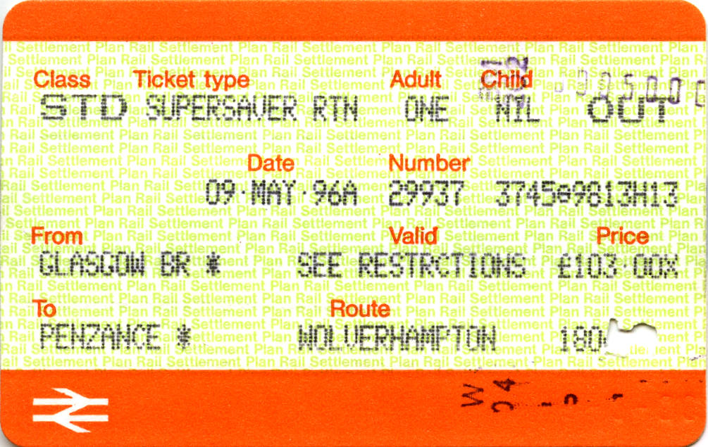
Day 0 - Thursday, May 9 — The Outward Journey
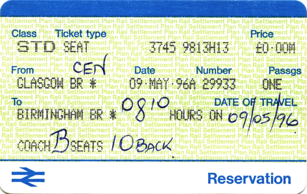
When I arrived in Central Station at five to eight, the 07:20 to London Euston was still on the departure board marked “delayed”. Not a good sign. I boarded the 08:10 to Bournemouth and made myself comfortable. Just after eight, there was an announcement - “This is the 08:10 etc. etc. Due to overhead line equipment failure at Beattock, we will be going via Kilmarnock. Any passengers for Motherwell please leave the train.” Two young persons got up and left. From an earlier remark, I had inferred that they had already been turned away from the 08:00 London Kings Cross via Carstairs.
|
|
|
| |
It is a pleasant run down the old Glasgow and South Western line through Kilmarnock. There was a short delay at Kennishead to allow a local train to sort itself out at Barrhead, then steady progress to arrive at Carlisle 34 minutes behind the original schedule.
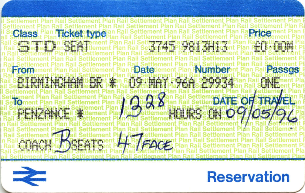
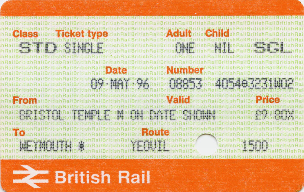
Earlier, I had spoken to the guard about my 29min connection at Birmingham and he had been quite happy with my suggestion that I should stay on his train to Bournemouth (which would get me to Weymouth an hour earlier). However, the train made up time and after Crewe, the third guard assured me I would make the connection as the other train was also running late. (It arrived three minutes early and left on time.) So it was change at Birmingham and Bristol.
|
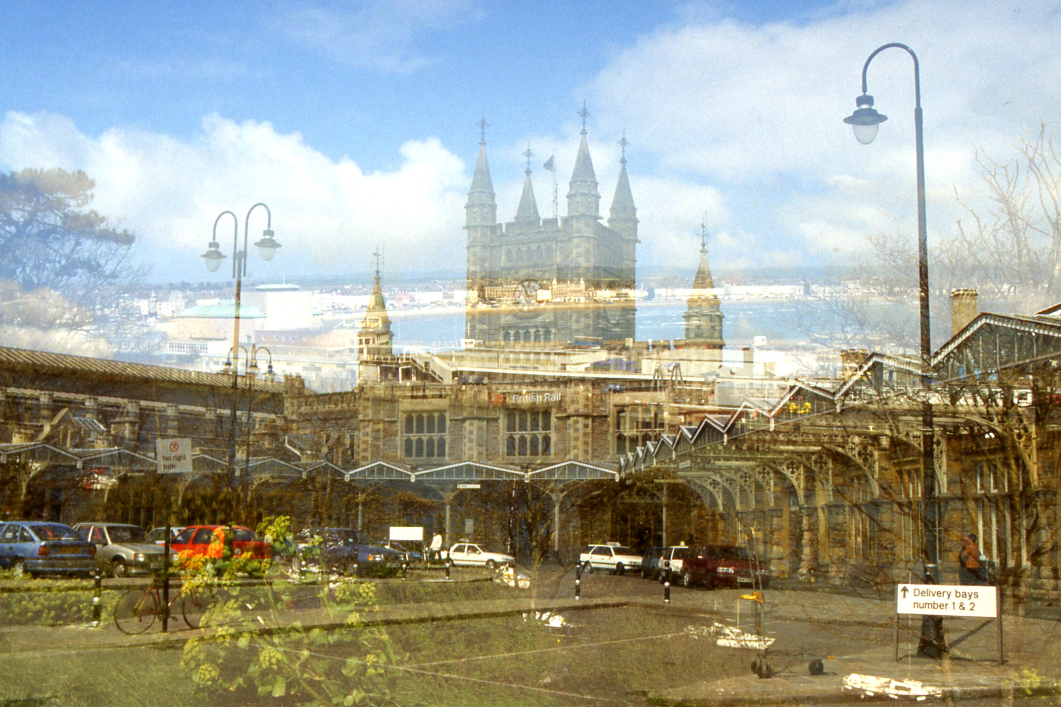
I emerged into the station forecourt at Bristol Temple Meads, recognised my surroundings from fifteen years ago and immediately realised why I had never got any further into Bristol. Ahead was a grey wall of concrete with a bit of glass; behind me, a pleasant stone station of graceful proportions and timeless elegance. Back into the station, bought a ticket to Weymouth and retired to the bar.
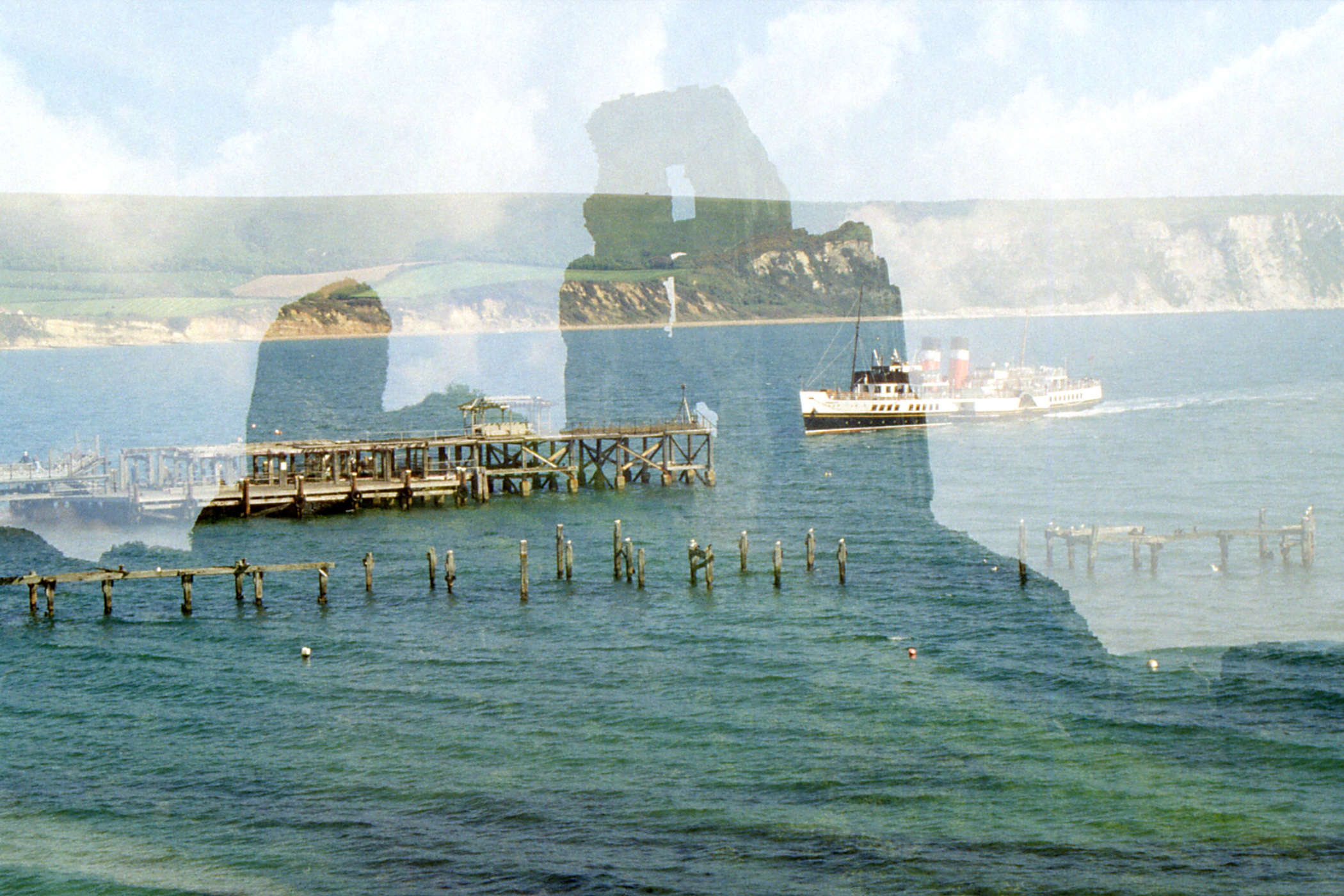
[I should perhaps mention at this point
that my new camera, previously untested, turned out to be prone to double exposures, as
exemplified on the right with the seafront at Weymouth superimposed on the magnificent frontage
of Bristol Temple Meads station. The camera was replaced without question on my return to
Glasgow, but some damage was already done. I got a couple of free films in compensation.]
|
So, an hour later, there I was, on the platform waiting for the 16:33 to Weymouth, watching sundry 125, 150, 153 and 158s going through the station, when into my platform rolled a grubby 37427 “Highland Enterprise” with ScotRail logo hauling four immaculate maroon Mark II? open coaches (with new seating). “Is this the train for Weymouth?” I asked a nearby railway employee. “Yes” he replied. Nostalgia rules!
I had a chat with the guard. This rolling
stock is owned and operated by the usual companies and does regular service as the 06:59
Westbury - Weymouth, 08:40 Weymouth - Bristol, sits around all day and then does the 16:33
Bristol - Weymouth and 19:38 Weymouth - Westbury where it remains overnight. It is popular with
day trippers to Bristol but the crew are not too happy with the safety aspects - passengers tend
to get on and off at the last minute, hang out of the windows, etc. Apparently, the powers that
be are considering fitting remote door locking.
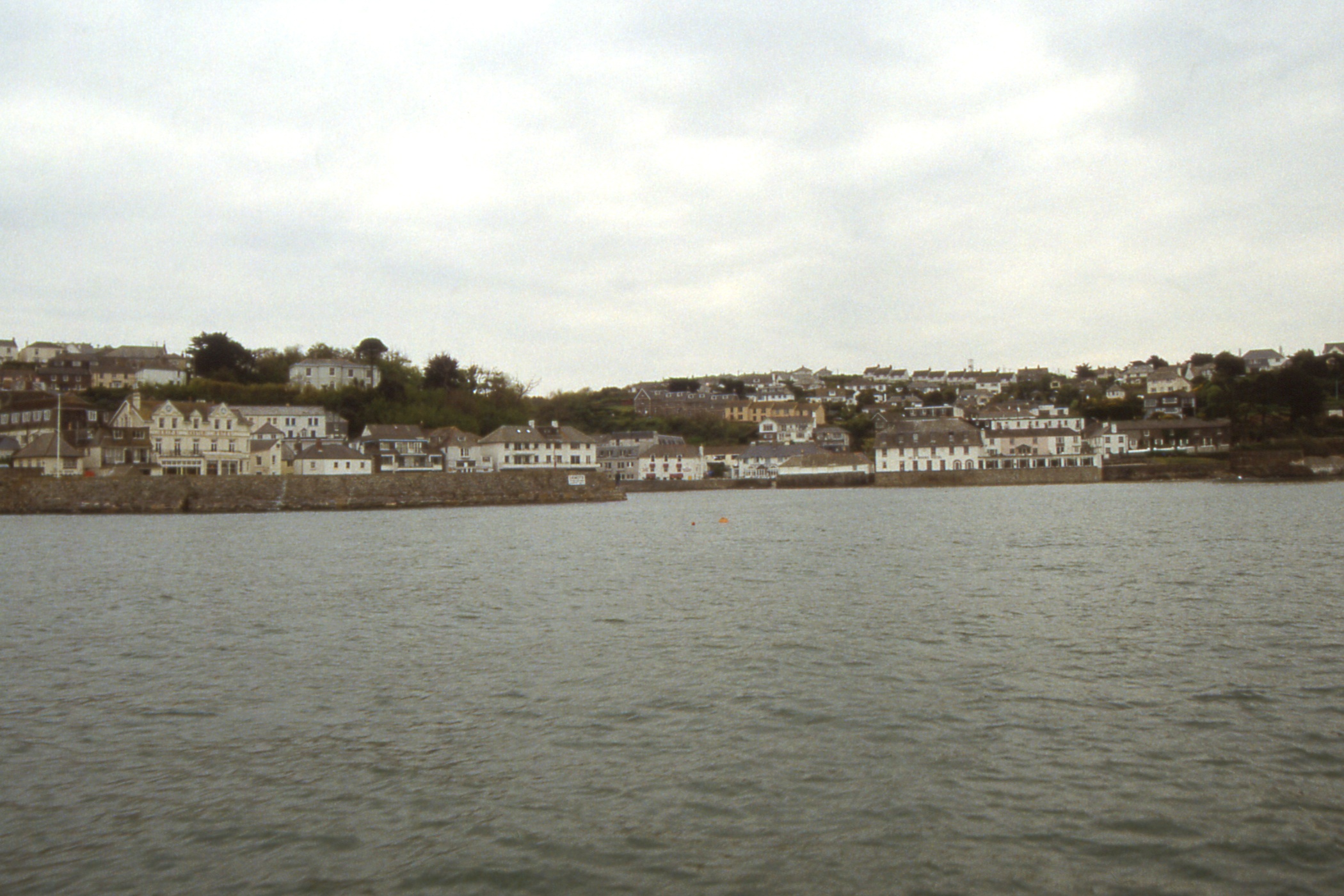
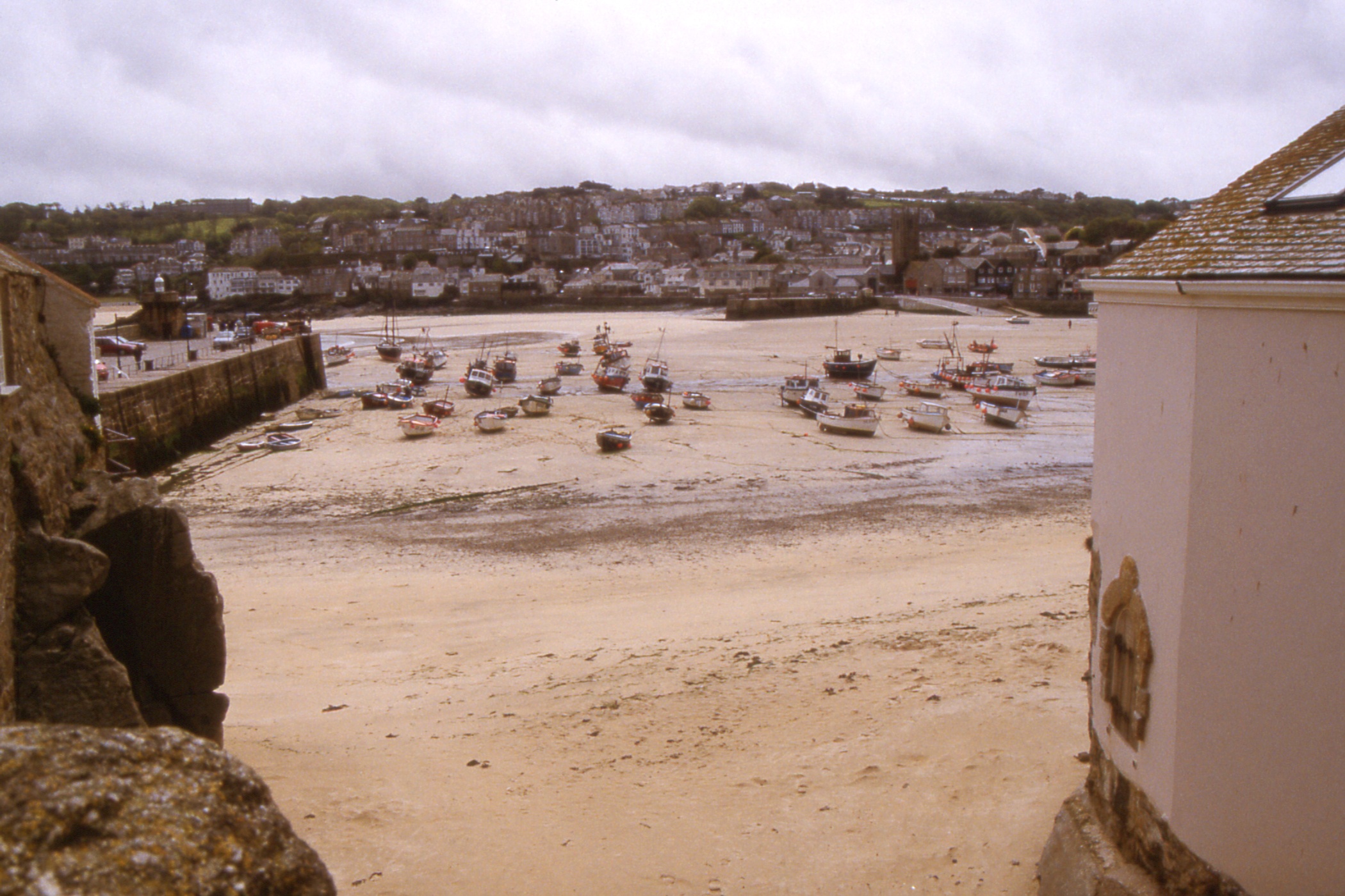
At Weymouth, I ambled down the street, looked in the Tourist Information Office window to determine the direction of the least expensive hotels and set off in that direction. En route, I spotted £15 B&B at the Leander Hotel and booked in for two nights. After a wash, I went out for a walk round the town, decent cod and chips for tea followed by an unimpressive pint of Flowers Original before returning to the hotel and bed.
Day 1 - Friday, May 10 — Round the Isle of Portland
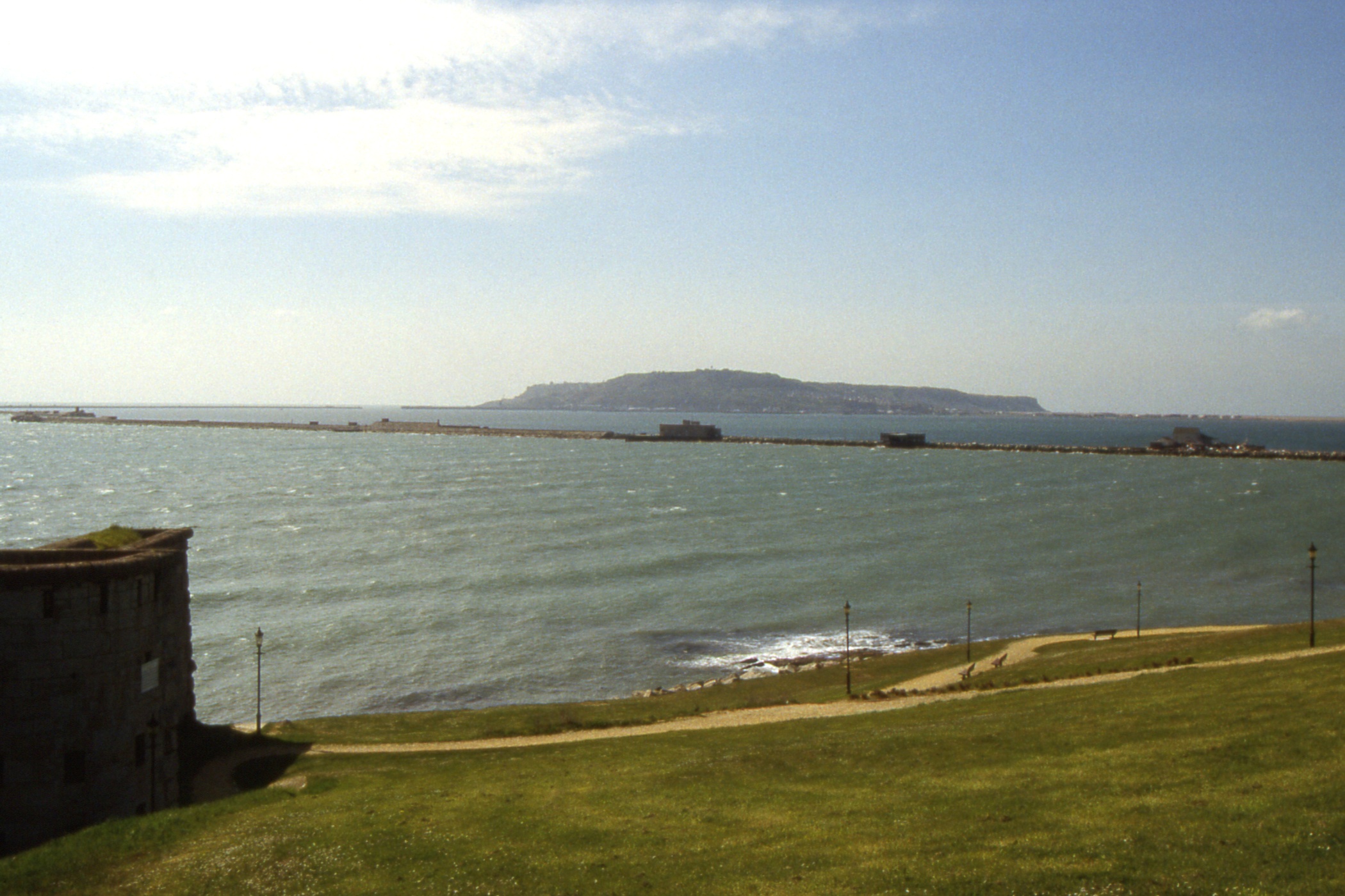
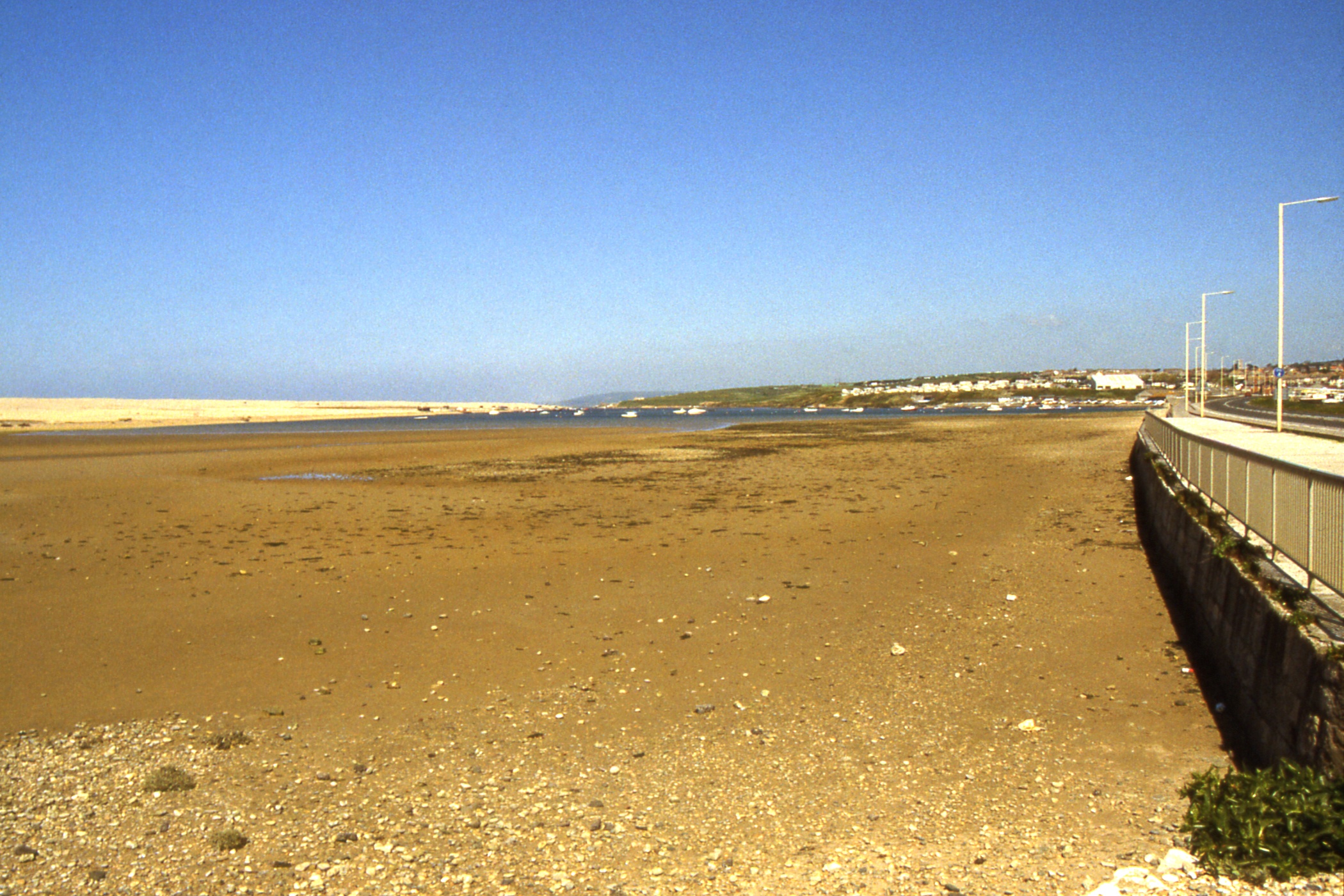
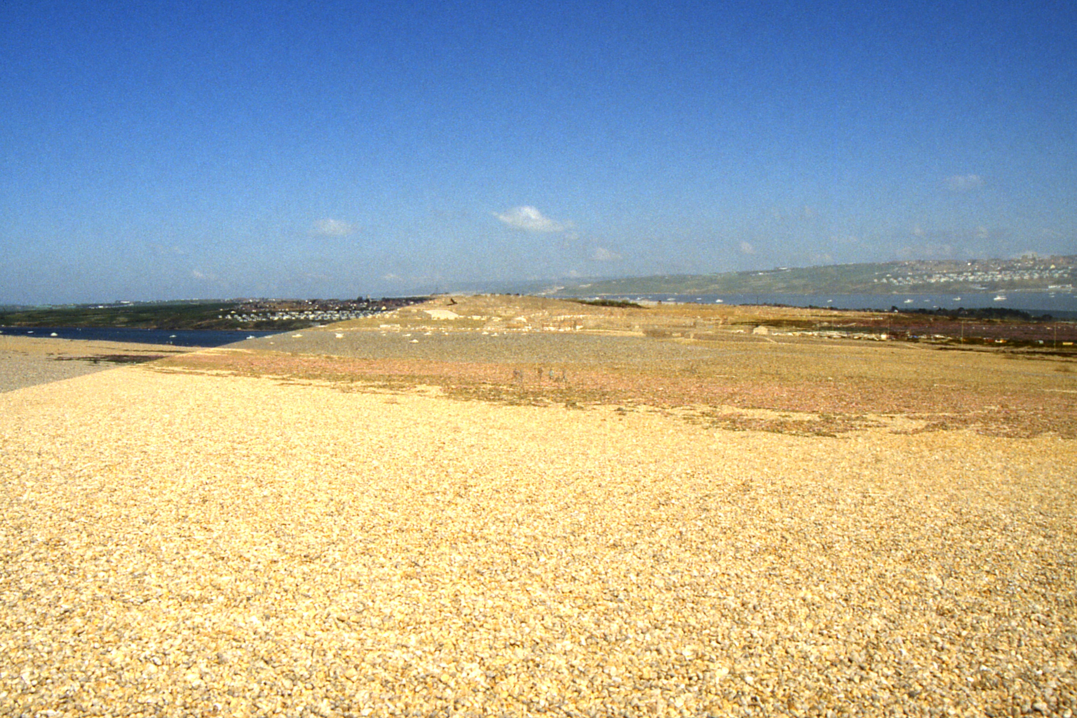
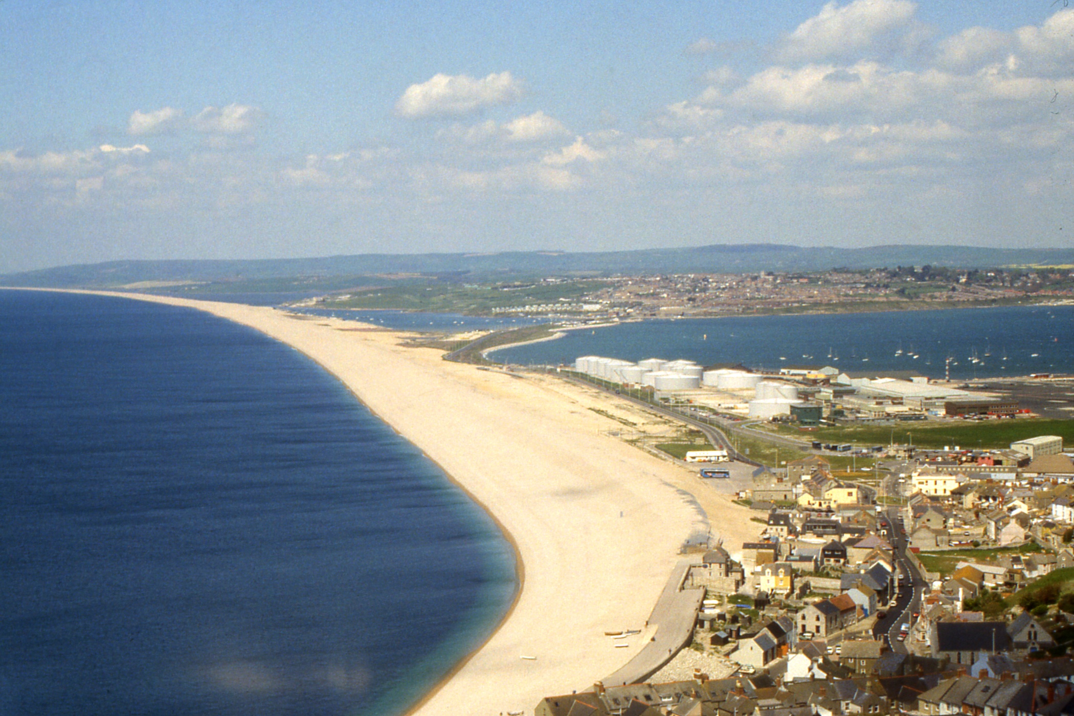
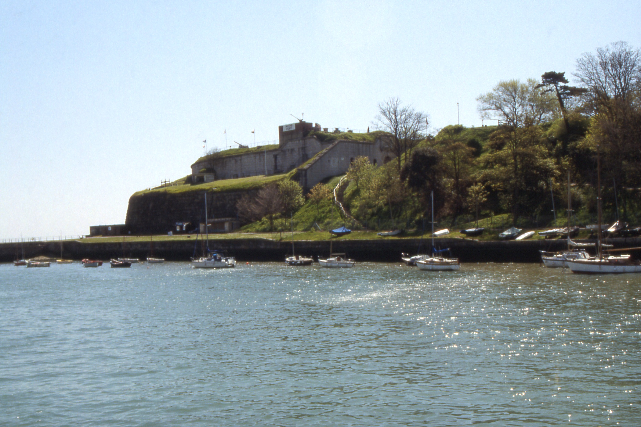
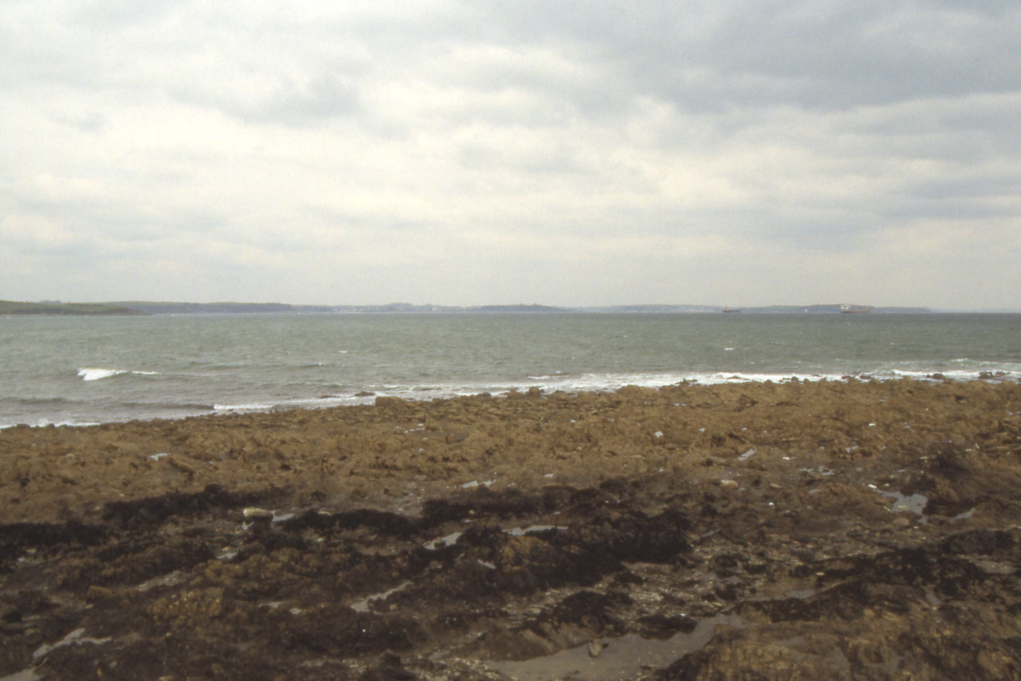
After a decent breakfast I wandered off in fine weather over the Nothe Fort to where the Chesil Bank joins the mainland to the Isle of Portland. This bank is composed of pebbles, about 60ft high, benched on the sea (west) side and with a strip of ground on the east side which carries the road and, once, a railway. I continued on the top of the bank, not easy walking on the loose pebbles. There was not much litter about, there were quite a lot of what I took to be cuttlefish skeletons, a lot of the pebbles had small holes right through them.
|
|
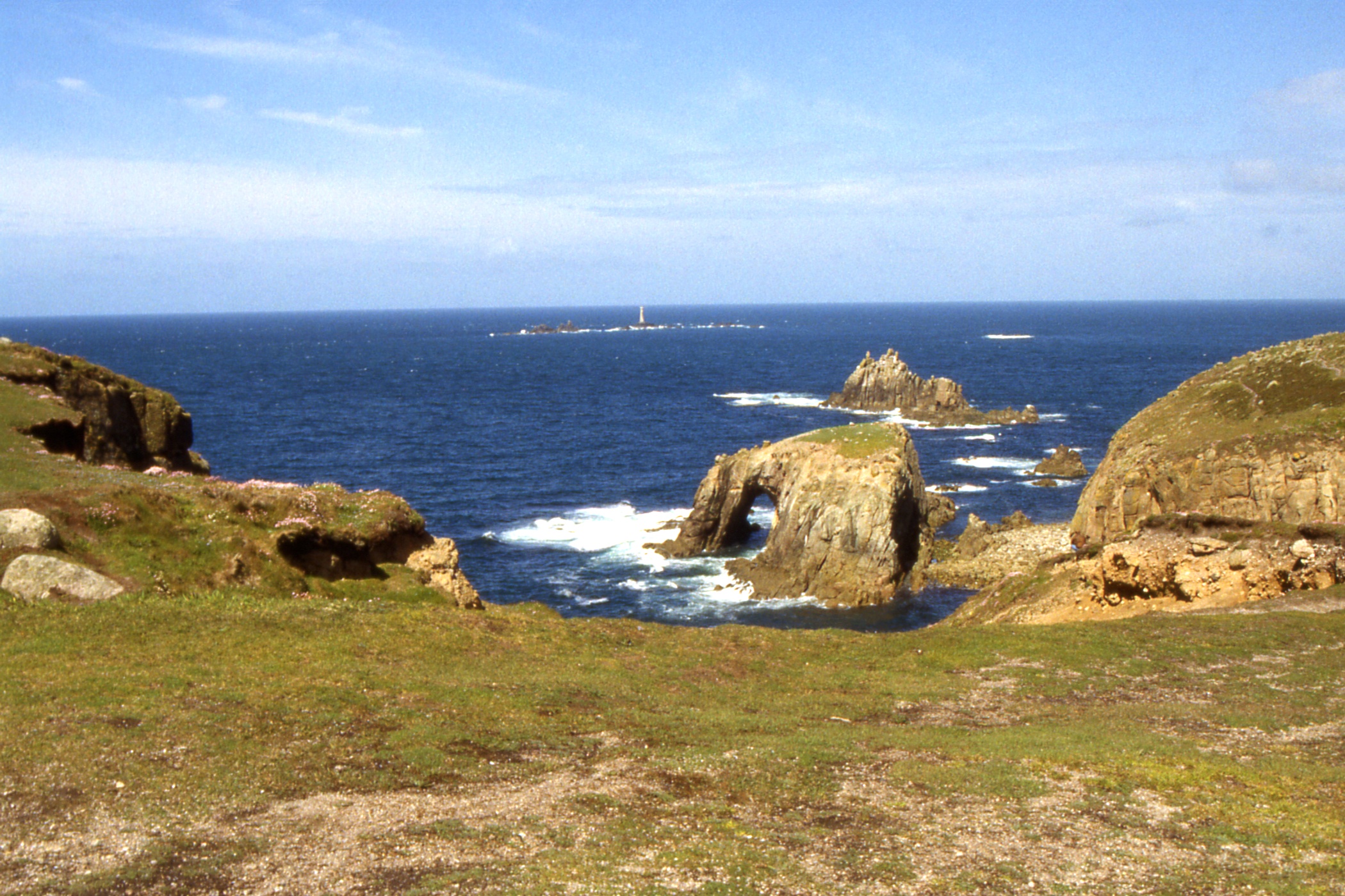
|
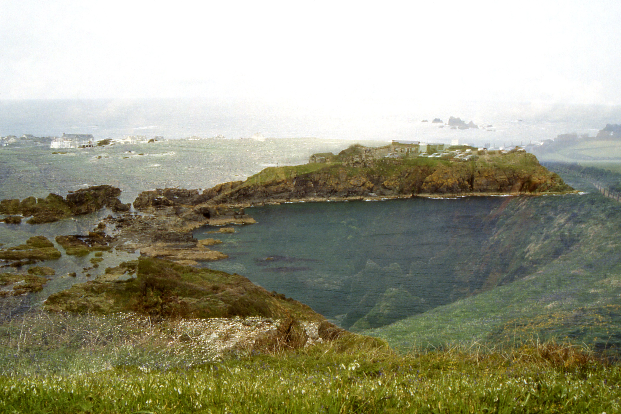
| Isle of Portland across Portland Harbour from the Nothe Fort |
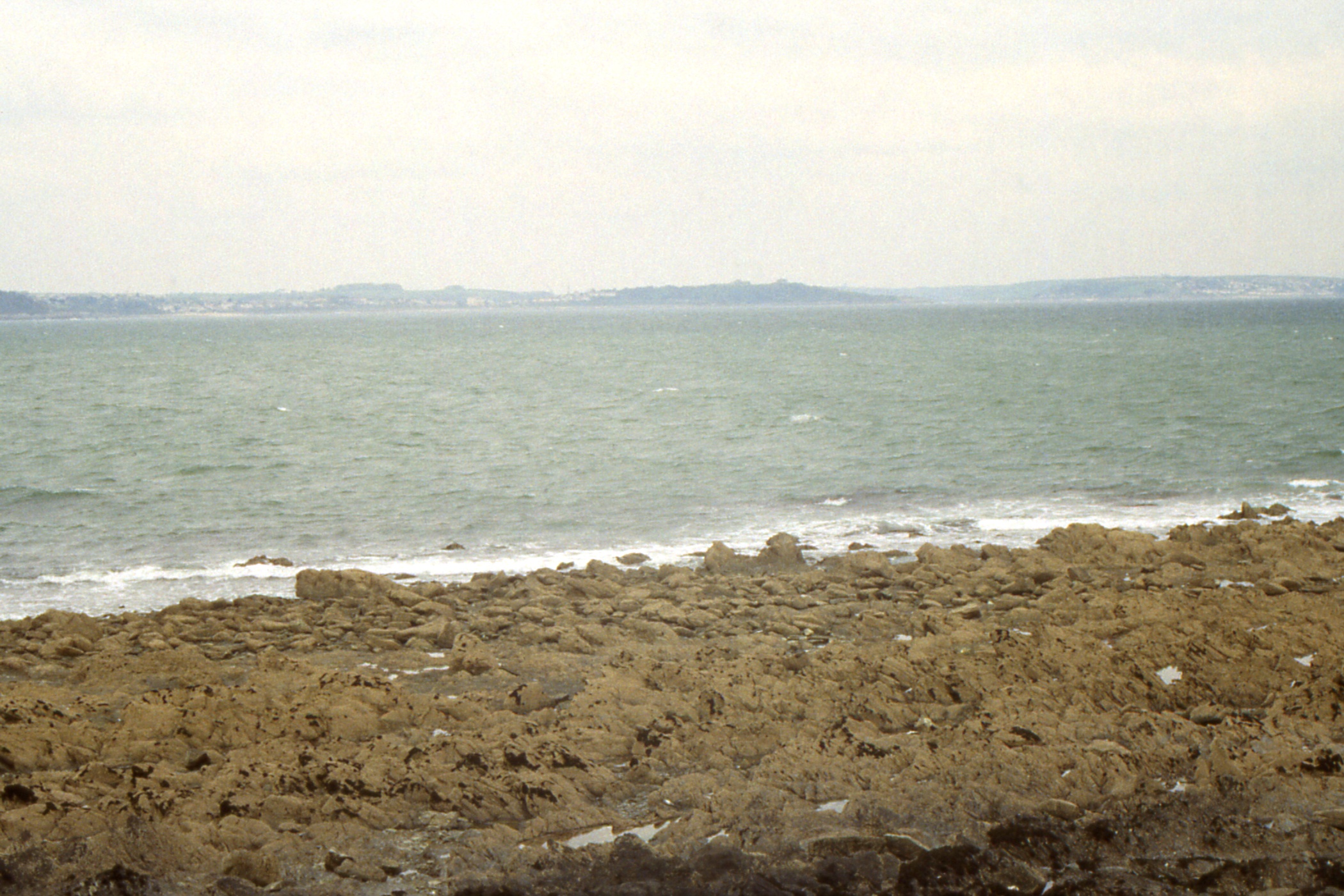
The Fleet, behind Chesil Bank, from near the Ferry Bridge |
The Fleet from the top of Chesil Bank + the top of Chesil Bank |
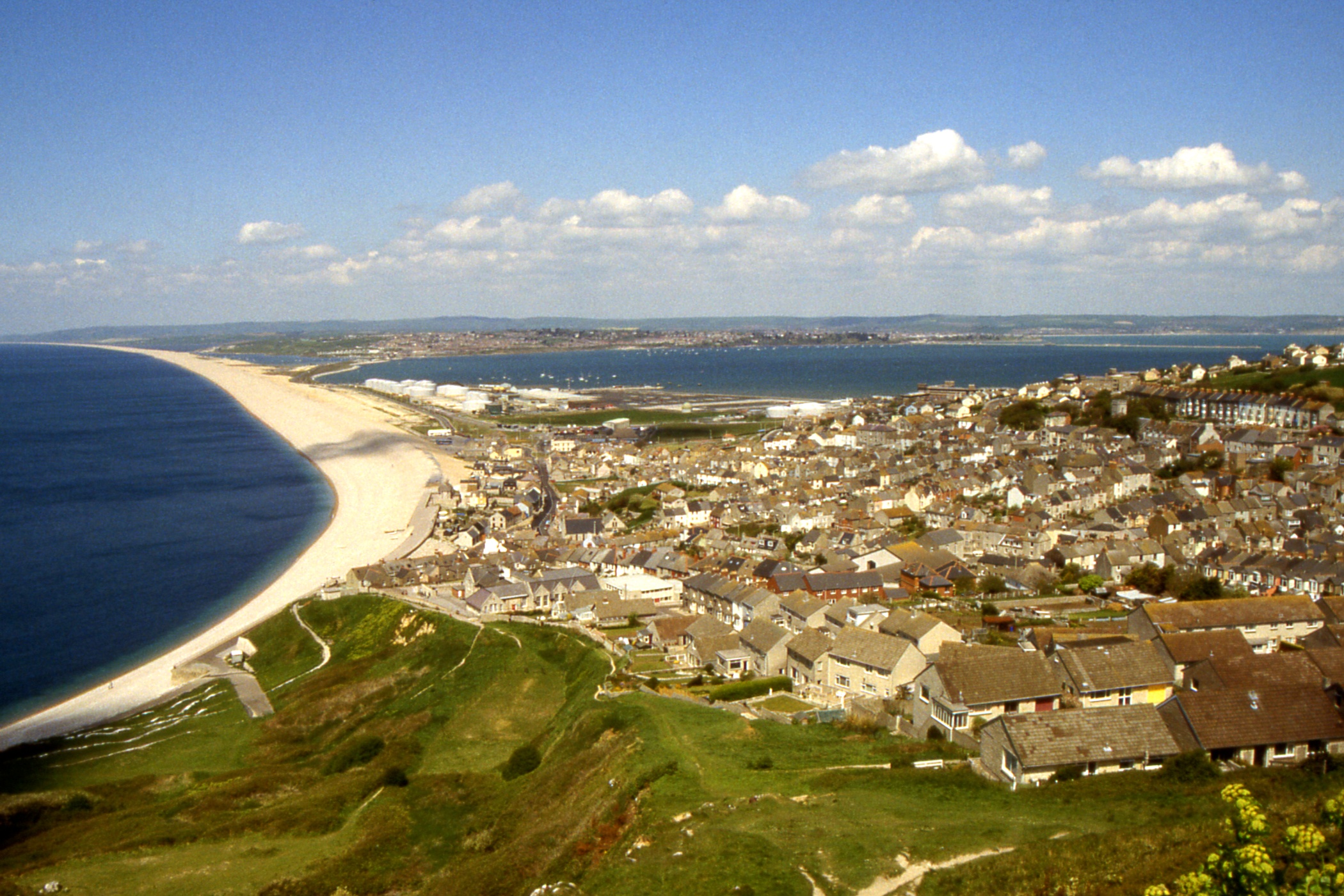
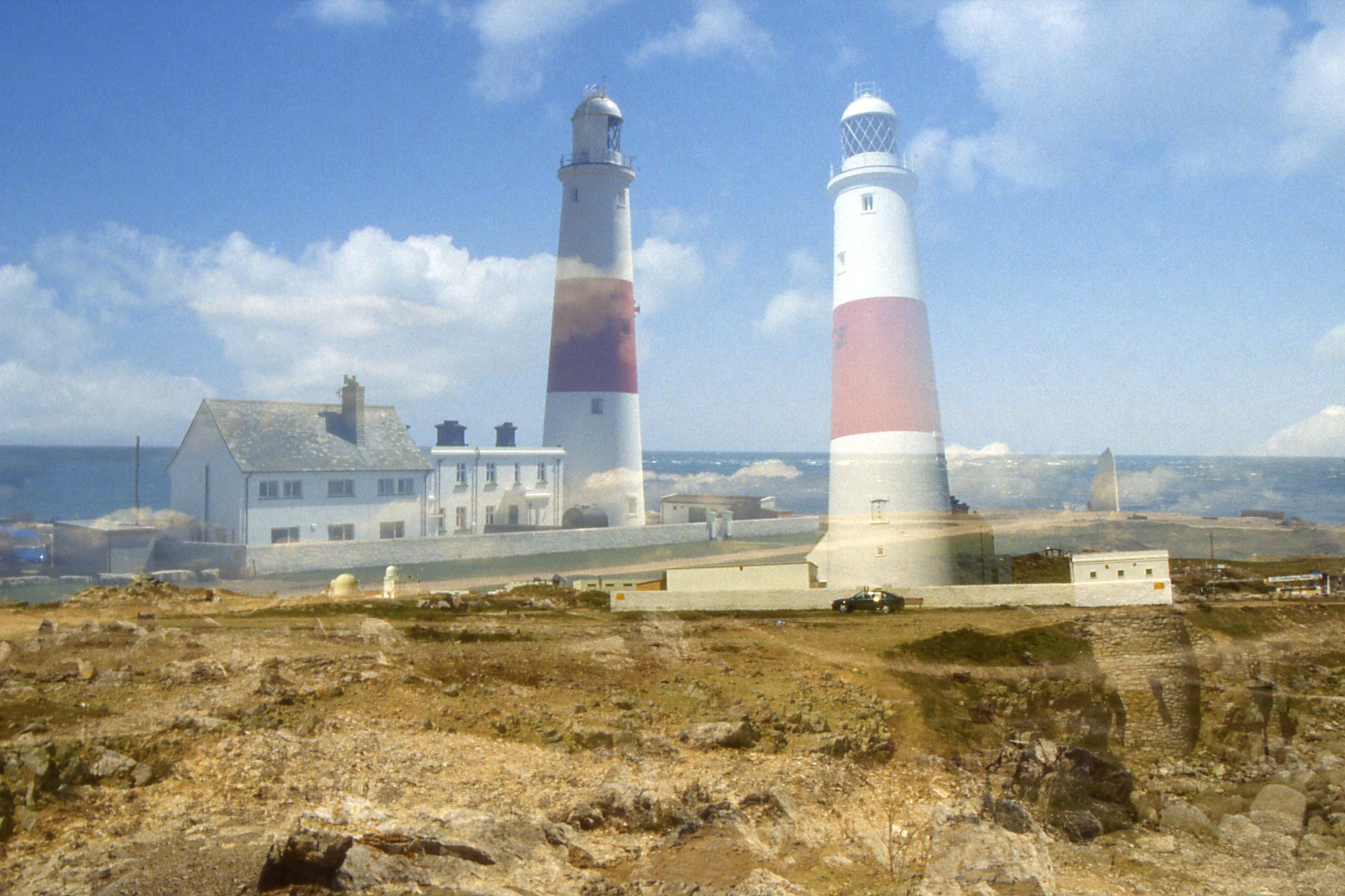
Once on the island proper, at Fortuneswell, I took the path up to the top of the West Weare which affords fine views back over the Bank. A quarry diverts the path at this point and I missed the first turn back to the cliff top but soon found another and walked on to the lighthouses at The Bill of Portland, the south end of the island, where I partook of tea, sandwich and cake for lunch. I then set off up the east side, passing through a collection of garden huts or small cottages which appear to be used as beach houses.
|
|
|
| Chesil Bank and Portland Harbour from the cliff above Fortuneswell |
Fortuneswell, Chesil Bank and Portland Harbour | Two shots of Portland Bill lighthouse |
|
|
| Very small catamaran "Condor"? on its way to Weymouth |
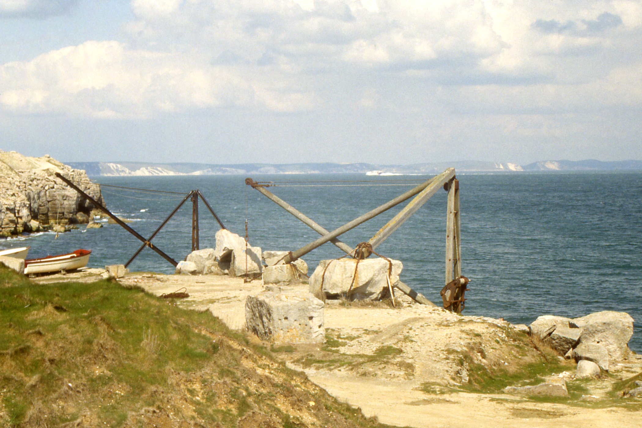
Disused quarry jetty with derrick on the Isle of Portland,
with the coast west of Weymouth beyond. Spot the catamaran! |
By the ruins of Rufus Castle and Church, I picked up the remains of the railway that once ran below the cliffs round the north east corner of the island to the mainland. I made good time along this until I reached a fence with a locked gate and a sign “MOD KEEP OUT”. There was a path along the shore side of the fence and I followed this for another half mile before being brought up short by the fence extending into the sea at Balaclava Bay. I had to retrace my steps over a mile and a half before I found another path up the cliff below the Young Offender's Institution. Someone might have thought to put a sign at that point!
Anyway, once up the cliff, I followed public footpaths through the YOI and a quarry before being thwarted again in my attempt to get round the corner. So I gave up and headed straight across and round the west side of HM Prison in The Verne, an old fort on top of the hill. It was about half past five when I finally reached the island end of the Bank.
From there, a bit of a trudge along the road until I could pick up the disused railway again, which continues as a walkway into the centre of town.
Day 2 - Saturday, May 11 — Weymouth to Lulworth Cove
After another decent breakfast, I set off in a fine, sunny morning along a mixture of esplanade, road and nature reserve for a mile or so before taking to the beach for another half mile to Bowleaze Cove with its holiday camp. From there, the Coast Path is pleasant walking along the cliff top/side through to Osmington Mills where there is a tea-room and pub. I visited both. The pub offered a good selection of beers, Courage Best and Directors, Ruddle's County and Old Thumper (5.9% ABV).
From Osmington, the path continued along low cliff tops to Ringstead Bay where began a slow but steady climb to the White Nothe (headland) where I stopped awhile at the abandoned coastguard lookout to admire the view and the change in the scenery before me.
I don't know the geology but behind me the cliffs were low and regular while before me they rose and fell as the coast cut across rolling downs. From the White Nothe (150m), I dropped down to about 20m then up to Bat's Head (100m) then down to about 20m then up to Swyre Head (100m) then down to about 20m then up a wee bit then down again to Durdle Door (a natural arch in an outcrop of cliff) and then up to 134m behind Dungy Head before the last descent into Lulworth Cove. All this in what looks like 3 miles on the map but with descents as steep as the ascents, it took me two and a half hours.
|
|
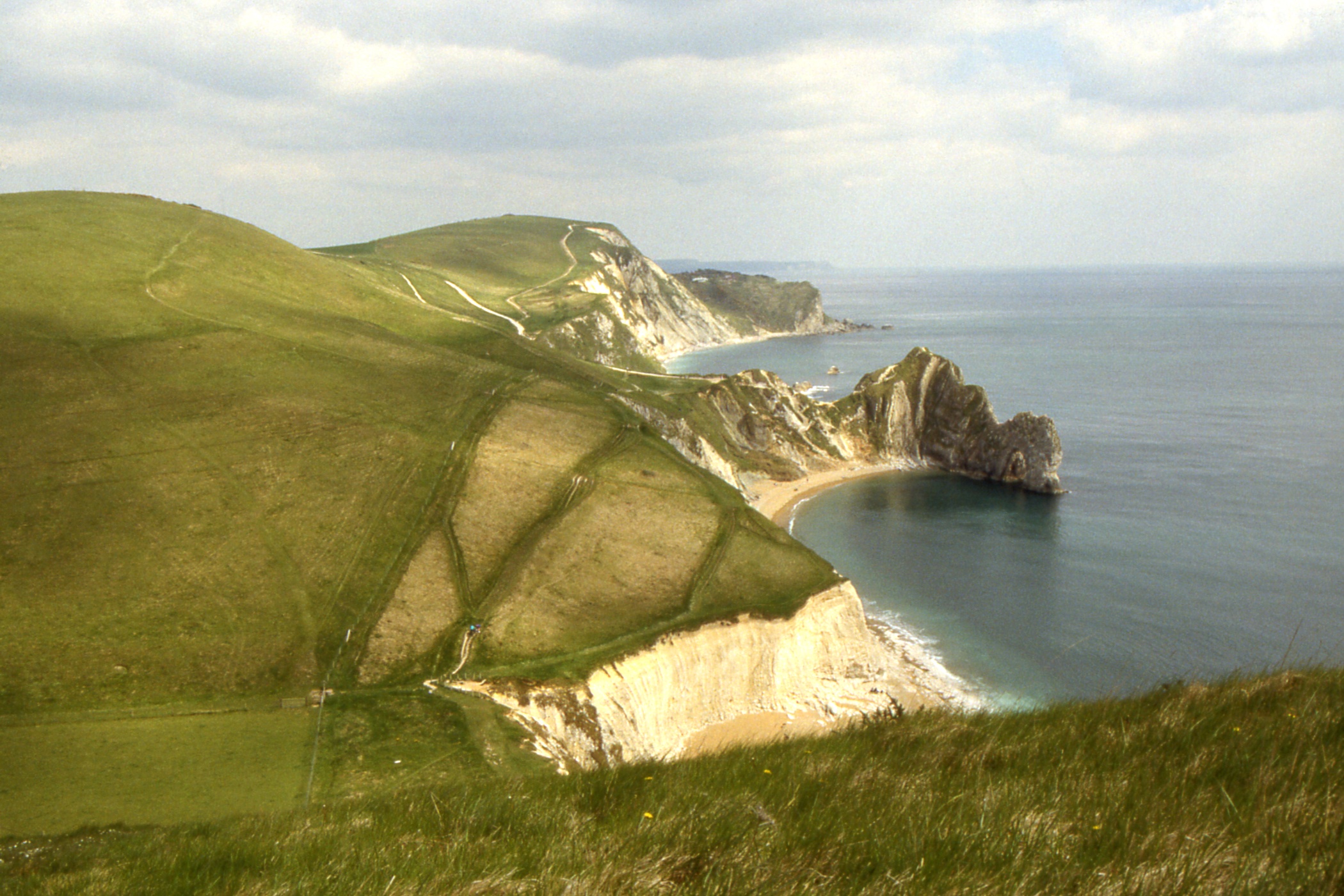
| Durdle Door and Dungy Head, west of Lulworth Cove. St Alban's Head in the distance |
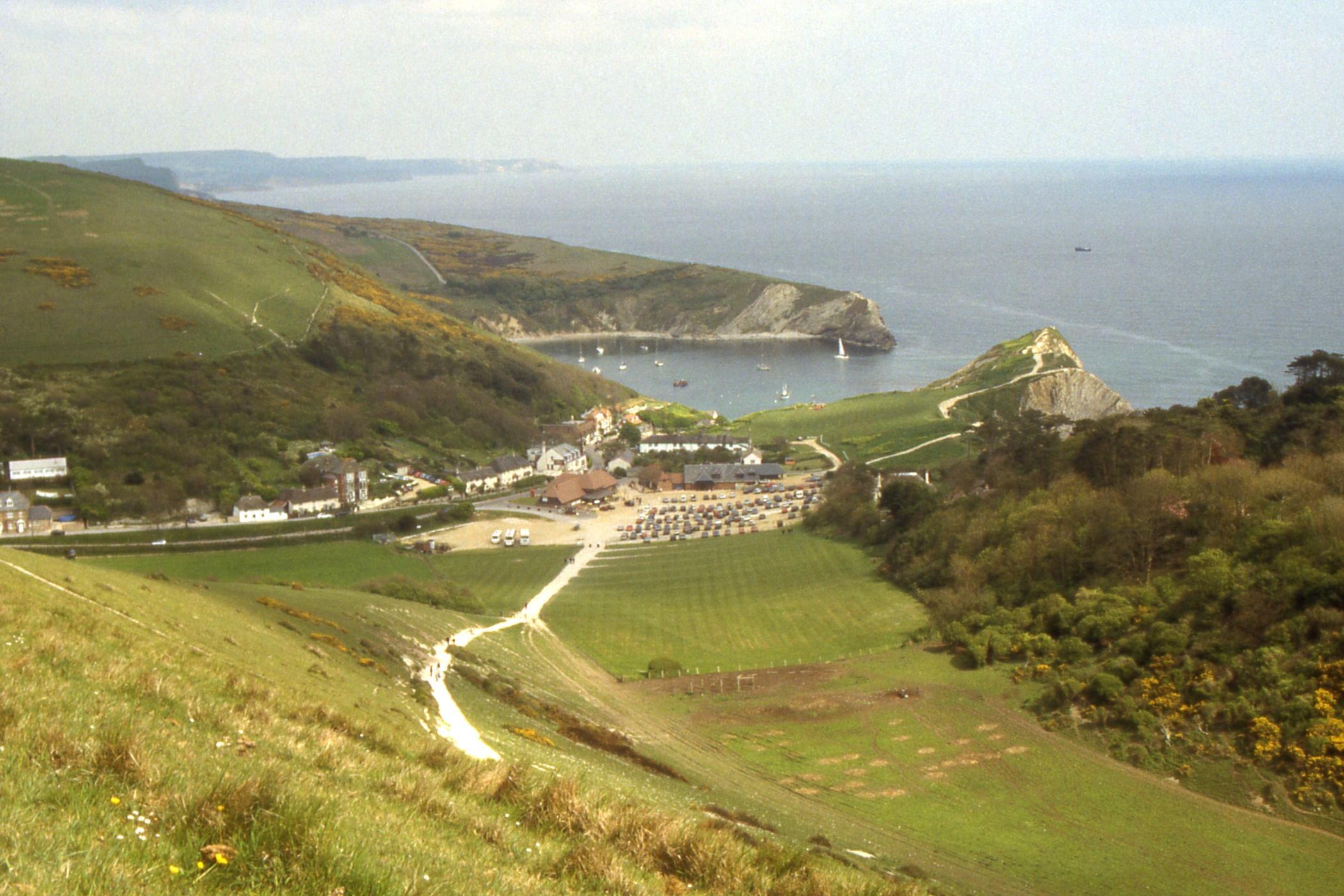
Lulworth Cove |
Time for a quick wash in the public conveniences then a pot of tea in the Heritage Centre before wandering down to the Cove where I discovered that the next wee bit of the coast path out of the cove has been closed following storm damage during the winter but there is an simple detour when starting from the hostel in the morning.
Ah yes, the hostel, about a mile away. I set off up the road and soon found a path up on to the hillside which I followed round to find myself with a last descent to the road 100m from the hostel in West Lulworth. I arrived at five past five to get the last bed. While I was booking in, the phone rang and someone was told the hostel was full. Just in time.
After I had cleaned up, I wandered down the road to the nearest pub, a strange place where the interior seemed designed to minimise the useful space available to customers, lots of nooks and crannies with wide separators. One pint then down the road to the Cove for a wander around and another pint. Back to the hostel and bed. The bloke in the bunk above me kept turning over energetically in the night, difficult to sleep through but I got a decent amount of rest.
Day 3 - Sunday, May 12 — Lulworth Cove to Swanage
Things were a bit confused at breakfast with two large groups getting in the way. I think I missed out on orange juice and toast but, that's life. As I was leaving, the warden warned me that it was a stiff day to Swanage. What's that to a rough, tough Scottish mountaineer? After all, had I not managed that sort of thing yesterday?
Today's route starts through the MOD Lulworth firing ranges which are usually closed Monday to Friday so it is just as well I was here at the weekend. I climbed the hill behind the hostel and decided to skip the detour back to the Cove and instead turned east on the crest of Bindon Hill, walking with the sea below me on the right and a tank park below me on the left,
The summit of Bindon Hill is at 160m, then there's a drop to sea level at Arish Mell then a climb to 160m at Flowers Barrow then down to sea level at Worbarrow Bay (I turned my ankle on the descent) then up to 140m on Gad Cliff then down ... I was beginning to see the warden's point ... to about 10m before about a mile relatively flat around Kimmeridge Bay. This is the site of the first onshore oil well in the UK, just a solitary nodding donkey with a couple of small oil storage tanks. Hardly a blot on the landscape. Car parks but no refreshment at Kimmeridge Bay, I ascended another 40m to a tower where I stopped for half an hour and a shot of carbohydrate.
From here, the ups and downs were less severe and I swung along, the main problem being occasional encroachments of nettles - not nice when wearing shorts. I was somewhere in the vicinity of Rope Lake Head (50m) and beginning to view with trepidation the sight of Houns-tout Cliff (150m) ahead of me when disaster struck. Stepping carelessly off a small bridge, I turned my ankle again and pitched into a bed of nettles. I shall draw a veil over the next five minutes.
When I had regained my feet and my composure, I found that I could still walk, albeit slowly and with great care to avoid further damage. I was probably equidistant from three car parks so I might as well continue with my planned route. Houns-tout Cliff was a serious slog and after the descent to Chapman's Pool, I'd had enough. I headed into Worth Matravers in search of tea and a bus. The tea shop was excellent. My request for a two-person pot confused the waitress who spent some time looking for the other person.
It's amazing what a pot of tea can do. Who needs a bus? I decided that I could walk the four miles of road into Swanage but had travelled barely a quarter of a mile when I saw a signpost for a footpath, the Priest's Way, across the fields. A quick check with the map showed a fairly straight route so off I went. It was a pleasant walk until I found myself in a caravan park on the edge of Swanage, lost the route and had to walk an extra half mile on roads.
The hostel was, as usual, up a hill. I wanted to stay for three nights but they had 90 school children coming in tomorrow and were fully booked for Tuesday night, still two nights is better than none. After a shower and change, I still had enough energy for a short stroll to get my bearings in town before bed.
Day 4 - Monday, May 13 — A day off in Swanage
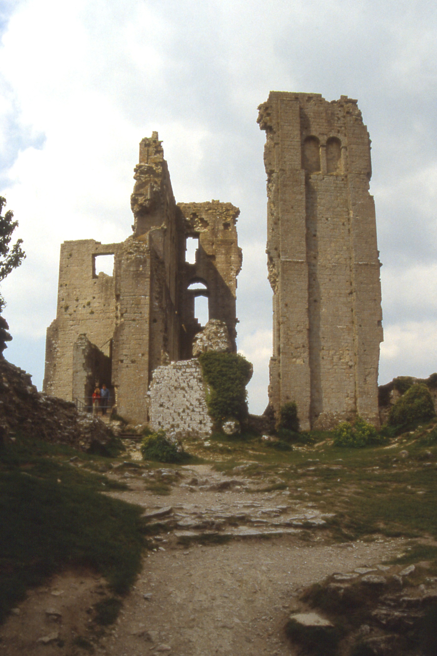
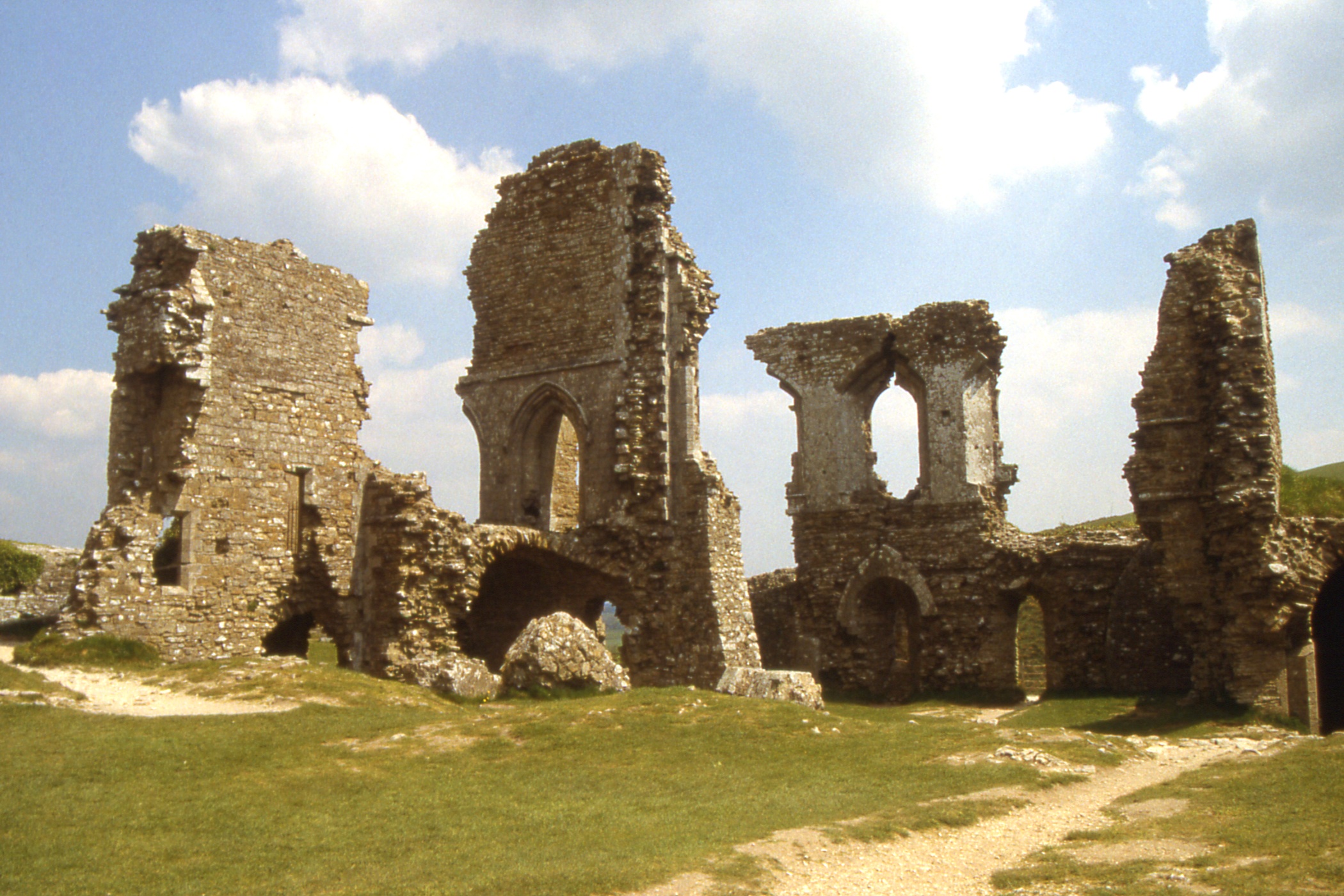
Well, the Swanage Steam Railway runs every day in May except non-Bank Holiday Mondays. What was today? I took a bus to Corfe Castle. Oddly enough, before I left I noticed a small tank engine being fired up and from the bus I saw smoke over the railway line. When I reached my destination, I saw a couple who had been in the vicinity of the station at Swanage and who had not been on the bus!
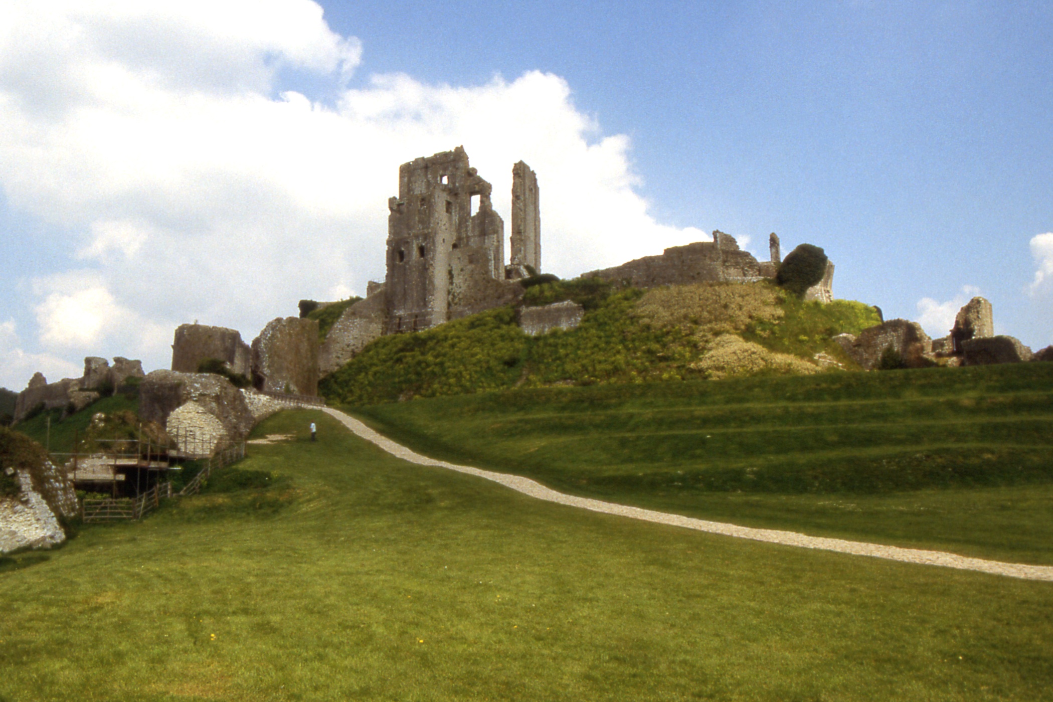
The village of Corfe Castle is small, largely stone built, some thatched roofs and a serious traffic problem on the main road. The castle sits on a knoll commanding a gap in the Purbeck Hills and was destroyed by Cromwell, thoroughly, the remaining fragment are merely picturesque but the site offers good views. I'm not sure if it is worth £3 admission but my NTS membership makes such matters academic. The tea-room in the village provided decent tea, soup and a sandwich for my lunch before I took the bus back into Swanage.
|
|
|
| The ruins of Corfe Castle from the outer bailey |
Remains of the keep | The village of Corfe Castle, from the castle |
|
|
| The ruins around the inner ward of Corfe Castle |
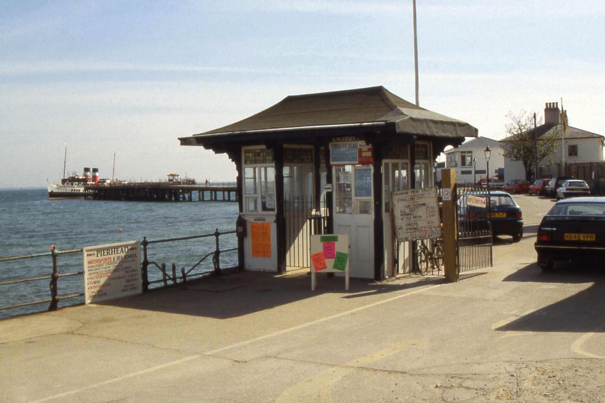
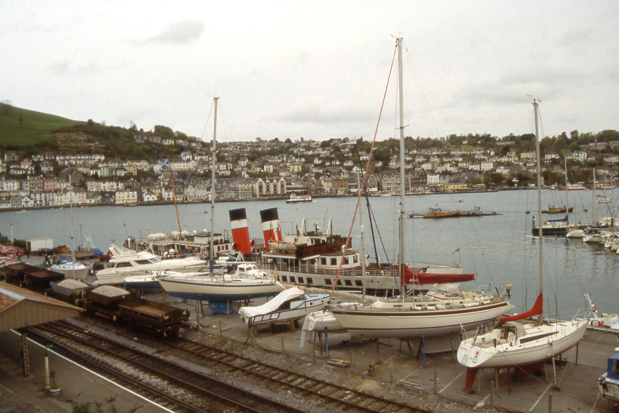
The remains of the keep at Corfe Castle + Waverley approaching the end of Swanage Pier |
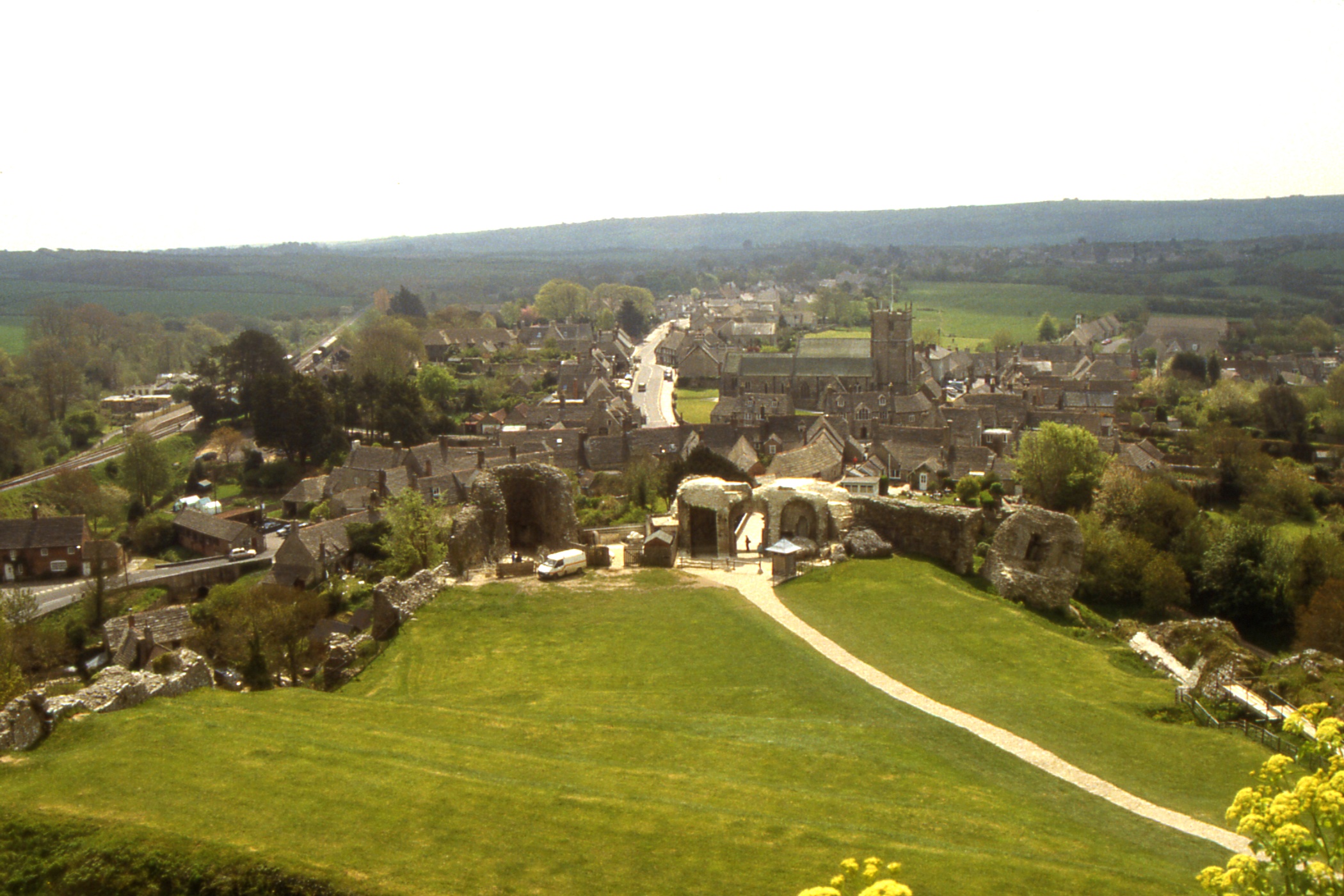
From the Tourist Information Office, I got a list of available accommodation with pointers to the cheapest, then spent the rest of the afternoon ambling along the esplanade and sitting in the park. On the way back to the hostel I located my target B&B. After a wash and brush up, I returned to make arrangements for tomorrow night. Bay View is run by Jean Butler (Mrs) whose father came from Maryhill. She lived there for a while, then in Bellshill and Dumbarton before moving south.
After a couple of pints of Strong Country Bitter (originally from Strong's of Romsey (near Southampton) but now part of Whitbread), poured straight from the keg, I returned to the hostel to find that I was sharing the room with two Australians who claimed that they were over for a vintage car rally at Beaulieu. One was from Queensland so we had a pleasant chat about preserved steam in Queensland. I'm told the static engine park at Redbank has been closed and the engines are being returned to steam.
Day 5 - Tuesday, May 14 — A day out on Waverley
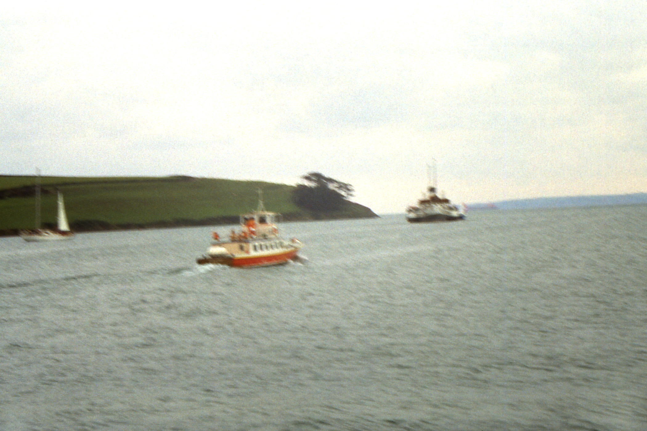
At last a sailing day. I rose late to avoid the 90 school children who were having breakfast at eight, but was still out into a fine morning by half past and went round to the B&B to dump my pack before proceeding to the pier. There was no sign of Waverley, still, it was only nine o'clock and I could see something in the distance over towards Poole. I wandered out towards Peveril Point where I began to be concerned that whatever it was that I could see to the north was not increasing in either size or proximity. Looking east, I could just make out the Isle of Wight and .. just south of the island, a ship. If that was the Waverley, she'd be pushed to get here in time. I drifted back along the road, glanced over my shoulder and there was Waverley steaming into the bay. Once again I had underestimated her speed (as I often do when awaiting her arrival at Largs).
At the end of the pier, I crept up on Jim while he was talking to other passengers and was rewarded with a decent double-take, not for the first time today. I asked what time we would get to Tarbert and was told I'd got the month wrong and would have to make do with Portsmouth Harbour.
|
|
|
| Pier toll gate at Swanage with Waverley at the end of the pier |
Swanage seafront from the Waverley | Swanage pier and seafront |
|
| Bournemouth with pier in the middle |
We were across at Bournemouth in under forty minutes and berthed alongside a narrow pontoon with barely enough room to deploy the gangways. The hose was put ashore for fresh water, up the stair on the main deck of the pier. Most of the crowd on the pier appeared to descend the stair and join the boat, which was a relief as there had not been many aboard from Swanage.
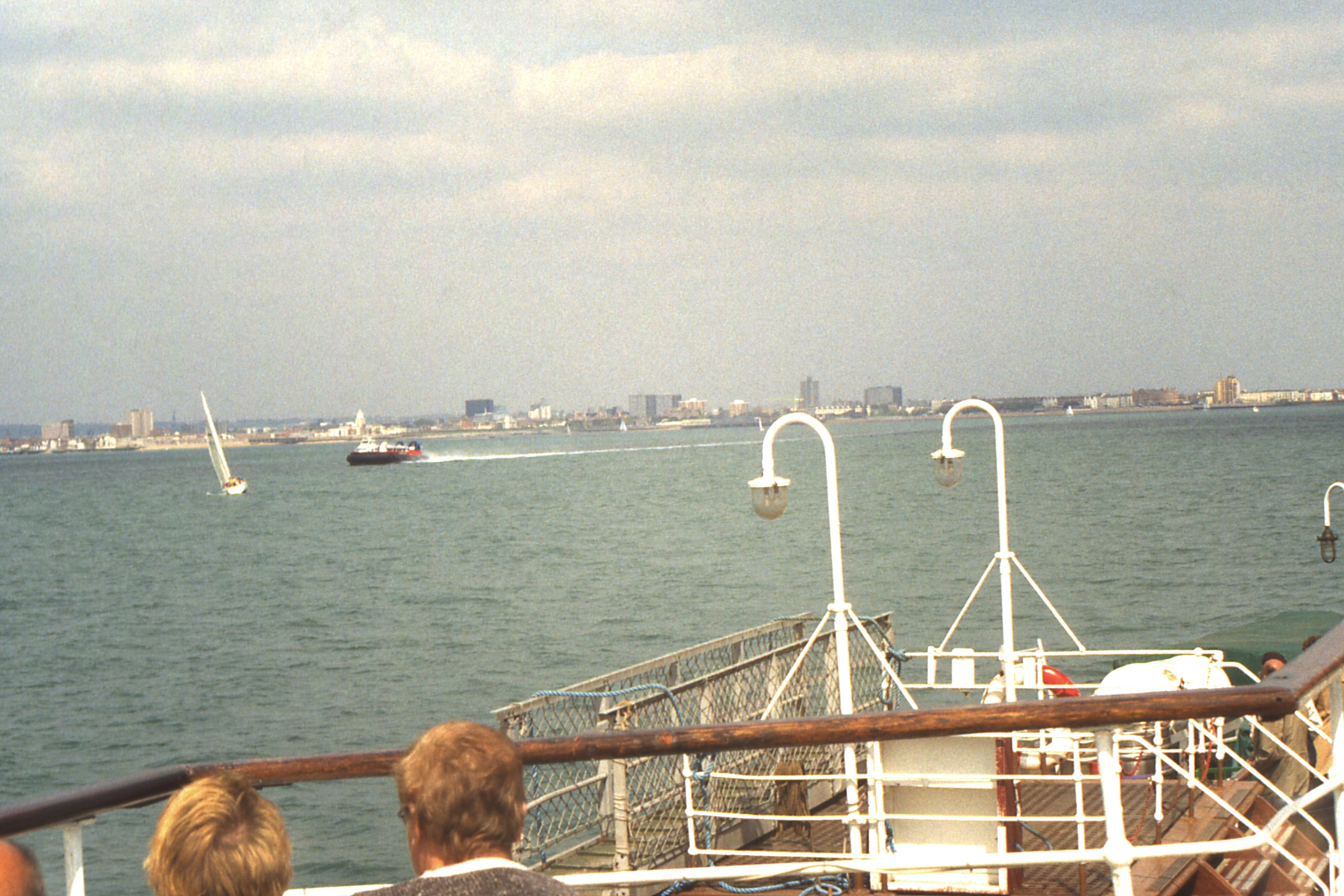
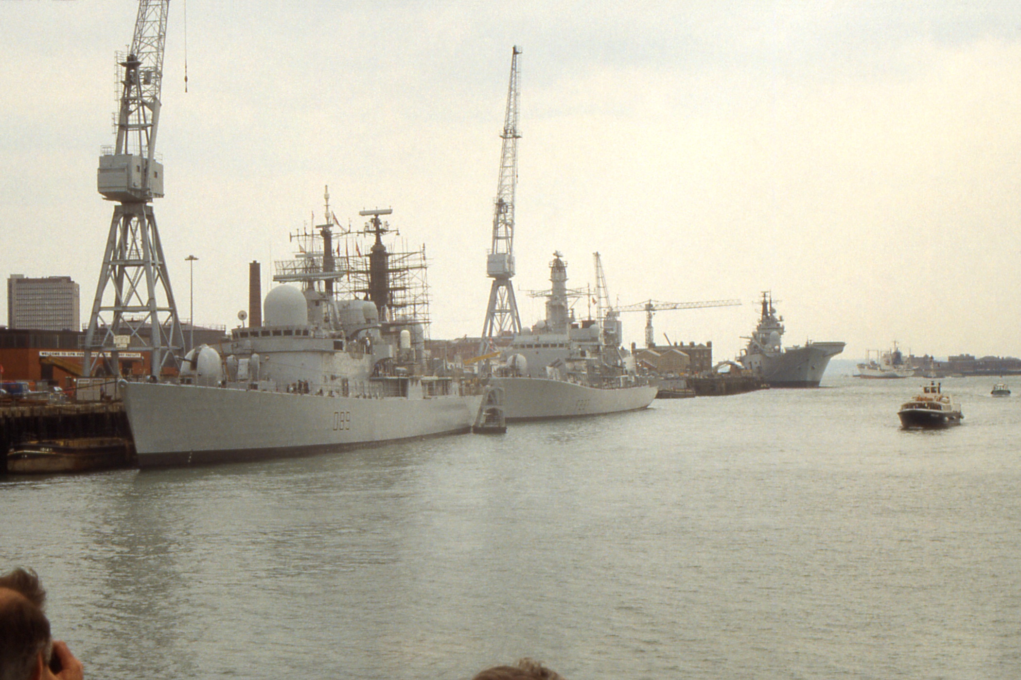
A pleasant cruise along the coast and across to the Yarmouth on the Isle of Wight. From there, we crossed the Solent without seeing much of interest in the way of shipping. The trip around Portsmouth Harbour and Naval Dockyard left me with the impression that most of the Royal Navy spends most of its time in port, including two of the three aircraft carriers. Some of the passengers seemed quite excited by it all, cameras clicking at a rate to gladden the hearts of the film manufacturers. I wondered if there were any foreign spies aboard.
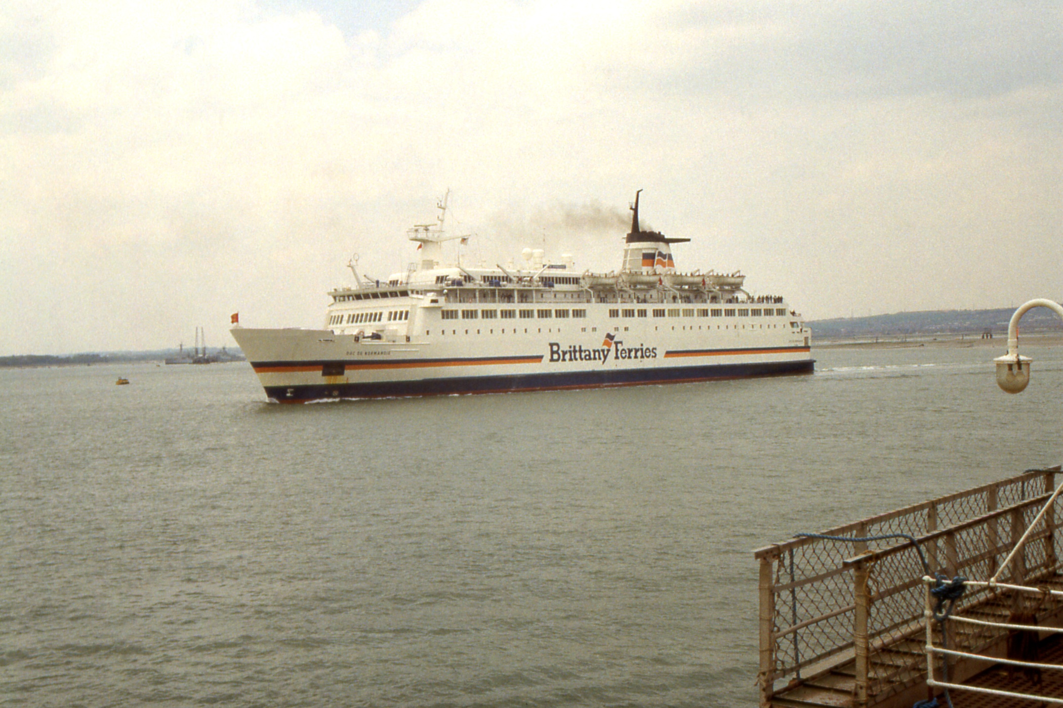
Two sizeable ships left while we were in the harbour, Normandy Ferries “Duc de Normandie” en route for Caen and a freighter “Nova Scotia” registered in Valetta!
|
|
|
| Approaching Portsmouth. The hovercraft is heading for Ryde on the Isle of Wight |
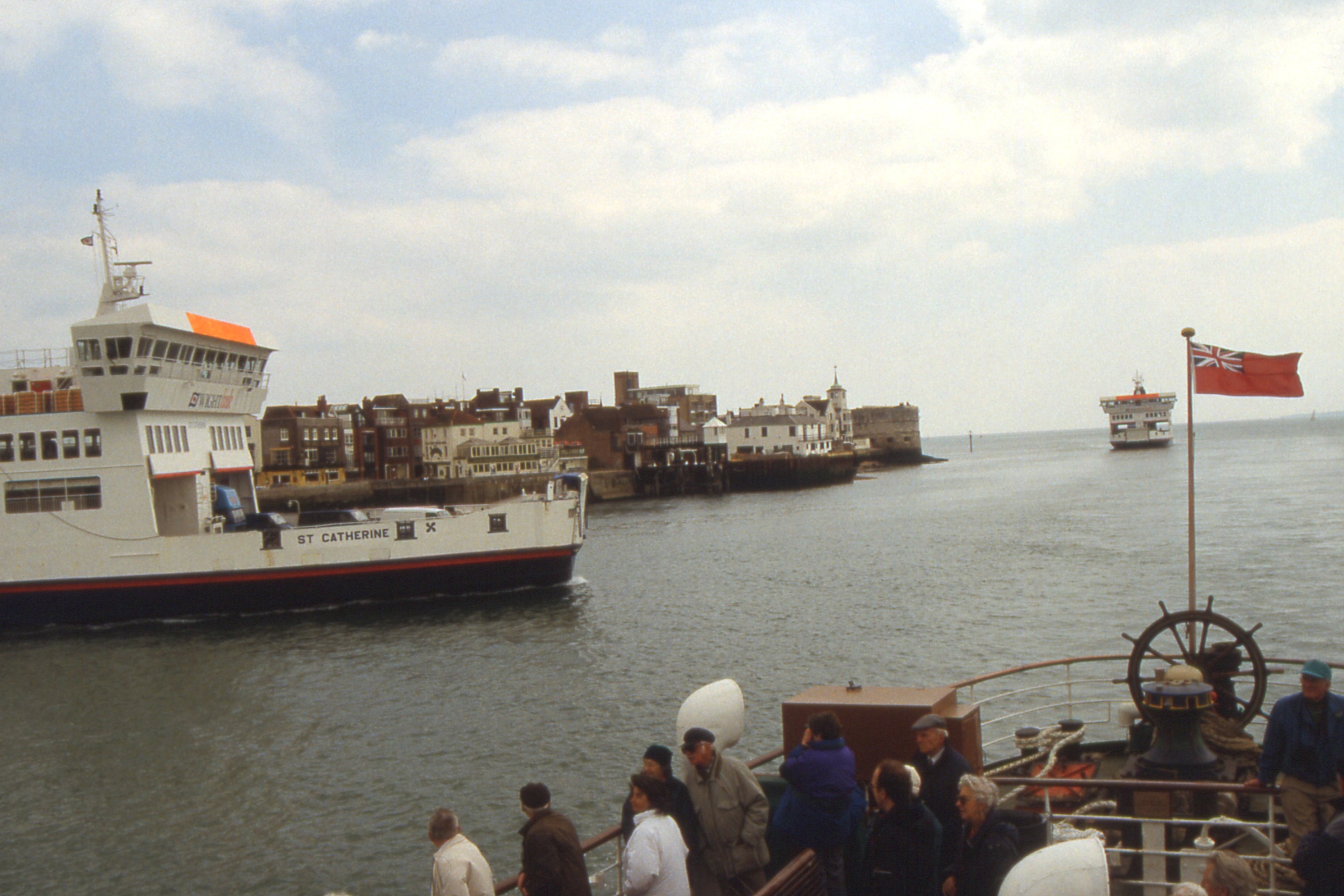
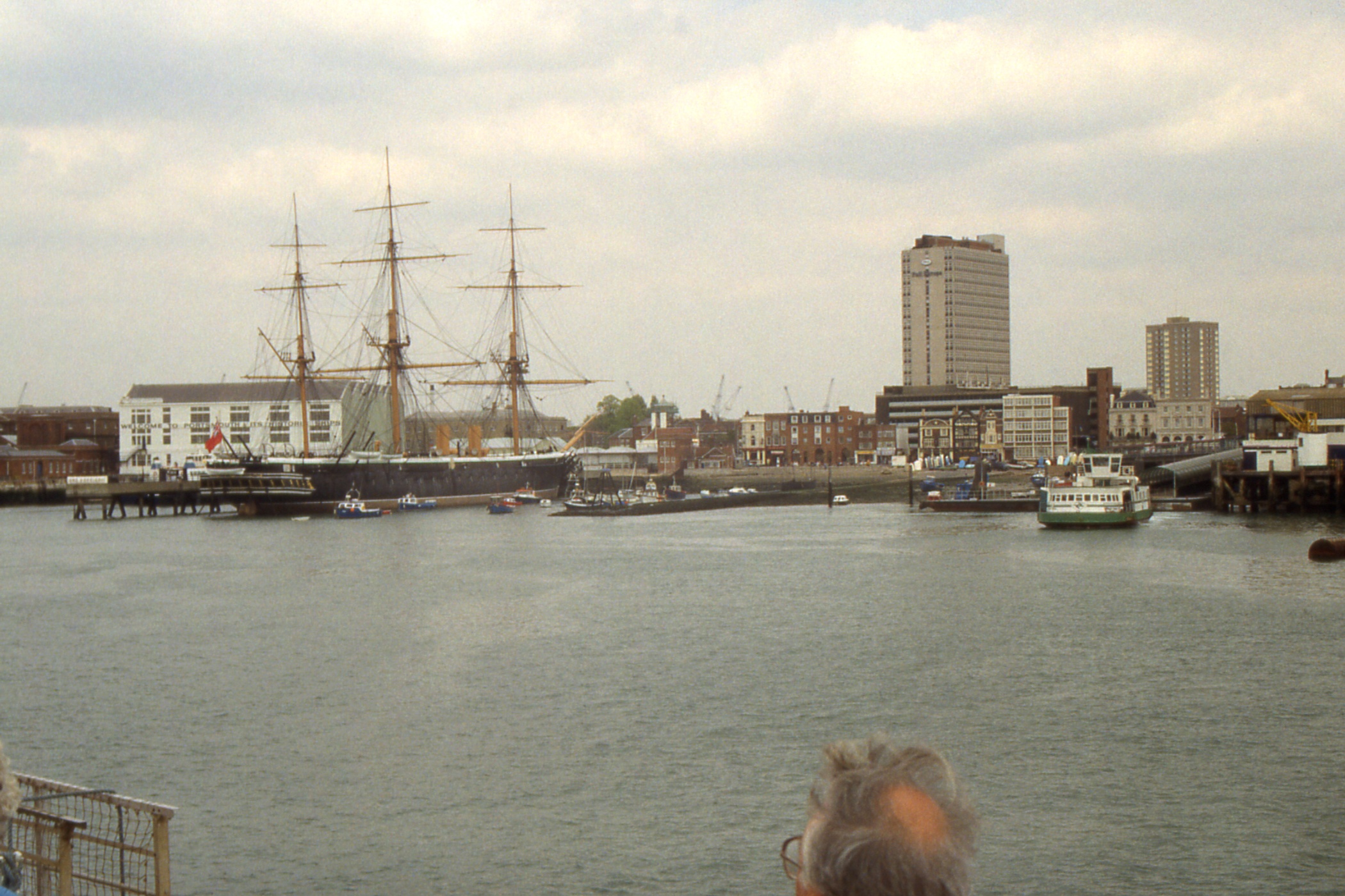
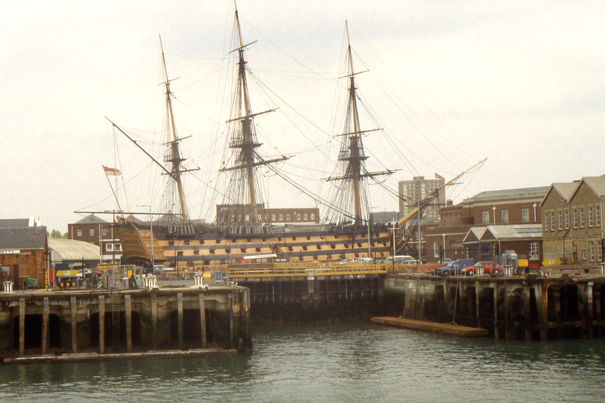
Portsmouth - Fishbourne (Isle of Wight) ferries | HMS Warrior and a cross-harbour ferry |
|
|
|
| HMS Victory in Portsmouth Harbour |
Brittany Ferries' "Duc de Normandie" | HMS Exeter (D89, Type 42, 1980), HMS Westminster (F237, Type 23, 1993) and the aircraft carrier HMS Invincible (R05, 1977) |
|
| |
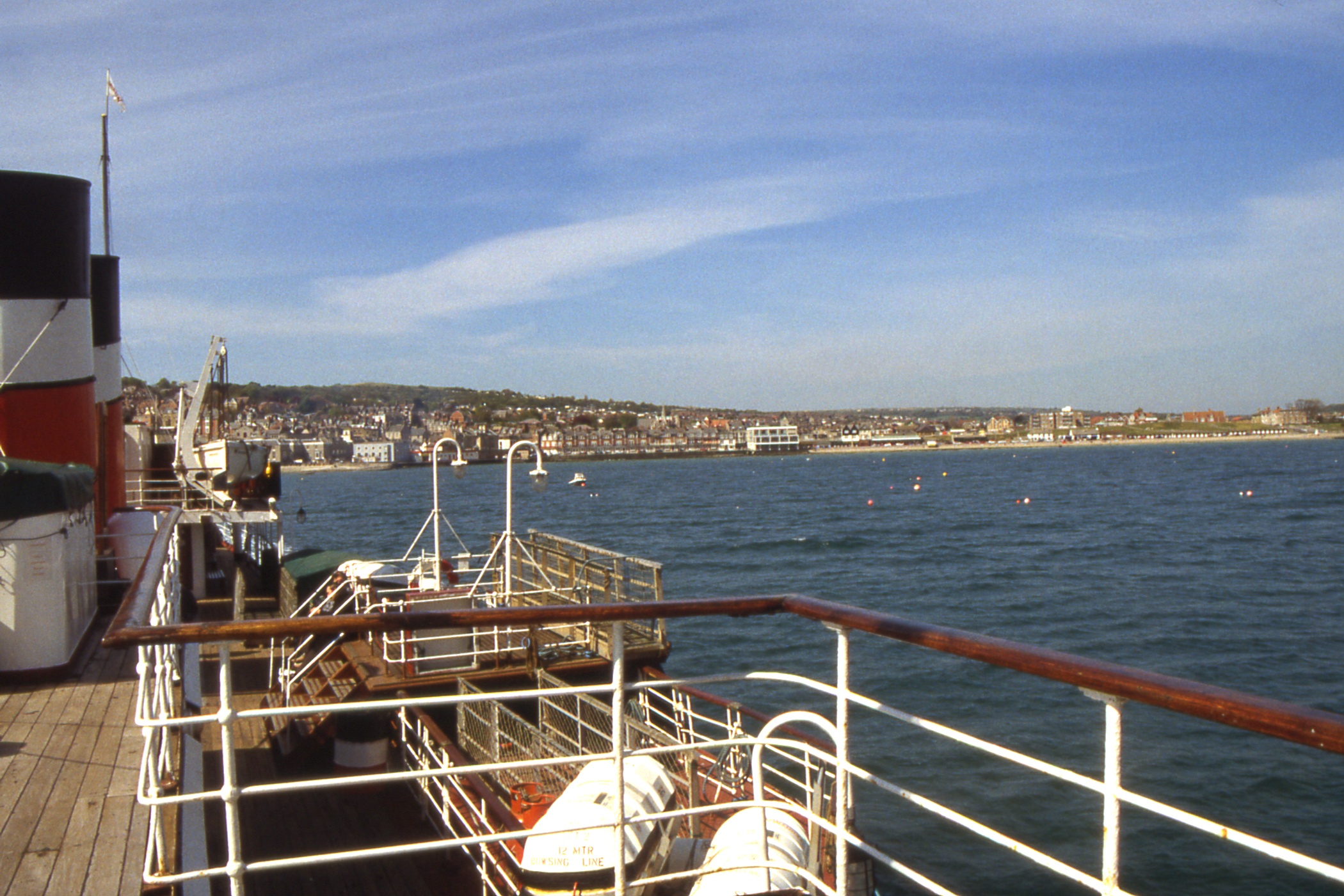
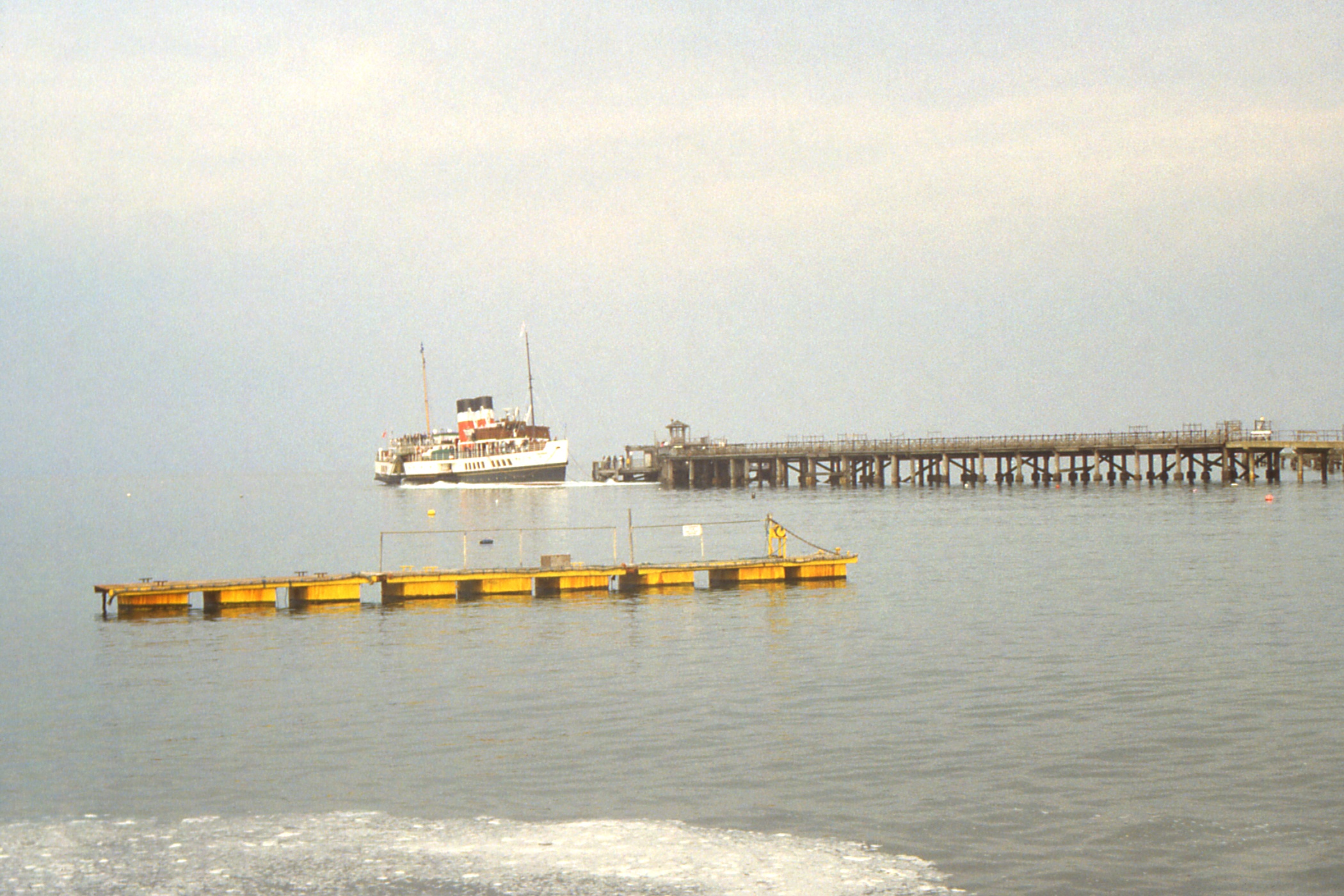
The return to Swanage was uneventful, arriving a little late but who cares. I hung around to watch the evening cruise depart before dining on cod and chips followed by a pint of Ringwood Forty-Niner which did not impress. Then it was back up the hill to the B&B, clean up and go to bed.
Waverley reversing off Swanage Pier for
the evening cruise
Day 6 - Wednesday, May 15 Swanage to Kingswear on Waverley
Another fine morning. I was up just after seven and I had a quick cup of tea while washing and packing before exchanging pleasantries with the landlady (who did not offer me a piece in my hand) and setting off for the pier. Waverley at the pier was a pleasant picture as I sat in the sun consuming my breakfast milk.
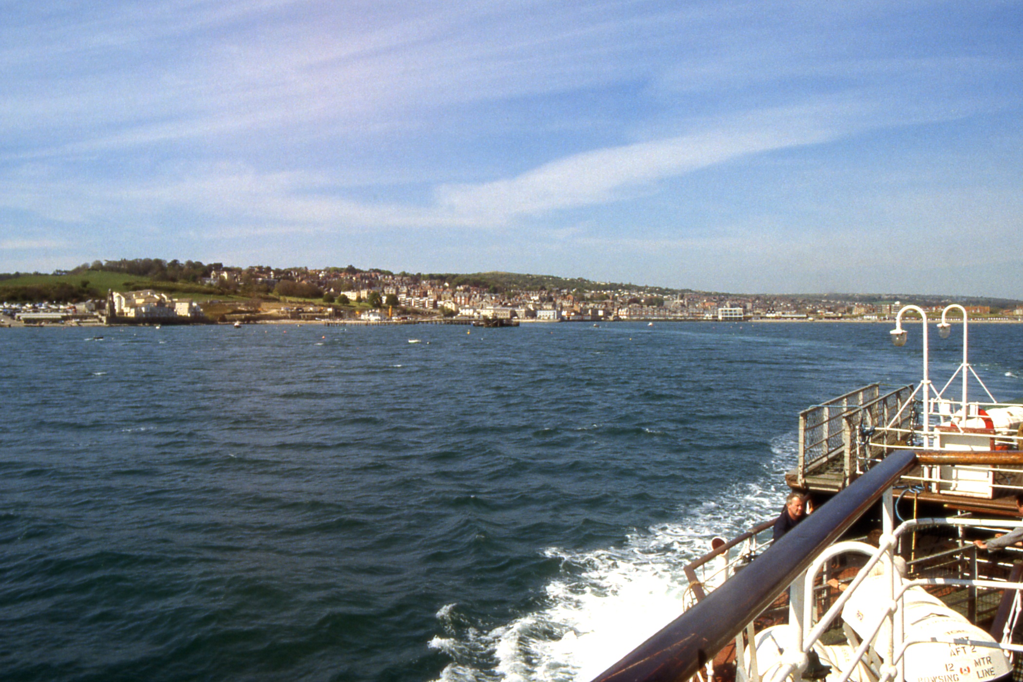
When I reached the boat, I noticed that they were taking water from a domestic sized tap on the end of a 3/8ths diameter pipe, and was told that they had been doing so all night and the tanks were still not full! A leisurely cruise across to Bournemouth, plenty of time to load passengers then back across the bay, past Swanage and along the coast. I took a few photos of the shore for a reminder of my pains on Sunday.
|
|
|
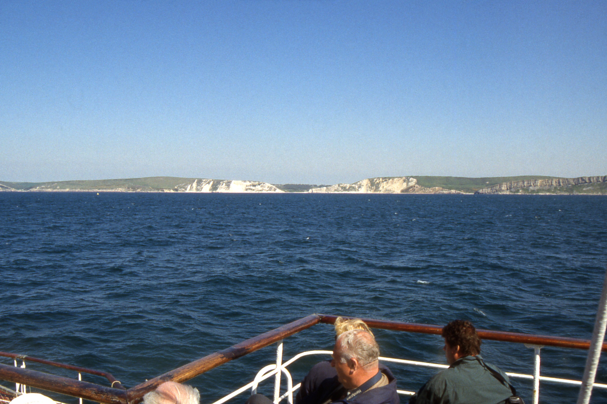
| St Alban's Head + the coast west with Chapman's Pool |
Kimmeridge Bay, site of the UK's first on-shore oil well |
Lulworth Cove on the left, Gad Cliff on the right, the dip in the middle is Arish Mell in the MOD Lulworth Ranges |
|
|
|
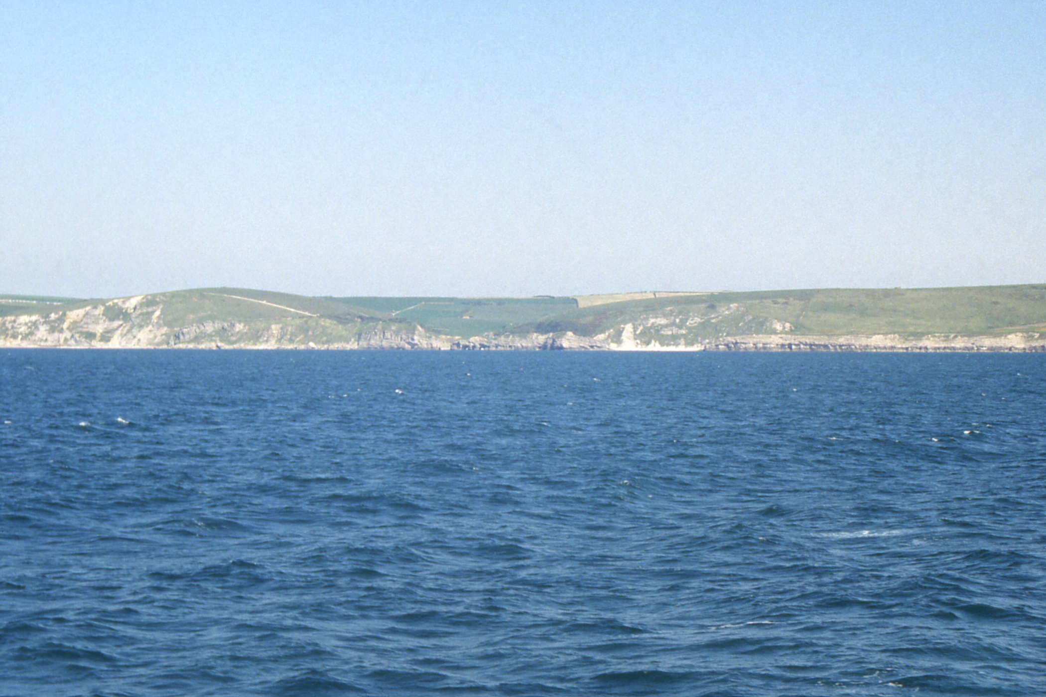
| Lulworth Cove |
The coast from White Nothe to the Durdle Door, west of Lulworth Cove |
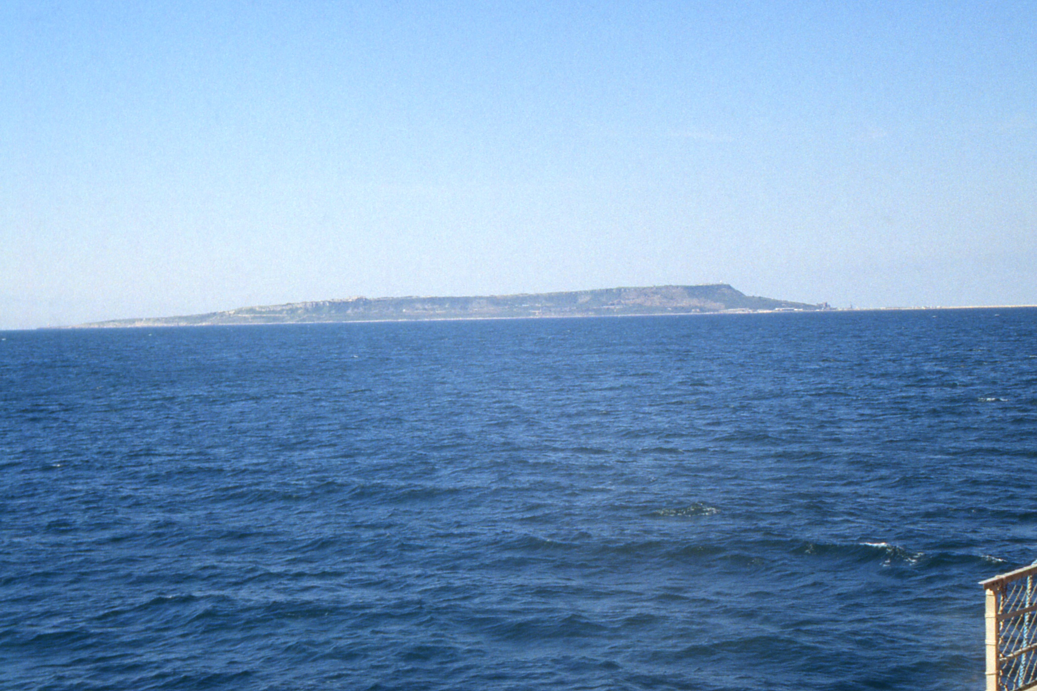
Isle of Portland from the north east |
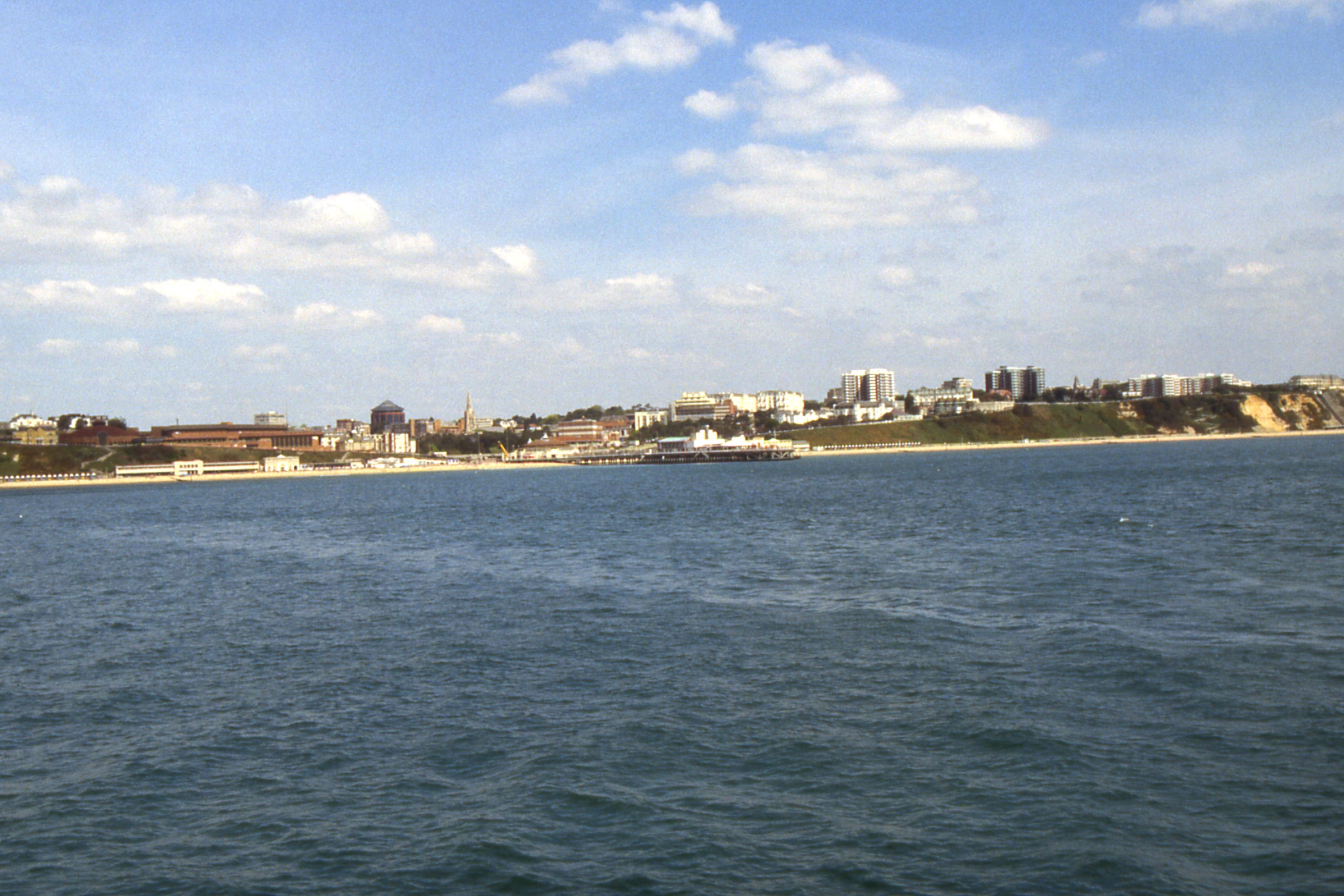
When we arrived at Weymouth, the Condor Ferries vessel “Havelet” was lying behind the loading ramp, blocking the berth Waverley should have used, and we had to go a bit upstream and squeeze in in front of the loading ramp, with a helpful nudge from the (padded) front end of the Harbour Master's launch. It was then announced that as we were berthed in a “restricted area” and only those making the one-way journey to Weymouth would be allowed ashore. The rest of the passengers had to make do with watching the crew loading stores.
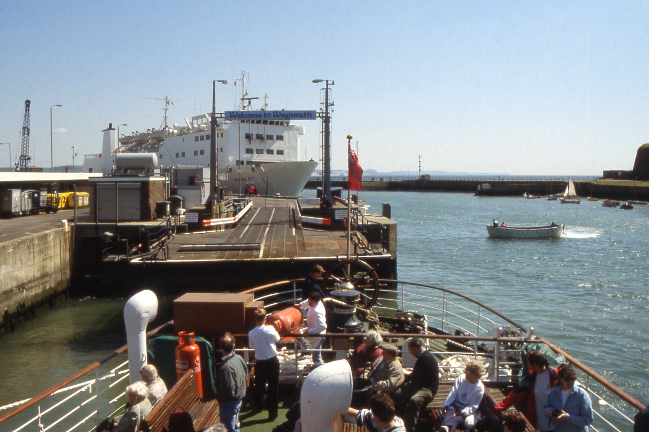
An awkward berth for the Waverley. |
|
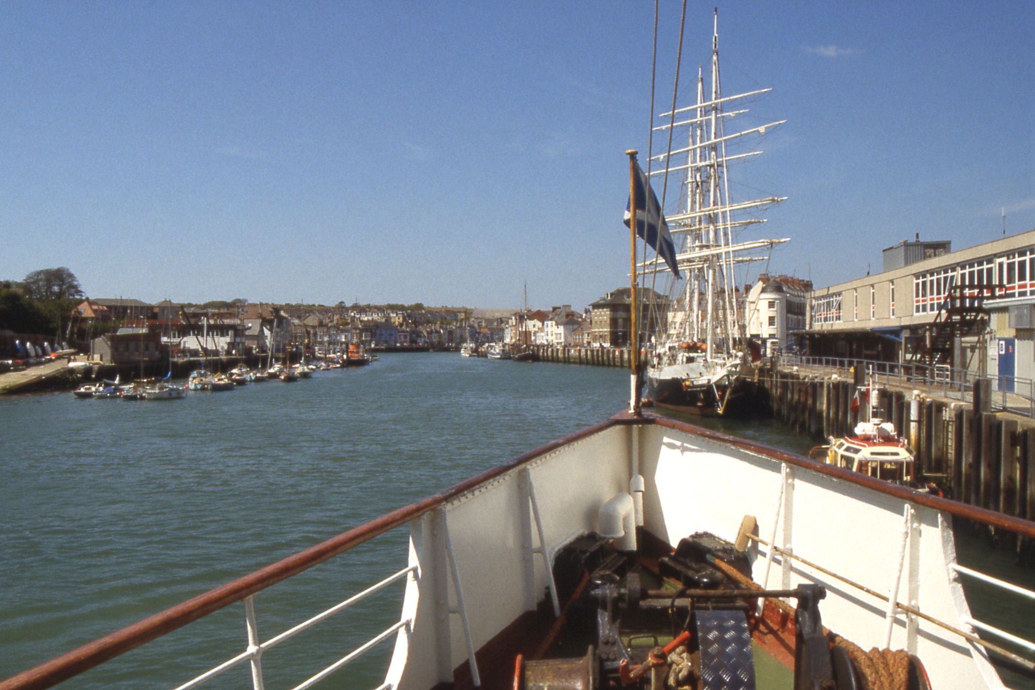
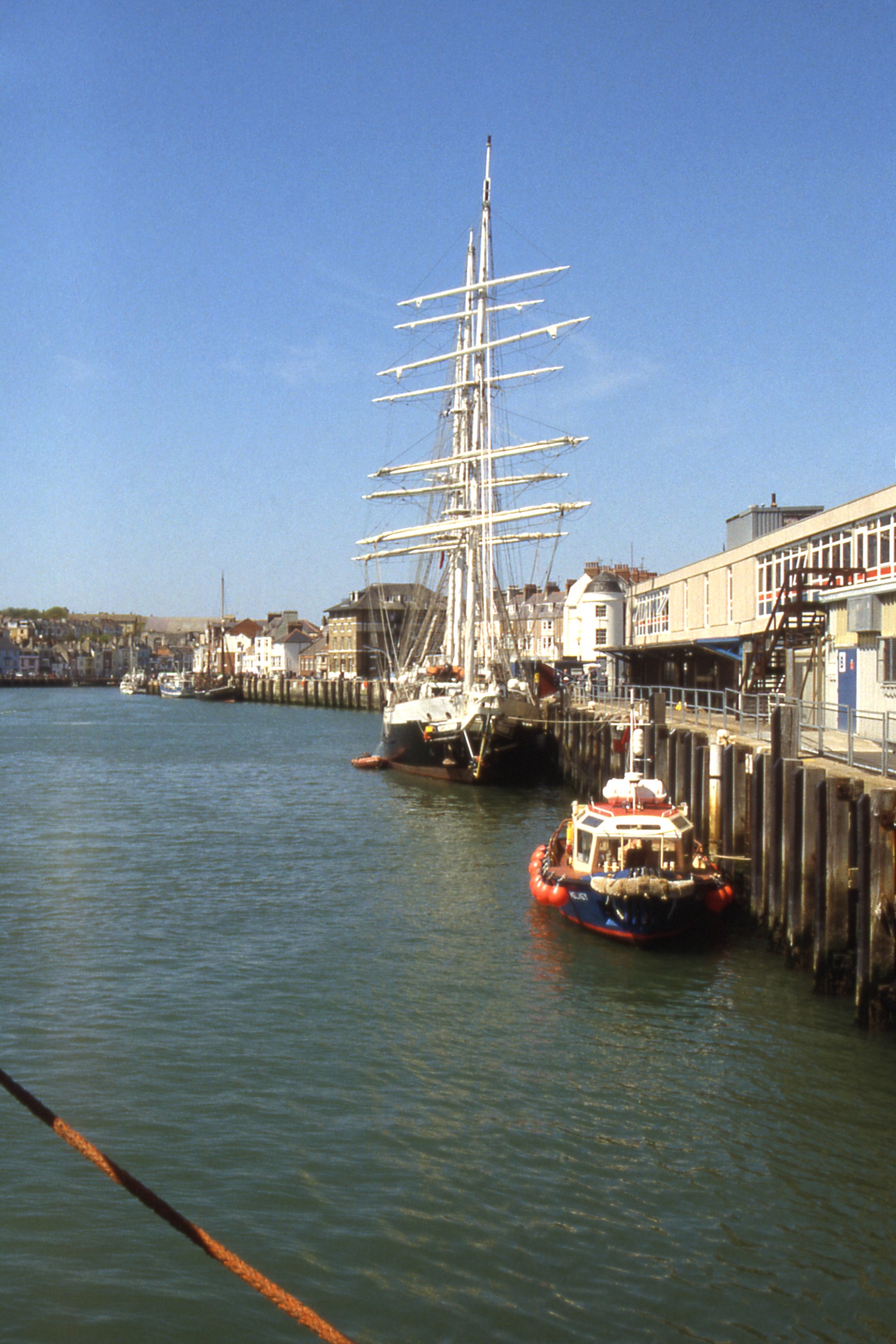
Sail Training ship "Lord Nelson" at the quayside |
| |
"Lord Nelson" |
|
|
| The Nothe Fort |
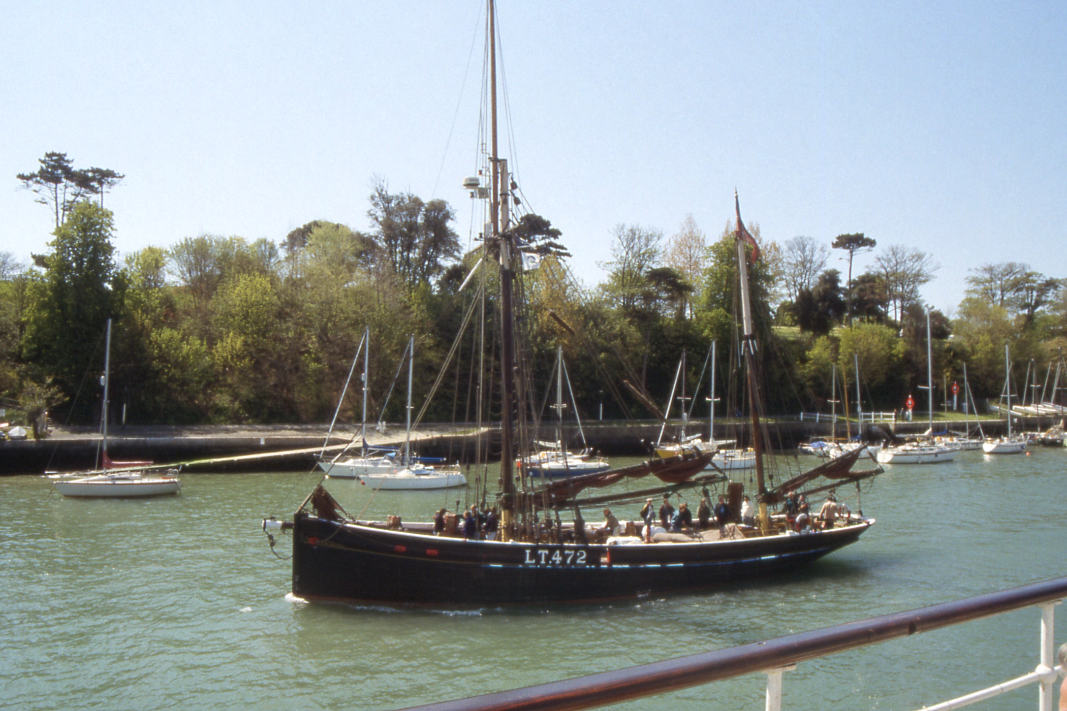
Old east coast fishing/trading vessel LT472 "Excelsior" leaving Weymouth Old Harbour |
Our departure was interesting. By winching in the bow rope, the stern was moved out just far enough to allow the Harbour Master's launch to come inside and push the stern further out clear of the ferry loading ramp. We then reversed into the river and stopped while the launch put its nose to the bow and lined us up to clear the harbour mouth. And off we went, reversing into Weymouth Bay.
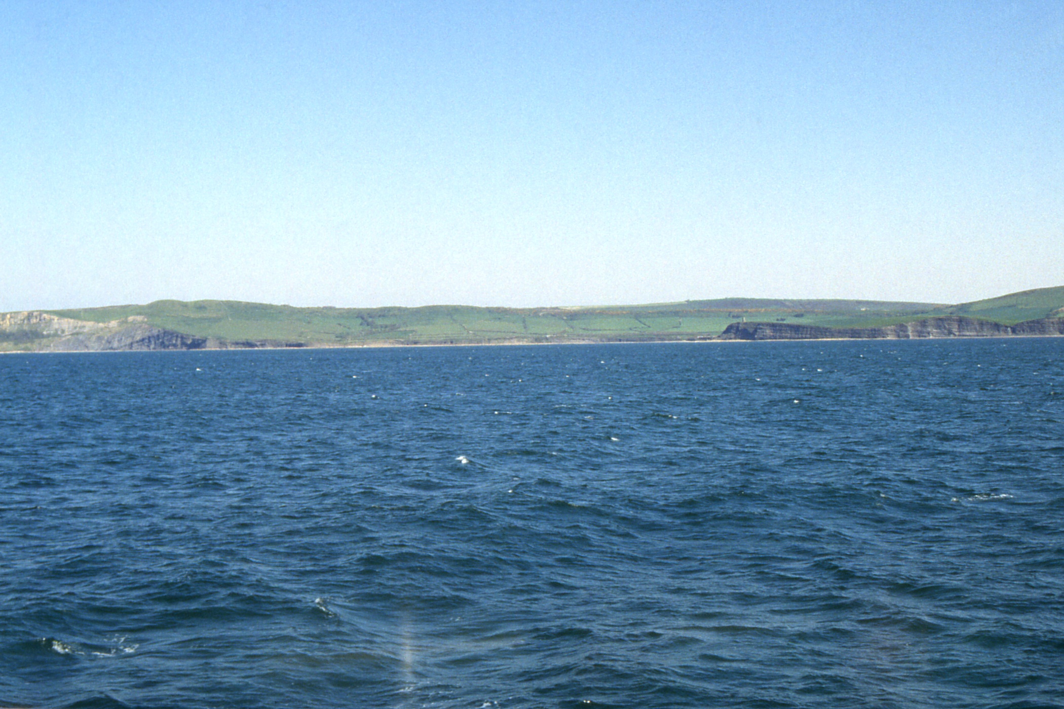
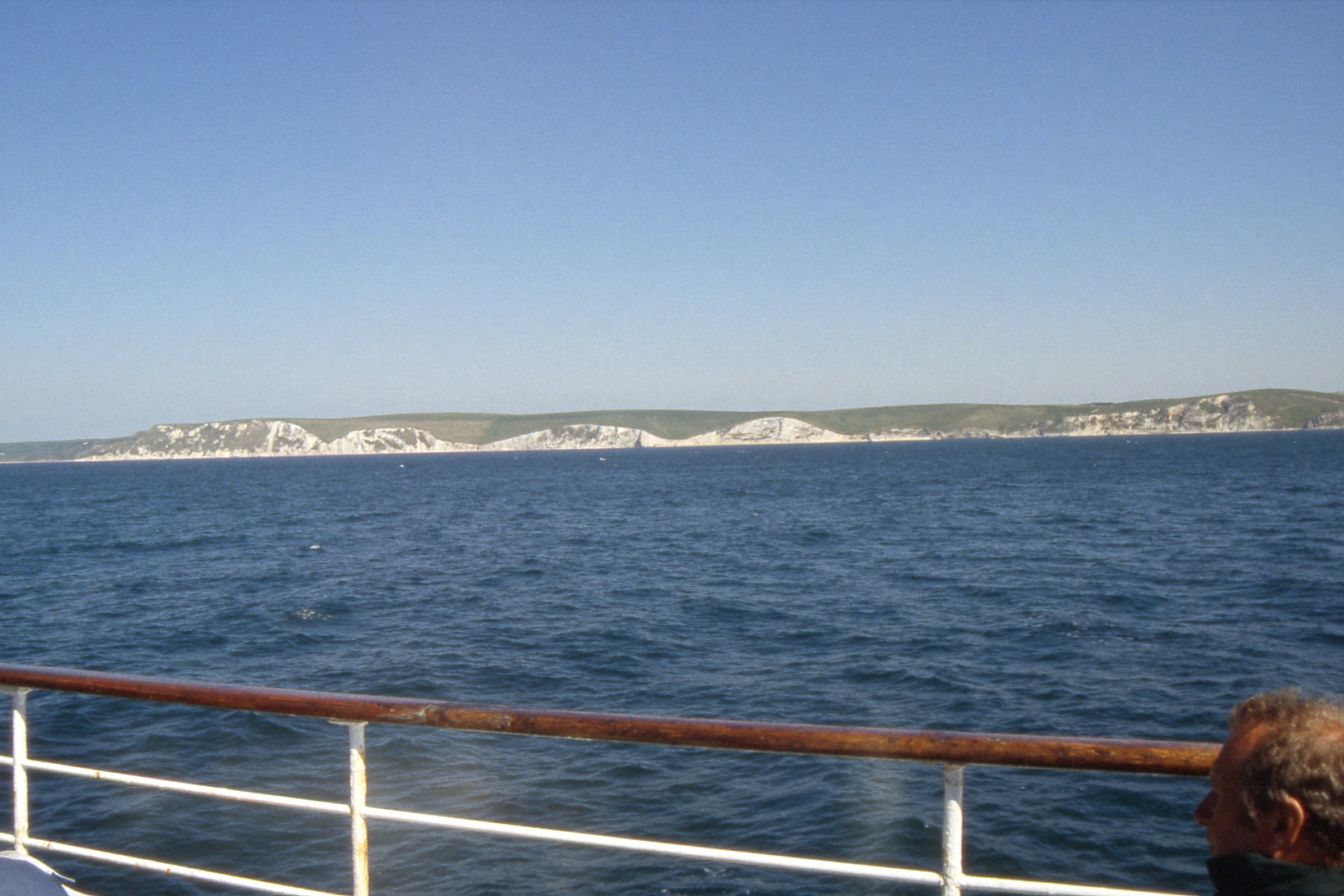
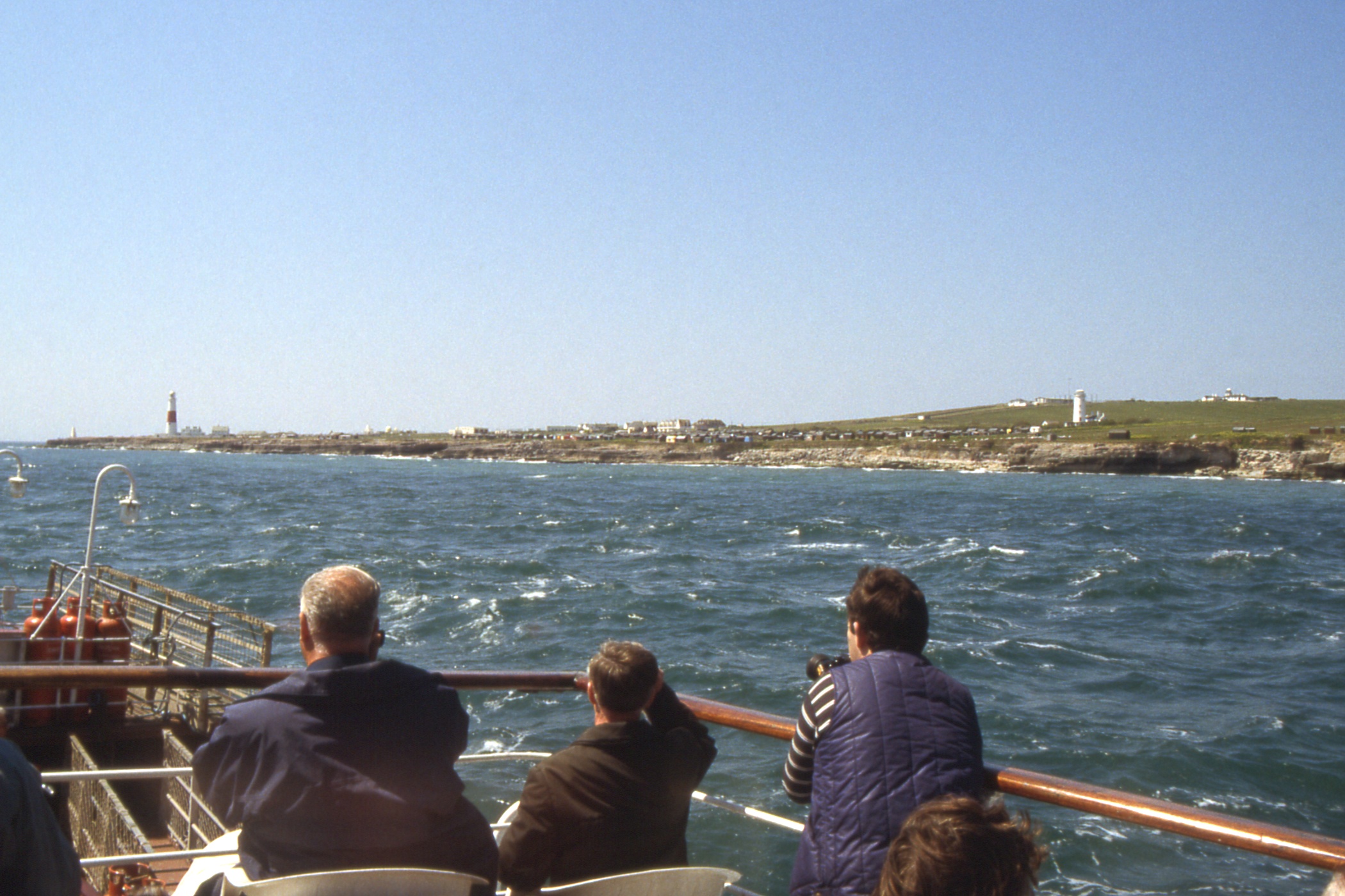
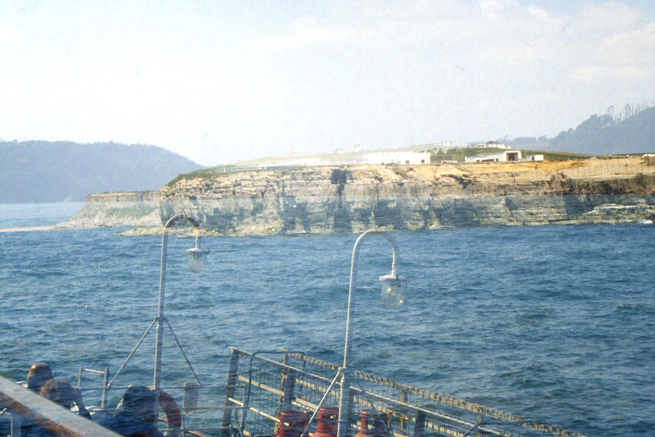
As we steamed down the east side of the Isle of Portland, we passed the catamaran “Condor” heading for Weymouth from the Channel Islands (Guernsey?). These catamarans are an impressive sight at full speed with twin wakes rising almost as high as the passenger deck. Round the Bill of Portland and across Lyme Bay to meet the coast again near Brixham, from where it is a short run to the mouth of the Dart.
|
|
|
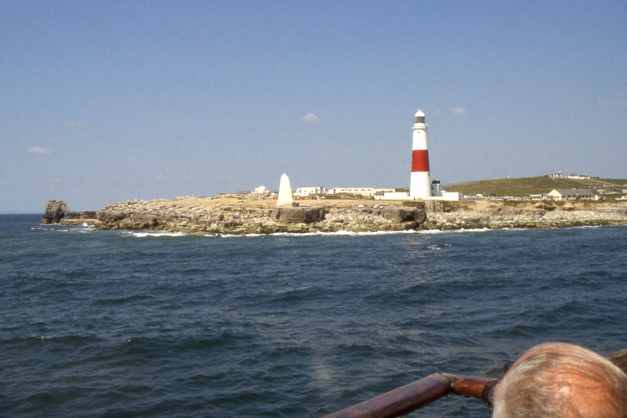
| Approaching the east side of Portland Bill |
Lighthouse at Portland Bill, Pulpit Rock to the left | A headland + the entrance to the River Dart |
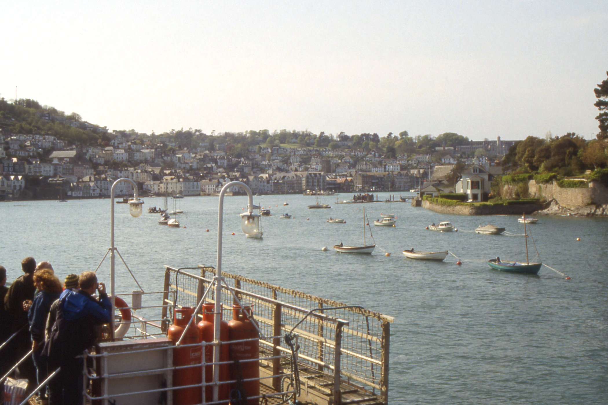
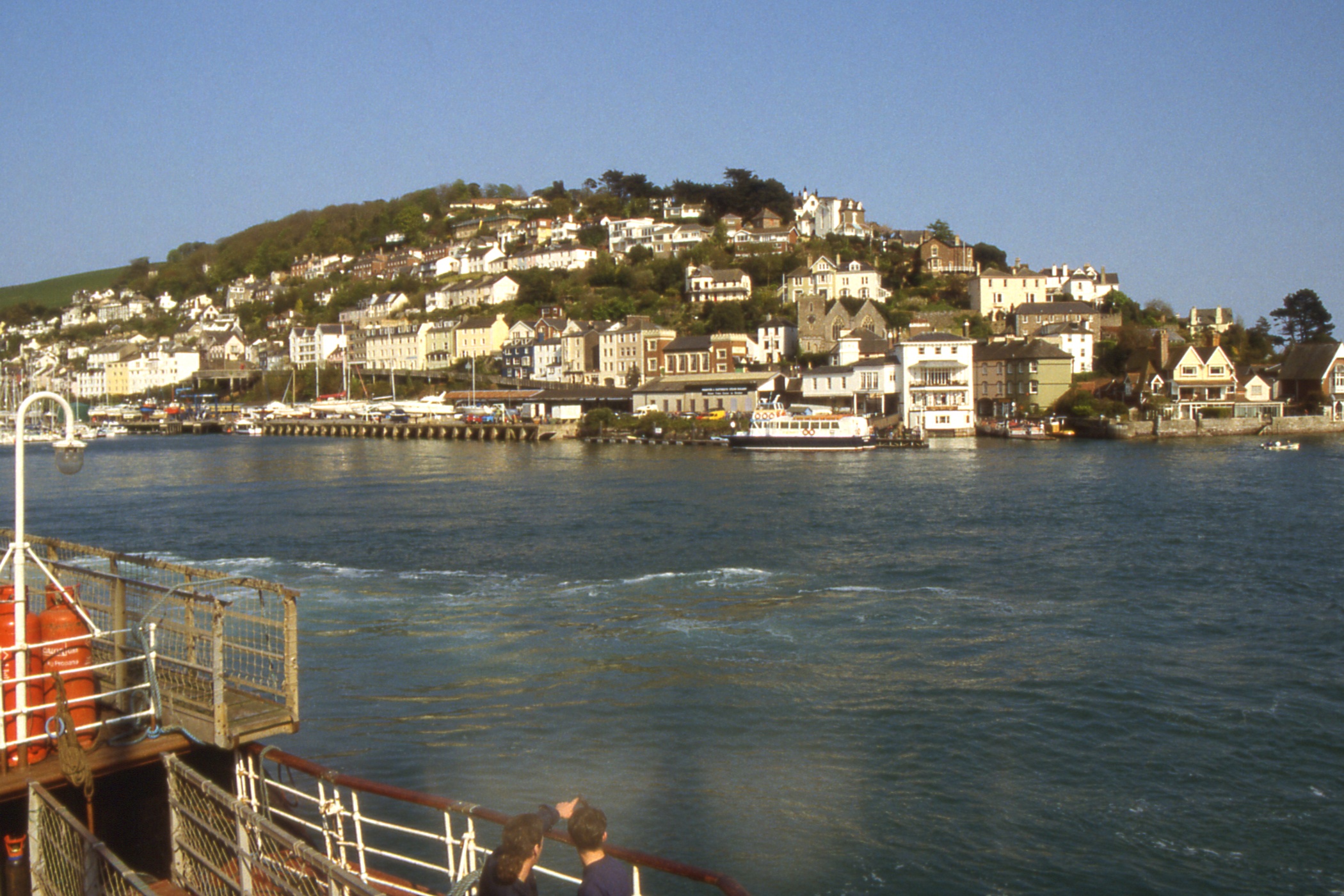
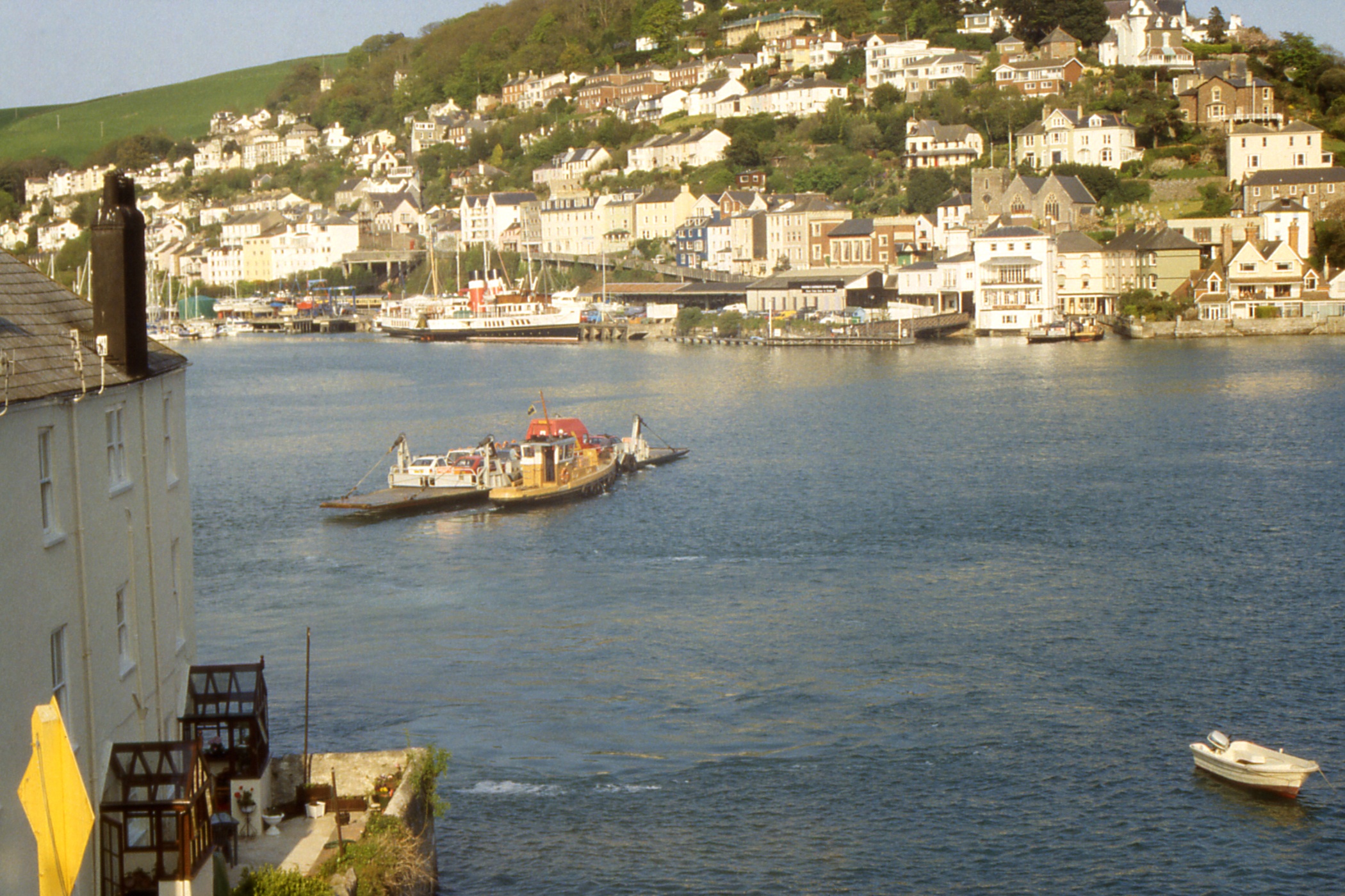
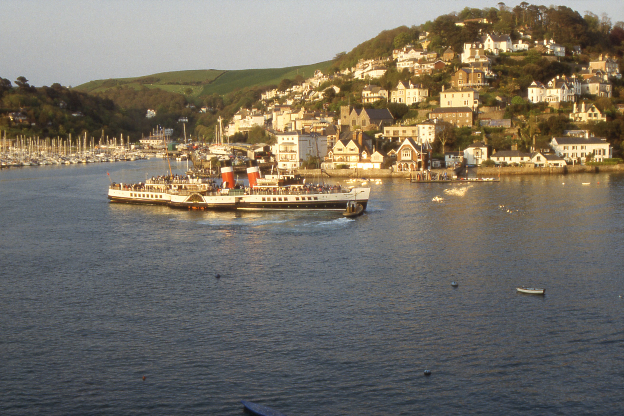
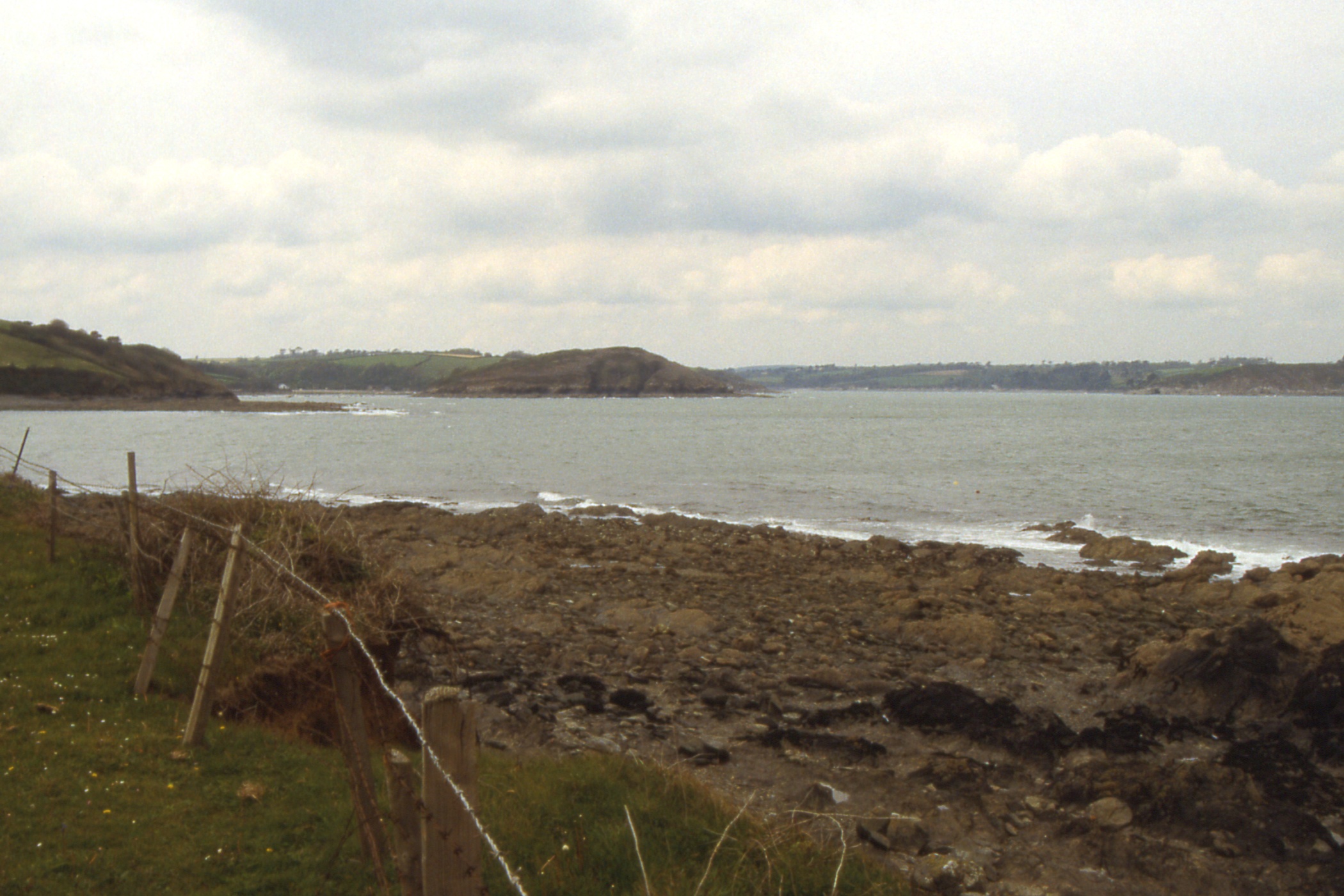
The entry to the Dart is impressive. It passes between wooded hills, widens only slightly and the channel is immediately marked on both sides by lines of yachts. The town of Dartmouth lies straight ahead with Kingswear peeping round the hill on the starboard side. The Kingswear quay is at right angles to the channel, close confined by moored pleasure craft, and we required the assistance of a small tug to align Waverley before reversing in.
We had arrived a bit early and rather than wait forty minutes to watch the departure of the train for Paignton, John, Myra, Ashley and Mark decided to seek out their accommodation. Since I was masquerading as one of Ashley's friends who had not turned up for the cruise, I went with them, crossing the Dart to Dartmouth on the passenger ferry “Kingswear Belle”.
|
|
|
| The River Dart, Dartmouth ahead and Kingswear on the right |
Kingswear with the passenger ferry "Kingswear Belle" at the end of the quay |
Two shots of the Waverley at Kingswear Pier |
|
|
|
| Kingswear, Waverley and the Dartmouth - Kingswear car ferry |
Waverley leaving Kingswear for evening cruise. Note the latest thing in bow thrusters |
Two shots of Waverley heading out of the Dart |
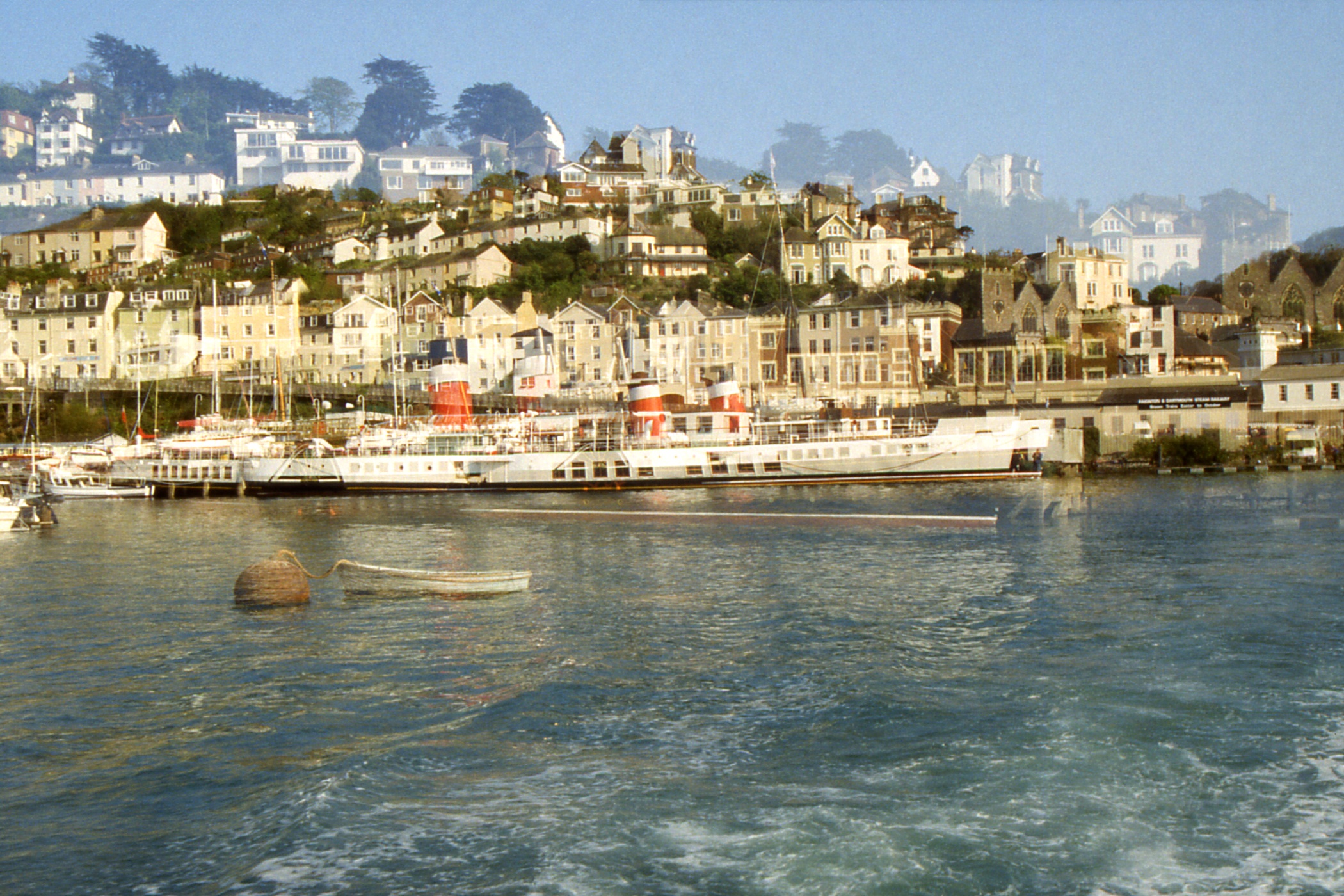
After dumping the luggage at the B&B we returned to the river. The others went down to the mouth in search of a good photo opportunity while I stayed nearer the town to watch Waverley depart for an evening cruise. I then dined on grey mullet in a seafood sauce and was not impressed. It seemed like bland mackerel and needed the sauce. After that, it was a wander around Dartmouth, a couple of pints and off to bed.
Day 7 - Thursday, May 16 — Kingswear to Falmouth
It was disappointing to wake to an overcast morning after the fine weather of yesterday but that's the way it goes. After a quick but hearty breakfast, I sped down to catch the ferry across to Kingswear. It was fairly full of school children, most of whom boarded buses at the far side. I went up the hill a bit to take photos of Waverley at the quay before going aboard. We reversed out into the channel and the small tug reappeared to apply its bow to the stern and push us round. I was amazed at the speed of this operation until it was pointed out to me that there was another tug at the bow.
|
|
| Waverley at the quayside at Kingswear with
Dartmouth on the far side of the River Dart |
|
As we reached the open sea, there was a bit of a sea running, the wind having increased somewhat overnight. We rolled a bit as we headed straight out to sea, and a bit more as we turned to head for Start Point. There was an easier motion with the sea behind and it was definitely a pleasant cruise along the coast but the Jeremiahs amongst us had already begun to speculate whether the scheduled cruise could be fulfilled.
They were proved right when we reached Mevagissey and found an uncomfortable swell across the harbour entrance. The Skipper decided (very wisely) that it would be foolhardy to tie up at the end of the breakwater and in the blink of an eye, we were going hard astern, leaving quite a large crowd on the pier. Richard (from Leeds) opined that getting the bow rope ashore constitutes a call but I'm not convinced.
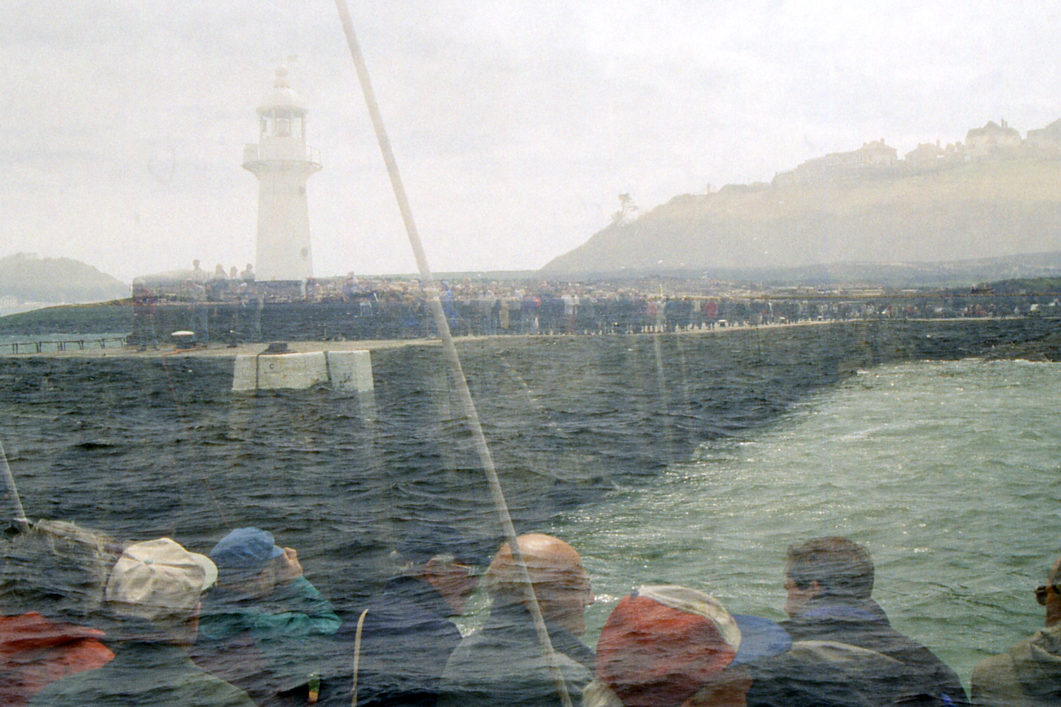
|
|
|
| Entrance to the River Dart + Mevagissey Harbour |
Mevagissey from a rapidly retreating Waverley | Cornish fishing village Mevagissey |
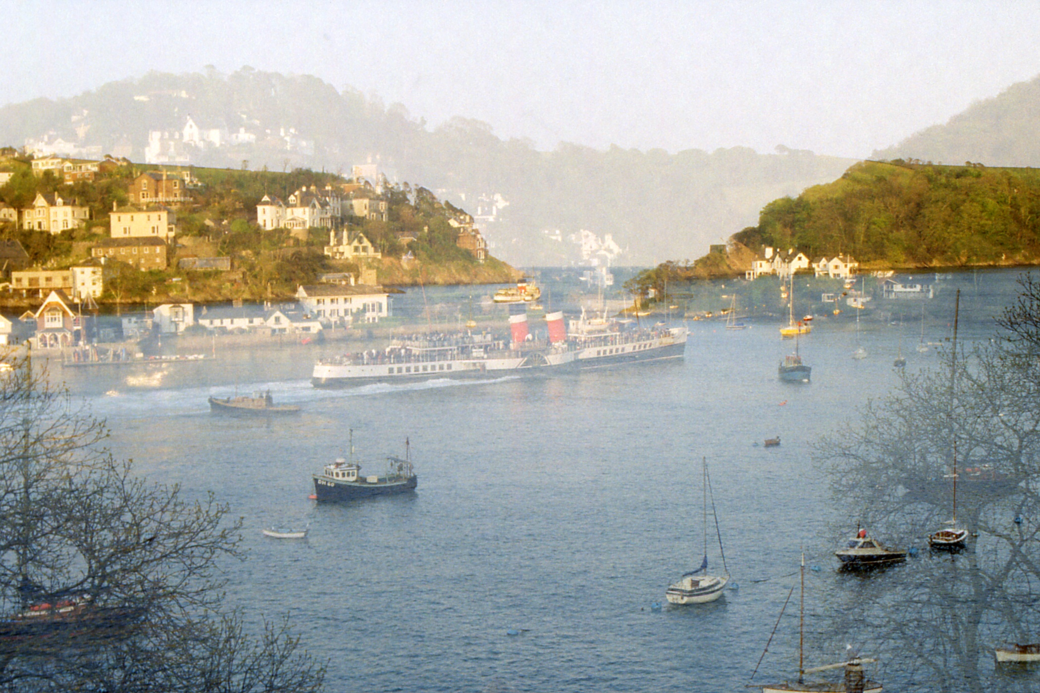
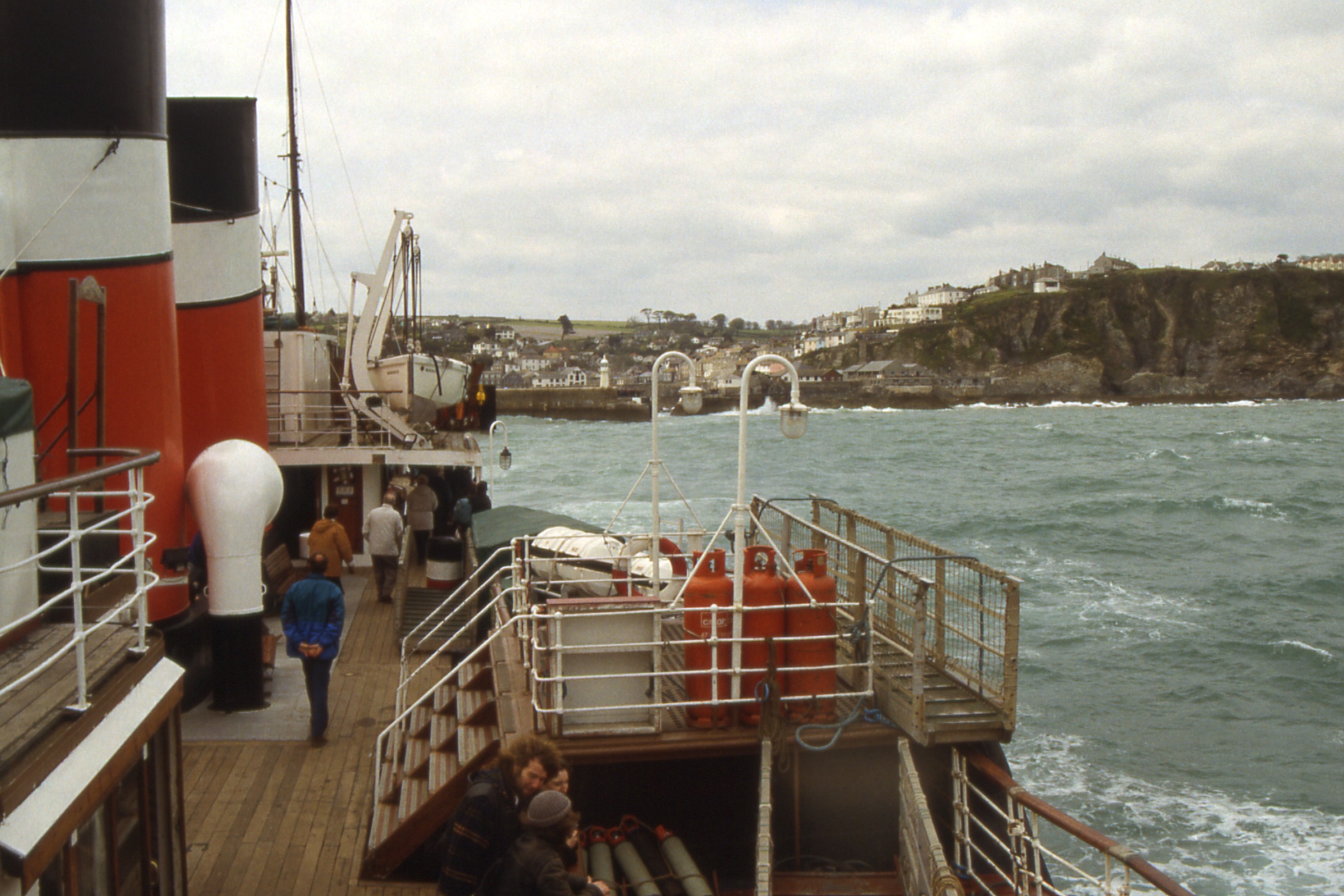
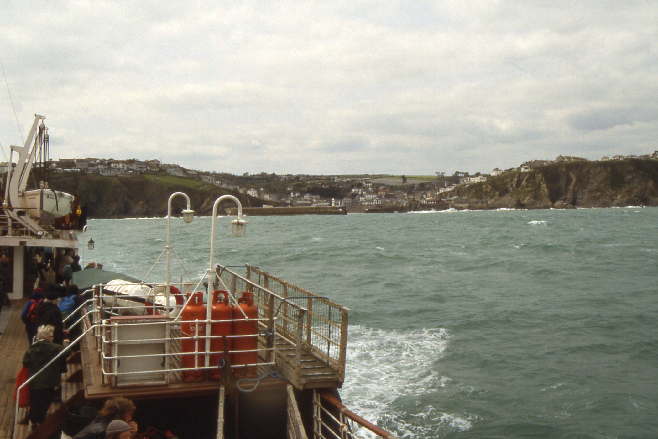
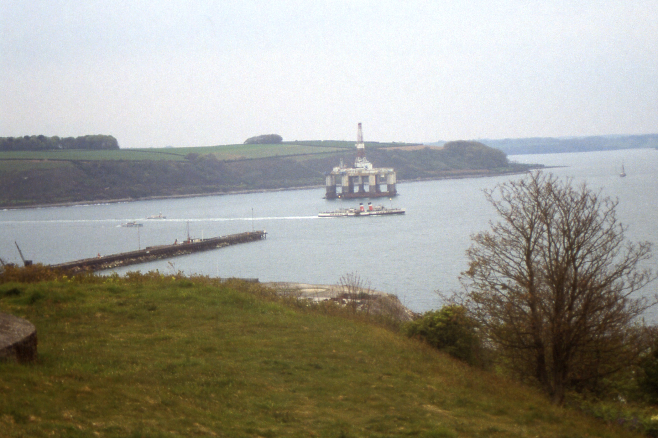
We headed due south for a bit, out to sea then west to close with the coast again just south of Falmouth, then south again to turn off The Manacles and return to the mouth of the Fal. At this point, we were told that we couldn't get a berth in Falmouth (my destination for this evening), and would drop anchor in the bay off St Mawes, opposite Falmouth which we did just in time to see the last ferry to Falmouth depart.
A small boat came out (the St Mawes - Place ferry) but had difficulty securing alongside due to a slight swell and a high coaming on the boat. The Skipper jumped in and went off to inspect the pier with a view to getting Waverley alongside. This must have been impractical as when he returned, a further attempt was made to secure the small boat alongside. This time it was successful and the small boat was quickly filled, me nearly first. Shortly after we got ashore, the Falmouth ferry returned but was not going back to Falmouth.
|
|
| St Mawes, which is separated from Falmouth by the Carrick Roads |
Waverley off St Mawes with the useless Falmouth - St Mawes ferry |
Now, the arrangement was that the last coach to Dartmouth would call at St Austell station to drop those who had other plans. One bus had already gone but the second needed just three more passengers to fill the bus and the driver offered to go via the station so I deserted my friends (well, I had a train to catch) and jumped aboard. At St Austell, Just before my train was due, the last bus arrived and Richard gleefully informed me that Waverley had now acquired a berth in Falmouth and I could have gone across after all. I was none too pleased!
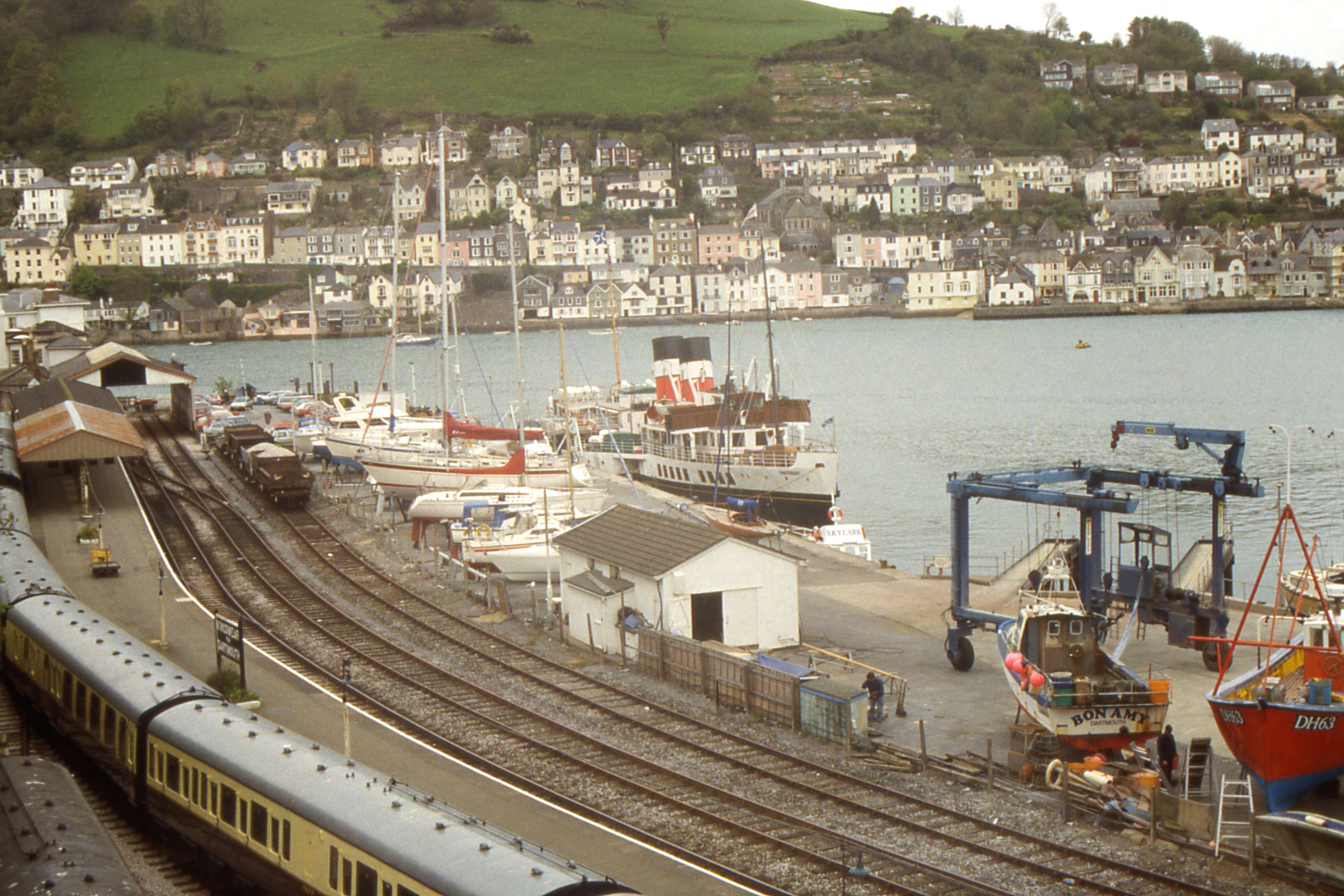
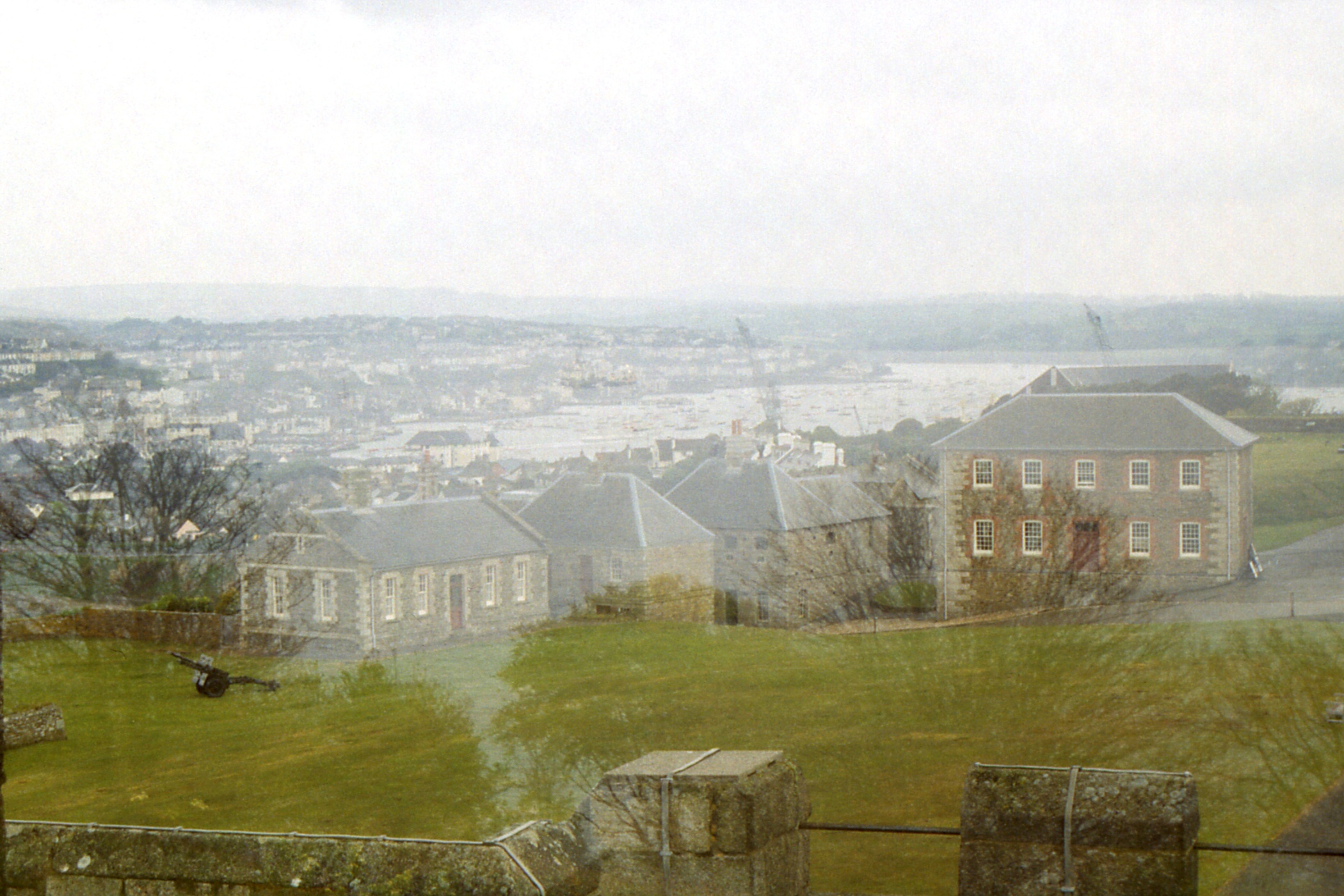
I changed trains at Truro for Falmouth Docks, transferring from a 125 to an antiquated DMU, probably older than the Strathclyde stock and unrefurbished. (Adverts for the Falmouth line show a sprinter!) from the station there, it is a short walk up to Pendennis Castle where the Youth Hostel is in the Victorian barracks. Before going in, I went to admire the view and was rewarded with a sight of Waverley leaving Falmouth Docks! Later in the evening, I went out for a smoke and a walk round the castle grounds and watched Waverley return from the evening cruise (without illuminated funnels!) and apparently anchor again off St Mawes about a quarter to ten. I left her there and went to bed.
|
|
| Waverley leaving Falmouth Docks for an evening cruise |
Waverley heading up the Carrick Roads + Falmouth from Pendennis Castle |
Day 8 - Friday, May 17 — A rest day in Falmouth
Time for a non-travelling day, so I had a leisurely breakfast in the hostel, in the company of a lad from Thunder Bay, Ontario and another from Switzerland. When I went out, it was overcast and almost not raining but as I walked round Pendennis Head I decided that it was raining after all and put on my waterproof jacket for the first time this holiday.
By walking slowly around Falmouth, I managed to pass most of the morning until it was a respectable time for lunch. I tried my first Cornish Pasty and decided that I prefer Forfar Bridies. After a leisurely couple of pints I visited the Maritime Museum which proved more interesting than I had expected, before returning to Pendennis Castle and the hostel to clean up for a night on the town.
Which comprised a large cod and chips. I'd had enough about half way through it do I started feeding a one-legged seagull. It had problems competing with the others on the ground so I amused myself by devising stratagems to see that it got more than its fair share. It quickly learned that when I put my arm down, I was about to throw a morsel up in the air and it took off in pole position.
Day 9 - Saturday, May 18 — Falmouth to Coverack
It was grey and overcast this morning, but not quite nearly raining. I hit the road just after eight and passed Maenporth about nine, the refreshment kiosk was not open. At Rosemullion Head, I briefly considered cutting across the neck, after all who would know, but didn't. I reached Helford Passage at five to eleven, no sign of ferry or landing stage, and enquired of a chap nearby who turned out to be the ferryman. Apparently in an easterly wind, it is not a good idea to have the landing stage on the beach so he rowed me out to the ferry (a small launch - 12 passengers) and took me to the other side.
As I walked from the ferry into Helford, the first thing of interest was a pub but I managed to restrain myself and bought a pint of milk in the shop round the next corner. And round another corner, there was a tea-room but I kept walking. At St Anthony-in-Meneage, I asked directions for the stepping stones across Gillan Harbour from a man on the beach who was decorating an eight oared boat “Helford” with white and yellow garlands. I found the stones clear of the still-falling water and made my way gingerly across. There was not much of Gillan or Flushing visible from the path and I continued round Nare Point to Porthallow. The tea-room on the beach was closed so I had to seek refreshment in the pub. When I set off again, I passed the Taranaki Tea-room just round the corner.
|
|
|
| Falmouth Bay featuring Rosemullion Head, Pendennis Head and Zone Point, from Nare Head |
Pendennis Head from Nare Point | Entrance to Gillan Harbour with the Helford River mouth beyond, with Dennis Head between, from Nare Point |
From Porthallow to Porthoustock, the route follows minor roads and I don't know how it happened but the roads I followed didn't match the ones on the map. However I passed through the small village and by road and field path, recovered the coast as expected just before Redpath's Dean Quarry. Once through that blasted landscape, it was a straightforward walk into Coverack and up a steep hill to the hostel as a few spots of rain fell.
I booked a bed for the night with evening meal (spaghetti bolognese) and breakfast. By the time I had cleaned up it was definitely raining. Despite this, after dinner I went down for a look round the small harbour and a couple of pints in the Paris Hotel before bed.
Day 10 - Sunday, May 19 — Coverack to Mullion Cove
It was still raining in the morning. During breakfast, we discussed the prospect for the day. Opinions varied between rain all day and clear by eleven. Either way, the walking still had to be done, so I decided that the waterproof jacket was necessary but I could do without the trousers. By the time I had covered a couple of miles, I realised that I'd made a mistake and took advantage of the shelter of an abandoned coastguard lookout on Black Head to correct the error. The fact that nettles had encroached on parts of the path added weight to the rain.
When I continued, I was pretty impervious to the weather (and the nettles) so, of course, the rain slackened and had gone off by the time I reached Kennack Sands but I couldn't be bothered undressing. Thus I arrived at Cadgewith at lunchtime in wet weather gear, took tea at “The Cellars”, a pleasant small restaurant with open courtyard, and continued with waterproofs stowed away.
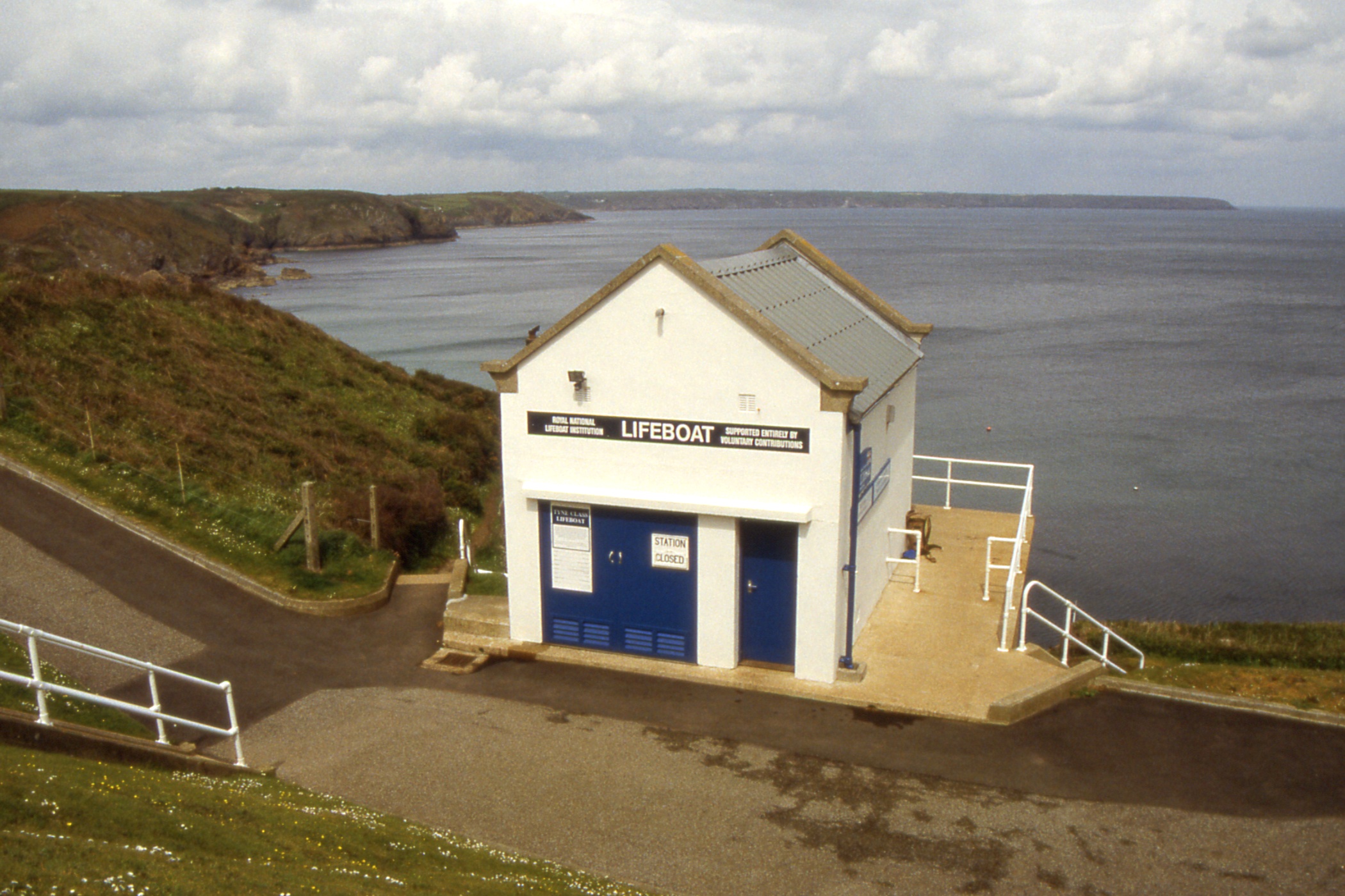
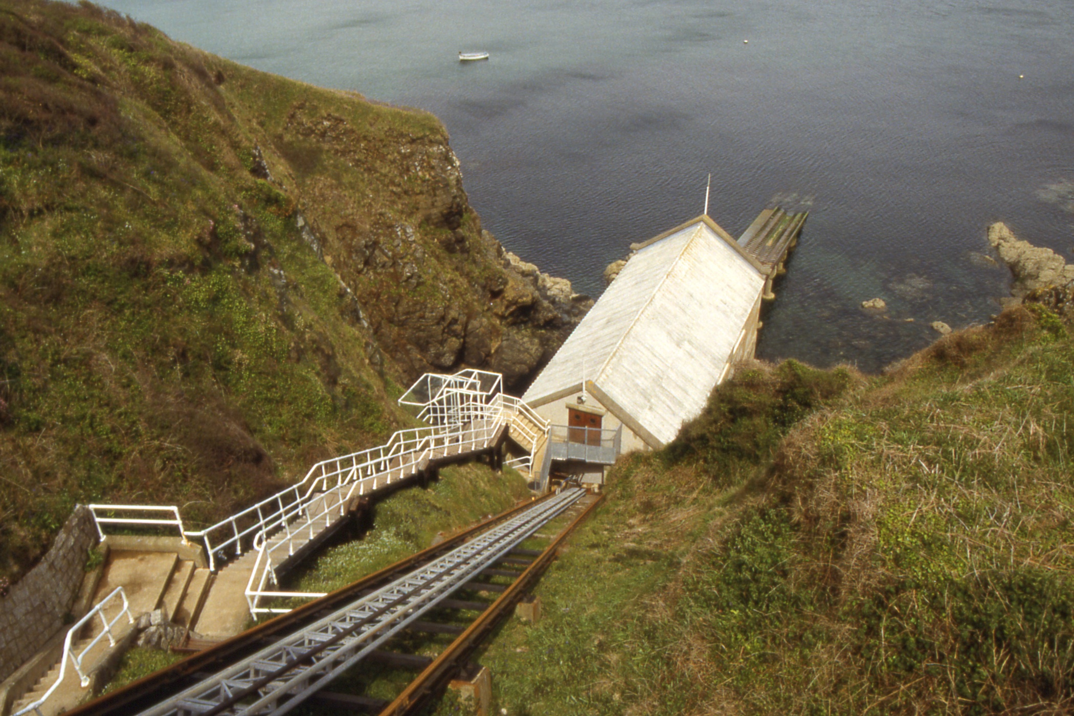
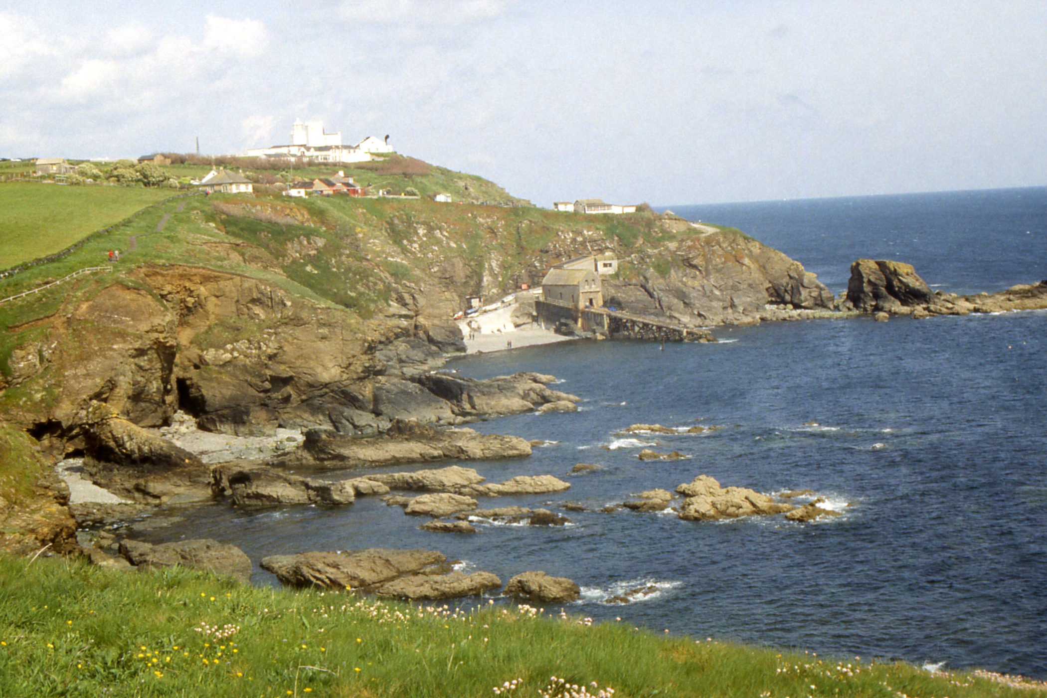
My first sight of the lifeboat station at Kilcobben Cove was a shock. It is perched on the cliff top about 90' above the sea with a very steep ramp going down. On closer inspection, however, I was relieved to find that this was the top station of an inclined railway with a cage to take the crew down to the real boathouse much nearer sea level. It was not much further to The Lizard, passing the old Lloyd's Telegraph Station and the lighthouse before reaching the car park, tea-room, gift shops etc. Given that it was now a fine Sunday afternoon, I was surprised how few people were about, they could be counted in tens rather than hundreds.
|
|
| The new Lifeboat Station at Kilcobben Cove
|
|
|
|
|
| Housel Bay to the east of The Lizard + Polbream Cove and The Lizard from the east |
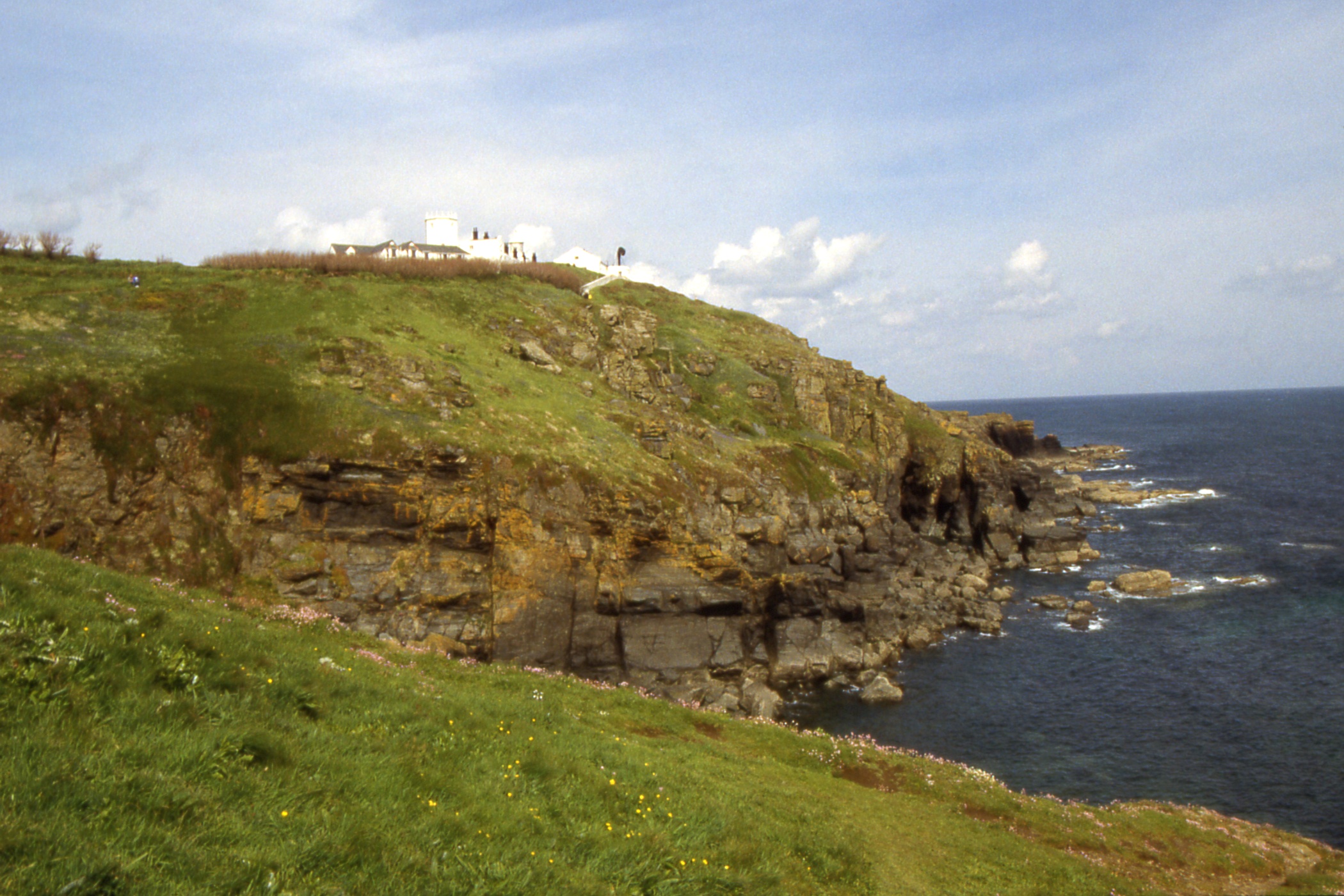
The Lizard Lighthouse which is just to the east of The Lizard |
The Lizard from the west, with Polpeor Cove and the old Lifeboat Station below |
After The Lizard, I began to slow down, feeling resentful each time the path took me down into a cove with the inevitable slog back up on the other side. It was well after six when I approached Mullion Cove, looking very attractive in the evening sunlight, and I could not raise any enthusiasm to go looking for reasonably priced accommodation and headed for the nearest hotel.
Which was the two star Mullion Cove Hotel, and even that was up a hill. I wandered into reception and asked for the cheapest bed and breakfast rate. £30 seemed a bit expensive but I took it. Well, I was tired. Single room, not en suite but exclusive use of a bathroom just down the hall. When I went to use it, someone was in it and when I did get in, there wasn't a lot of hot water. The tea things were somewhat limited, three tea bags, two coffees, one hot chocolate, two white and two brown sugars, only one UHT milk and no bikkies! Still, there was a colour television and a teasmaid (without instructions) so no doubt it met the standards for its two start and three crowns.
I went round to the public bar for a couple of pints, a pleasant place with large windows through which I could admire the sunlit evening, and Boddington's. While there, a fox ran across the car park.
Day 11 - Monday, May 20 — Mullion Cove to Penzance
I got up early to use my bathroom before anyone else got there. Someone did try the door while I was in the bath so it was worth the effort. I switched on the television for the news and weather, showers are forecast but the sun is shining outside. Breakfast was from half past eight but there was a coach party of German walkers having breakfast at eight so I went in at quarter past. Service was a little slow but the meal was all right.
I was packed, paid and on the road half past nine. Near Poldhu Cove, there is a monument to Marconi who sent the first transatlantic radio signal from this spot to Signal Hill, St John's, Newfoundland which I visited in 1989. There is nothing left of Marconi's base at either end but there was a notice here of a planning application by what I took to be a group of Cornish radio enthusiasts to erect a radio mast.
|
|
| Marconi Memorial near Poldhu Cove + the end of Cornwall |
Predannack Head and Mullion Island |
From Gunwalloe to Looe Bar, I walked on the beach (rather than on the low cliff top), reasonable underfoot but not as firm as the Curran Strand at Portrush. At Porthleven, I had a Cornish pasty and tea for lunch. The pasty was large with a bready rather than a pastry casing which defeated me but not before I had extracted all the contents. Presumably this was a more traditional pasty but I still prefer Forfar Bridies.
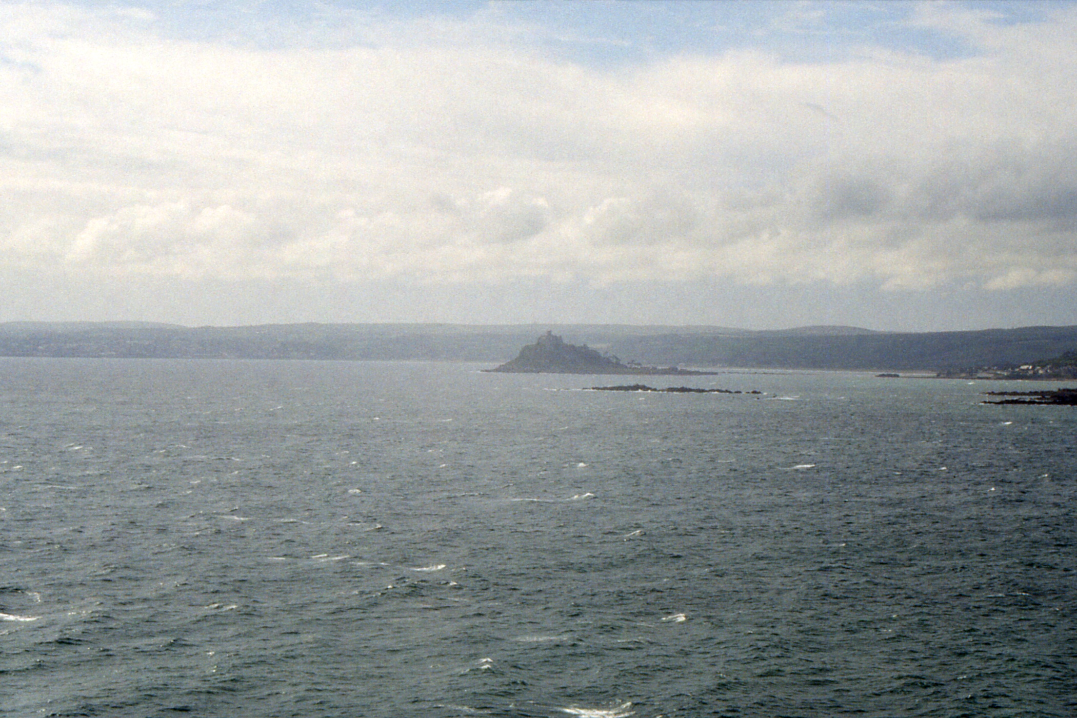
It was steady progress to Praa Sands where I took liquid refreshment (no, not beer, I wanted milk but the shop had none so I settled for a chocolate flavoured milk drink). A couple of miles further on at Prussia Cove, I was accosted by a couple who asked if I had a car, they had noticed me earlier passing through Porthleven and were impressed by my progress. From Cudden Point, I had my first sight of St Michael's Mount and knew I was on the home straight.
|
|
| A long shot of the Cornish coast |
St Michael's Mount from Cudden Point |
There were notices about path diversions at Perranuthnoe, due to coastal erosion, but the net result seemed to be that I went round the inland side of a field rather than the shore side. A field apparently full of rotting cauliflowers until I noticed that some, but only some, had been harvested. And then I was in Marazion, end of path, and starting to rain. Time for a pint of milk before the three miles along road and railway into Penzance, which I managed in just over an hour. Not bad after 60 miles in three days.
I could have done without the final mile and a third to the youth hostel but I managed it and booked in for three nights. After a shower and change, I had no energy to go out again to the pub, besides, it was raining. There was another energetic turner-overer in the bunk above me.
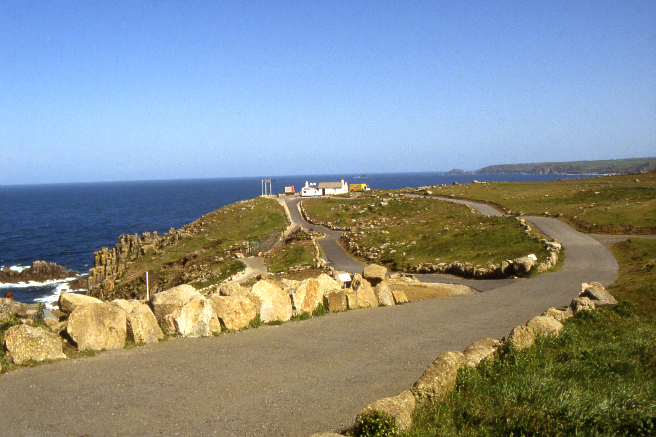
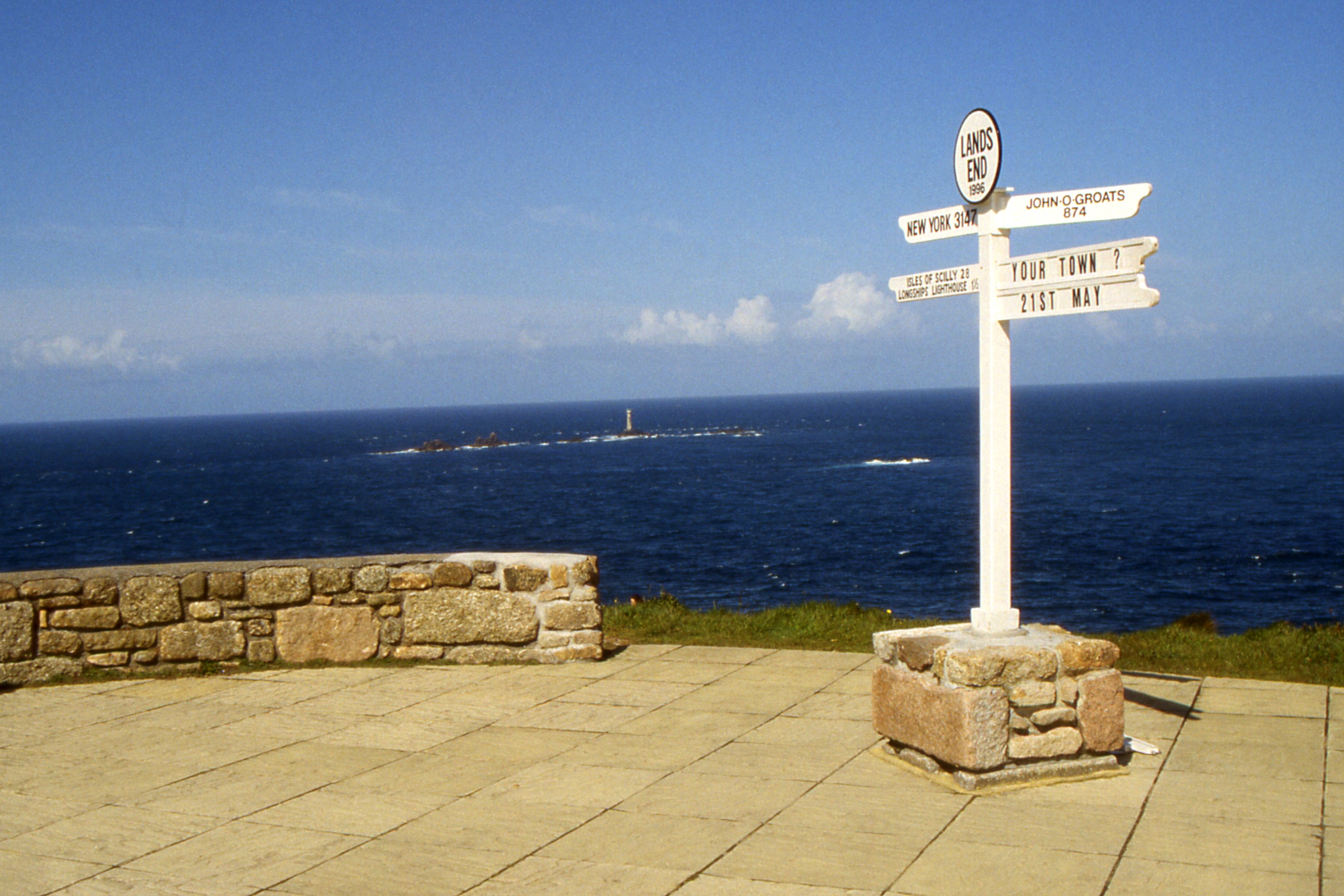
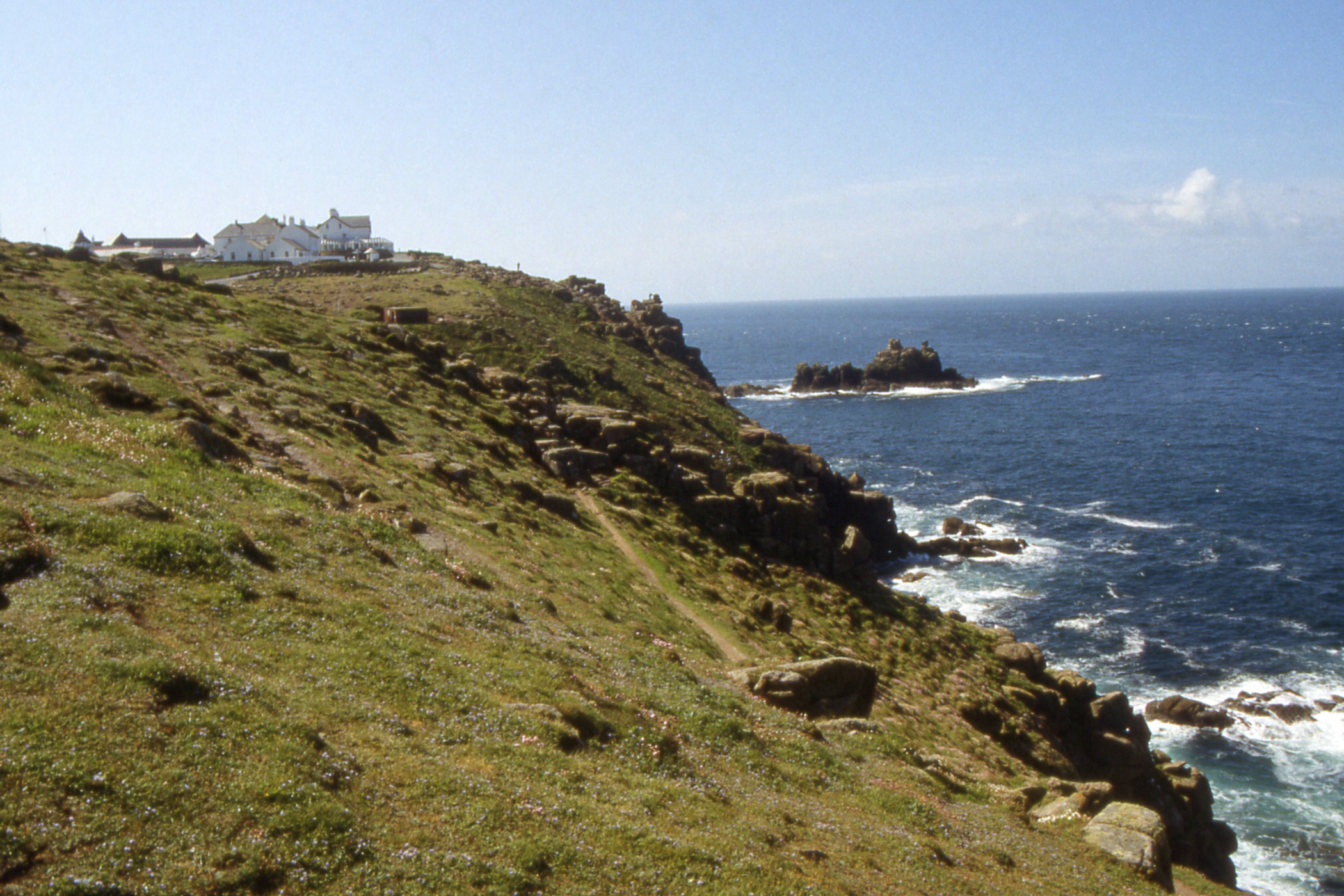
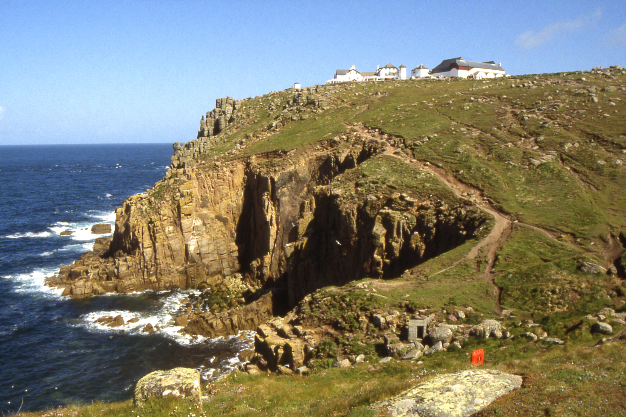
Day 12 - Tuesday, May 21 — Land's End
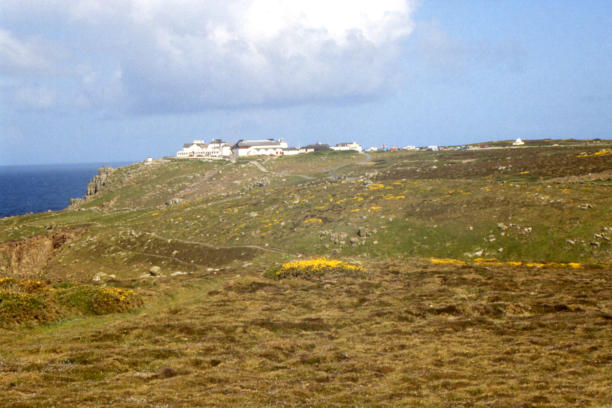
I awoke to a beautiful morning. After breakfast, I went down to the bus station for the 09:20 to Land's End. This went along to Newlyn then up an amazing hill before meandering along rural roads to Land's End. The approach there is horrible. Acres of car park, grotty funfair and a large (but low) hotel. I ambled around a bit, taking a few photos, then headed south on the coast path round Gwenapp Head to Porthcurno. This is the site of the open-air theatre Miniack Theatre where I decided not to pay £1.70 for a look, thinking I could see it from the cliff on the other side of the cove. This proved not to be the case, it is carefully hidden from freeloading eyes.
|
|
|
| The First and Last House in England, at Dr Syntax's Head, Land's End |
The Longships Light | The hotel at Land's End on Dr Johnson's Head from the north |
|
|
|
| The hotel at Land's End on Dr Johnson's Head from the south |
The Longships Light | Land's End tourist trap from the south |
|
|
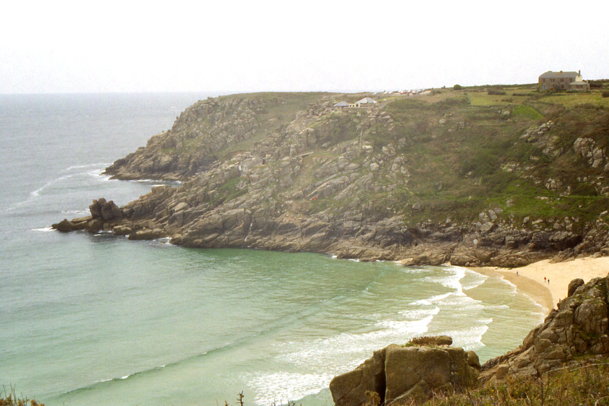
| The sands at Porthcurno. The Miniack Theatre is hidden in the cliffs on the other side |
The Harbour, Newlyn |
By the time I reached St Loy's Cove, it had clouded over and I started to imagine the odd spot of rain as I sat airing my feet. By the time I had reached the next headland, Boscawen Point, it was definitely raining. The effect was not to bad as the rain was on my back, walkers in the other direction were having much less fun.
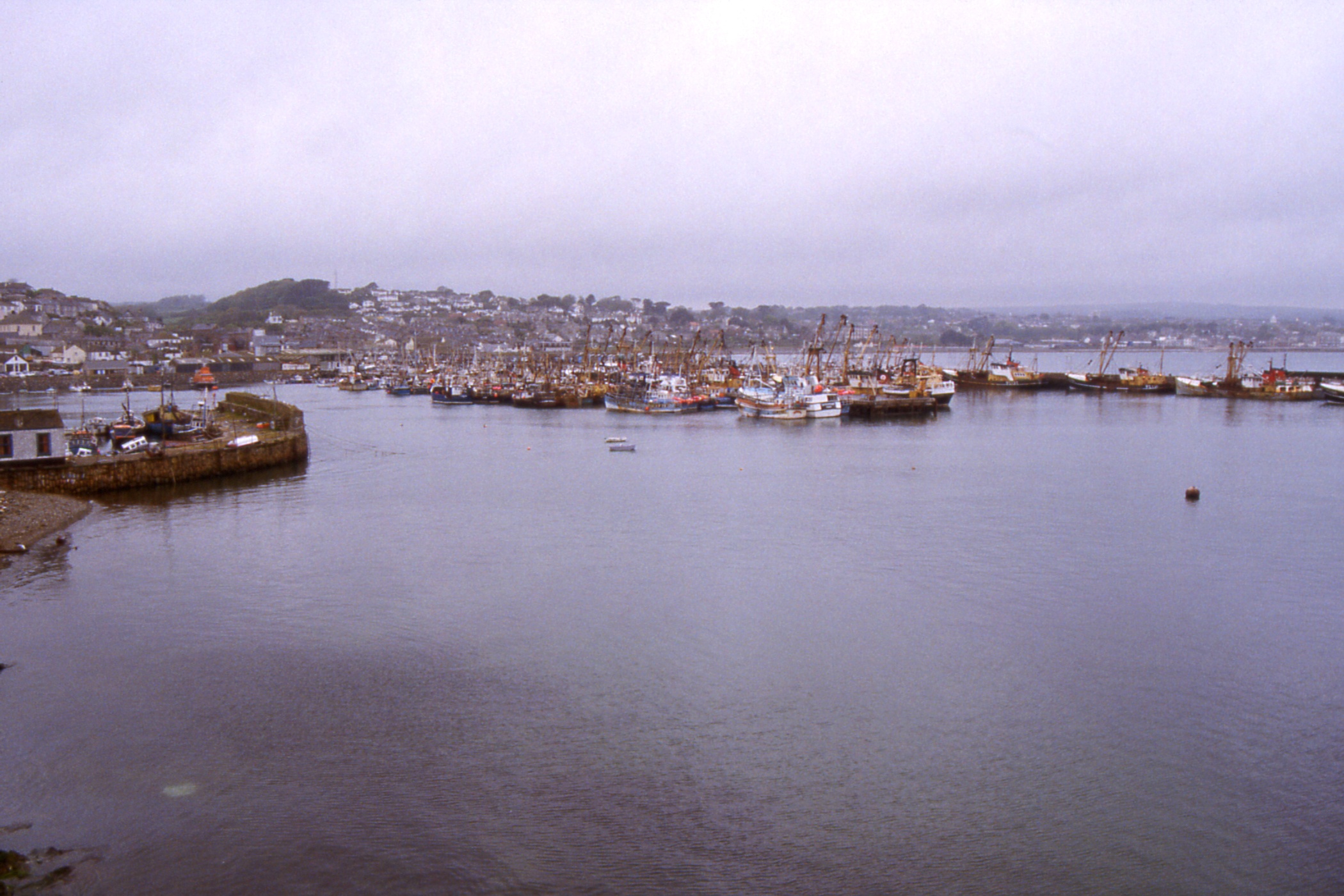
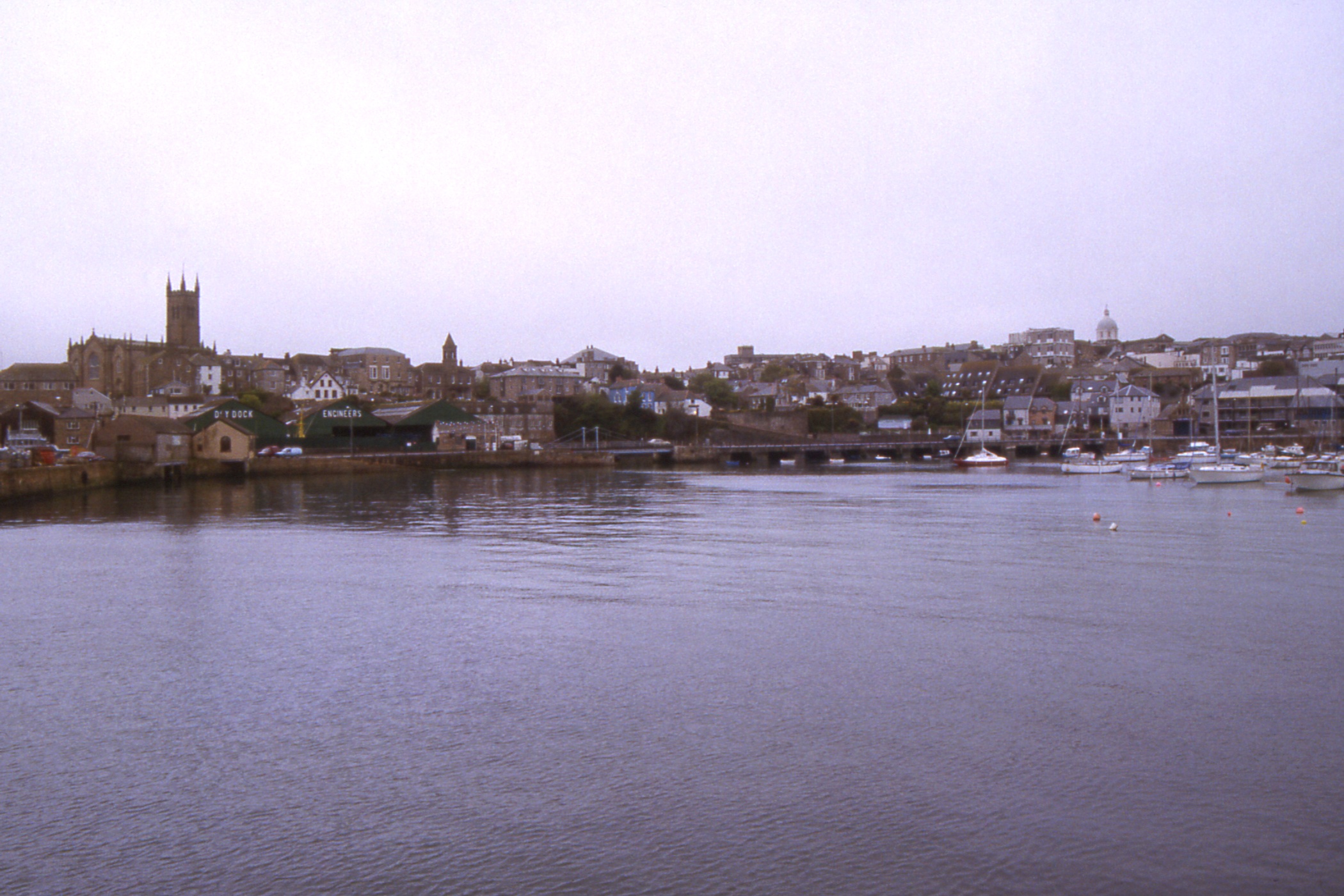
I stopped for tea at Lamorna Cove, and believed the rain was off when I came out but it wasn't and didn't go off until I was nearly at Mousehole. It was road into Mousehole (a pretty harbour) and then to Newlyn, the fishing capital of Cornwall. I wandered briefly around the harbour before continuing along the esplanade into Penzance then on to the hostel and bed.
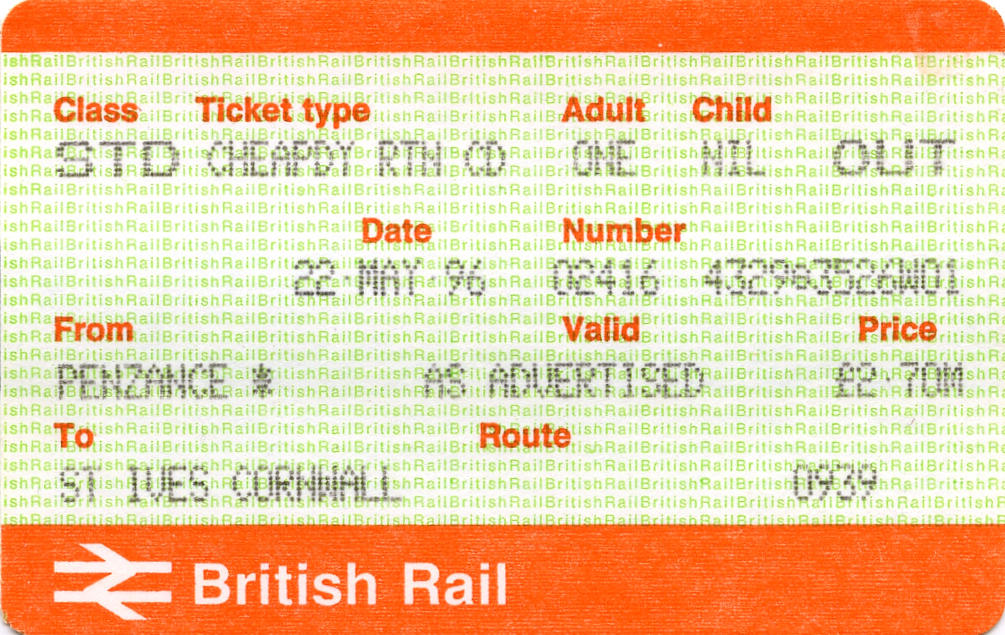
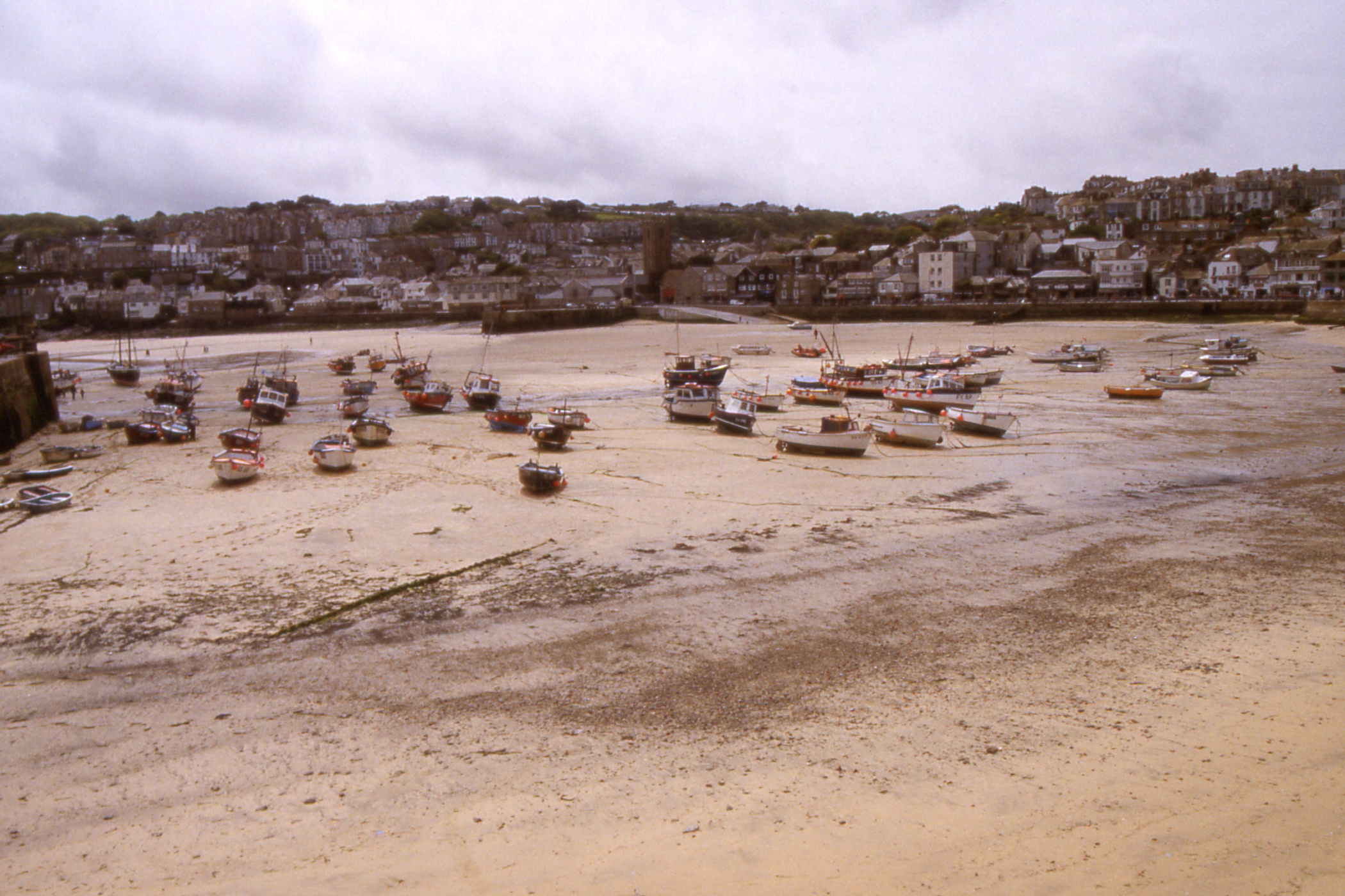
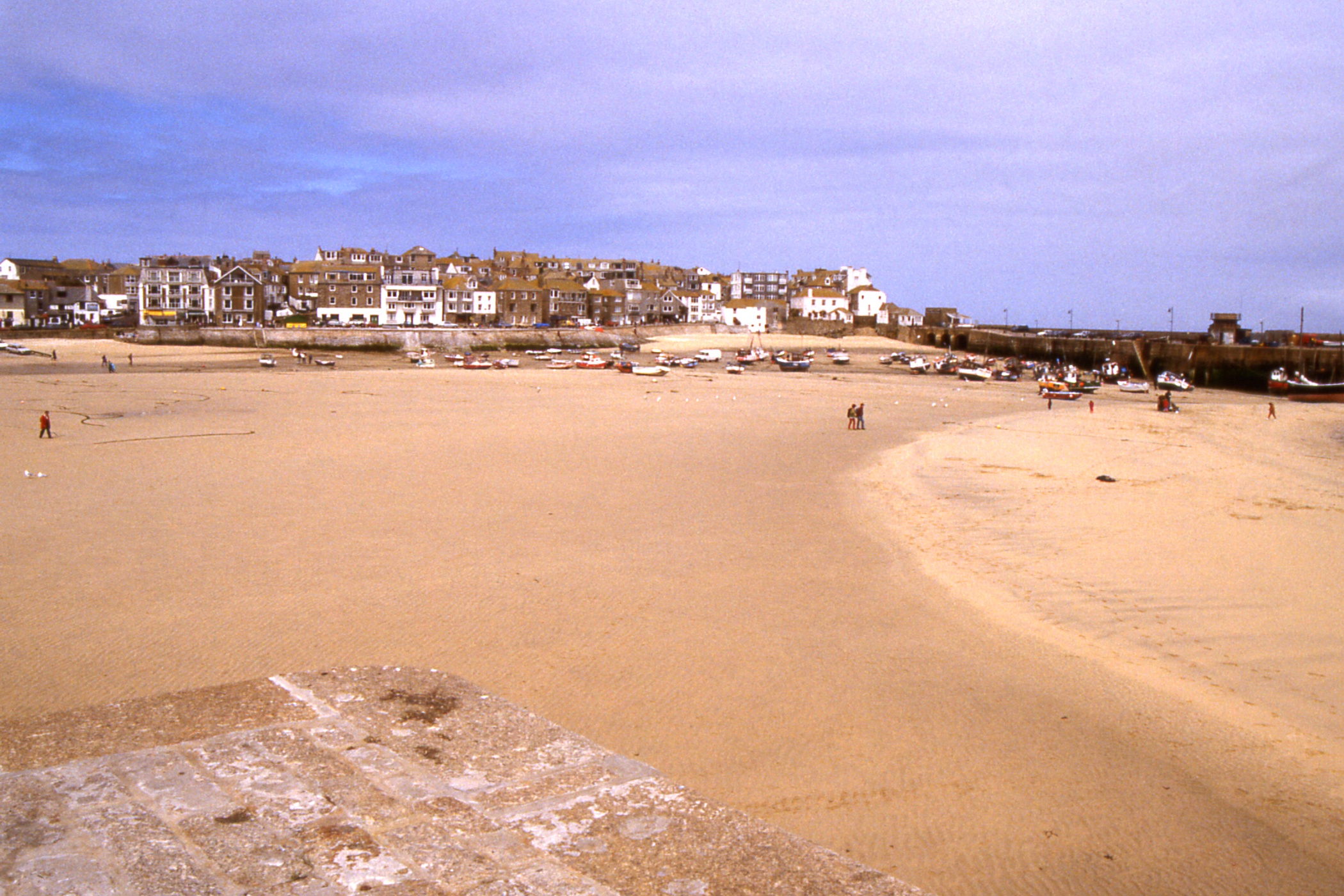
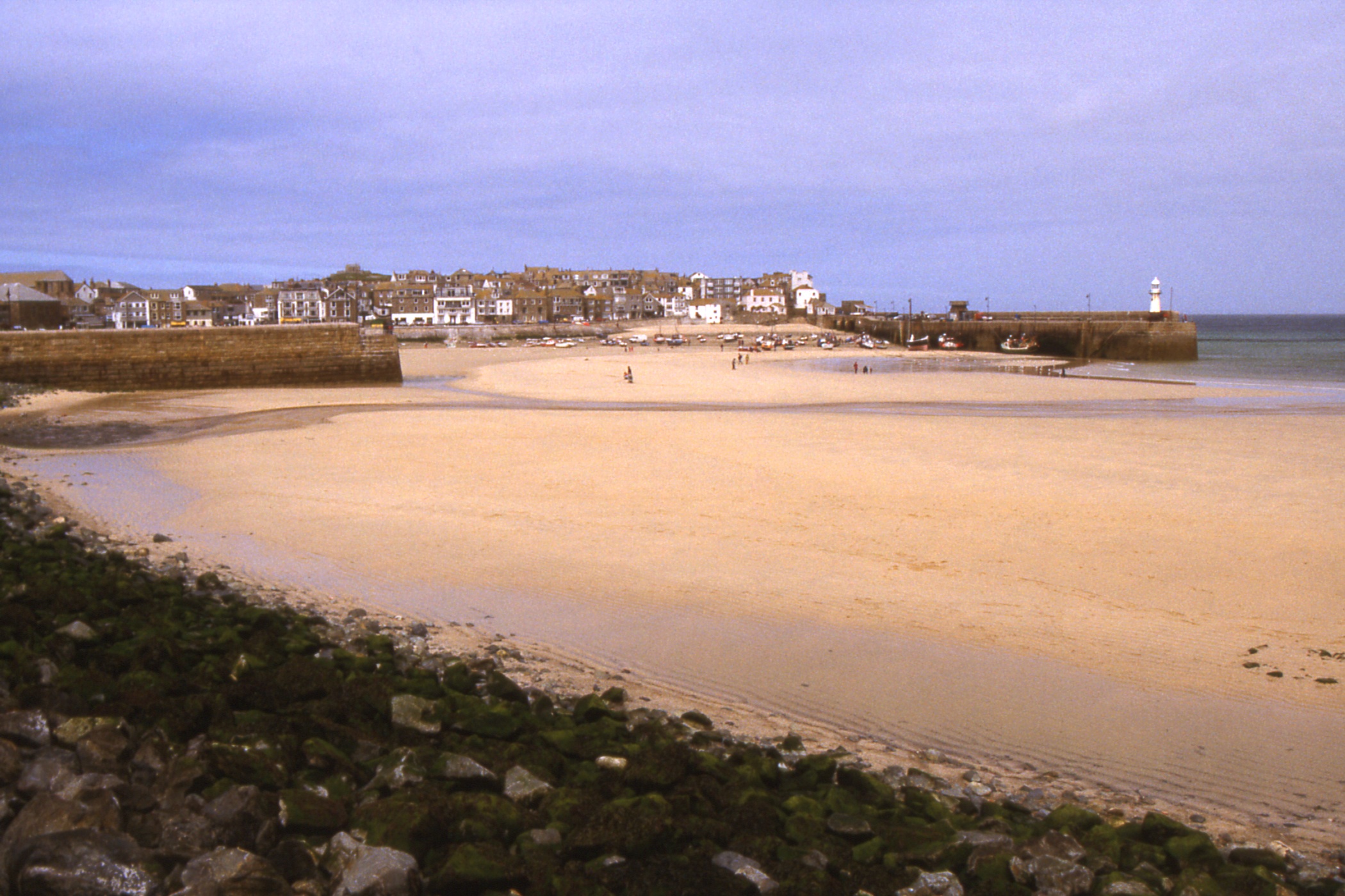
Day 13 - Wednesday May 22 — A Visit to St Ives
There was a lot of rain-type noise when I woke about six but it had diminished by the time I got up and looked out. Perhaps the trees had exaggerated the effect. It was still raining a bit after breakfast so I decided not to walk along to St Michael's Mount and instead went to the station for the 09:57 train to St Ives.
|
The train from St Ives (153392) came in on time but was immediately abandoned by the crew and withdrawn from service with a faulty speedometer. A taxi was provided for myself and the other would-be passenger. She was going to St Ives to visit the branch of the Tate Gallery and asked the taxi driver to take her there. I said I wasn't bothered where I went. As we passed the railway station, the driver reset the meter so I bailed out when we got caught in a traffic jam.
It was still raining. I wandered through
the town and into the museum which I found quite interesting if a little disordered. This easily
absorbed an hour and a half after which it was a respectable time for lunch, which was a
Ploughman's in a pub, The Sloop, which claims to have been around since the 14th century. I
suspect it has had several total rebuilds in that time.
|
|
|
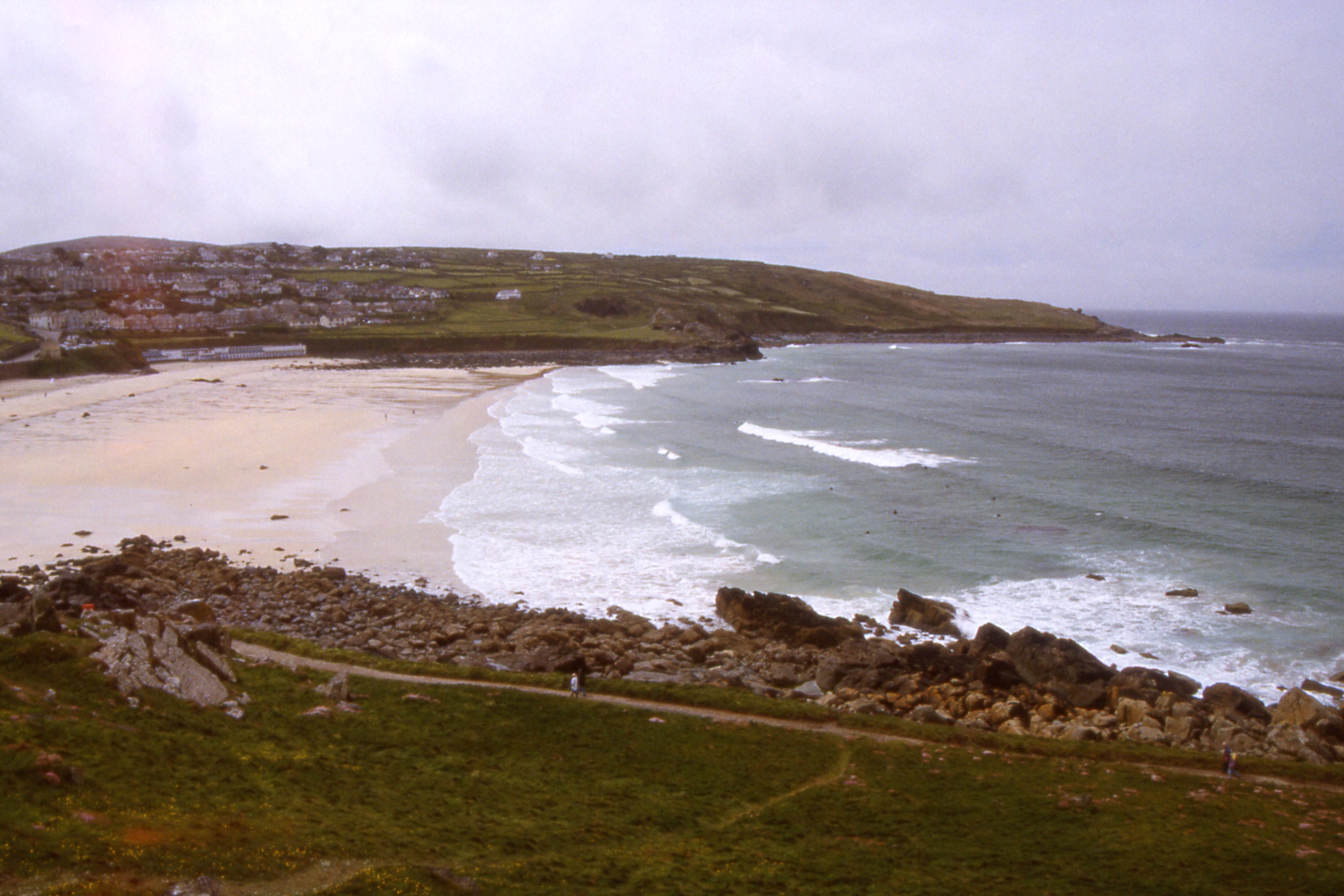
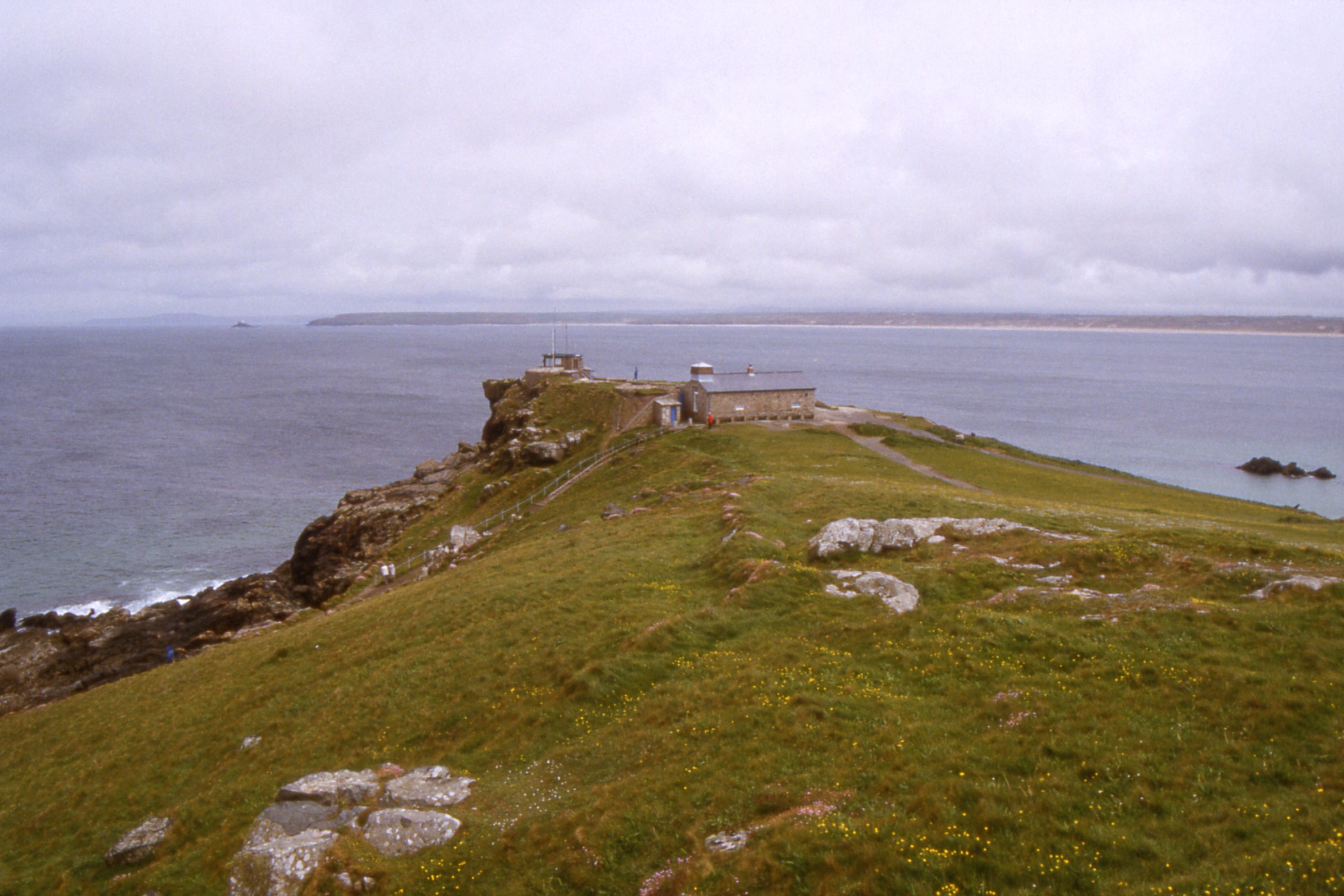
| Clodgy Point and Porthmeor Beach, St Ives |
St Ives Head with Godrevy Point and Island | St Ives between the Harbour and Porthmeor Beach |
|
|
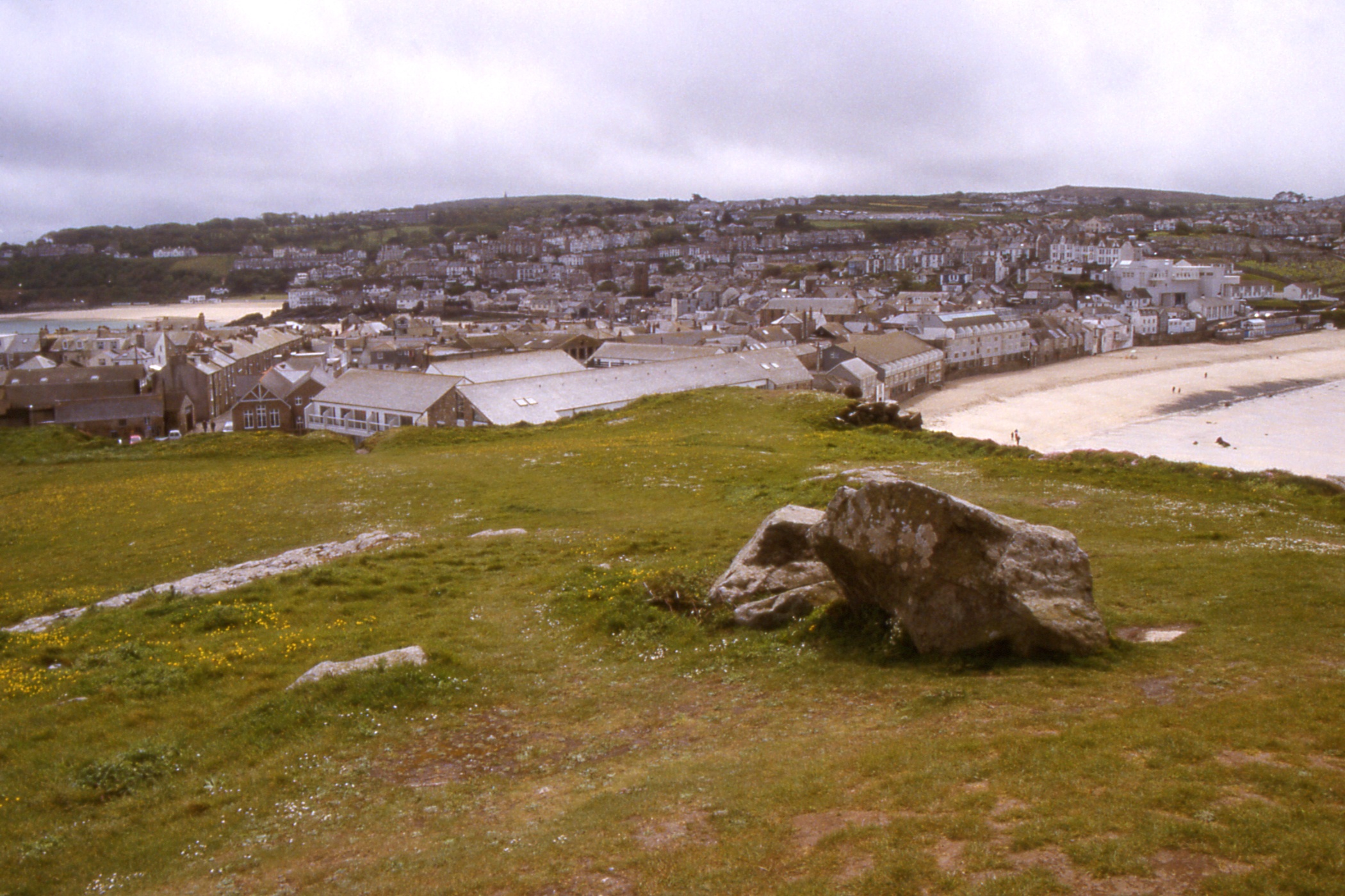
|
| St Ives across the Harbour |
St Ives Harbour | |
|
|
|
| St Ives Harbour |
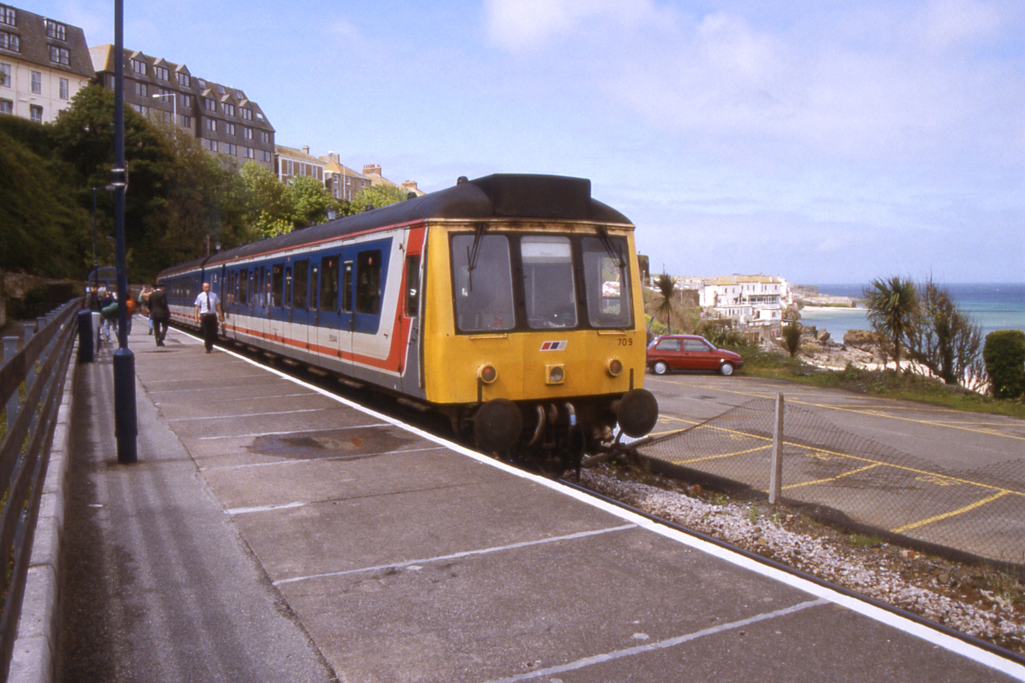
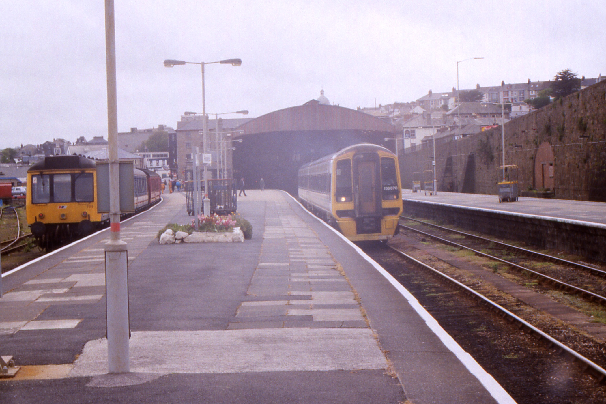
St Ives railway station with the 14:55 Regional Railways DMU 709 for Penzance |
The rain was off when I came out so I wandered
over St Ives Head and back past the harbour towards the station, taking a few photos as I went. This
time I did travel by train, another antiquated DMU, which rattled back to Penzance in twenty minutes. In
the station, there was a former ScotRail loco 47976 “Aviemore Centre” on a track monitoring
train. I don't know why they attached a Class 08 shunter before it left.

|
|
| 47976 "Aviemore Centre" just outside Penzance railway station |
St Ives service DMU 709 sits on the left while 158870 leaves Penzance Station as the 15:20 to Birmingham |
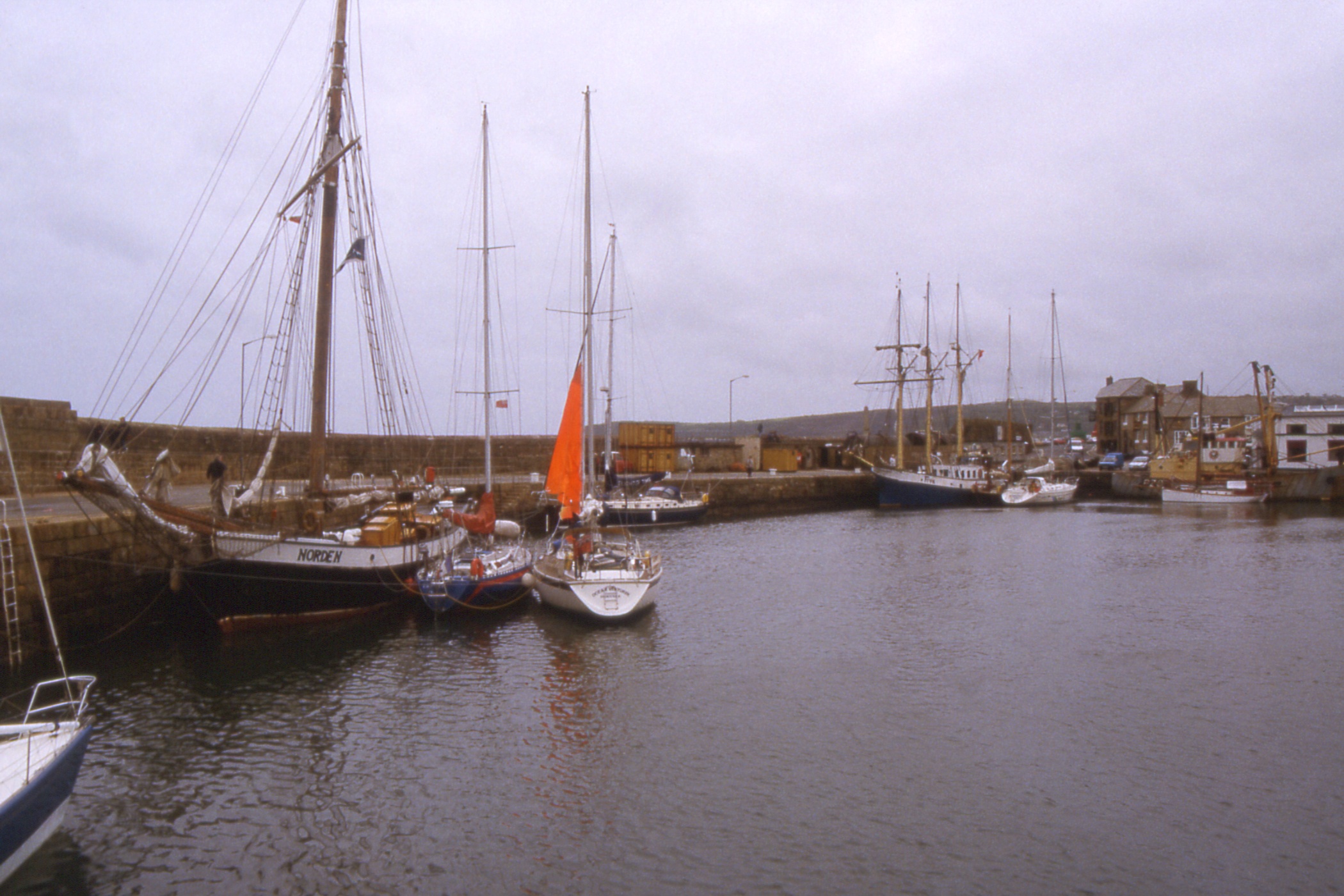
I wandered yet again round the harbour, taking photos of a couple of sailing ships, the “Freya” which claimed to be Baltic but was registered in Dover, and the “Norden” registered in Lubeck, built about 1880. On the way back to the hostel, I was admiring the exterior of a square-built church when I was accosted by a lady called Mary who considered it ugly. I did not agree but had her whole life story before I escaped ten minutes later.
|
|
| A couple of sailing ships, the "Norden" (Lubeck) and the "Freya" (Dover), |
Yachts in Penzance Harbour |
At the hostel I showered and changed into my last clean clothes before dining on cauliflower soup and spaghetti bolognese. Then it was out for an evening in town, or rather in a pub where I tried three different beers from the St Austell brewery. They do an excellent XXXX mild. I even remembered to post the film I'd been carrying around all day.
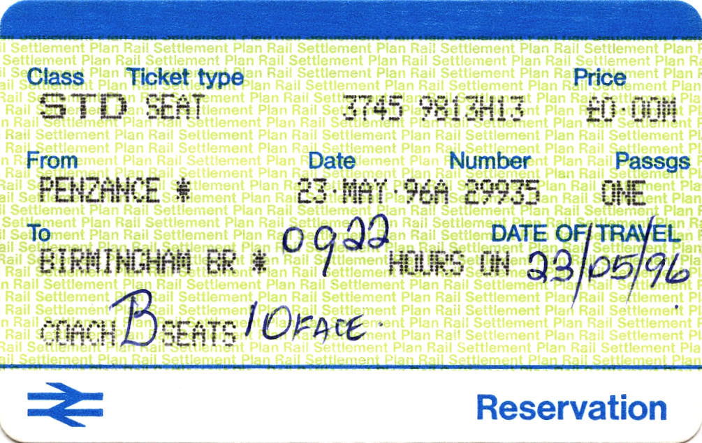
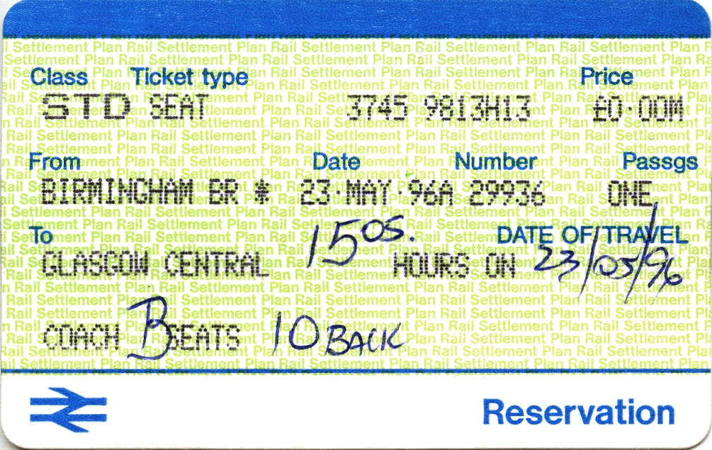
Day 14 - Thursday May 23 — The Return Journey
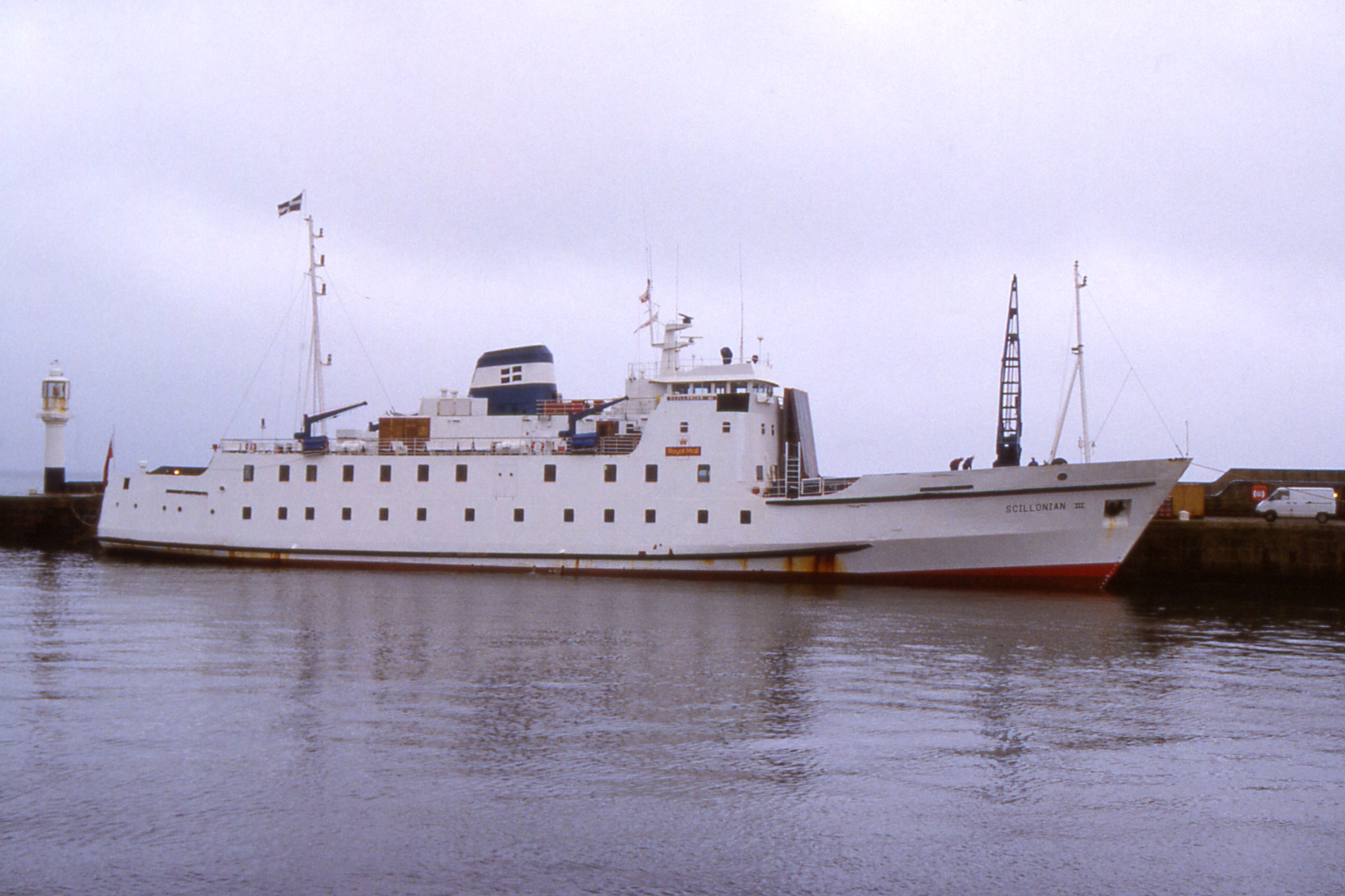
I woke several times during the night, probable worried about oversleeping, so I overslept and didn't wake until half past seven. Still, I was washed, packed and away by eight, into an overcast but dry day. Despite the weather, I went straight past the station to photograph the Scilly Isles ferry, Scillonian III, in her usual berth at the Lighthouse Pier.
|
|
| The Scilly Isles ferry, "Scillonian III" |
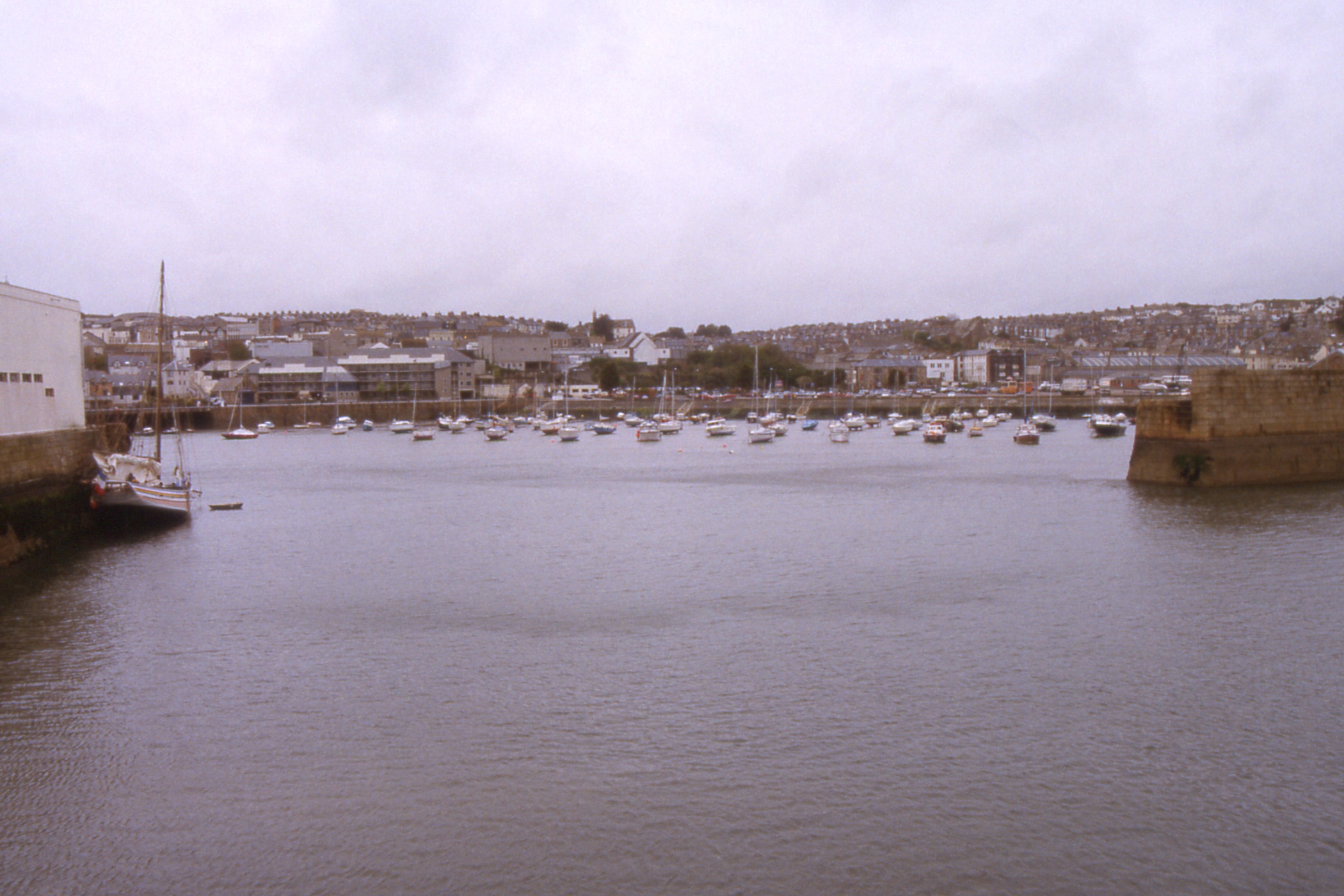
Penzance, across the harbour |
|
|
|
A few spots of rain fell as the train departed and continued as we travelled through a misty morning most of the way to Bristol where we arrived in good time. However, we did not depart at the scheduled time; it was announced that fitters were working on the lead power car. Presumably, they worked well and we left eleven minutes late. We were still ten minutes late at Birmingham but that still left me with fifteen minutes to change platforms for the 15:05 to Glasgow. This train had come from Bournemouth and was pretty busy. My reserved seat was unmarked but unoccupied so I had no difficulty in taking possession.
The train remained busy until Preston, after which it gradually emptied, except the smoking coach which remained nearly full all the way to Glasgow.
As we approached Carlisle, there was a cold steam engine 46203 in LMS red sitting in a siding with cream and maroon support coach. Couldn't make out the name. [Later - LMS 6203 (BR 46203) “Princess Margaret Rose”, built 1935, withdrawn 1962, returned to mainline action 1990, withdrawn again 10 April 1996 at Carlisle and returned to Swanwick on 29 May.]
As we came over Beattock, there was a 20mph speed limit with sleepers and lights by the lineside. I don't know if this had any connection with the overhead line equipment failure of a fortnight before.
Ten minutes early into Glasgow, I rearranged my luggage and headed for the bus stop where a 64 to Tollcross arrived within minutes to convey me to my abode.
End of trip
[ Back To The Top ] [ Contents ]
John Reynolds - 1996, 1998, May 2015