North Antrim Coast Path — June 1994
Day 0 - Tuesday, June 7
I am no slave to alarm clocks, so when it went off at half past five, I demonstrated my independence by lying on for five minutes before I got up, washed, broke my fast and had to rush out of the door to catch the last bus which would connect with the 07:23 for Stranraer. There was a threat of drizzle in the air but not enough to justify putting on a waterproof jacket.
The two-car train seemed busy until we got to Paisley where it emptied, only to refill at Kilwinning before emptying again at Ayr. The weather improved considerably about that point and we travelled in sunshine for the rest of the journey. We reached Stranraer four minutes early at 09:36 with only 19 passengers, all of whom headed for the courtesy bus to connect with the 1015 SeaCat.
At the ticket counter, I enquired for a discount under every heading I could think of but no, the fare was £20 single. How come some people can get day return shopping trips for £12?. My attempt to walk out to the vessel was scuppered for “safety reasons” and all the foot-passengers had to board a double-decker bus for the hundred yard trip down the jetty.
The vessel (SeaCat Scotland) is just a large cabin on twin hulls, very comfortably furnished, with a small refreshment area at the rear, the only indoor area where smoking is permitted. There is an observation platform at the front of the cabin, immediately behind the bridge, from which it is possible to admire the computerised controls and displays. A very small open deck at the rear was partly exposed to the spray of passage. Where it was possible to see the structure of the vessel, it looked a bit insubstantial, presumably built for lightness and speed (although I would not dream of questioning its strength).
I have to say I was not impressed with the crossing. There seemed to be a bit more vibration than on conventional vessels, though that may be attributed to the sea conditions which limited the maximum speed slightly. We were just seven minutes late at Belfast at 11:52, after overtaking a couple of coasters in Belfast Lough with contemptuous ease.
The sky had become overcast as we crossed the water, there may even have been showers but who could tell with all that spray about, but it cleared again as we entered the Victoria Channel and the sun shone as I disembarked at Donegal Quay and set off for the Crown and a couple of pints to pass the time before my train. The front windows of the pub seemed a bit less ornate than I remembered them but then, they have been blown in a couple of times since my last visit (an occupational hazard of being across the road from the Europa Hotel).
At the station, I bought a ticket to Portrush (a mere £4.70 single for 75 miles) and had time for another pint before boarding the 13:50 InterCity train for Londonderry. We bowled along merrily through the countryside, through Lisburn, Antrim, Ballymena and into Coleraine where I changed to the local train. At 15:35, I was in Portrush, a holiday resort waiting for holidaymakers. Very quiet.
|
|
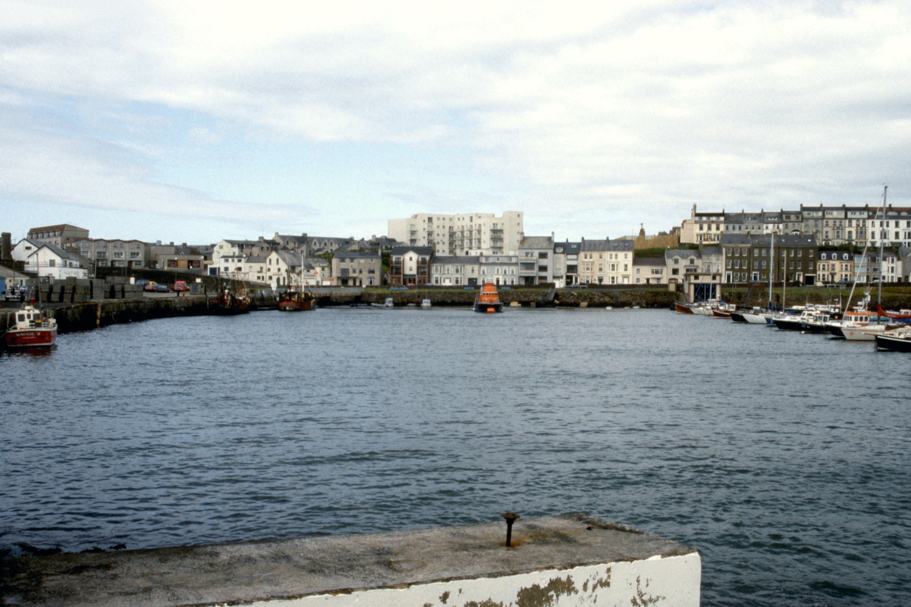
| Portrush Harbour |
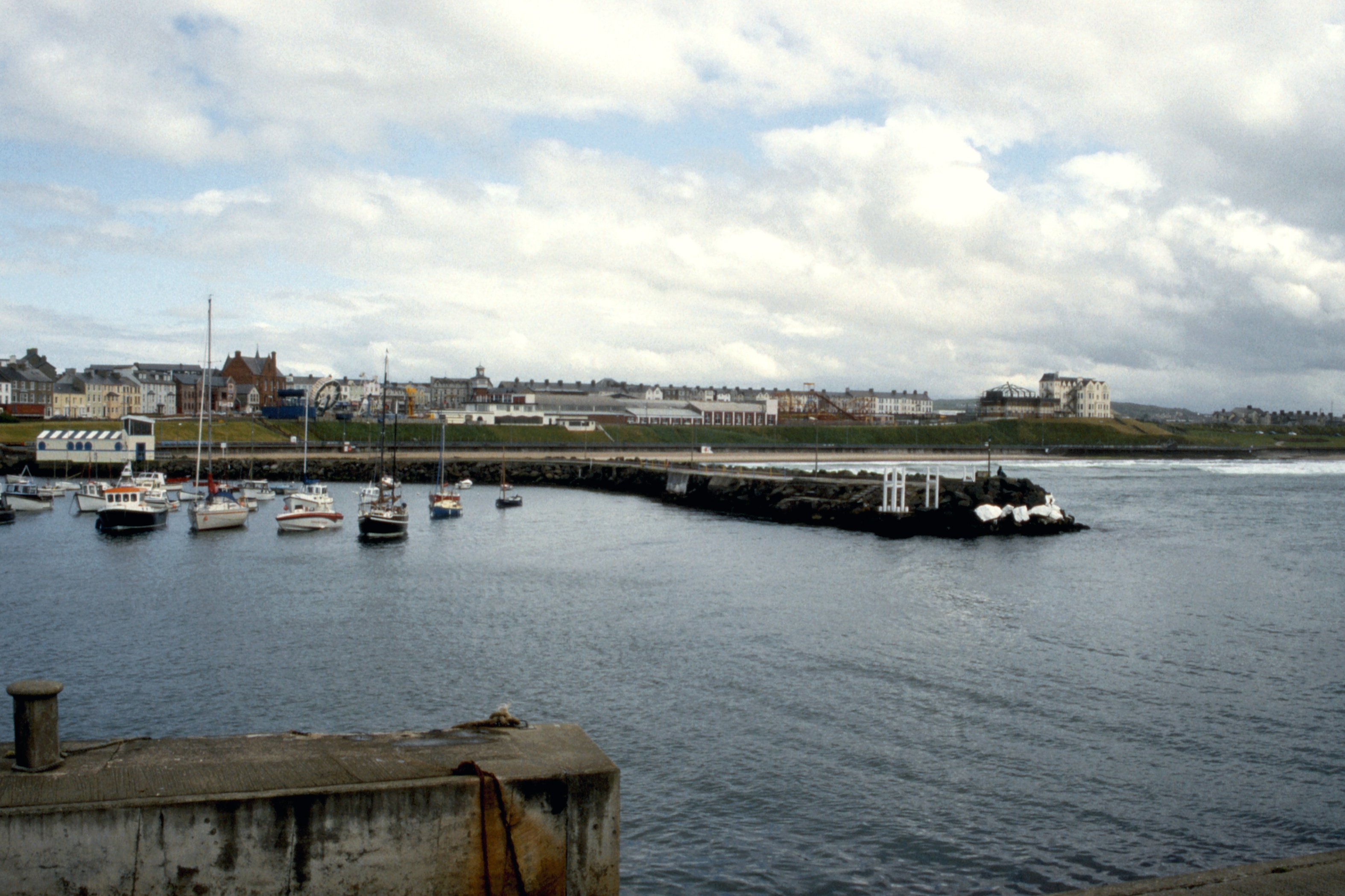
East end of Portrush from the harbour |
There was an advert on a gable end near
the station showing the location of McCool’s Hostel and I did my best to memorise it as
I set off for the harbour. A look around there, a wander over the headland, and it seemed
a good time to find the hostel, which I did without much difficulty. £5 for a bed
with linen, not bad. Usual offices, shower, kitchen, television lounge, all clean and in good
order, small but adequate for the few people in sight. I suspect it would be a different story
if the place was full after a wet day.
Out for an evening stroll, fish supper for tea followed by a pint of milk for dessert. As I wandered around, I looked in vain for any sign of the Ulster Way passing through the town, and concluded that the way must lie along the beach (the Curran Strand) or the main road. Back through the town, everything was closed, even some pubs. Down at the harbour, a threat of rain drove me into the nearest pub, for just the one, after which it was back to the hostel where I found in the bookcase a set of cards describing walks on the north coast, which provided confirmation that the way indeed lay along the beach. And so to bed.
Day 1 - Wednesday, June 8
There was rain on the window when I woke at the back of seven so I went back to sleep. No such luck the next time I surfaced so I had to get up and face the day. With everything more or less ready, I issued forth in search of breakfast. It seems that Portrush does not open till nine. I made do with a pint of milk.
|
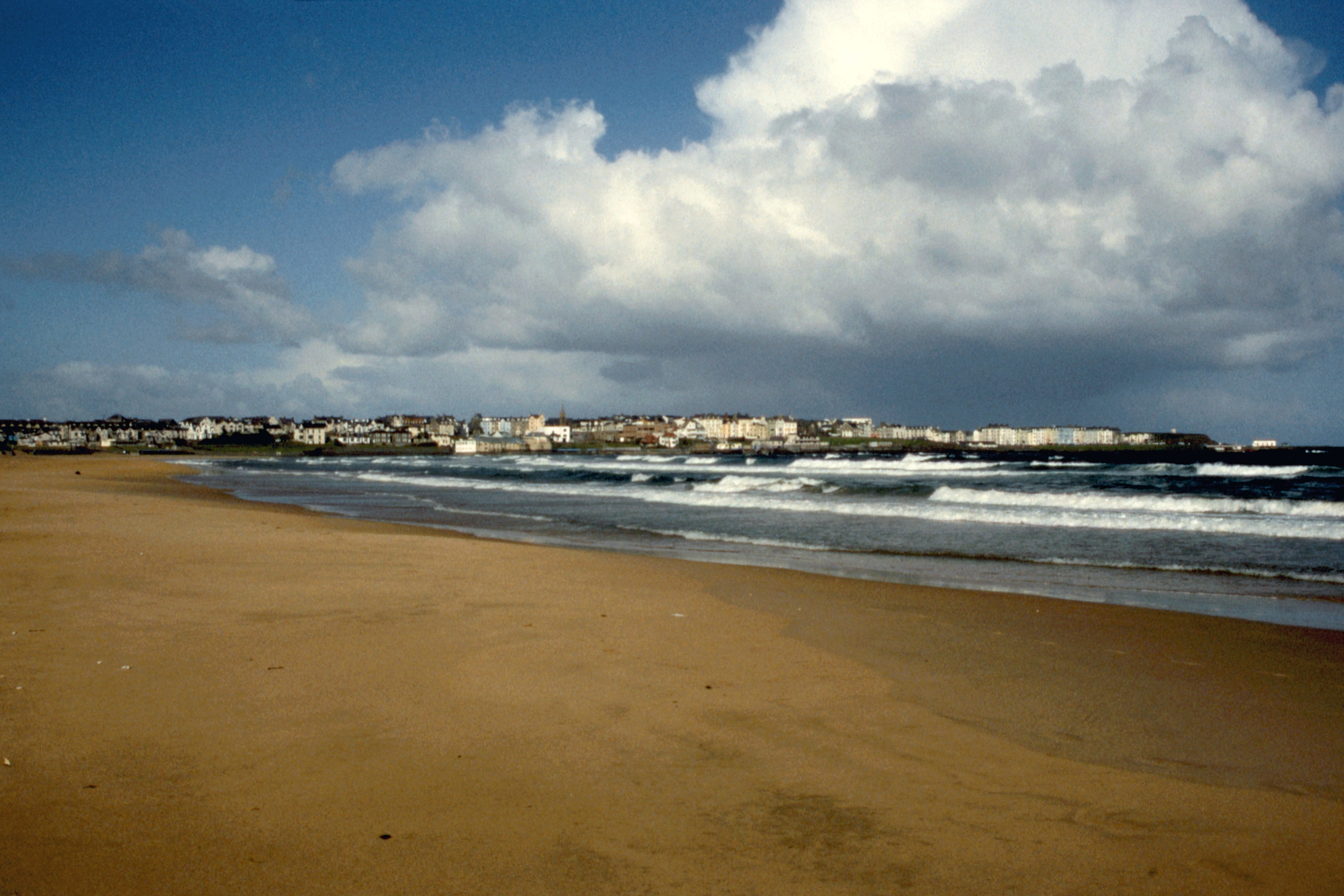
| Portrush from the Curran Strand |
Back to base, picked up the pack, out the door at ten to nine and the rain started. I dodged from shelter to shelter down towards the beach and loitered in the last looking hopefully at the sky. The rain went off! and so did I along the beach. The tide was just past the full so I could walk on firm recently exposed sand without much fear of inundation. It was easy going most of the time, pleasant in the sun, watching showers coming in across the sea and petering out before they reached me.
I passed a dead seal and met a man in the
two miles of the beach, and another man in the car park at the end, near the White Rocks (which
are whiter than the White Cliffs of Dover) then it was a short sharp slog up to the road and
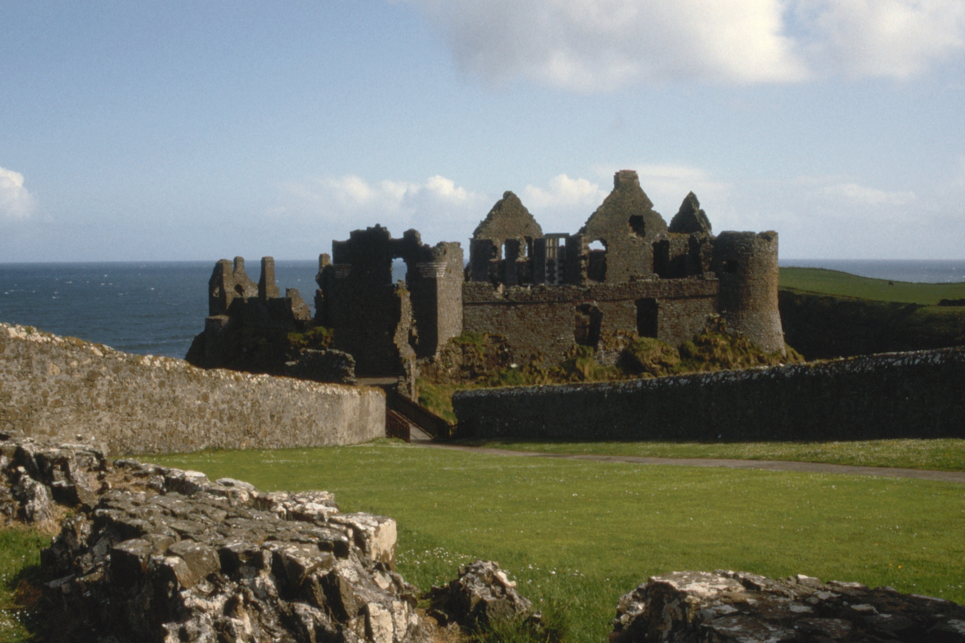
turn left for another couple of miles to Dunluce Castle, which I reached five minutes after it
opened at 10:00.
|
|
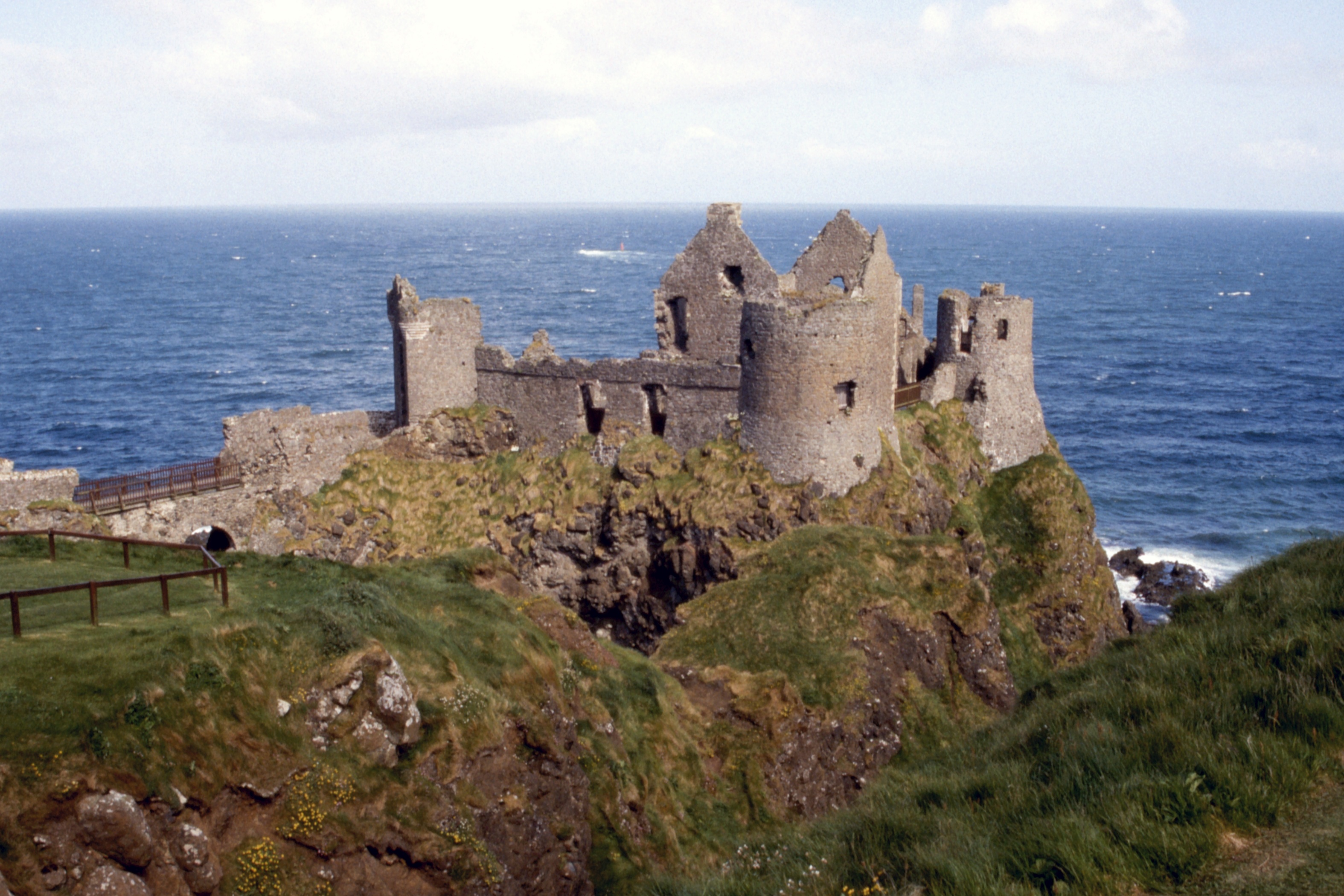
| Dunluce Castle from the fore-ward. |
Dunluce Castle |
My being a Friend of the Scottish
Monuments cuts no ice in Northern Ireland so I had to pay £1.50 admission. Was it worth
it? Well, maybe. The audio-visual presentation was rather good and there is enough of the castle
left to convey something of the power and of the harshness that must once have reigned here. A
recent restoration of late sixteenth? century windows fairly points up the changing culture as
“civilisation” found its way from London.
A couple of drops of rain as I left the castle came to nothing and it was a reasonable amble along the road to Portballintrae, passing the first Ulster Way sign that I have seen, at a road junction where you would have to be pretty stupid not to know which way to go. The small village of Portballintrae has a tea-room open 10 till 5 at weekends in summer. Not much use on a Wednesday in June.
Cross the Bush river, skirt the golf course and pick up the line of an old tramway, now a footpath, leading to the Causeway Head. A car park with toilets provided a quick wash before I reached the tourist trap and found the tea-room. Tea was available only by the cup but a second cup was free. A small egg mayonnaise and two bits of excellent cake completed my meal for £3.05. Another quick wash (I do sweat a lot) then out just before one and down to the Giant ’s Causeway.
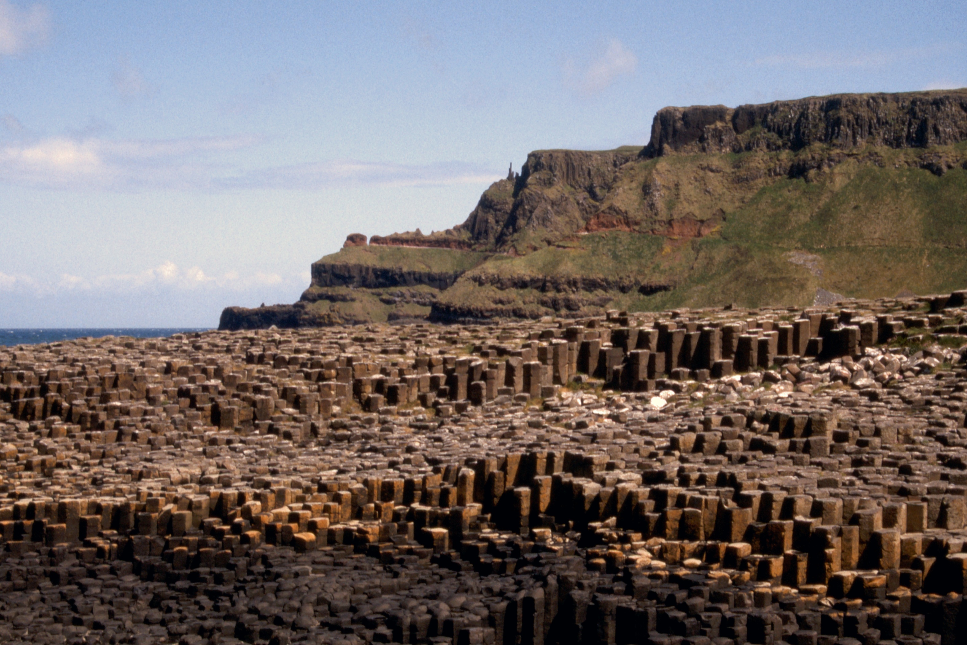
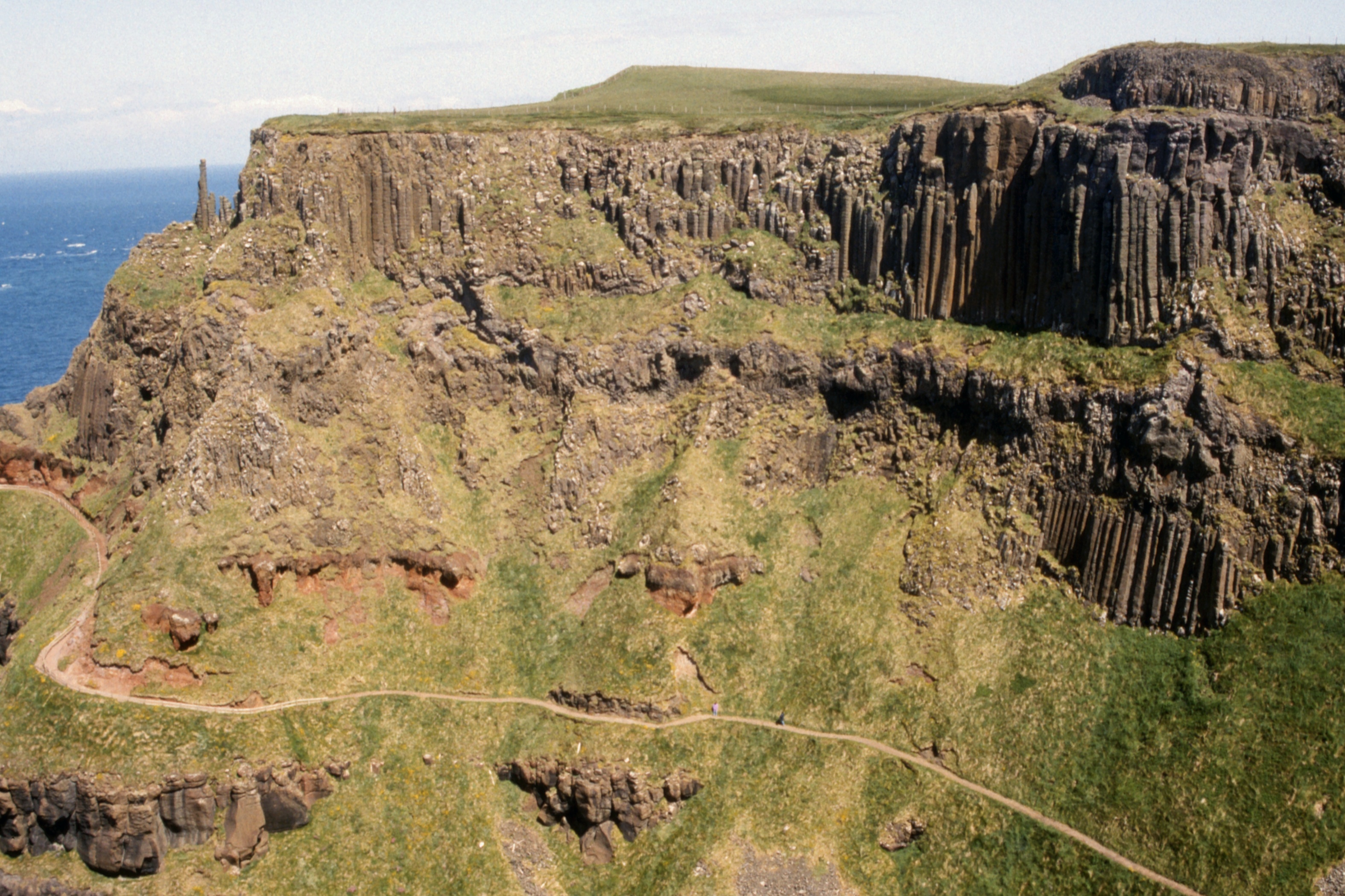
Something of a disappointment, I fear. It is much smaller than the Tourist Board photographs had led me to expect (though I found later that I have taken the archetypal TB photo). I pottered about a bit and considered my options. There are two paths east from the Causeway, one on the cliff-top and one about half way up, just as the cliff steepens. Several signs warned that the middle path was closed due to rock-falls and the ascent at the far end was dangerous. Being less than keen on scrambling with a full pack I decided to take the near ascent and continue on the top path.
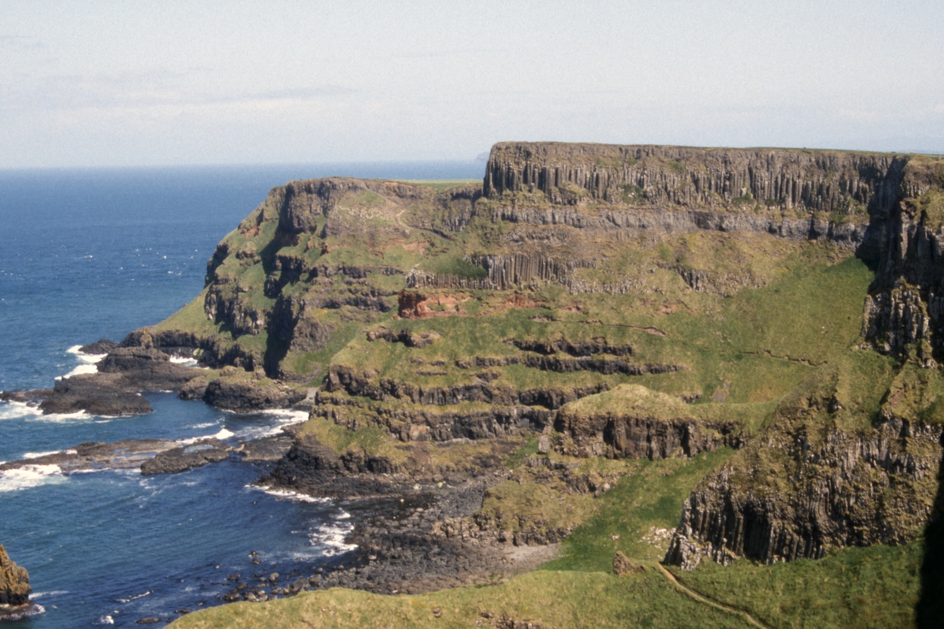
|
|
|
| Hexagonal basalt columns |
The Giant’s Causeway from the top of the cliff | Cliffs to the east featuring “The Organ” |
This proved a superb walk with a sequence of four or five bays, each with magnificent rock formations, the path is just far enough back from the cliff top to allow relaxed walking despite the wind. A visitor to the Giant’s Causeway who misses this bit misses three quarters of the experience.
|
|
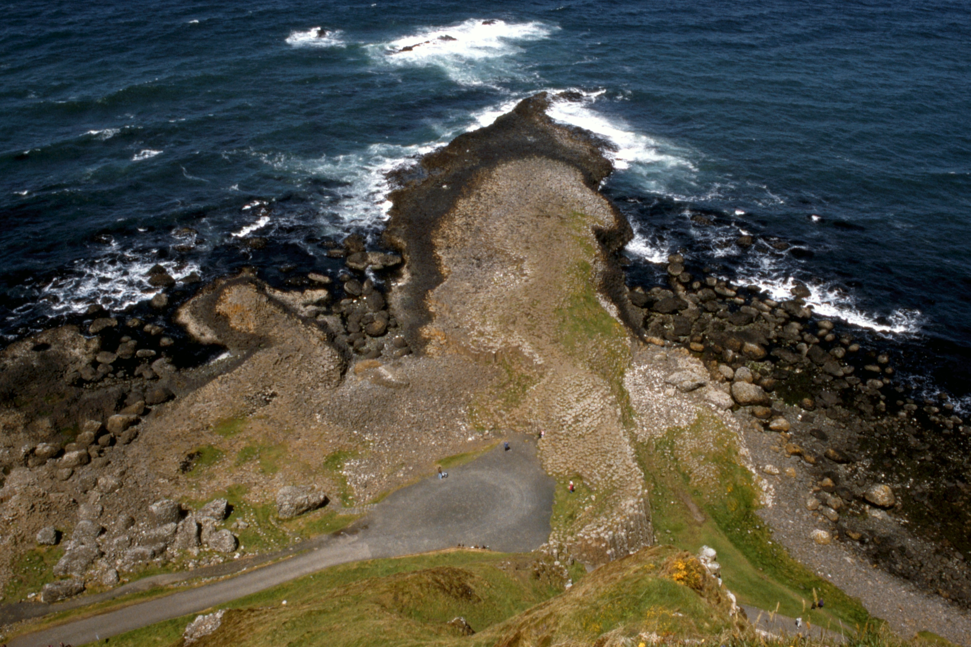
Contham Head (I think) and a hint of Fair Head in the distance with Sheep Island and Ballintoy Harbour in between. Rathlin Island off-shore. |
| Benbane Head |
The scenery was less dramatic as I continued to touch the road at Dunseverick Castle (little more than a pile of stones) then on to the shore again along to find a cave through the rocks leading to the fishing station of Portbraddan at the east end of White Park Bay about four o’clock. The tide was just far enough out, and falling, to allow me to skirt below the last bit of cliff to the beach, saving a daunting climb up the road. Still a bit early for the hostel so I took my boots off and went for a paddle. 14 miles is a pleasant day’s walk.
Plenty of room at the inn, pleasant conversation with the manager-persons (who provided milk for my tea) then a shower and I sat outside a while smoking my pipe. I went inside when it threatened to drizzle and browsed in the library until it was time for bed.
Day 2 - Thursday, June 9
I had booked a small Ulster Fry for breakfast. I have seen smaller Full English Breakfasts! It was about quarter past nine when I set out along the beach in the sort of weather where it seems a good idea to wear a waterproof jacket but unnecessary to zip it up.
The harbour at Ballintoy is cunningly crafted among the rocks but must still be unpleasant in a north-westerly. A tea kiosk was shuttered and there being no other amenities I climbed the hill and followed the road to the township and headed east again. A New Zealander from the hostel was standing at the bus stop, I passed the time of day and continued east for Carrick-a-rede.
Down to the shore at a disused quarry where the NT have a visitor centre (closed) then along a cliff walkway to the rope bridge. This looked a dawdle so I dropped my pack and started across. About 5 yards out the wind hit me as I emerged from a wind-shadow created by the surrounding cliffs. It was a case of cling on for dear life and inch forward. On the other side, a quick run round the top of the stack before facing the return trip. This time I was starting in the wind so it wasn’t too bad but I was still relieved when I was safely back across. I cut up a farm track to the road and trudged along to reach Ballycastle just after one.
A quick look around the harbour then into the Harbour Bar for lunch. Friendly place, just one other customer, pleasant conversation then off to the Castle Hostel to arrange a bed for the night. At the Tourist Information Office, I discovered that the Ulster Way leaflets which I received free in Glasgow were on sale for 30p each. The Moyle Way has been diverted off Knocklayd following complaints from the farmers. I headed for the town centre, about half a mile away, and had an excellent fish tea on the way, a couple of pints, and returned to the hostel and bed.
Day 3 - Friday 10 June
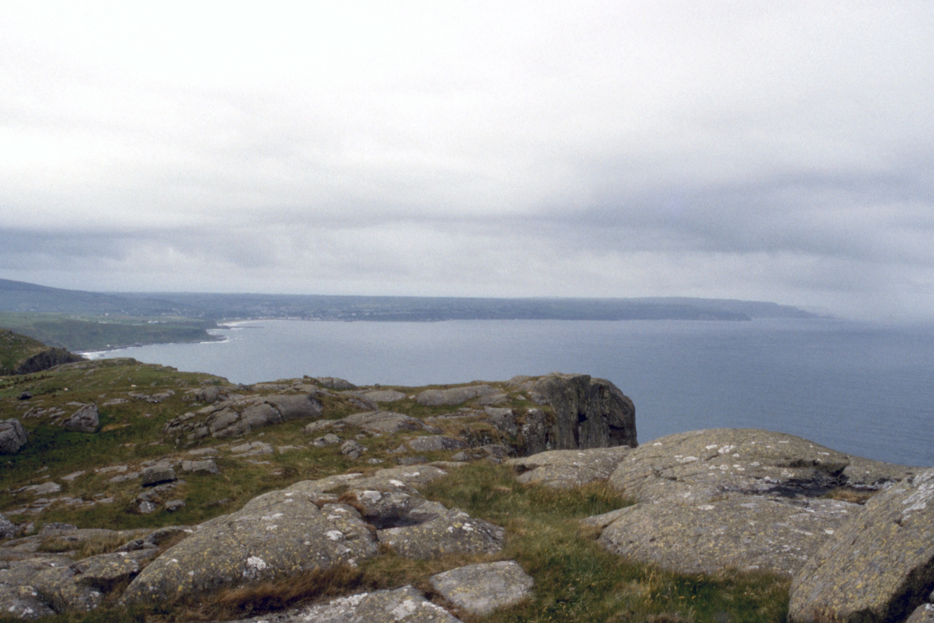
After a pint of milk for breakfast, I left Ballycastle at twenty past eight, along the shore, picking up a cliff bottom track which turned into a rough road which zigzagged up the cliff just west of Fair Head. At the top, instead of turning sharp left along the cliff top, I made the mistake of following the road too far and found myself on a farm road which took a long way round, a very long way round but at last I reached Fair Head about eleven o’clock.
There is an impressive view over Rathlin Island from the headland, not to mention the distant shapes of Islay and the Mull of Kintyre.
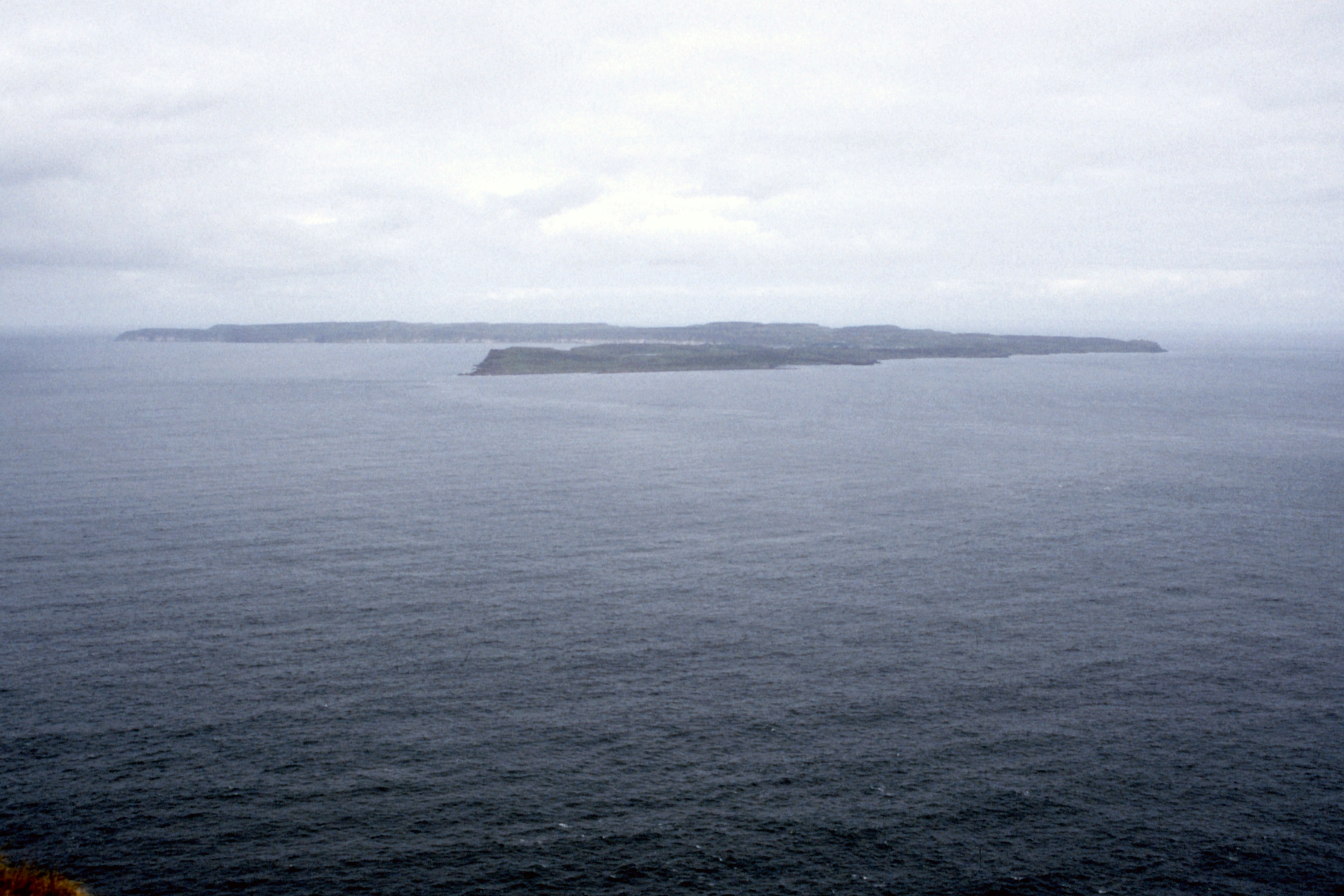
|
|
|
| Rathlin Island from Fair Head | The Mull of Kintyre, Sanda Island and maybe even the Ailsa Craig |
West along the Antrim Coast over Ballycastle |
After about half an hour, I continued my way east along the cliff top passing above Murlough Bay and crossing over Greenamore to reach the coast road two hours later. Here, my route should have been straight across and up the slope of Carranmore but there was cloud gathering over the hills and I decided to stick with the road. Of course, once I was committed, the clouds blew away and the sun came out.
I took a break at a picnic table in a lay-by and noticed a lamb with its head caught in the fence. When I approached it with good intentions, it panicked so I decided to leave it, and a mile or so down the road I informed a convenient farmer who said he would check it out later. The walking was very pleasant as I swung down the road above the sea, with few cars to disturb my peace and quiet.
By four o’clock I was on the outskirts of Cushendun and stopped at the car park toilets for a wash and brush up before skirting the Conservation Village and finding a welcome tea-room which provided excellent fare. Across the road was a period pub (without, unfortunately, period prices) where I partook of one pint and pleasant conversation, discovering that the proprietor had a cousin in the Commercial Inn in Campbeltown.
Then, just after five, it was back to the road again for the last leg over to Cushendall. Up a hill, down a hill and found the hostel on the way in to the village. No problems with accommodation for tonight and I booked a breakfast for the morning. After a pot of tea, I wandered down for a quick look at the village and phoned home before retiring.
Day 4 - Saturday, June 11
After breakfast I booked for another night and set off for Trostan. When I reached the village, I bought a sun hat in case the forecast sun materialised. It was about twenty past nine when I took the road for Glenann and Ossian’s Grave, passing two young girls, one of whom was carrying a fox in her arms.
At the road end for Ossian’s Grave, there was a minibus. As I approached the site, I caught up with a party of foreign teenagers so I did not linger before setting off across the fields to pick up a farm track leading round the slopes of Tievebulliagh (402m). At the top of this eminence is a radio/TV relay mast. As I descended, I passed the end of the track at some peat diggings which were obviously still in use. Time for a brief lunch on the banks of the Glenann River (about two feet wide at this point) then a steady slog up the slope to the summit of Trostan, at 550m the highest point in Antrim.
The summit is more a plateau with two or three peaty lumps sticking up, a bit as I remember the summit of The Cheviot but without the glaur. An interesting feature was a line of orange topped poles coming up from the direction of Glenariff which I promptly followed downhill to pick up the line of the Moyle Way (which contours the hill). The orange poles went off in a different direction but I stuck with what I assumed was the Way, marked on the map but not much sign on the ground. Once into the forest, the first mile or so was quite pleasant through fire-breaks and along a stream, until I was on to a forest road and met the orange poles again.
It was a bit of a trudge from there into the “facilities” bit of Glenariff Forest Park where there were indications that even pedestrians should pay, but the collector was at the gate of the car park where I had no cause to go. A tea kiosk was not open so it had to be the restaurant, a bit posh for comfort (despite a quick wash in the toilets) but the tea and scones were good.
I was on my way again by half past three, down through a wooded gorge to view the waterfall, meeting some cyclists who were staying at the hostel and for whom I took a photograph. and out of the park by another entrance. From there it was a road walk down the glen towards the sea. About half way there, I encountered a handful of sheep on the road. There was a car parked at an open field gate, I assumed a farmer was moving the flock but I was the only person in sight so they moved in front of me. I get quite worried when this sort of thing happens, don’t want to be accused of rustling but I can never think of anything constructive to do. Anyway, after a bit they went through another open gate in to another field and I was relieved.
When I reached the sea at about five o ’clock, I wandered along the shore to Waterfoot where I found a pleasant pub for a couple of pints before spending a few minutes at the Red Bay pier, previously seen only from the deck of the Balmoral, before returning to Cushendall and the hostel about half past seven. Time for a shower the tea and I was ready for bed. The hostel was near enough full for tonight.
Day 5 - Sunday, June 12
My breakfast was a little late this morning, some confusion between he who took the order and she who cooked it, but I was on the road about quarter past nine, back past Red Bay, through Waterfoot and back up Glenariff to the point where I met the sheep yesterday. The gate was not open today so I had to open it to pass through (and closed it again) to start the climb by the Altmore Burn in order to cross the high ground to Carnlough.
There were a couple of way marks as I ascended but as usual at the critical point - go east or west of Lough Natullig - there were none to be seen. I don’t know that the east side would have been better but my feet were pretty wet by the time I had reached the Trosks and started the descent. My route led to a concrete farm road, very hard on the feet, for the last stretch into Carnlough where I arrived just before two o’clock.
So a quick look round the town, spotting a sign for the Ulster Way pointing up a street which was not the street I had come down, saw a sign for fresh dulse in a shop window and bought some, then headed down the three mile road to Glenarm. After a wash and brush up in the public toilets there, it was on, ever onward, up the village street and onto the Town Brae. Some brae, the road sign said 19% and it felt like it. After half a mile, it eased to 18% for a further half mile and then it became almost flat at maybe 5%.
Even flat road walking is tedious and I was definitely flagging when a pick-up stopped and the driver offered me a lift. I was tempted, I definitely was, but I reckoned it shouldn’t be more than half a mile till I got off the road, so I demurred. The driver was accompanied by a visitor from New Zealand so I pointed out that my Swannie came from there too.
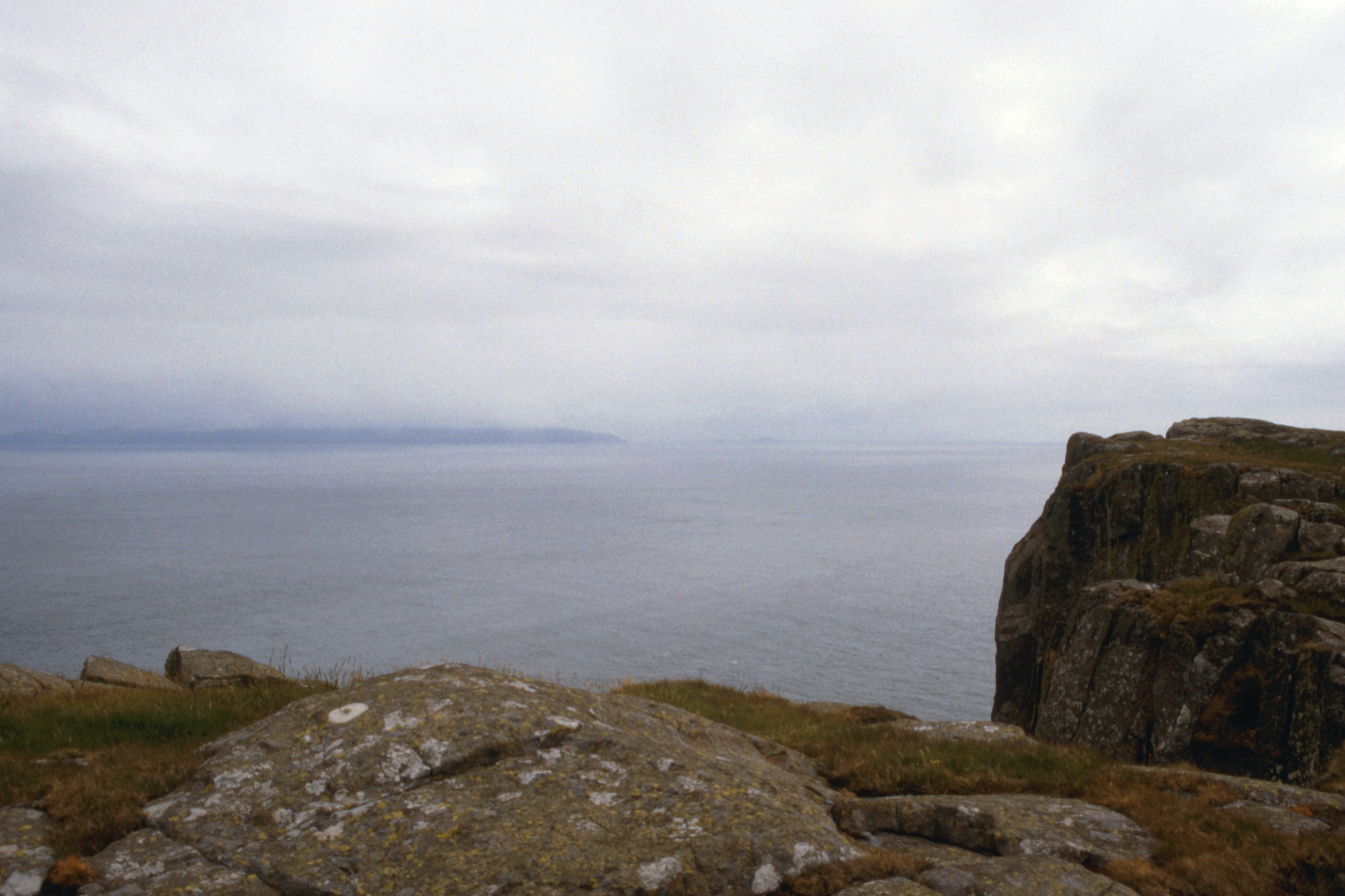
I was right about the proximity of the escape from the road and it was with some relief that I climbed the stile and started up through gorse for a short distance to clear the first rise and find open hill. A slight dip brought me to the side of Black Hill where a slight track is beginning to mark the slope. This I followed, reaching the top just after five. I could see no marks to indicate the route forward so I picked the best direction and ended up amongst the peat hags. When I reached the other side, I spotted marks showing that I should have come round further to the north.
In clear conditions, there would be a good view from this point, I could just make out the Mull of Kintyre but the Galloway coast, although nearer, was lost in mist. The view to the south has definite potential with Island Magee and the Larne Lough stretching away.
My way was now along a broad grassy ridge, excellent walking to Scawt Hill. Here, the Ulster Way heads for the col towards the Sallagh Braes but I cut more directly down the hillside to reach the Carncastle road about a mile below the col. I passed through Carncastle just as the Kirk was going in, I hope the folk weren’t scandalised.
Another mile or so brought me into Ballygalley and I reached the hostel about half past seven, had to dredge through various pockets to find change to pay my dues, dumped my bag, showered and changed and headed off to the Ballygalley Hotel for refreshment. The only bar open was the cocktail lounge but they were unperturbed by my casual dress and I had a pleasant couple of pints to end a long day.
Day 6 - Monday, June 13
Decisions, decisions. Thick mist but just a hint that it would lift sometime. The forecast is for a warm day and my feet are sore. Take the easy way out and go home. Orange juice, Weatabix, boiled egg, tea and toast for breakfast (£1.75) before packing up and setting off at 0900 along the last stretch of the Coast Road towards Larne.
An RUC road block at Tweeds Port took no interest in the passing tramper, apart from a few polite “Good morning”s, and I pressed on to the music of a couple of foghorns. A pavement appeared at Drains Bay. I stopped briefly at the Devil ’s Churn (a blowhole) beside the Blackcave Tunnel but the calm sea provided no entertainment.
The road began to rise as I entered Larne and a park inserted itself between road and sea. I cut into it and an elderly gentleman confirmed that there was a path through to the Chaine Monument. He also pointed out the Chaine Grave behind a railing - I would have taken it for a rath (for so it is marked on the map). I was less than fifty yards from the monument before it appeared through the mist.
The road I was now following was blocked off at the back of the ferry terminal and I had to detour past a small industrial estate before reaching the terminal with an hour to spare. Almost five miles in an hour and a half, with only slight discomfort from the blister on my left foot.
The booking clerk was delighted to give me student rate on the strength of my SYHA card, £10 seems a bargain compared to SeaCat. The security man ran a hand-held detector of some sort over my pack and I boarded the Stena Antrim and headed for the bar.
We sailed a couple of minutes before the scheduled departure time of 11:30 and the captain announced that the crossing would take a little longer than normal because of the fog. Three pints, a sandwich and many foghorn blasts later, I went on deck. We emerged suddenly from the fog, leaving a white wall behind us, just in time to see Corsewall Point and the entrance to Loch Ryan. A P&O ferry was just in front of us for the couple of miles till it turned in towards Cairnryan. The SeaCat appeared in the distance behind and steadily closed the gap to be within a hundred yards as we reached Stranraer.
We berthed five minutes late at 13:55 but, as usual, foot passengers have to wait till the cars are off and it was fifteen minutes before I disembarked through the car deck and walked the short distance to the station where a four car 156 waited to take us to Glasgow.
We departed on time at 14:30, crossing an incoming train at Dunragit, before turning north for Barrhill and Girvan. As we regained sight of the sea south of Girvan, the mist still lay offshore with the top of Ailsa Craig and Arran rising above it. Further stops at Ayr and Kilwinning before reaching Paisley on time, but were delayed there for ten minutes, apparently for a faulty door, and so ten minutes late into Glasgow at 16:55.
I still had not accumulated the correct change for the bus so decided to take the 17:13 train to Carmyle. I won’t do that again in a hurry. £1.35 single, the driver had to get out to phone for clearance from three successive signals from Polmadie and the eleven minute journey took twenty-three.
Sixteen minutes to walk home from the station, getting in at 17:52.
Holiday over.
[ Back To The Top ] [ Contents ]
John Reynolds - 1994, 1996, May 2015