
|
|
| |

|
|
| |
Sunday 14 February — Wanaka to Invercargill (335km)
It rained most of the night. My socks, which I’d optimistically left out on the line overnight, were wetter this morning than they were last night. I wrung them out and put them on the back window ledge of the car to get the benefit if there should be any sun today. (Which there wasn’t.)
A quick breakfast before the crowd got up then onto the road over Cardrona to Frankton, where I did not go into Queenstown but turned, instead, towards Kingston, home of the Kingston Flyer, where I arrived about half past ten to find a deserted station, an un-fired engine in the shed and three coaches in a siding. Then I saw the small sign, “train departs 1000, returns 1115”, so I leapt into the car and headed towards Fairlight, the other end of the trip, in the hopes of getting a lineside shot of the returning train (even though it was still drizzling).
There was a reasonable spot at Allandale Station (absolutely no sign of a railway station, perhaps the sign refers to a local sheep station) but kept going a bit further until I saw smoke, time for a quick U-turn and back to Allandale. I photographed the passing train, then returned to Kingston, getting back before the train.
|
|
|
| |
|
|
|
| |
By this time the rain was heavy enough to discourage much photography so I loitered under the station eaves and asked the guard/stewardess person when the next run was. She said tomorrow at 1000, they are having a very poor season, sometimes running with only one or two passengers, so they have cut back to one run a day. I’ll just have to get back there later, early in the day, and not too far in the future or it might be gone altogether.
I drove on to Lumsden for lunch, which had been the base for the Kingston Flyer when I passed this way in 1979, but it was running at a loss then too so they moved it to the other end and lifted most of the line. The lunch was a bit disappointing as the pubs are not open on Sundays and I went into a cafe where the service was slow.
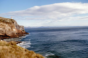
On down the road through Invercargill to Bluff, the end of the road. Still drizzly weather. They say that on a clear day you can see Stewart Island (24 kilometres across Foveau Strait) from the top of Bluff Hill but today you (or rather I) couldn’t even see Bluff as the cloud base was below the top of the hill.
Returned to Invercargill, filled up with petrol and noticed that one of my tyres was breaking up, literally. It must have been a remould. I had noticed on Thursday that a couple of tyres were a bit worn, I put it down to the unsealed roads I keep finding, and according to my list of authorised suppliers, replacements could be had in Alexandra, Timaru, Dunedin or Invercargill (or even in Christchurch but that’s a bit far in the wrong direction) so it’s not quite an accident that I got to Invercargill for tomorrow morning.
I booked in to the hostel for two nights, depending on the weather I’ll either go for a half-day tour tomorrow (after I get the tyres fixed, of course) or sit in a bar somewhere. If I get drunk, I might get my hair cut, it needs it.
Monday 15 February — Invercargill (246km)
I got my hair cut before I went into a pub! A really miserable day, weather-wise, I couldn’t see Bluff Hill from Bluff. Drove round to the aluminium smelter at Tiwai Point, across the harbour entrance from Bluff. The weather and view were no better. Had a look round the Southland Museum, and worst of all, heard a long range weather forecast, not much prospect of an improvement before the weekend. So I think I’ll work my way up the east coast towns for the rest of the week, and now I’m off to the pub.
Tuesday 16 February — Invercargill to Dunedin (315km)
Having decided on an early start, I was up in time to watch three hardy lassies set off for Stewart Island, a place reputedly knee-deep in mud during periods of drought so who knows what it will be like in this weather. I set off around the Catlins Coast road towards Balclutha. This served to lengthen the journey, which is the only thing it did because the weather continued miserable with rain and low cloud. A bit of a nuisance really, as there were several lookouts and waterfalls and suchlike just a short distance from the road but with the sky dripping and the bush dripping, I was loath to leave the cosy comfort of the car.
Anyway, at Balclutha I wandered up and down the main street and inspected a train-less station before driving on to Milton where I went into a pub for lunch. Picked up two hitch-hikers leaving Milton, genuine New Zealanders for the first time, but they were students returning to Otago University, not tourists.
On arrival at Dunedin, I drove about a bit in the car as it was still raining then went to the YH, which has moved and is larger since my last visit in 1979, and booked in for two nights. All the hostels have been very close to full, if not full, since Murchison (which wasn’t). It could be that the weather is driving people out of tents and mountain huts and into more civilised surroundings.
What better way to spend an evening than on a pub crawl. However the strong Scottish influence on Dunedin’s development was mainly Presbyterian and there is a sad lack of pubs in the city centre. I walked the length of George St and found only three. (Mind you, I don’t think there are any in George St, Dun Edin.) One was called the London Lounge so I couldn’t go in there, the others, one pint and move on.
Then I went into the Empire in Princes St, barman and two customers, one of whom hobbled off to the toilet on a crutch as I entered. He, I was warned, was a Scot, Willie Dodds from Hamilton, been in New Zealand 17 years and still unintelligible after one pint. So, we got talking and I stuck there for what was left of the evening. I think he was bothered with arthritis, I’m not quite sure, even for me it was sometimes difficult to follow his rural accent. The whole atmosphere was very congenial and I spent a very pleasant hour.
I left just before closing time (this is a very uncivilised country, most pubs close at ten with a few staying open till eleven at weekends) but it was a good time to stagger back to the hostel and bed and to pray for better weather tomorrow.
Taiaroa Head
Wednesday 17 February — Dunedin (110km)
My prayers were answered. When I woke, it wasn’t raining, the cloud looked fairly thin and there was even the occasional gaps. I drove out to the end of the Otago Peninsula, where there is the only mainland nesting colony of Royal Albatrosses, visits by appointment only, but I did see a number of them soaring above the cliffs, and they were big - up to ten foot wingspans I’m told.
Turning back, the sky looked dark over Dunedin although still quite bright above me. Not quite sunny, just bright. I drove along to Larnach’s Castle, a neo-gothic monstrosity made grotesque by the addition of glassed-in verandah around the lower two floors. Built of local stone at great expense by a Scot (Larnach) who imported masons from Scotland and marble from Italy and furniture from France. It is now privately owned by a family who are restoring it and have opened most of it to the public, for a fee. Inside it is very nice and the owners are gradually acquiring appropriate bits of furniture. The gardens aren’t up to much, obviously the available money is still going into the house.

|

|

|
| Up the Otago Harbour |
Larnach’s Castle | Down the Otago Harbour |

|

|

|
| Up the Otago Harbour |
Dunedin | Down the Otago Harbour |
There is a tearoom in the ballroom (which was added for Larnach’s daughter’s twenty-first) where the meals were microwaved but the soup was real.
For the afternoon, I went for a train trip up the Taieri Gorge, a freight-only line nowadays, one train in each direction up to Alexandra, but they run an excursion train every day in summer, up through the interesting part with stops at various points, taking just under four hours return and costing $35 but YHA members get for $23. The chap doing the commentary and collecting the tickets or money spent most of the war at Montrose and hopes to make his first trip back to Scotland next year.
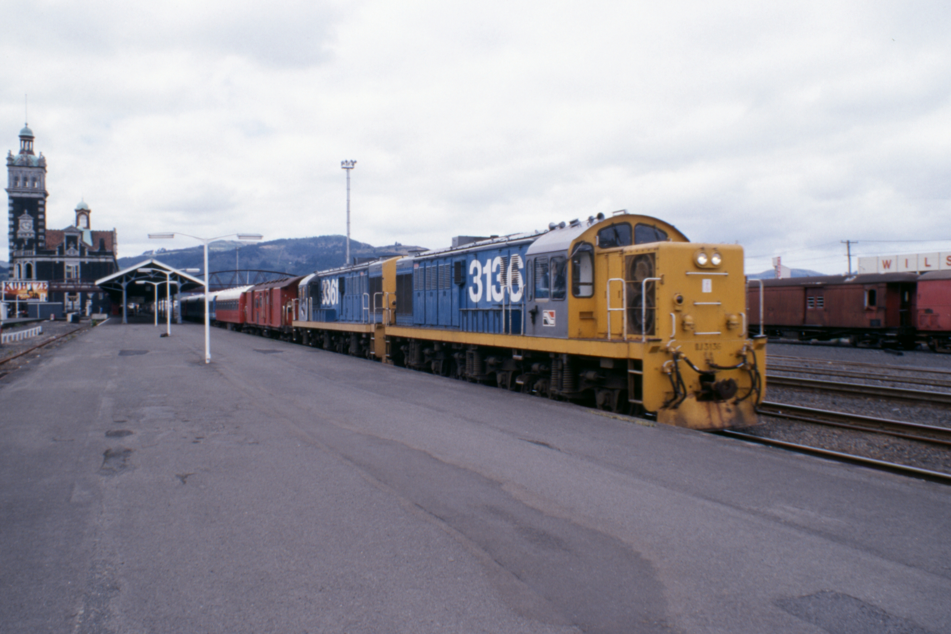
Dunedin Railway Station

|

|

|
| Front |
Back | Back |

|
|

|

|
| The Southerner arrives |
The Southerner departs | Breakdown crane |
Taieri Gorge

|

|

|
| |

|

|

|

|
| |
Changing ends at the top |
The forecast for tomorrow was quite good so I think I’ll head inland.
Thursday 18 February — Dunedin to Alexandra (272km)
So much for weather forecasts. When I woke about seven, the sky in the east (over the sea) was bright, with pale blue bits. I leapt enthusiastically out of bed, abluted, had a bite to eat, packed everything into the car, changed the rubbish bag in the kitchen and started the car at quarter past eight. Then I noticed that the sky was no longer bright, with pale blue bits, it had turned decidedly dull. Before I’d gone half a mile, the rain started. What to do now? I thought. Oh well, I might as well continue for the time being and if the weather didn’t improve, I could turn back further up the road.
So, through Mossgeil, across the Taieri Plain and up the hill into Strathtaieri. Stopped for ten’ses in a very pleasant coffee shop (they also sold tea) in Middlemarch where they were setting up for a Tupperware party. The weather had improved, it was now just occasional rain, so I decided to continue.
Just north of Middlemarch, the seal ended and the road became a divided carriageway with a central barrier of loose road metal, up to twelve inches high in places. Which reminds me, last evening, I found a good-sized chuckie embedded in the decorative grill in front of the radiator. I must have acquired it from some passing vehicle on the way up from Invercargill. I’m very glad it wasn’t twelve inches higher, it would have taken out the windscreen and maybe me too.
Anyway, back to the Middlemarch divided highway. A bit later, I met a grader. This seems to be the sum total of maintenance of unsealed roads, the roadie runs over the road occasionally with a bulldozer and flattens out the ridge, hopefully filling the ruts at the same time. However, this chap didn’t have his blade set quite right, and all he was achieving was to move the ridge about six feet sideways, to the end of the blade, right in the middle of the northbound lane. So I drove on the wrong side of the road for quite a few miles, luckily without meeting anything before the seal resumed.
Further up the road, I met a sheep float and trailer on another unsealed section. I usually drive at about 40kph on loose metal but this chap was doing nearer ninety. His dust cloud (coming up off a damp road too) was so thick I had to slow down to walking pace at first. There wasn’t much wind and I was driving in the dust for the next half mile.
When I reached the junction which was my last chance to turn back towards the coast, I thought, och, t’pot, I’ll just keep going, if the weather’s bad then the weather’s bad. The next town was Ranfurly, named after the shield no doubt, an interesting place which would be a one-street place except that the main road goes right through the town, does a U-turn around a couple of shops and heads back out parallel to itself, forming the other street. There is a link road on the edge of town, about 100 yards long, which would serve perfectly as a bypass but the local business community obviously prefer the traffic to come past the shops. Mind you, I suppose at perhaps fifteen cars an hour in each direction, it’s not to much of a disturbance.
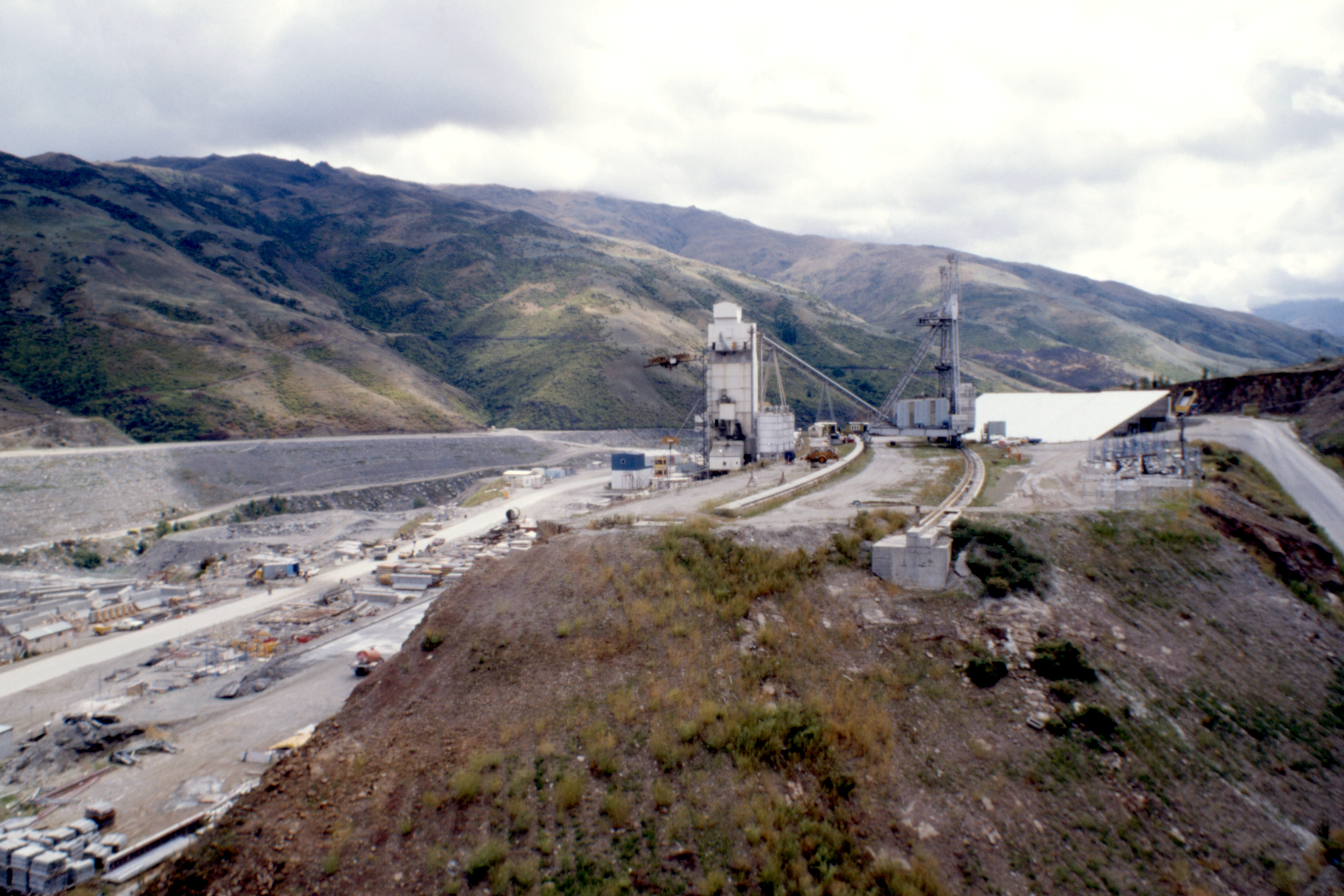
I went up to view the works on the Clyde Dam, on the Clutha. Clyde is the name of the nearby town, much expanded and made prosperous in the ten years the dam has been a-building. It is due to be completed next year, but ah hae ma dou’ts, it doesn’t look that far advanced. Once it is finished, it will drown the Cromwell Gorge to create Lake Dunstan, and drown the old centre of the town of Cromwell at the other end of the gorge. A new town centre has already been built on the other side of the town and the old area is being stripped and searched for gold before it disappears under the water.

|
|

|
| |
(Next 37 slides overexposed.) |
However, the generating capacity of the Clyde Dam will be surplus to requirements until well into the next century. The government has only just scrapped plans to build another dam at Luggate, a few miles further up the river, as the only justification anyone could offer for that one was to provide another fifteen years of employment for a thousand dam builders, but it seems the dole would be cheaper.
Drove up the hill across the river for views over the dam and the river valley down to Alexandra, a genuine dirt road with wide crumbly cracks in places, as if it was about to disintegrate. I would have turned back but the road was too narrow, and in the end, the views were good.

|

|

|
| The Clutha towards Alexandra |
Clyde | Dam construction |
I spent the night at Alexandra YH, a nice place, not full, so the facilities were not overstretched. The forecast for tomorrow is promising. (Promising what? I hear you ask.)
Friday 19 February — Alexandra to Lake Wakatipu (302km)
Promising my first mountain since St Andrew’s Day, 1985. (Richard and I took the train to Tulloch and went up Beinn a’Chaoruinn, just missing the afternoon train back to Crianlarich and spending a frozen hour in the unheated waiting room before Richard took steps and got us into the station master’s office for the other three hours.) This time it would be Mt Grandview, near the bottom right hand corner of Lake Hawea.
On my way there, I gave an Englishman a lift to Cromwell, then spent some time looking around the new town centre. A place without character, just like any modern urban shopping mall with public toilets well hidden.
On to the mountain, a grassy pimple at the end of a ridge but at 1396 metres, about fifty metres higher than Ben Nevis and therefore higher than I’ve ever walked before (although I was starting from about 350 metres). I won’t mention the fact that there was a farm road passed within fifty metres of the summit and I met the farmer up there with his pickup, repairing fences. The weather was predominantly sunny with some thin high cloud developing later. I got a bit burned by the sun despite what I thought was a very prudent policy on the length of time that any part of my anatomy was exposed, and the judicious application of protective cream (most of which was washed off by my sweat). Worth it in the end for good views all round, pity I didn’t know that I had the setting wrong on the exposure meter on my camera.

|

|

|
| South from Mt Grandview |
West over Lake Hawea | Hawea Flats |

|

|
| North-west |
Mt Grandview |
When I got back down, I made a bee-line for the Lake Hawea Hotel and a very moderate refreshment, making up the bulk with L & P. At this point I should have enquired about a bed, had a shower and set about a serious evening’s refreshment, but no, on the map I had spotted a place called Bannockburn near Cromwell which appeared to have a hotel. So I drove there to find only a tavern, no accommodation. On to Queenstown, not my favourite place (too touristy), then spent the night in a very pleasant rest area on the shores of Lake Wakatipu, just north of Kingston.
Saturday 20 February — Lake Wakatipu to Te Anau (293km)
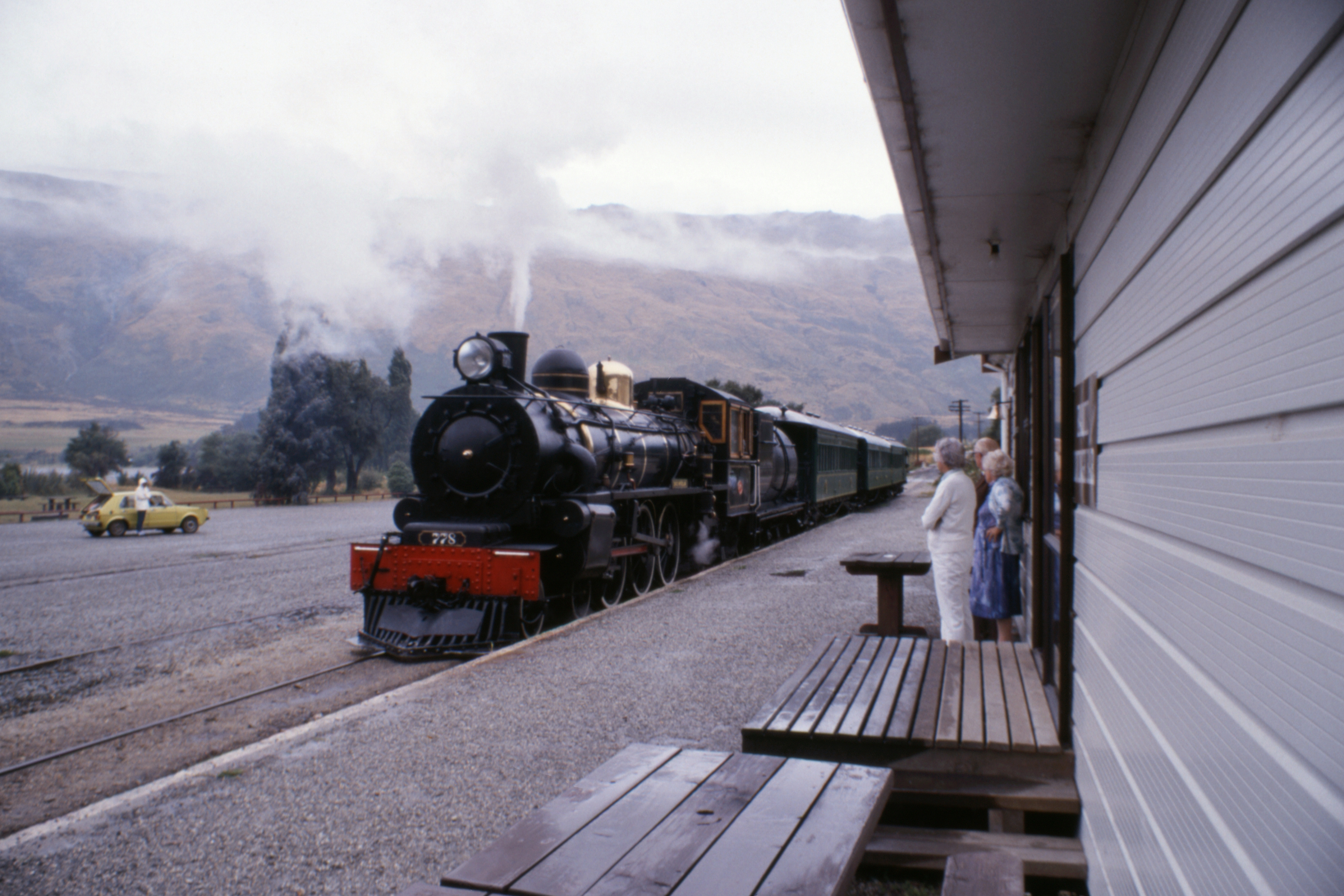
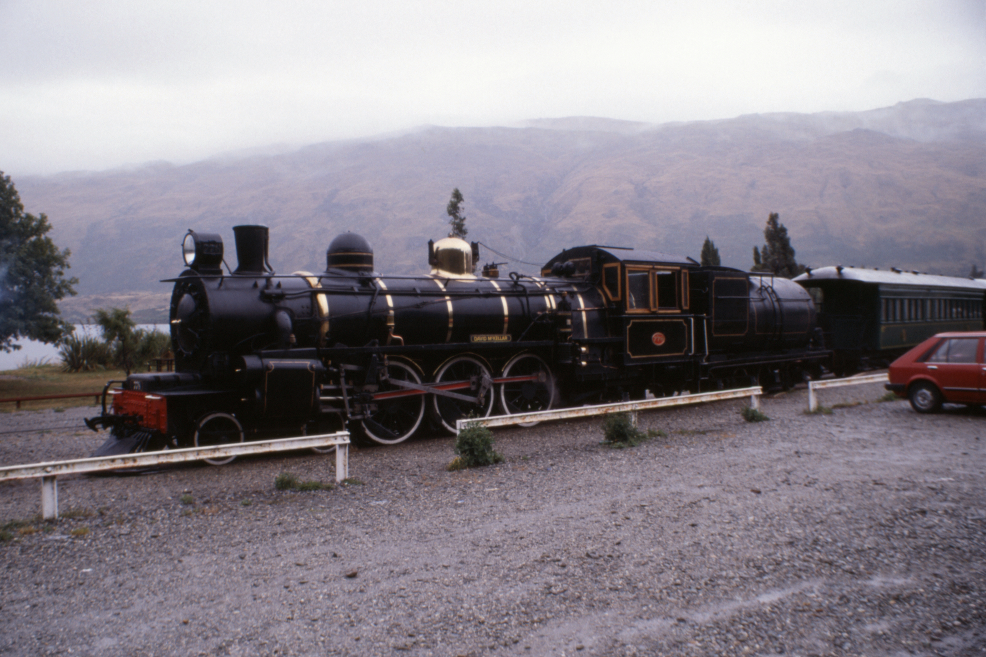
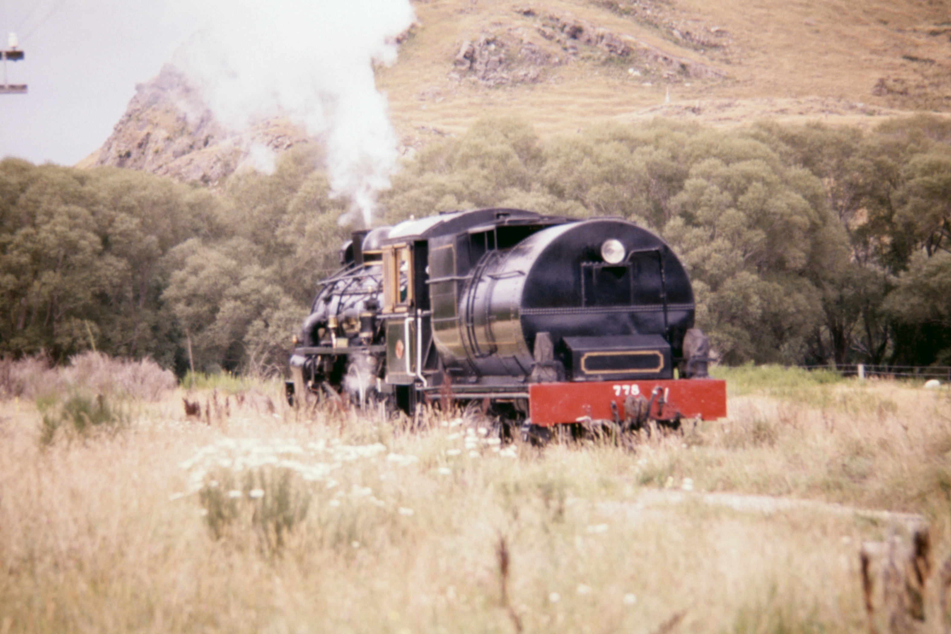
Today, the Kingston Flyer, at the second attempt. Being just a few miles north of the station, I had a long “lie” in the car before arriving at Kingston in good time. A different guard/ stewardess person had no difficulty in selling me a ticket, and later a “Colonial Tea” consisting of a cup of tea and a scone with jam and real whipped cream, a T-shirt and a souvenir booklet. All a bit overpriced but it’s in a good cause.

|
| At Kingston |
|

|

|

|
| Turning the engine at Fairlight |
Open corridor coach | ||

|

|
| Coaling |
Boarding the turntable |

|

|

|
| Turning the engine at Kingston |
||
The trip, half an hour each way with fifteen minutes at the other end, was much as you would expect. I sat awhile in each of the three coaches, all different but all of the same period (1920’s), so the quality of the ride was much the same. On the way back, I went to the rear platform to take the traditional shot of the engine rounding the bend. There are two long bends, one each way, and there was this woman hanging out on the inside of the first so I settled down to wait for the second. When we got there, the woman, with a middle class English accent, came across and stood in front of me all the way round the bend. I was not pleased.
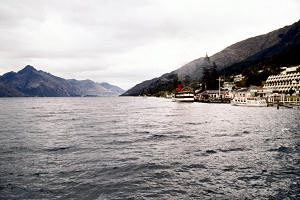
Lake Whakatipu at Queenstown The station provides the only pub in the town so I had a pint there, and on asking, I was told that they would be swapping the engines round in two or three weeks time. Just too late for my schedule. Schedule? What schedule? But I think I’ll be up at the top of the South Island by then. I returned to Queenstown to get some money and films, but I couldn’t get the type I wanted.
In a deteriorating temper and deteriorating weather, I returned to Kingston to photograph the extra run the Flyer was to do today (the day of the Kingston to Queenstown yacht race so there would be more tourists around than usual), but I was late so went on to Fairlight to watch the engine turning on the triangle there. I parked the car with a good view of the manoeuvre and a campervan arrived and parked right in front of me. I moved the car ten yards. A bit later, the campervan driver seemed to decide that he was a bit close to the tracks so he moved, right in front of me again. So I moved again, trying to run down one of his companions but she proved too agile in spite of her grey hair.
I drove back to Allandale to photograph the passing train (there is a slight rise there so you get a bit of smoke from the engine) but luckily the campervan continued towards Kingston.
|
|

|

|
| (last Sunday) |
Passing Allandale | |
I continued to Lumsden then on to Te Anau. It was my intention to go into the park headquarters and ask when I might get on to the Milford Track, but when I got there, the whole place was hoaching with people and normal business had been suspended. This weekend was Fiordland’s turn to celebrate the centenary of New Zealand’s National Parks. I watched the axemen chopping logs for a bit then went shopping. Still can’t get the film I want so settled for a Kodak, if the weather is good tomorrow, I don’t want to run out of film in Milford Sound.
The YH was full so I headed on up the road and here I am, sitting in a camping ground just before the “Avenue of the Disappearing Mountain”, knocking off a bottle of wine and writing this rubbish. It has rained off and on for most of the afternoon and evening, but not since I stopped here. The forecast for tomorrow is for more showers (probably a euphemism in this neck of the woods) but a lad in Alexandra said that Milford is Marvellous, even in the rain. Roll on tomorrow.
Sunday 21 February — Milford Sound (226km)
And tomorrow was well worth the wait. It rained during the night but the day came up with broken cloud and the sun touching the tops of the surrounding hills. I tried to listen to the football results but reception was not good. I thought I heard the man announce Dunfermline 2, Rangers 0, but I couldn’t be sure so I’ll have to wait until (if) I see a paper for confirmation. I also heard that Queen’s drew, Aberdeen won, and Celtic play Hibs today. I missed the Hearts result completely. Definitely not pleased with the rugby.
On towards Milford. The Mirror Lakes did not reflect, a couple of ducks made sure of that, with some help from water dripping from overhanging branches, and the Disappearing Mountain did not disappear, it merely sank behind some intervening high ground. When I reached the Divide, there were about twenty trampers off the Routeburn, optimistically trying to thumb lifts but really waiting for the 0930 bus.
I decided to go for a short walk, the sign said two and a half hours return to Key Summit, which gave very good views of the surrounding mountain tops. Some of the higher mountains were still covered in cloud, but others, particularly to the north, were clear and snow-capped. Then I nipped along to see Lake Howden where sits the first (or last) hut on the Routeburn.

|

|

|
| Views from Key Summit |
||

|

|

|
| Views from Key Summit |
Lake Howden | |
Back to the car and on to the Homer Tunnel through magnificent scenery into a spectacular corrie where the tunnel entrance is a tiny thing at the bottom of a mighty cliff. The trip though the tunnel is an experience. It was build as a government work project during the Depression. Until recently, it was one way traffic, changing direction every half an hour, but now it is a free-for-all with buses exercising considerable care when passing within it. Going west, it starts flat for about twenty yards then dives down a one-in-ten slope with a kink about thirty yards from the far end, so for most of the way you cannot see daylight at either end. The sides and low points in the roof are marked with reflectors and the floor is somewhat rough in places.

|

|

|
| A corrie near the east entrance |
The road up to the Tunnel | Rock wall beside the east entrance |

|

|

|
| West entrance |
Eroded rocks in a stream | |
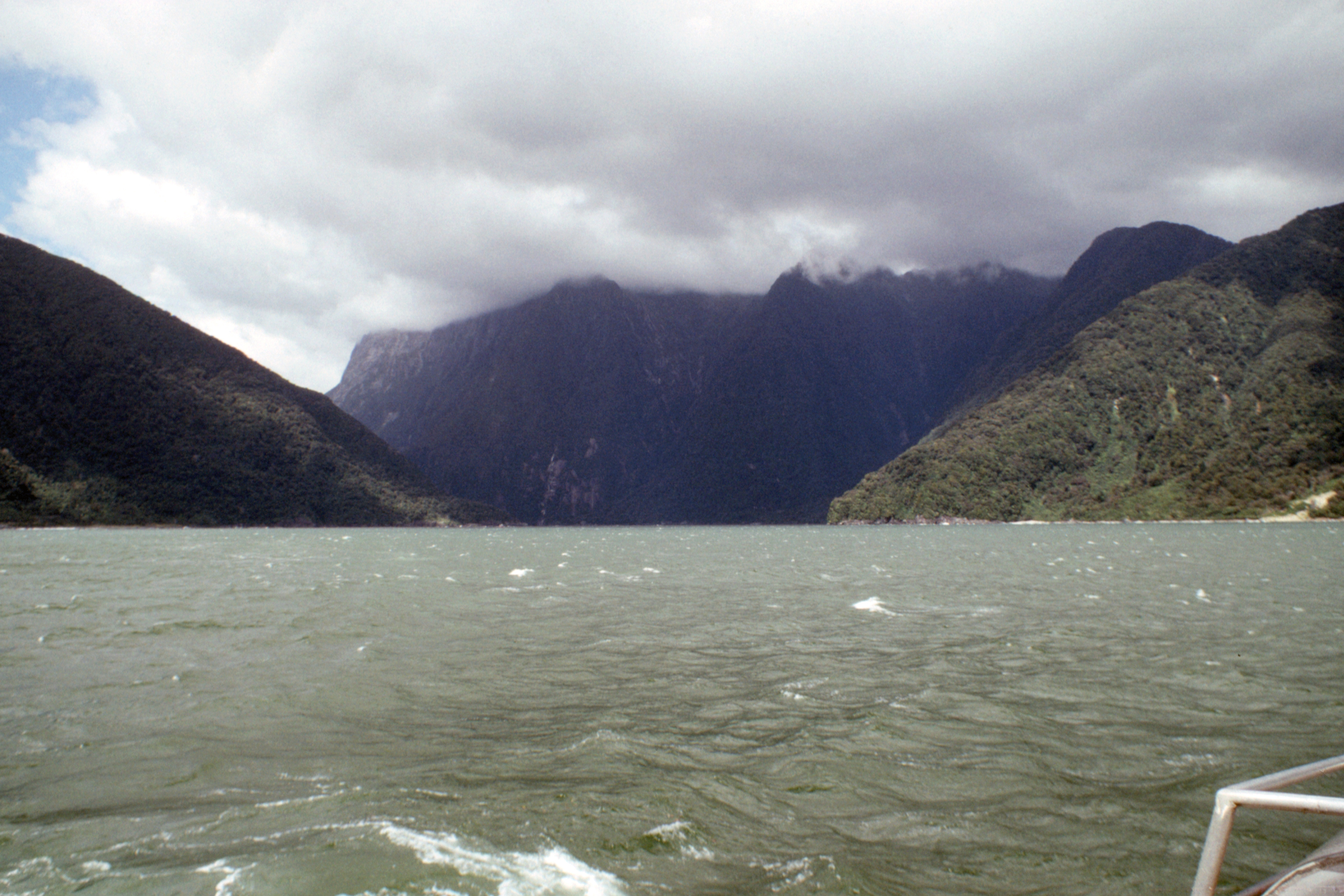
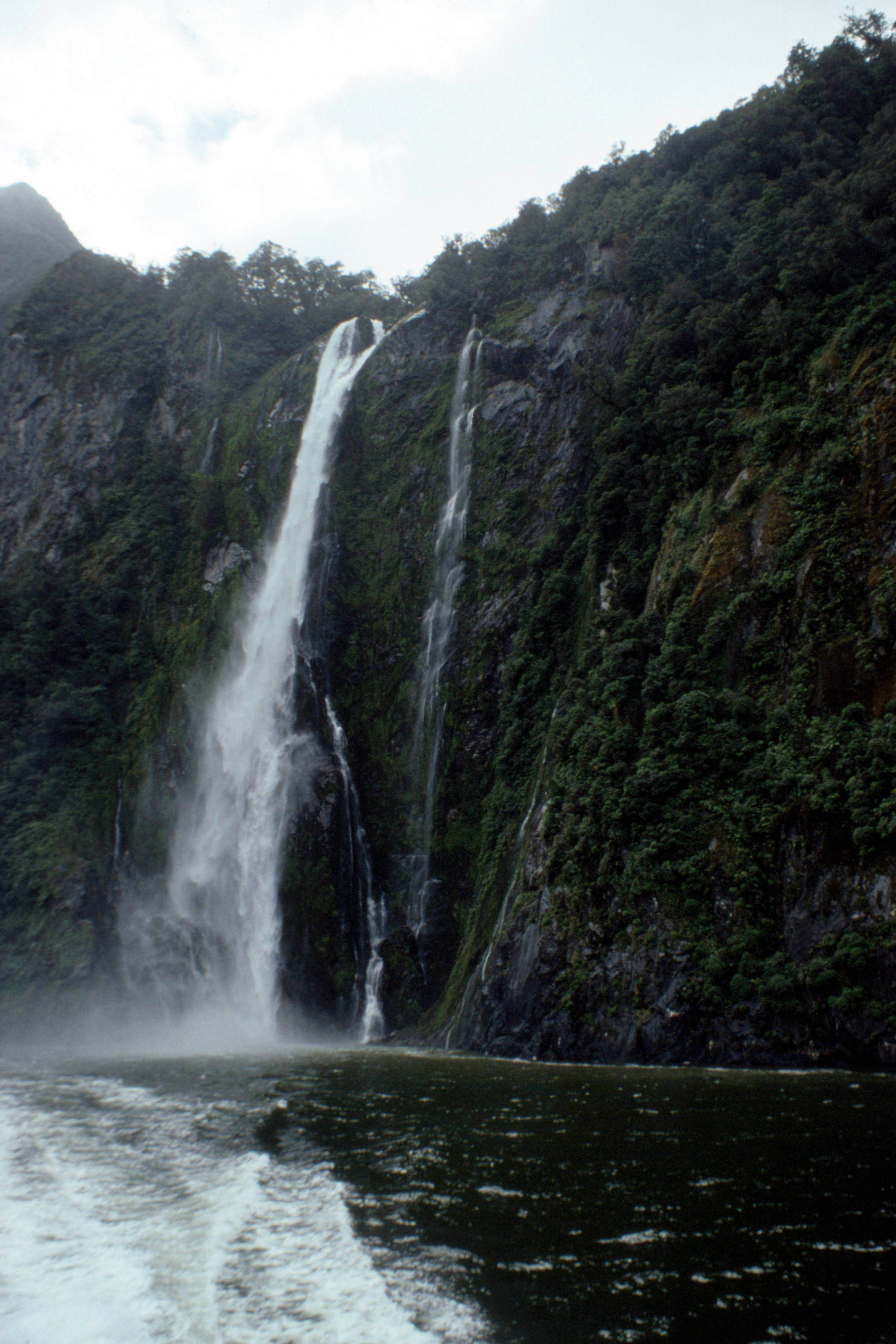
Down at the Sound, I took the cruise on a catamaran which went right out to the open sea at a rate of knots and in a fair amount of spray which sent most of us on the upper deck diving for cover. The scenery here is spectacular too, sheer cliffs cut by the ice, several thousand feet high with waterfalls dropping straight from hanging valleys and in the stiff breeze, some of them didn’t reach the bottom. There were some seals on the rocks.

|

|

|
| Milford Hotel |
Mitre Peak | An excursion boat (correct exposure resumed) |

|

|

|
| Fiordland Flyer |
Bowen Falls | Milford Sound |

|

|
|
| A mountain |
A waterfall | The entrance to Milford Sound |

|

|

|
| The coast to the south |
Milford Sound | A mountain & waterfalls |
|

|

|
| A waterfall |
A mountain | Mitre Peak |
After the cruise, a quick walk up to the lookout above the hotel to admire that view and as I got back to the car, the first raindrops of the day fell. On the edge of the settlement, I picked up a couple of US persons who had just started to don their waterproofs. I dropped them at the Divide, they were off on the Routeburn, then I returned to Te Anau to book a trip to Doubtful Sound for the morrow.
When I went to the YH, it was full so here I am again, in a lakeside camping ground twenty miles out of town waiting for tomorrow. The breeze seems to be keeping the sandflies away, I haven’t had to use the Dimp (the best known insect repellent and quite effective too). No wine tonight, just beer.
Monday 22 February — Te Anau to Lumsden (135km)
Some you win, some you lose. It rained all through the Doubtful Sound trip. The cloud base was low, the mist was lower and everything was wet.
But first, the night. I was invaded by a mouse, small, silvery grey and very active. It first made its presence known by noises from the boot, scratchings, scamperings and the occasional squeak. That was bad enough but when it decided to explore further afield and started crawling over my sleeping bag it was too much. I kicked out and it hit the other side of the car with a thud, but even that didn’t slow it down. I managed to catch it in the torch light a couple of times and it froze, but when I tried to get a hand out to grab it, my movements were hampered by my sleeping bag and as soon as the torch beam wavered, the little thing was off back into the boot. The prospect of getting out to empty the boot in the dark did not attract me so I decided that it would have to wait till the morning, and I went to sleep.
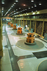
Manapouri Turbine Hall
When first I woke, it was still dark but there was no sound except the rain and I decided against emptying the boot in the wet. I dozed a bit longer then drove to Manapouri where I checked the surface things in the boot and found that the mouse had got at my cheese slices, which promptly went in the bin, but apparently nothing else.
The trip started with a cruise in a (covered) launch across Lake Manapouri and up the West Arm to the hydro-electric power station at the end. Instead of building a dam to get a head of water, they dug a hole, 600 feet straight down, and built the power station at the bottom with a tunnel to take the water through the mountains to the head of Doubtful Sound. Access to the power station is down a spiral road where the traffic drives on the right to make it easier for drivers to judge the clearance from the tunnel wall when passing. The turbines were built by Siemens and “the electrical bits by a firm in Glasgow”. I forgot to ask which one and I didn’t get close enough to see the makers plates.
After the power station, the bus went down the road to Doubtful Sound. This road was built during construction of the power station as a way of bringing in the necessary heavy equipment, it was cheaper than improving the public road all the way from Invercargill, but is now used mainly for tourist access to the Sound. Another launch trip here before returning the way we came.

|

|

|
| Doubtful Sound |
Hall Arm | Malaspina Reach |
Throughout the trip, the various drivers assured us that we were lucky to be there on a wet day at it meant that the waterfalls were performing well, in dry weather only about ten percent have any water in them and in most cases just a trickle at that. They gave commentaries on what we would have seen if it hadn’t been raining, or if we’d been there at some other time of the year when various flowers and trees were in bloom. All tending to create the impression that it would be worth another visit, but next time I’ll wait till I see the weather on the day.
Back at Manapouri, I looked in the boot again. There was a strong smell of mouse, a fair amount of droppings, but no other sign of the invader, and I never saw it again. I’m sure it is just a coincidence, but there was a cat sitting on the wall beside the rubbish bin in which I had deposited the cheese slices in the morning.
The rain finally stopped before I reached Lumsden, so I stopped too, in the Royal Mail Hotel. Nice place, nice price, and good company in the bar. The bar in the Lumsden Hotel was not bad either. The railway station is now the bus station and visitor centre, but not many visitors since the Kingston Flyer moved to Kingston.
[ next chapter ]
John Reynolds — March 2013


