New Zealand 1988
Tuesday 23 February — Lumsden to Oamaru (421km)
|
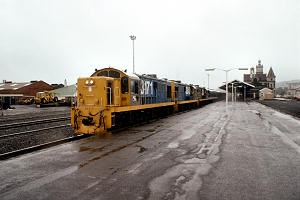
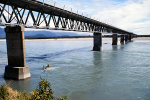
The Southerner at Dunedin
|
It was dry when I left the hotel just before eight, but the rain started by the time I got to Gore where
I stopped for breakfast, cash and petrol in that order. I left town heading north on the road to
Alexandra but turned right at Raes Junction for Dunedin. The rain slackened on the way north but started
again and got heavier as I approached the coast.
At Dunedin, I watched the late northbound Southerner acquire a third engine, then decided that it was too
wet for the half-mile walk to the Otago Early Settler’s Museum so drove out the coast for a quick
look around Port Chalmers, not exciting, the back to Dunedin where the weather had not improved so I
headed north to Oamaru where I saw one of the original two engines off the Southerner in the station
yard, attached to another engine, but just as I was thinking of getting my camera out, off they went.
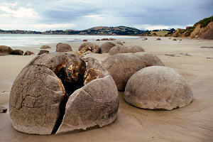
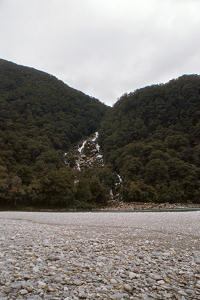
Moeraki Boulders
|
|
|
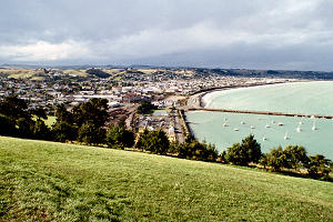
Oamaru from the south |
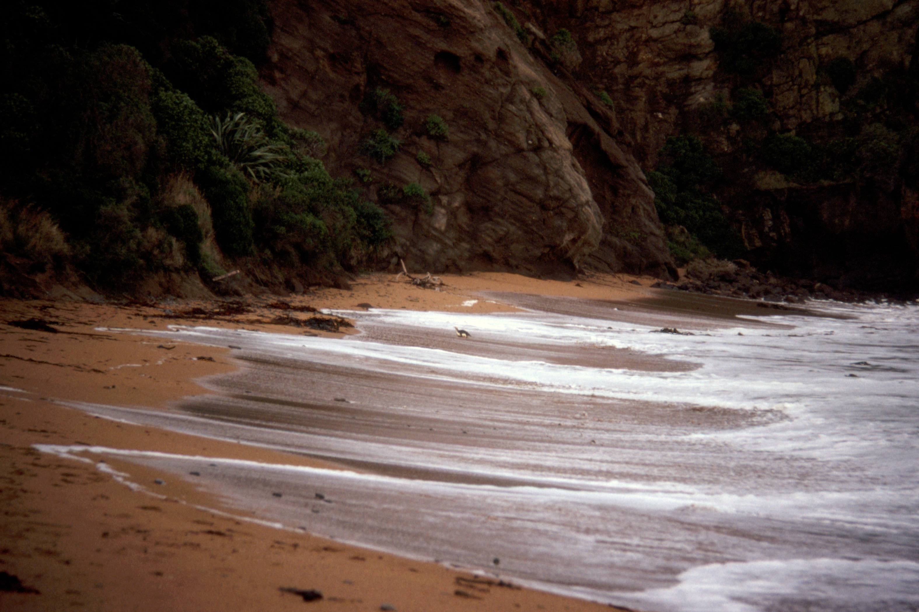
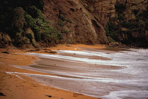
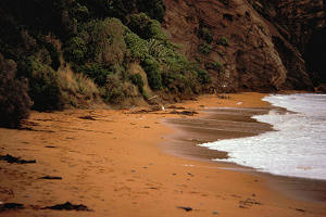
After booking in to the Red Kettle (the YH), I went off to Bushey Beach in the hopes of seeing some
penguins, which nest in the bush behind the beach. They go out to sea in the morning and return,
sometimes, at dusk. The surf was “energetic”, the tide was high, and I was beginning to
think I was on a fool’s errand when, just before eight o’clock, one appeared at the edge of
the surf, lurched to it’s feet and was into the bush before I got the camera out. (The camera was
zipped inside my jacket out of the way of the occasional raindrops.) About ten minutes later, another
one appeared and this time I did get the camera going, although the light was marginal and the bird was
a fair distance away. Still, we’ll see what develops.
|
|
Blue Penguin
|
Wednesday 24 February — Oamaru to Timaru (253km)
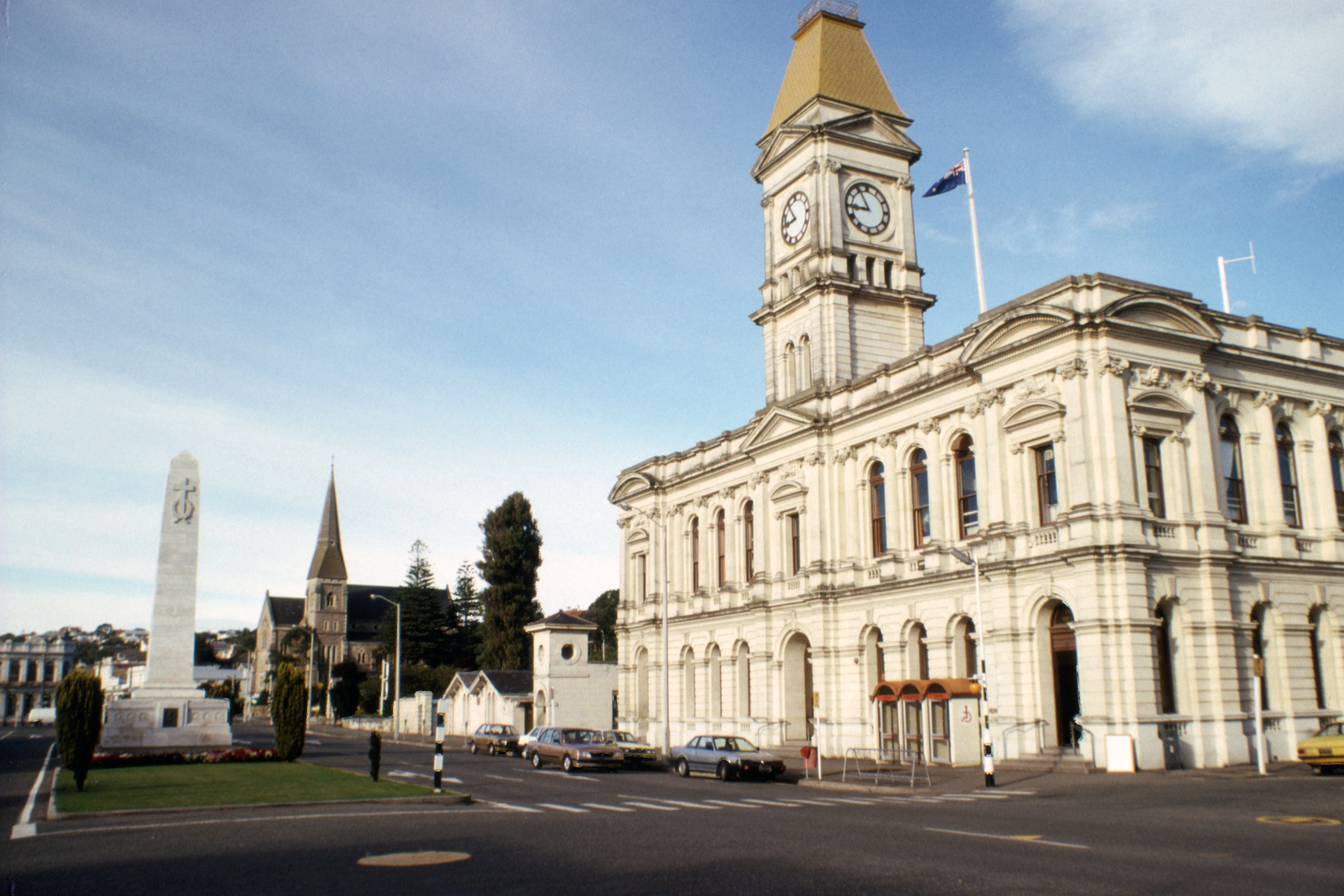
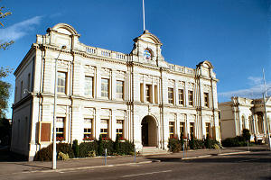
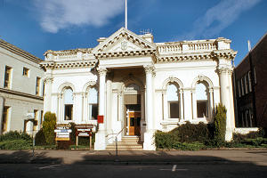
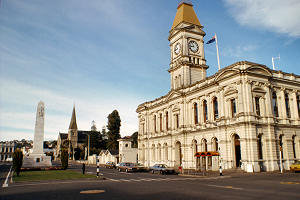
The day dawned sunny and bright, and I spent most of the morning wandering around Oamaru, much impressed
by their Public Gardens, where they have fitted a pleasing diversity of flora and feature into a limited
site. The local Oamaru stone used for public buildings (of a certain age) is almost white in the
sunlight.
|
|
|
Town Hall
|
Waitaki County Council Chambers |
Cenotaph and Post Office |
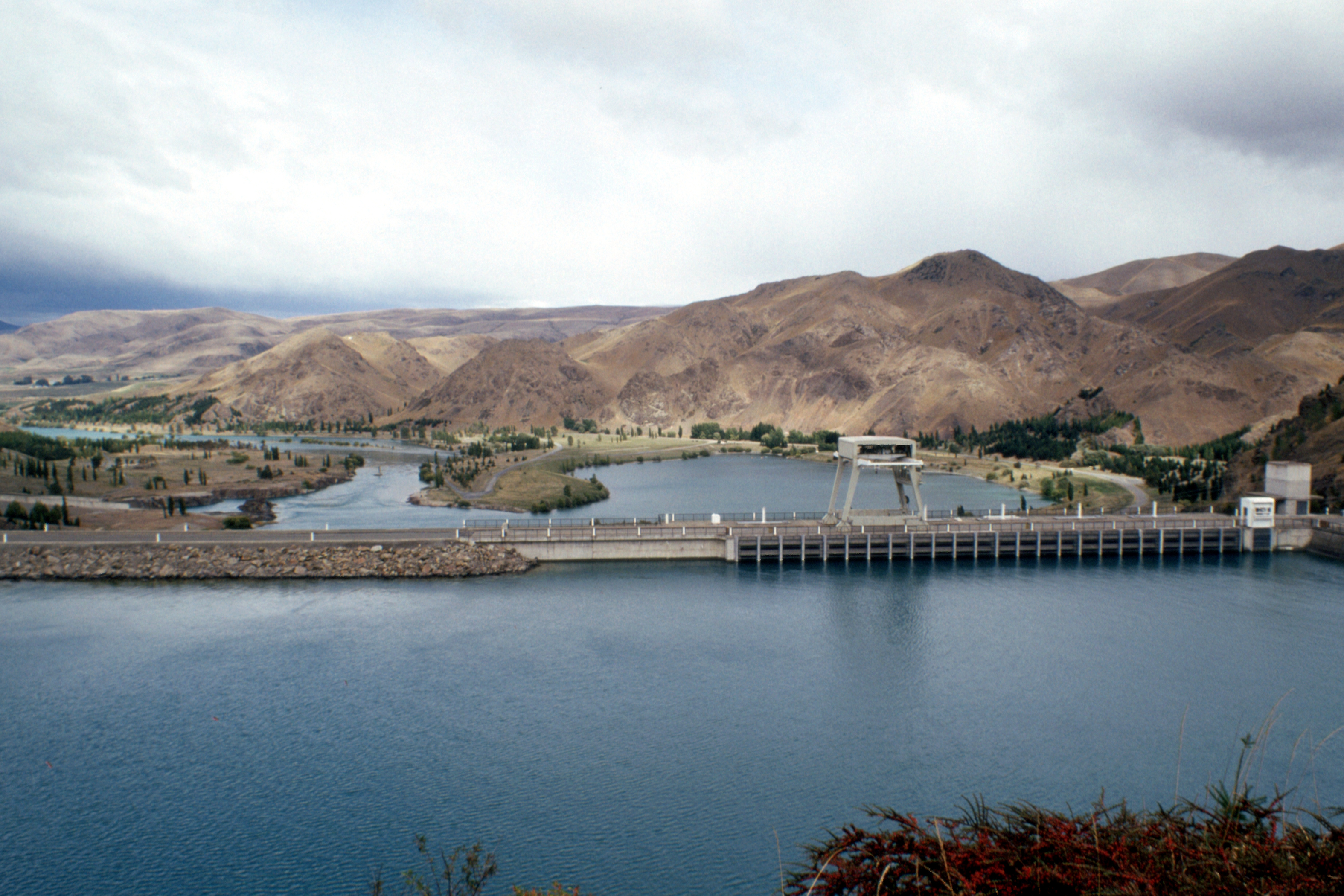
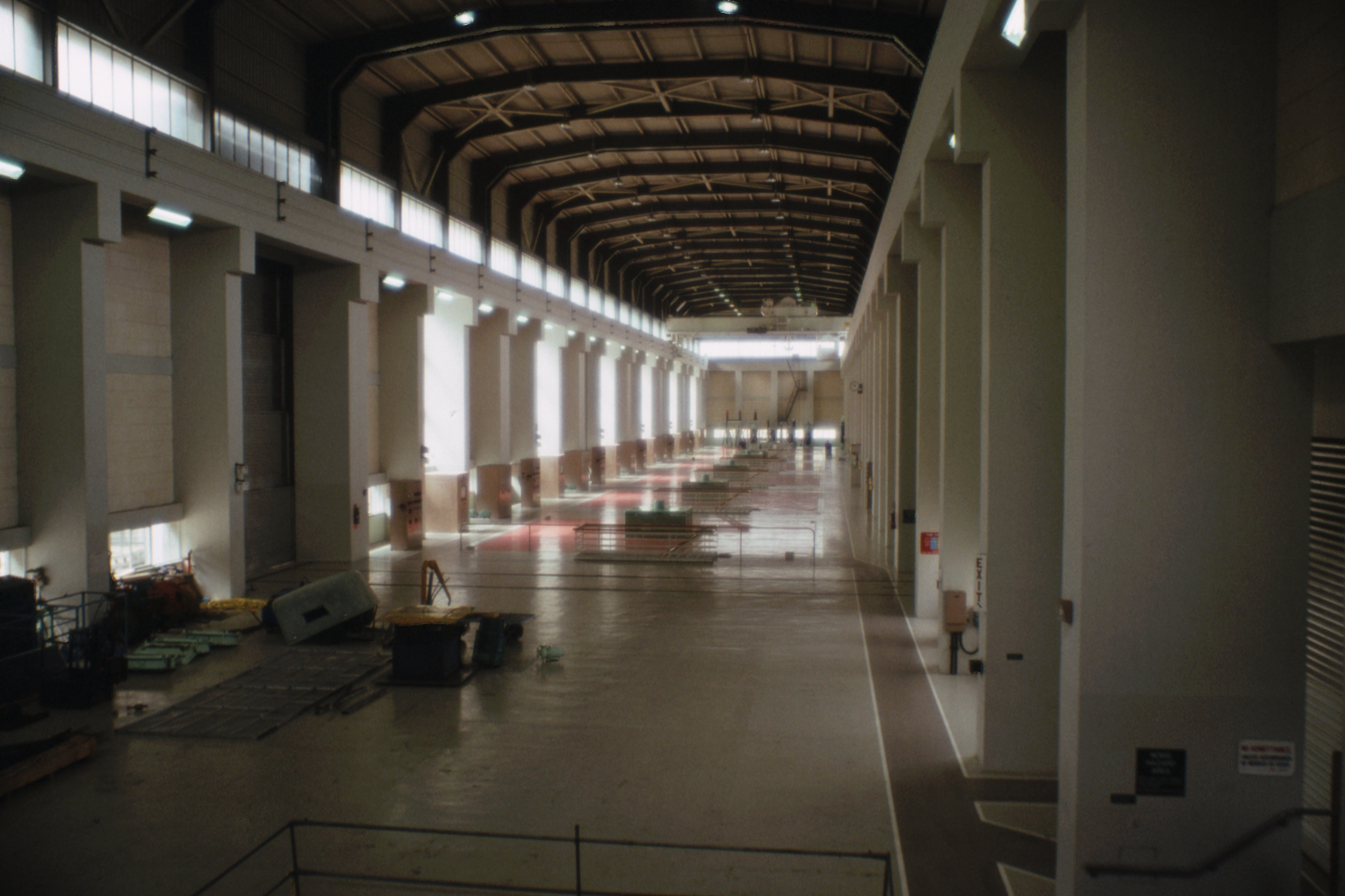
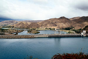
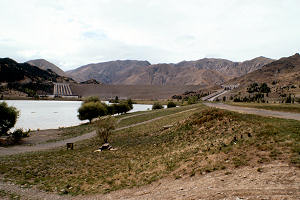
On leaving Oamaru, I drove up the south bank of the Waitaki River whose waters are tapped for a
significant share of the South Island’s hydro electric production. There are power stations on the
way up the river, at Waitaki, Aviemore and Benmore, and four more on the rivers and canals linking Lakes
Tekapo, Pukaki and Ohau to the Waitaki above Benmore. There is an aquatic recreation area just below the
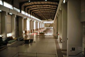
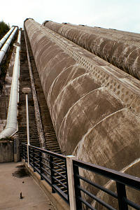
Benmore dam with a visitor centre and conducted tours of the power house, of which I took advantage.
|
|
|
|
Benmore Dam
|
Turbine Hall |
Penstocks |
Benmore Dam |
|
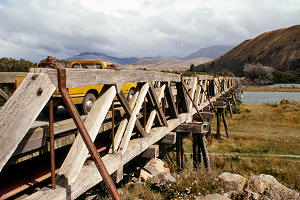
Road bridge near Kurow
|
Back down the river, crossing to the north bank over a wooden bridge at Kurow, then turning north through
Waimate to rejoin SH1 and head north to Timaru where the YH boasts the only bath in all the hostels in
New Zealand.
Thursday 25 February — Timaru to Christchurch (288km)
Was a constructive day, achieving much of little consequence. I hit the road just before eight, dropping
a US hitch-hiker at the end of SH8 on the outskirts of town and shortly after, I picked up two
“locals” en route to Christchurch. Both physiotherapists, one an English lassie who’d
been working in Christchurch for two years, they’d been sitting in a hut at the end of the
Copeland Pass for two days waiting for the weather to clear sufficiently to allow a crossing. Having
finally given up and headed for home, the weather immediately improved.
When I reached Christchurch, I looked up the ICL office in the phone book and went there to send off my
petrol chits to the administrator in Wellington, and to find out which local garage I should contact to
get the car serviced. When I went round to the garage, they offered to do the car immediately, which
pleased me greatly as I had expected to have to hang around for a day or two.
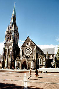
So I set off on foot to admire the sights in the city centre, not much changed from my last visit in
1979, and lunched in an Irish pub called Baillies, just beside the Cathedral. For the first time in New
Zealand, the pints came in a straight glass (rather than a dimple). A shower of rain arrived so I had
another pint before going along for a look around the Postbank Computer Centre where there was still a
real live (just) 7905.
|
|
Cathedral
|
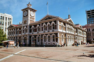
Post Office |
Returned to the garage to collect the car, they’d replaced a rear wheel bearing, there are some
loose baffles in the “muffler”, everything else normal, then I set off for the Banks
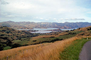
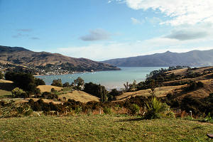
Peninsula and the Pigeon Bay Hostel. On the way, I picked up a German lassie on her way to Akaroa, which
is not much further so I took her there and bought some provisions. Akaroa is a French settlement, the
houses are a bit fancier, or rather, a bit more ornate, than elsewhere, and there’s a few Rue this
and Rue that. Otherwise it seemed the same as anywhere else.
|
|
Akaroa Harbour
|
Returned to Pigeon Bay where I found an English lassie in residence (her third night), spent a quiet
evening listening to the rats in the roof, and went to bed.
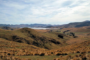
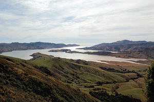
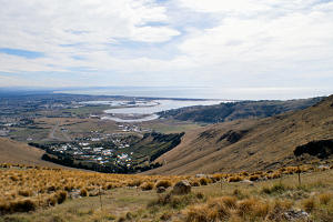
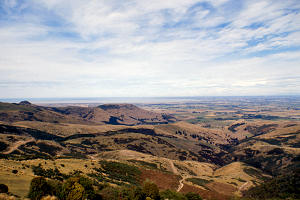
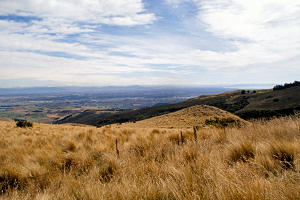
Friday 26 February — Christchurch to Tekapo (400km)
The day dawned fine. I started slowly, pottering around and drinking tea, and it was almost half past
nine before I got going. I took the back road from Pigeon Bay over to Diamond Harbour, another road
unsuitable for caravans and trailers, but quite scenic whenever I could take my eyes off the twists and
ruts in the road, before cutting up to the Summit Road along the Port Hills between Christchurch and
Lyttleton Harbour. The view was clearer than in 1979, I could see right across the coastal plain to the
mountains inland.
|
|
|
Diamond Harbour
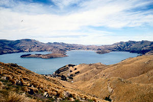
|
Lyttelton Harbour |
Avon Estuary |
|
|
|
South from the Port Hills
|
Christchurch |
Lyttelton Harbour |
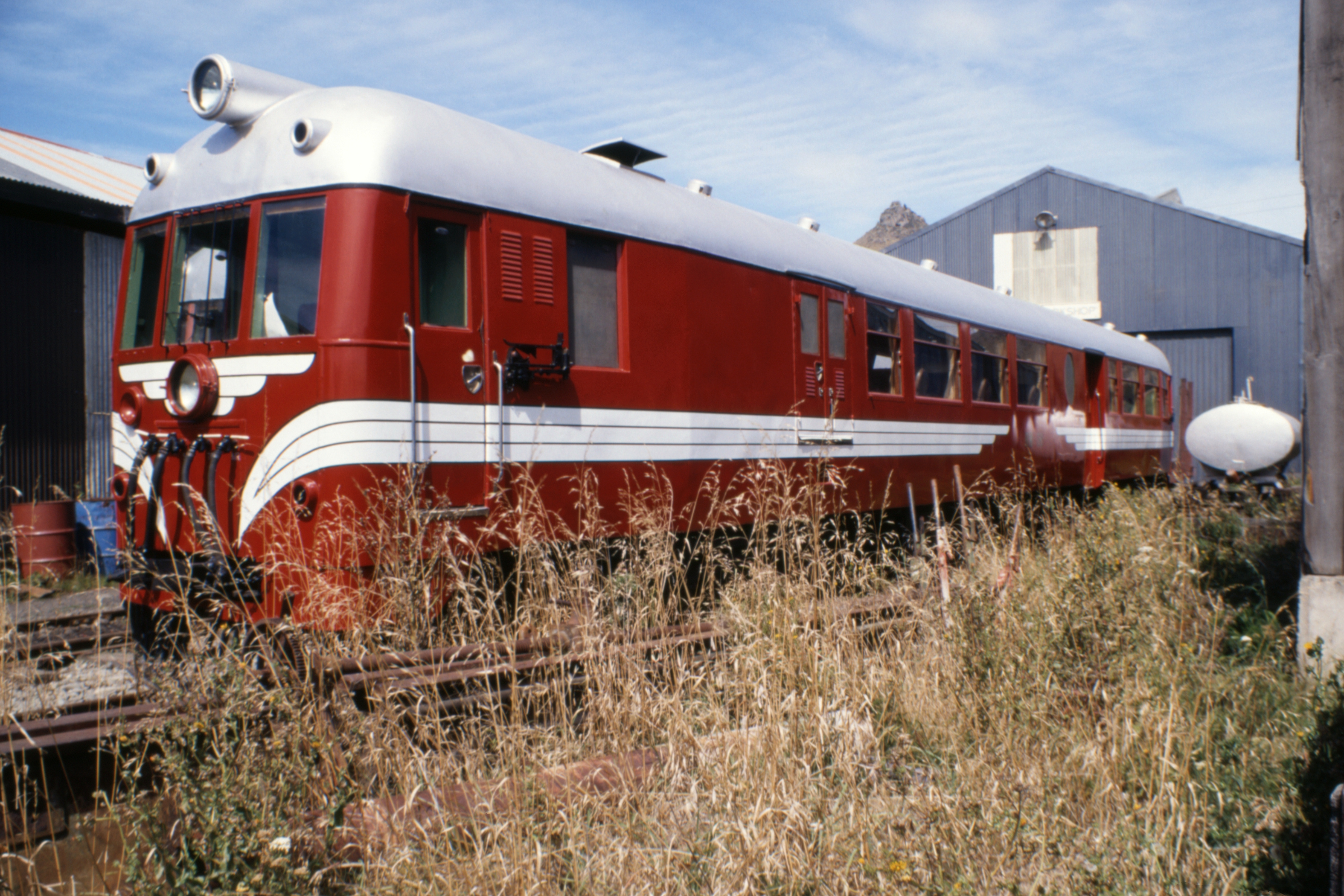
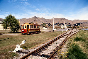
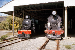
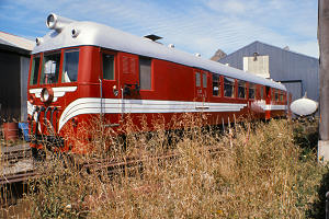
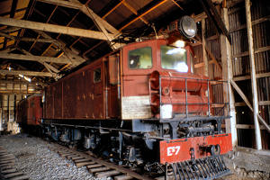
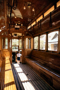
Down into Christchurch and round to the transport museum at Ferrymead, where they keep some old trains
and other things. It was very quiet there, no trains on weekdays, only trams and only one of them
running, Dunedin City No 11. One of the engine sheds, the one holding most of the working engines, was
closed, but there were a few other engines scattered around. Reasonably interesting but obviously better
at weekends. Perhaps I’ll manage another visit.
Ferrymead Transport Museum.
|
|
|
Dunedin tram
|
Steam engines |
Vulcan rail car |
|
|
Christchurch - Lyttelton loco
|
Dunedin tram |
|
Then I set off up the road towards Arthur’s Pass, intending to turn left when I reached the
foothills and head back down to high Otago and the Mackenzie Country. About twenty kilometres before the
junction, I picked up a couple of lassies heading for Arthur’s Pass and took them as far as
Springfield, mainly because I went belting past my turning before I recognised it. So I dropped them and
had a quick look at the deserted railway station before resuming my intended route. Stopped at Geraldine
to buy some tobacco, milk and a pint of beer.
|
|
Rakaia Gorge
|
Mt Hutt |
Leaving there, I picked up two New Zealand girls on their way to Mt Cook and dropped them at the far side
of Lake Tekapo township before finding the YH and booking in for two nights. The wind had been getting
up a bit for most of the afternoon and when I stopped at the Rakaia Gorge to take photos, I had to brace
myself against a fencepost, and now it was flexing the walls of the hostel, a fairly new building.
I went into the local hotel bar but it was very busy, apparently there is a water-skiing competition on
the lake this weekend, and the bar staff were going round in circles so after about five minutes with no
sign of getting served, I left.
Plans for the morrow will have to wait until I see the weather, showers forecast. I fancy a scenic flight
round Mt Cook, hostellers get a cheap rate on standby seats, but that would depend on cloud cover and
wind strength. There’s a nice hill called Mt Edward just down the road, over 6000 feet with two
nice long ridges enclosing a narrow valley. We’ll see what happens, I might just spend the day in
the pub.
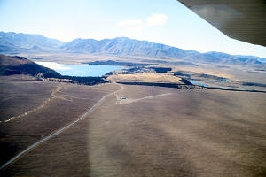
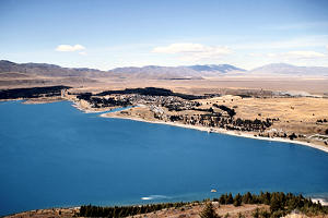
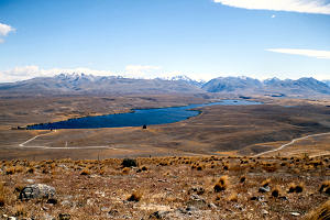
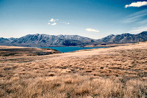
Saturday 27 February — Tekapo
A beautiful morning, the wind had dropped so I decided to try for a scenic flight. The warden phoned the
operators, Air Safari’s, but they didn’t know what conditions would be like up in the
mountains and would phone back after they’d had a look. I loitered. When they did phone back,
conditions were marginal but they were going to fly anyway as they had a number of people off a coach
who wanted a look then taken to Ashburton where their coach would pick them up again. This was good for
a German couple who were interested in a flight before hitch-hiking to Christchurch, as Ashburton is
halfway there, the only problem being how to get their packs there. Perhaps on the coach?
I gave the Germans and a Japanese lad a lift out to the airstrip to see what was what. After much
confusion, the Germans and their packs got in a large (28 seat) plane with the folk off the coach, to
end up in Ashburton, and the Japanese lad, myself, and four middle aged North Americans got in a small
plane returning to Tekapo.
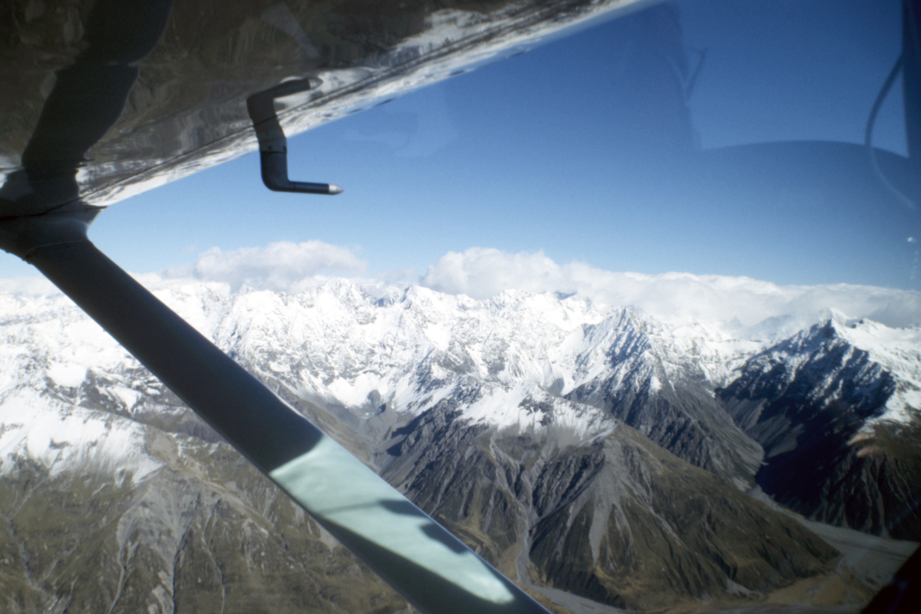
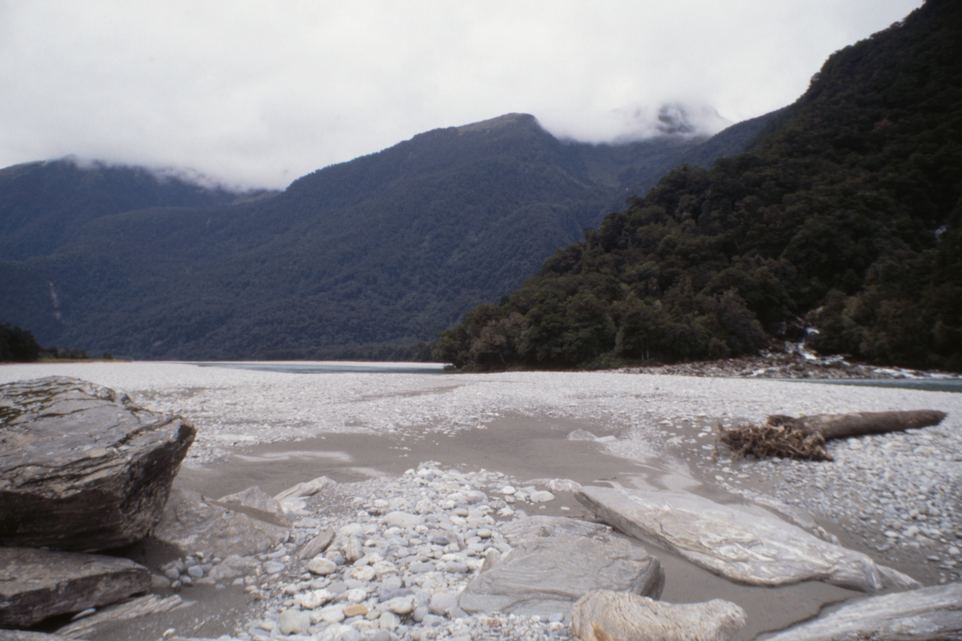
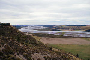
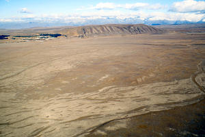
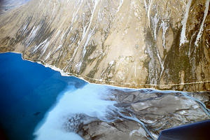
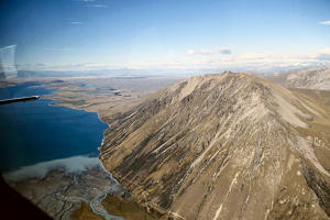
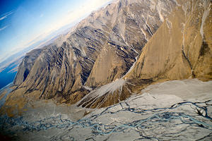
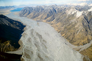
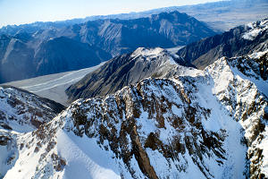
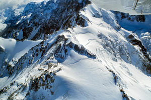
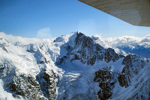
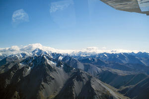
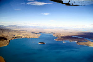
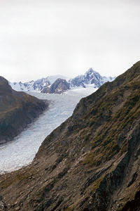
We took off first and headed up over Lake Tekapo and the Godley River where streams of glacial meltwater
have created a fantastic braided pattern through the millennia of deposited gravel which forms the flat
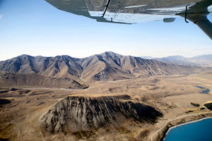
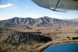
bottom of a wide valley. There was a fair amount of turbulence when we turned into the mountains and the
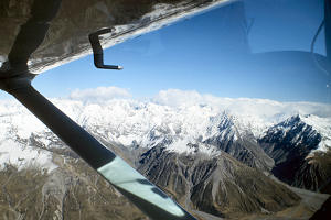
pilot decided to cut short the usual route and just flew through the fringes. Still a magnificent
experience, the mountains and glaciers were very impressive.
|
|
|
East of Tekapo
|
Lake Tekapo |
Lake Tekapo |
|
|
|
Braided watercourses
|
Southern Alps |
Godley River |
|
|
|
Snow
|
Leibig Range |
A mountain |
|
|
|
Mountains
|
Tekapo in the distance |
Mountains |
|
|
Mountains
|
Tekapo Airstrip |
When we landed after about forty-five minutes in the air, one of the North American ladies was not too
bright and the Japanese lad, who had been quite ebullient earlier, was now very quiet. Now, I never have
liked flying but I thoroughly enjoyed this flight and felt no ill effects, perhaps it has something to
do with being in a small plane, having plenty to see and spending most of my concentration on keeping
the camera steady amongst the sudden ups and downs in flight.
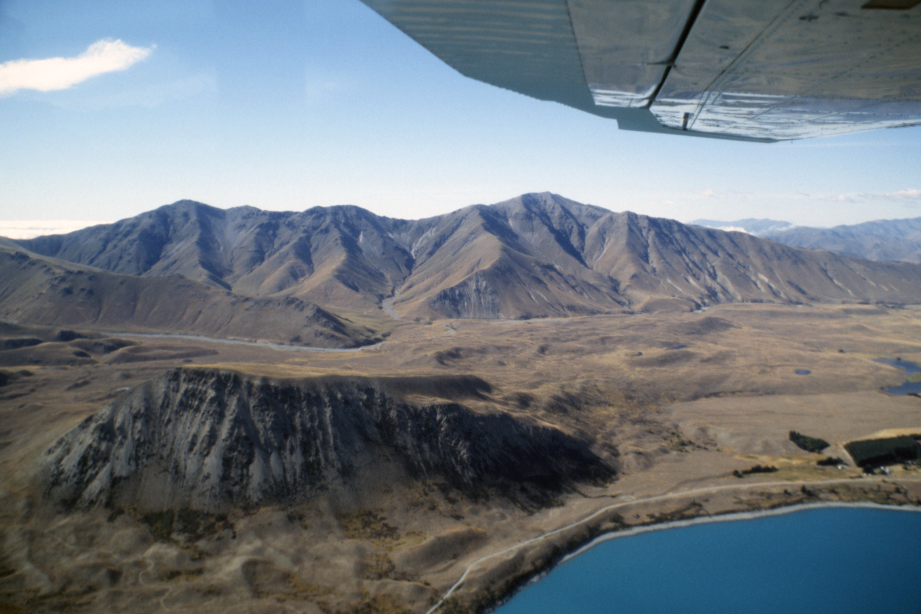
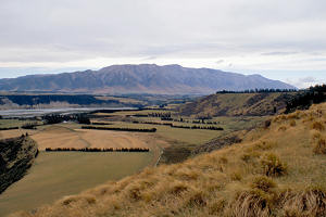
I decided it was too late to start a large mountain, particularly as the forecast was for increasing
cloud and showers, so I went over Mt John, past the Canterbury University observatory (at 44 degrees
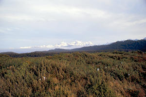
south, the southernmost professional observatory in the world), and on to Lake Alexandrina, Lake
McGregor and back part of the way along the shore of Lake Tekapo until a rocky stretch of shoreline
forced me back up onto Mt John. A leisurely six hours in all, the terrain was very dry with thin, sparse
vegetation and multitudes of rabbit holes. I started quite a few rabbits in the course of the day but,
despite this supposedly being sheep country, not a single sheep did I see. I think it might take about
ten acres to support one sheep and the beast might still starve while searching for the next nutritious
blade of grass. So much for the Mackenzie country.
|
|
|
Tekapo
|
Lake Alexandrina |
Across Lake Tekapo |
There is a church (the Church of the Good Shepherd) built here in the Thirties of local stone to
commemorate the early settlers in the area. I think it must be Anglican as it was dedicated by a Bishop,
but outside there is a statue of a sheepdog with the bottom line on the plaque “Beannachdan air na
cu caorach”. It doesn’t quite add up, perhaps the settlers were Scottish Episcopalians.
In the evening, the hostel seemed to be full of Japanese persons, including three girls which seemed odd,
most independent Japanese travellers that I’ve come across have been male, especially in the back
blocks.
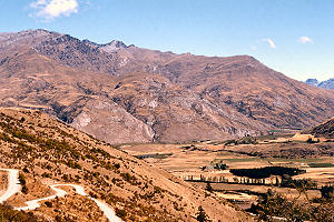
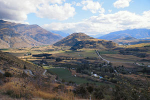
Sunday 28 February — Tekapo to Alexandra (370km)
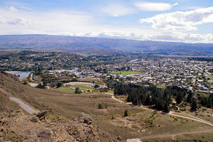
|
Alexandra
|
The increasing cloud and showers had not materialised yesterday, so I had a bit of sunburn to add to my
tender feet this morning, enough to decide against another day’s walking and to hit the road south
towards Alexandra. As long as I was on the main road, the weather was fine and sunny, although there was
some mist and cloud obscuring the mountains, but, when I detoured up the side of Lake Pukaki to the
settlement (hotel, hostel and campsite) at Mt Cook, it started to rain.
I had a look around the visitor centre, indoors of course, then bought some petrol (with relief I might
add, as I doubt if I could have made it back down the road to the next pump). The pump attendant was
quite definite that the rain would stop, but I didn’t wait to see when. I emerged from the rain at
much the same point as I had entered it, and at the last viewpoint, the mountains were still shrouded
while out on the plain it was sunny for the rest of the day.
In Auckland, the town of Twizel has the reputation of being the most boring town in New Zealand so I
stopped there for a look around. It was built in the middle of nowhere for the headquarters and staff
housing for the complex of hydro-electric schemes in this area which finally drain into the Waitaki
River. There certainly wasn’t much happening, but it was a Sunday after all.
I carried on towards the Lindis Pass, stopping at Omarama for lunch, and at various other places to
admire the scenery. Not very exciting but quite pleasant. The weather forecast for tomorrow is not
encouraging so I’m not sure what I will do, the most likely thing is a sail on the Earnslaw on
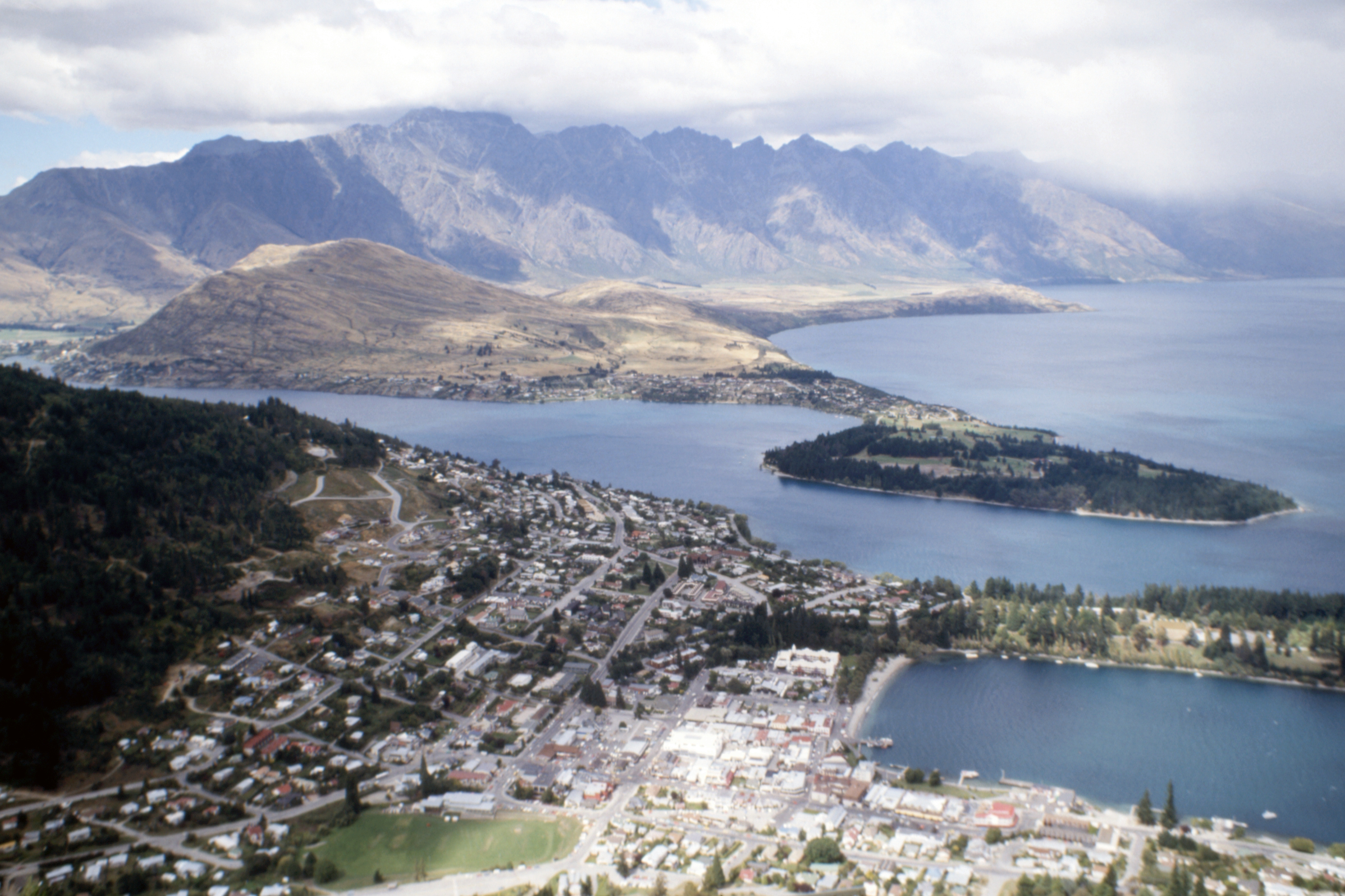
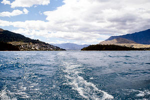
Lake Wakatipu at Queenstown, then on to the West Coast, but Queenstown is not my favourite place so I
spent the night at the hostel at Alexandra
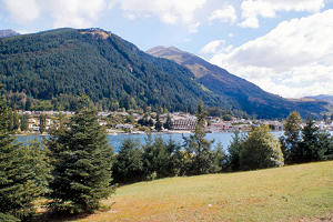
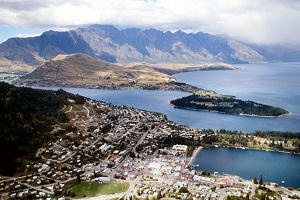
Monday 29 February — Alexandra to Wanaka (175km)
The weather turned out to be quite reasonable, some cloud, dull in the late morning and early afternoon
but then clearing to a fine evening. I drove down to Queenstown (after a pleasant chat with a lad called
Bill Grey from Aberdeen who reappears in Wanganui) and bought a ticket for the morning cruise on the
Earnslaw and had a short walk around the town while waiting for the departure.
|
|
|
Queenstown
|
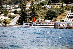
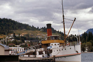
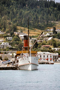
TSS Earnslaw |
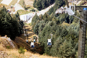
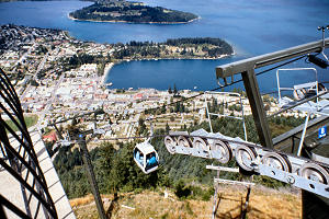
Gondola top station |
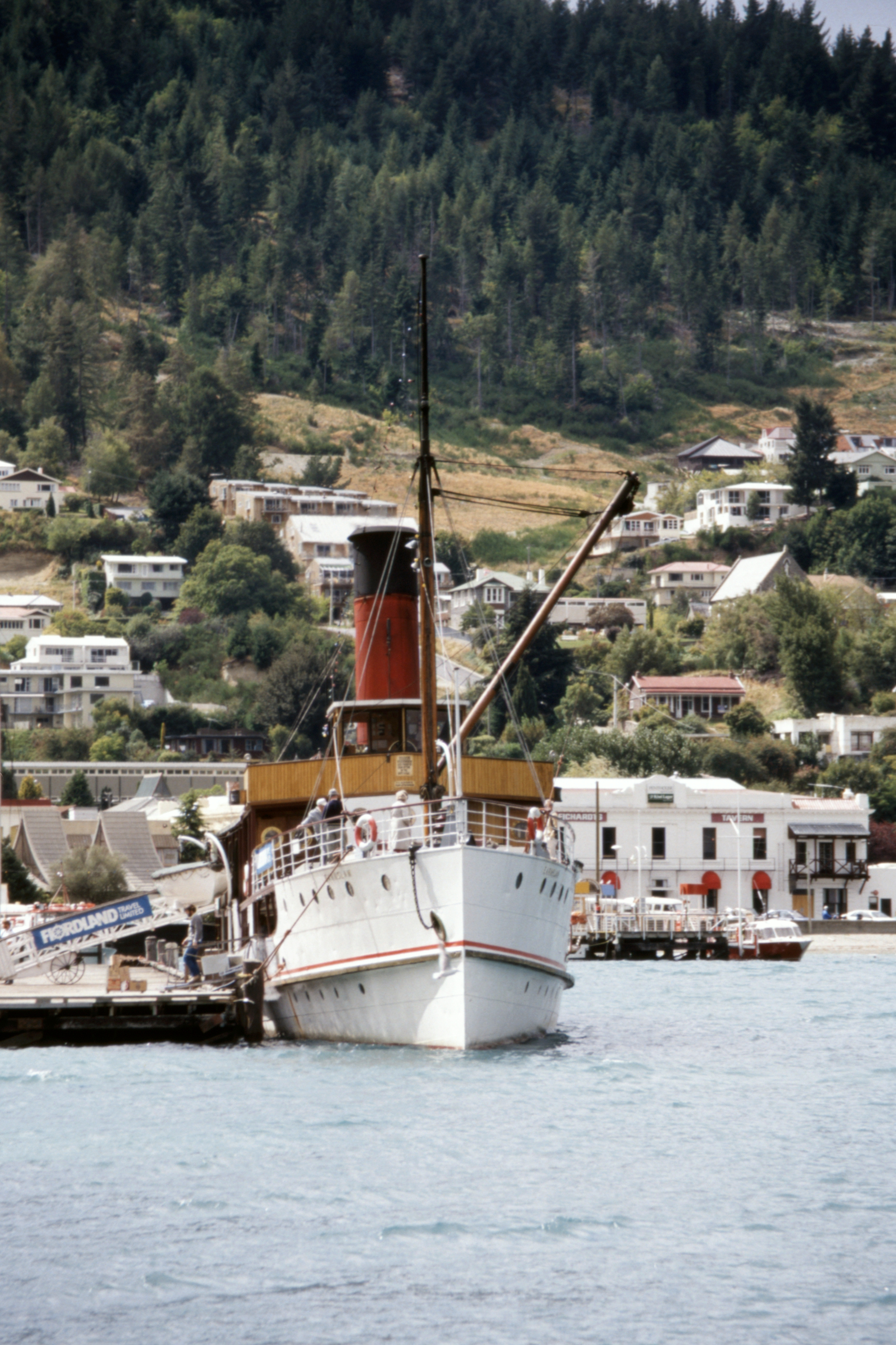
The TSS Earnslaw is a twin screw steamer, built by McGregor in Dunedin and brought up by rail for final
assembly at Kingston. She was launched on the same day as the Titanic but is still afloat. Most of her
working life was spent carrying people, goods and livestock amongst the settlements and sheep stations
on the shores of the lake, now she is a major tourist attraction.
The morning cruise was quite short, only an hour, up the Frankton Arm of the lake and I spent most of
the time watching the stokers shovelling coal for the two boilers and admiring the clouds of smoke
coming out of the funnel. Then I hung around to watch the afternoon departure for a cruise across the
lake and a visit ashore at the Mt Nicholas sheep station.
|
|
|
Entrance to the Frankton Arm
|
|
|
From the top of the Gondola.
|
|
|
|
The Remarkables beyond Queenstown |
Queenstown |
After taking a few photos of the Earnslaw diminishing with distance, I headed off to try out the Gondola,
an aerial cableway up a hill at the back of the town with a restaurant, giftshop etc. at the top. The
views were definitely good. A late lunch in the town (which I still don’t like much) then off by
the back road to Arrowtown before setting of again over the Cardrona road to Wanaka.
|
|
(1979)
|
Arrowtown from PH89 |
|
|
(1979)
|
The other direction (Morven Hill 750m) |
This time, the YH was fairly empty and consequently rather more pleasant than on my last visit. The night
was clear, but the moon was bright and the stars a bit bland, not like some nights I’ve spent in
the car. There was a girl from Newcastleton in the hostel.
Tuesday 1 March — Wanaka to Fox Glacier (286km)
In the morning, the weather in Wanaka was fine but it looked a bit grotty towards the Haast Pass.
However, off I went after refusing a lift to a couple of Yanks who were going to Franz Joseph, on the
grounds that I had no idea how far I would get today, and the warden person’s daughter was driving
that way anyway.
I stopped at various interesting points along the way, mostly waterfalls. As I approached Haast, the sky
over the sea was blue so I decided to stop at the hotel for a bit. When I came out, the blue had reached
land and everything was very pleasant along the coast, although there was low cloud shrouding the hills
just a few miles inland.
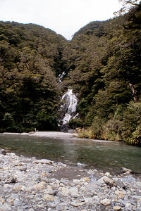
|
|
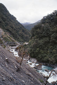
|
Fantail Falls
|
The Gates of Haast |
The Gates of Haast |
|
|
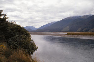
|
Haast River
|
Roaring Billy |
Haast River |
|
|
|
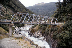
Haast Bridge
|
downstream |
upstream |
I picked up a Swiss girl about eight kilometres north of Haast. She had got a lift that far and then
decided to walk for a bit. I was aware of some sort of a bundle at the edge of the road and as I was
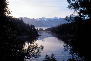
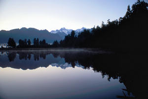
passing it, a thumb came out. She had been in the ditch picking brambles. Anyway, we got to Fox Glacier
and went into the hotel, then she went off to the Backpackers and I drove down to Lake Matheson for the
night, to get an early start to see the reflections. The clouds had cleared during the evening and in
bright moonlight, the snow-capped peaks of Tasman and Cook seemed to float in the sky among the stars.
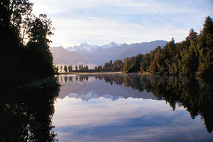
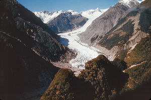
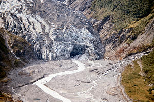
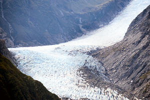
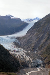
Wednesday 2 March — Fox Glacier
Well, I didn’t get up early enough. By the time I got to the end of the lake, the ripple had
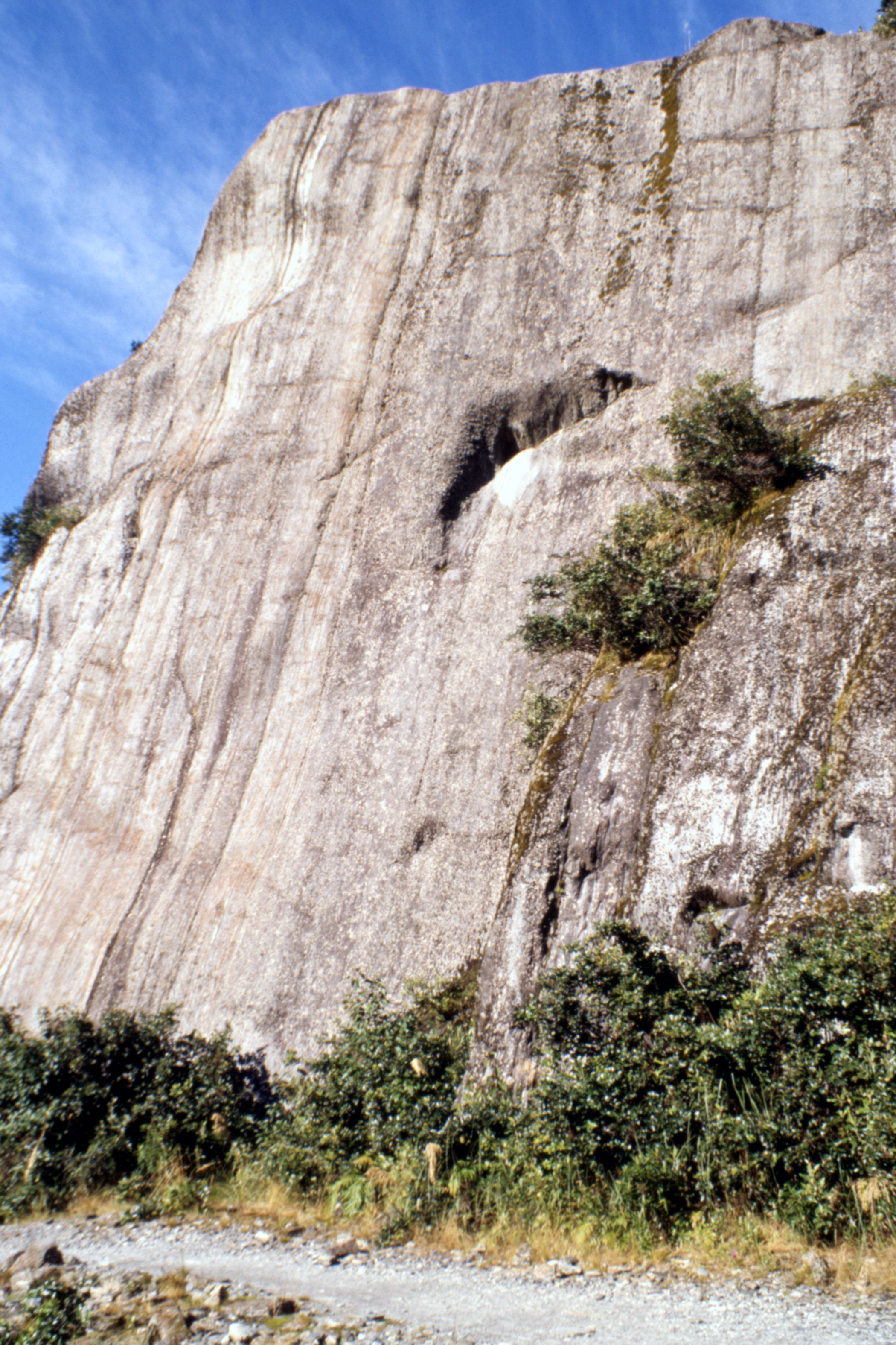
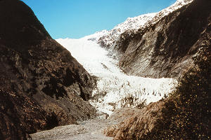
started and was spreading quickly across the surface. I spent the morning climbing Cone Rock,
recommended by the hotel barman as a good place to view the glacier, which it certainly was, and then in
the afternoon I tried to join a helicopter trip to land on the glacier but there was insufficient
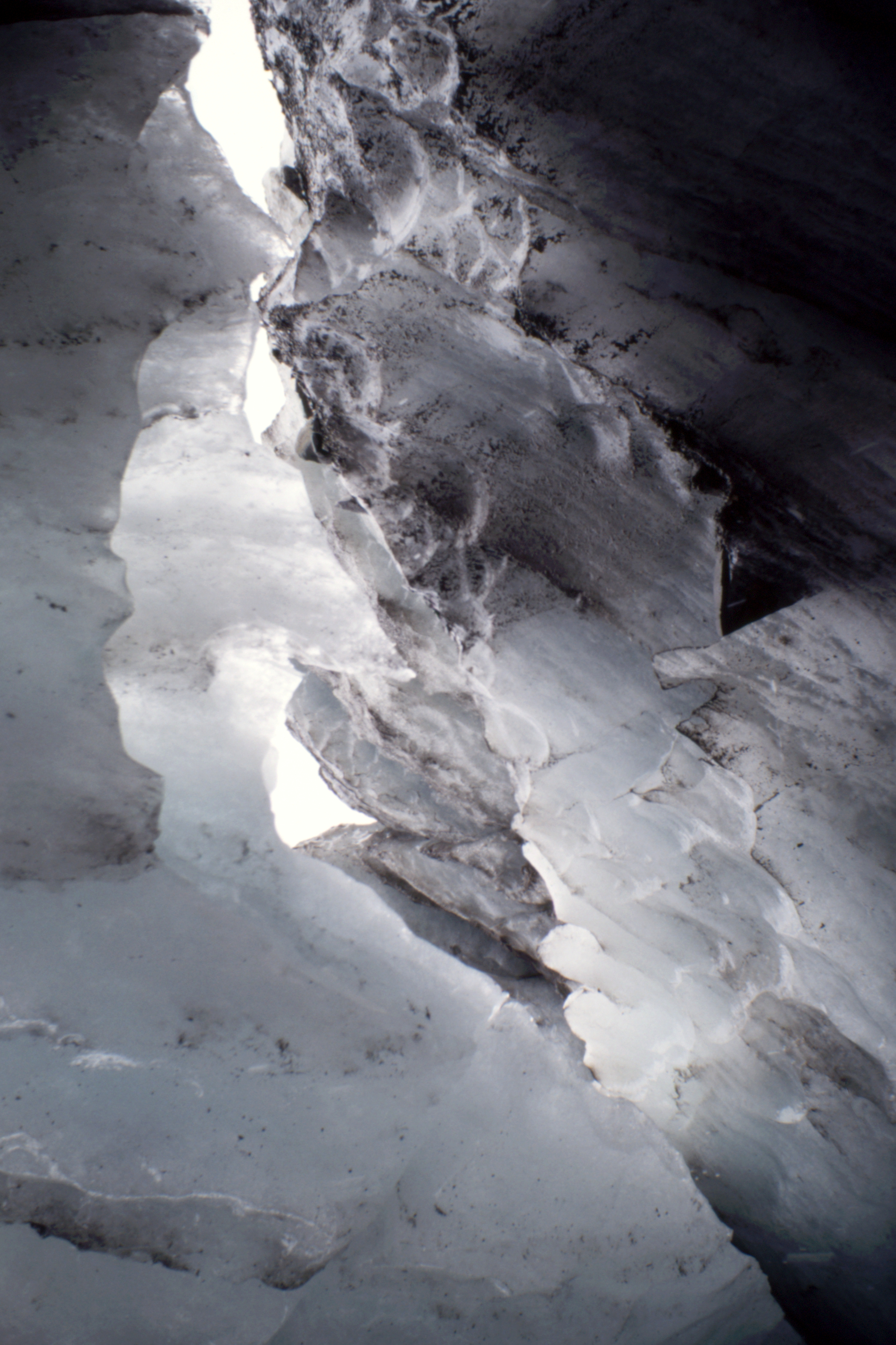
interest and I had to settle for a guided walk on the bottom. The ice was filthy but fascinating.
|
|
|
Reflections in Lake Matheson
|
Fox Glacier from Cone Rock
|
|
|
(One I bought in 1979)
|
The ice has retreated slightly |
Snout |
|
|
|
|
Top
|
Middle |
Bottom |
Cone Rock |
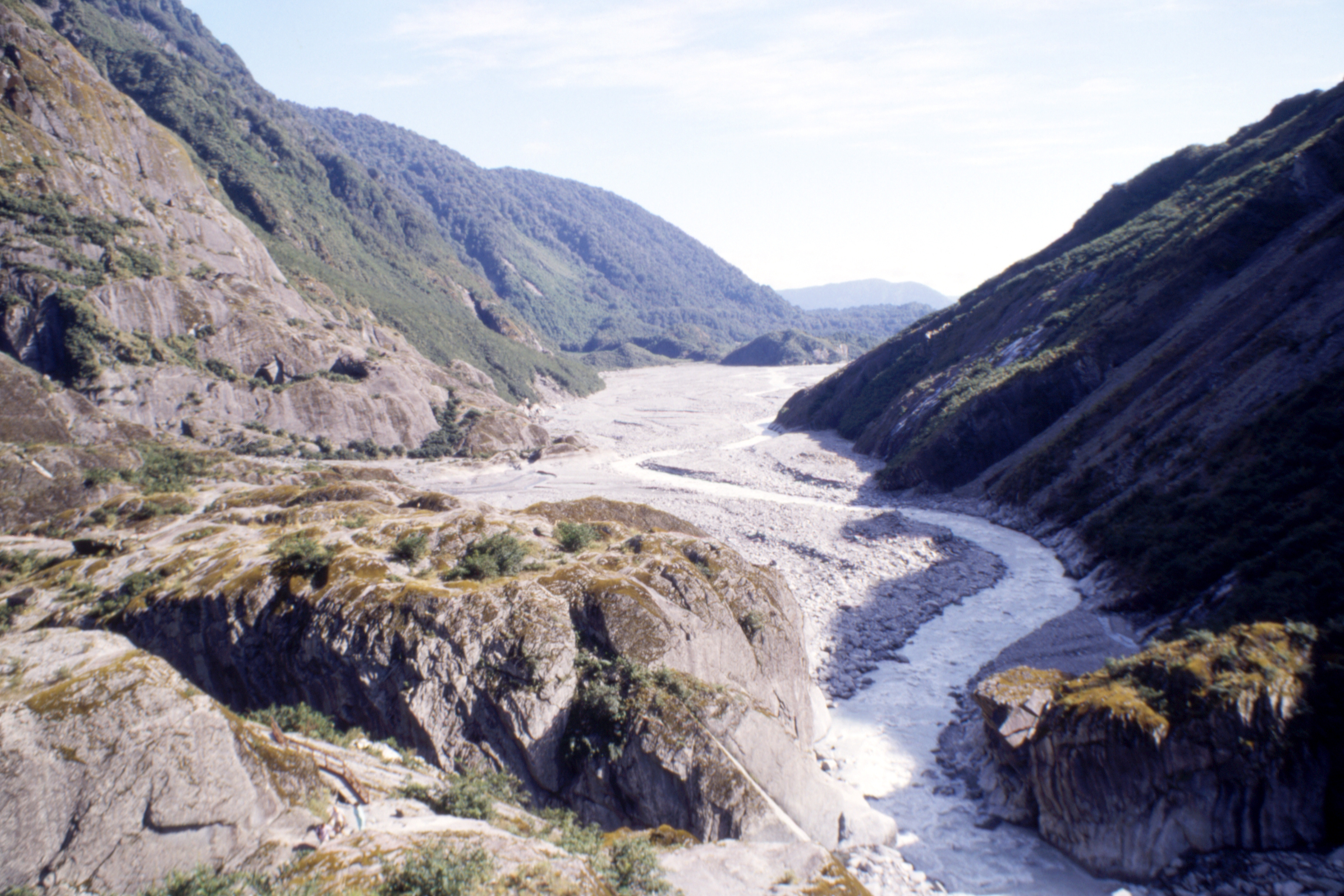
Fox Glacier
|
Mt Cook above the evening mist
|
In the evening, there being not much else to do, it was a few beers in the hotel and, having failed to
get a bed at the Backpackers, back to Lake Matheson again. The morning had been fine and clear, cloud
developed at lunchtime but it did not rain, and the cloud cleared again in the evening. Apparently this
is a frequent weather pattern in this area.
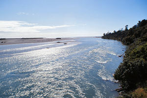
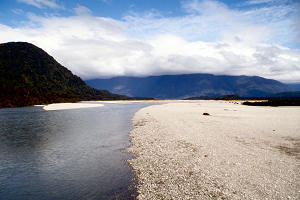
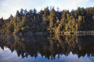
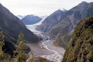
Thursday 3 March — Fox Glacier to Okarito (65km)
|
Lake Matheson again
|
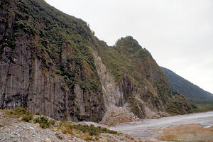
Still missed the best of the reflections in spite of being there at half past seven. I took the road to
Franz Joseph to see the glacier there. It would have involved a lot more climbing to get a view over the
glacier here so I just walked up and looked at the end of it. Unguided persons are not allowed on the
ice because of the unstable nature of the structure. Bits keep falling off it.
Franz Joseph Glacier
|
(One I bought in 1979)
|
Lunch in Franz Joseph then down to Okarito again in the early afternoon. I washed my socks and went for a
walk along the beach, picking up some driftwood for the fire on my way back. Made some tea and went for
another walk along the beach, in the other direction, picking up more wood for the fire. Only three
other people present, and no beer in the boot, so a very quiet evening before I drenched myself in Dimp
and went to bed.
[ next chapter ]
John Reynolds — March 2013