Australia 1997/8
Thursday 25 December — Devonport to Stanley
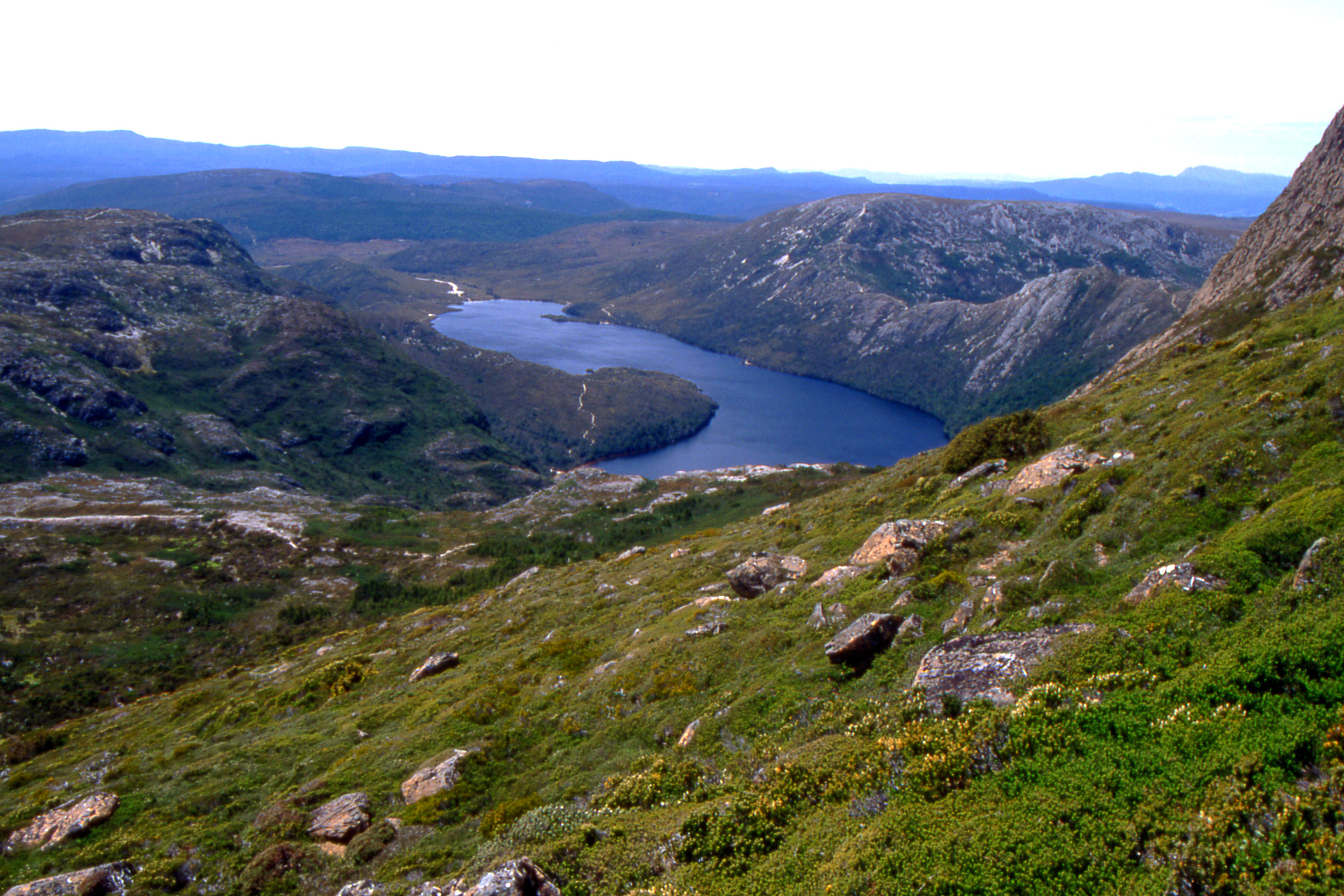
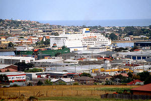
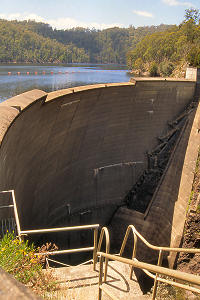
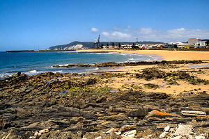
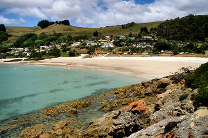
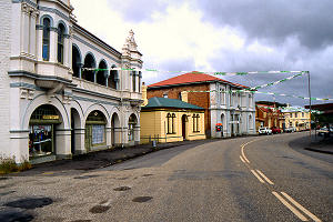
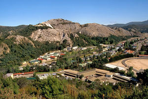
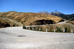
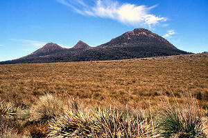
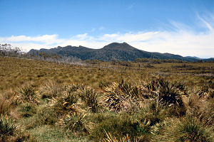
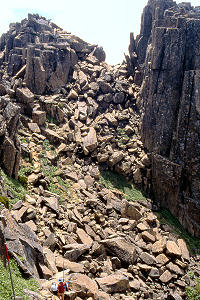
Well, Christmas Day and not much different from any other day. I was up bright and early as is my wont; I don’t know where the time went but it took two hours to hit the road. But off I went back to East Devonport, this time to find a vantage point to photograph the town. Had I been out earlier, I might have caught the Spirit arriving. Anyway, next it was south to Sheffield where I admired Mt. Roland then across to Lake Barrington and the Devil’s Gate Dam before returning to the north coast about one o’clock for a look at Burnie, then along through Wynyard to Stanley where I ascended the Nut (10 minutes) and walked around the top (not much longer).
 |
 |
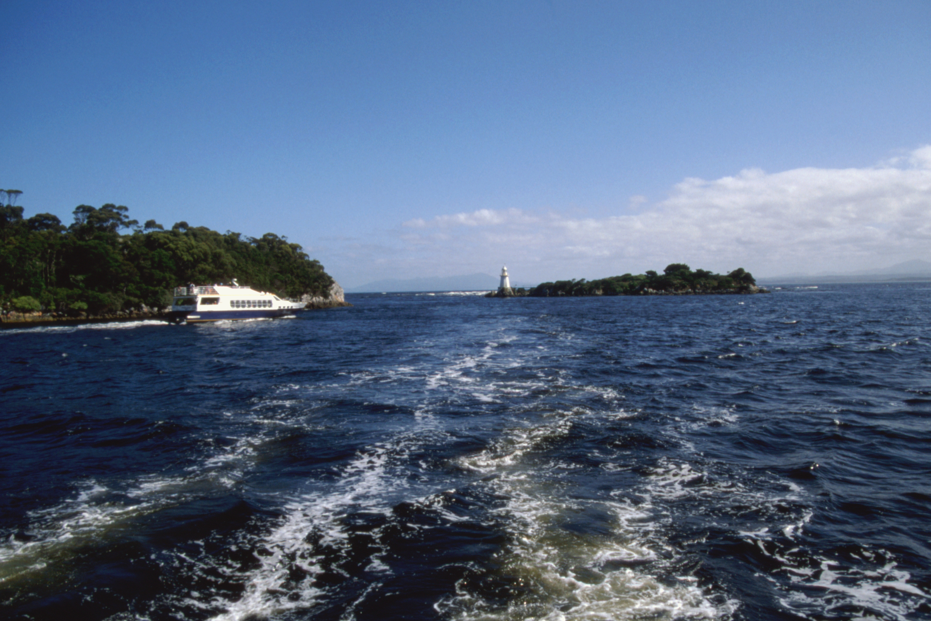
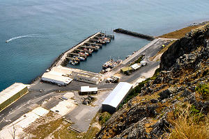
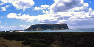
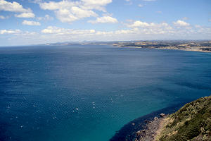
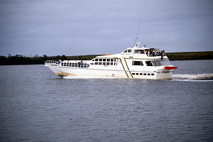
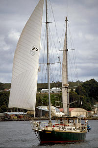
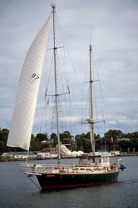
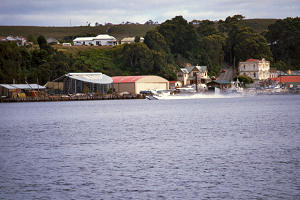
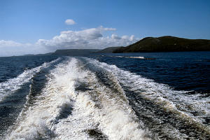
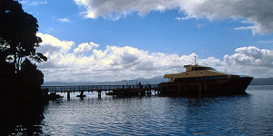
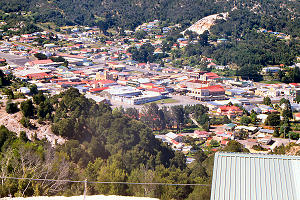
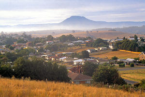
East Devonport featuring the Spirit of Tasmania
|
Spirit of Tasmania berthed at East Devonport |
 |
 |
 |
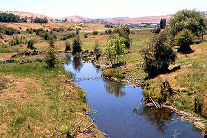
The Devil's Gate Dam
with Lake Barrington behind it
|
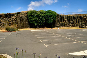
Burnie West Beach car park
Tasmania's answer to the Giant's Causeway |
Burnie sea front & port
from the West Beach car park |
 |
 |
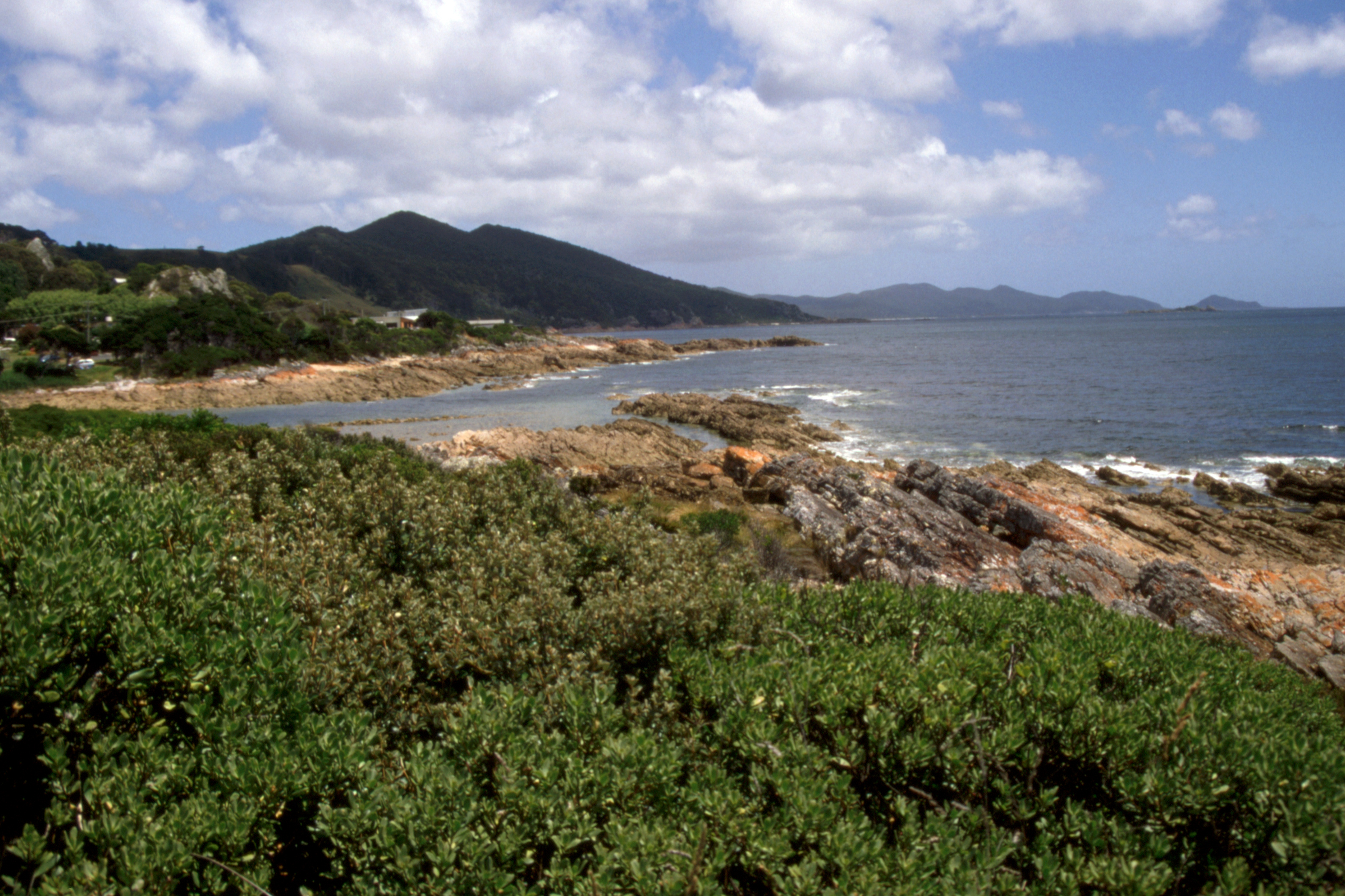
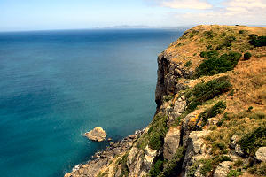
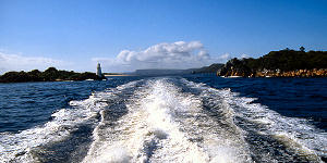
| North Tasmania coastline from The Nut |
Sawyer Bay, east of the spit of land
which connects the mainland with The Nut
|
 |
 |
 |
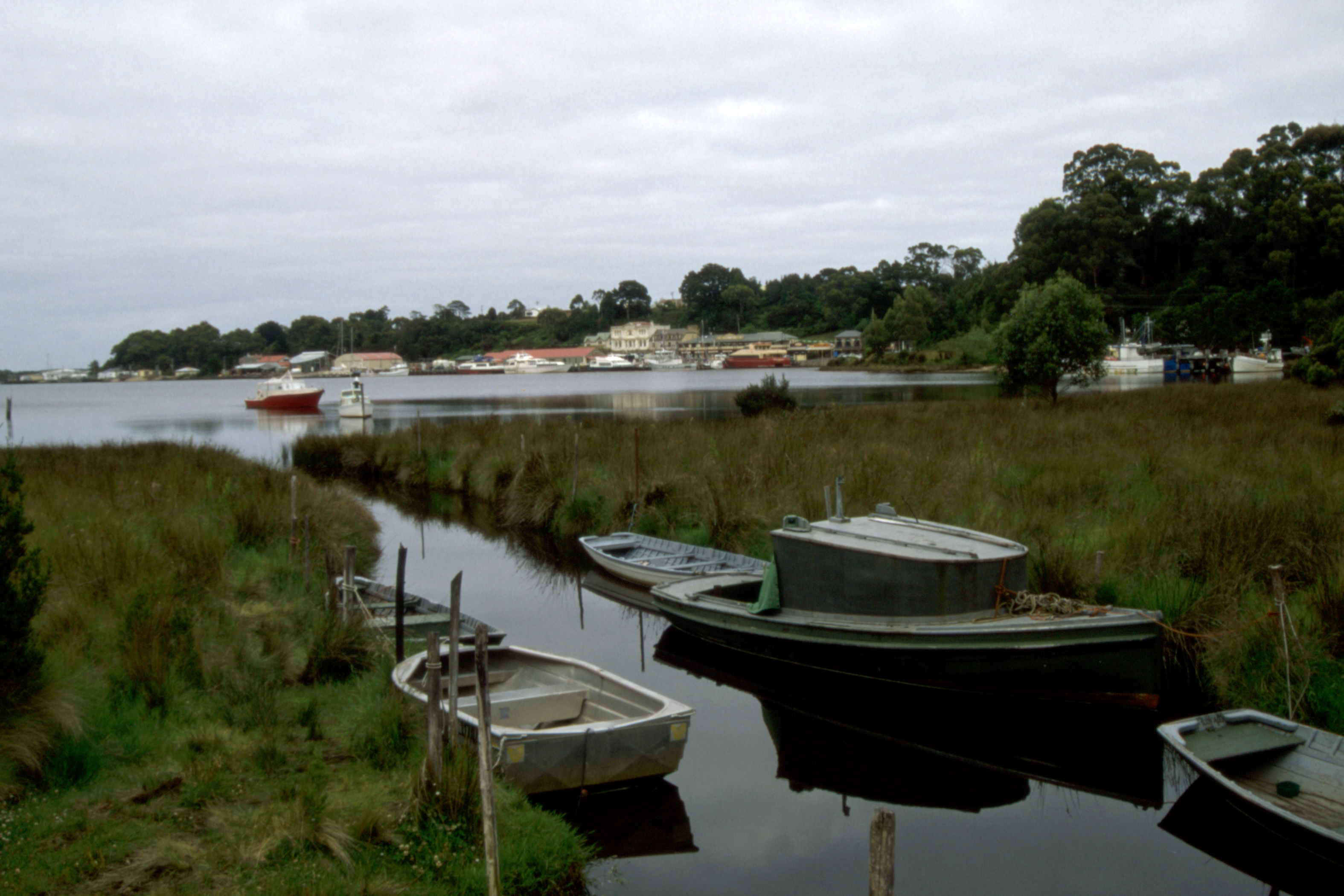
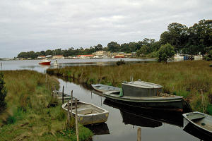
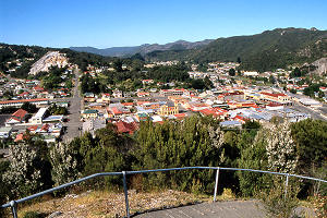
The fishing harbour at Stanley
|
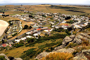
The village of Stanley (west) |
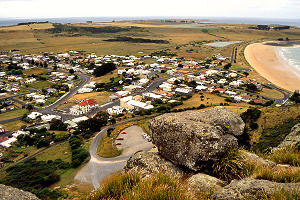
The village of Stanley (east) |
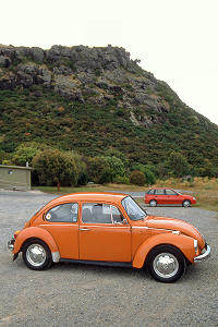 |
An orange Beetle parked below The Nut
|
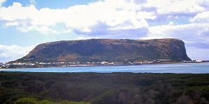
The Nut (official name Circular Head) is an isolated volcanic rock formation connected to the mainland by a narrow spit of land. It provides a sheltered anchorage which was chosen for the headquarters of the Van Diemen’s Land Company in 1826. The village of Stanley developed in the lee of the rock. Today, it is a small fishing village with many old houses.
I loitered in the car park until five then booked into the Youth Hostel (a small three or four roomed bunkhouse in the caravan park). After a shower, I went for a walk around the port and town, where I fell into conversation with a local who provided some useful ideas on where I should visit as I went around the island. The local shop had a sign on the door - Christmas Day, 10-12 and 2-4 - so what it was doing open at 8.30 p.m. I don’t know but I bought some milk and yoghurt before returning to the hostel for tea and bed.
Friday 26 December — Stanley to Wynyard
I thought I’d phone home but when I got to the box it was occupied by one of the Japanese girls from the hostel and she showed no signs of stopping, so I went back for the car and when I passed the box again, she was still there. So much for the “talk as long as you like for $20” promotion. By the time I was next conveniently placed near a phone box, in Smithton, it was a bit late in the Glasgow evening. However, I did top up my phone card.
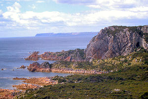
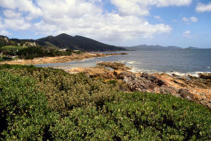
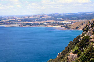
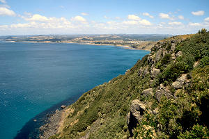
Smithton was not particularly interesting, Montague even less so. I headed back to Stanley to take some photographs of The Nut from Trewthie’s Lookout which I should have taken yesterday afternoon, then on through a heavy shower to Rocky Cape National Park. The weather was still threatening so I did not linger and moved on to Boat Harbour Beach where lunch was a chicken and vegetable pie - not a lot of veg though there was some chicken amongst the goo. From there I drove on to Table Cape, which gives a very good view along the coast to Burnie and inland to St. Valentine’s Peak and other hills.
 |
 |
Stanley and The Nut from Trewthie's Lookout on the approach road
|
 |
 |
East from Rocky Cape to Table Cape
|
West from Rocky Cape to The Nut |
 |
 |
Boat Harbour Beach. I didn't find the harbour
|
The non-beach side of Boat Harbour Beach |
 |
 |
 |
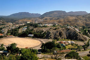
Wynyard from Table Cape Lookout
|
East from Table Cape Lookout |
Further east from Table Cape Lookout |
After admiring the view for a while, I drove inland to Henriette then back to Wynyard, inspected the town, found no food shops open (except a couple of takeaways) and realised that my chances of buying maps here are nil. I checked into the hostel, just myself here tonight and a South African biker called Stuart, The solar heated shower cost 10 cents for 5 minutes, just enough, no more (and not very hot either). After that, another wander along the main street, souvlaki takeaway for supper and checked out the two pubs which were open. I quite liked the Federal.
Saturday 27 December 1997 — Wynyard to Strahan
Since I had no milk, I could have no breakfast so was out and beside a phone box to phone home about eight o’clock. All was well there but I think I was charged 50 cents yesterday just for finding out that I had no voice mail. I didn’t notice that charge on the advertising blurb.
So I set off for Burnie in search of maps, and was there before most of the shops opened. Time enough to see no sign of any likely to offer a decent range of maps but a newsagent provided me with a tourist map for the whole of Tasmania (a bit more use than just the north west corner) and I then had tea and an apple and cinnamon swirl (of respectable proportions) for a mere $2.50, by which time the larger shops had opened and I was able to stock up on food. I decided to take a chance on the milk surviving the day in the boot of the car (which it did, it was quite a cold day with occasional showers).
From Burnie, I headed south, buying cheap petrol at Yolla before stopping for a half hour bush walk in overcast conditions by the Helyer River. There was not a lot of scenery in that area, just trees. After that it was on to Tullah for grilled lamb chops for lunch, the first time in Australia I’ve had frozen (or tinned) peas and carrots with a meal. I noticed that the price of petrol was 83.9 cents per litre, 4 cents more than in Yolla.
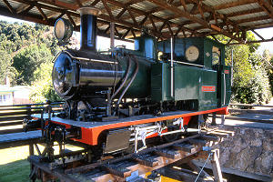
After lunch, a quick look round Tullah’s tourist attraction, an amusement park steam train which operates on public holidays only.
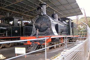
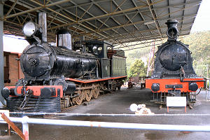
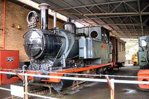
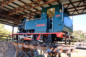
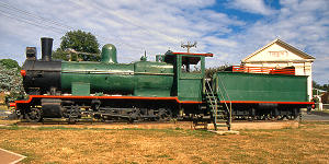
The next stop was Zeehan where the Pioneer Memorial Museum turned out to be mostly mining and transport. It was well worth the visit, indoors a fine collection of early photographs and artefacts from the mines while outside a veritable scrap yard of machinery plus four steam engines on static display, two by Dubs, one an Abt rack railway engine from the Mt. Lyell Railway and the other No.6, a twin of No.8 at Don River.
 |
 |
 |
Ex-Emu Bay No.6 "Murchison"
(Dubs, Glasgow, 1900) |
Ex-Emu Bay loco by Beyer Peacock (1885)
and "Murchison" |
Mt Lyell Abt rack locomotive No.1
(Dubs, Glasgow, 1896) which worked between
Queenstown and Strahan until 1963
|
 |
| Main Street with the former cinema on the left |
I could have stayed much longer but had still some miles to go to Strahan where I intended to spend the night. The YH was fairly full but still had some beds in the overflow dorm so I booked for a couple of nights and South African Stuart turned up, having followed an entirely different route from Wynyard, closer to the coast where my map shows no roads! I went into the town for a beer or three and got lost trying a shortcut back to the hostel in the dark, and was reduced to consulting the map. (I should have taken second on the right, not the first.)
Sunday 28 December 1997 — Strahan
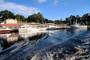
One of the local attractions in Strahan is the Gordon River Cruise across Port Macquarrie and a short distance up the Gordon River so I went down to book for that. Unfortunately, both operators were fully booked for today so I walked round to Regatta Point to photograph the fleet leaving - two all-day cruises and one morning cruise. On the way back into town, I made a short detour to Hogarth Falls and an even shorter (though somewhat steeper) detour to the Town Lookout.
 |
 |
Strahan from near the Peoples Park
|
Strahan from Regatta Point |
|
 |
 |
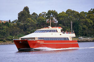
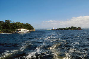
MV Gordon Explorer sets off from Strahan for a day cruise on Macquarie Harbour
|
 |
 |
 |
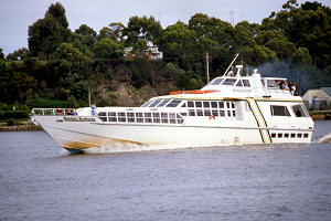
Catamaran Wanderer II sets off from Strahan for a day cruise on Macquarie Harbour
|
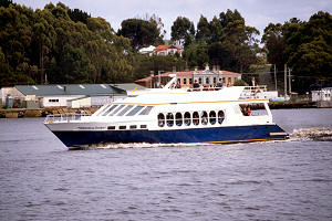
MV Wilderness Seeker sets off etc |
 |
 |
 |
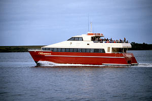
Stormbreaker sets off from Strahan for its morning cruise on Macquarie Harbour
|
 |
 |
 |
|
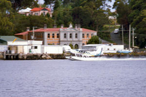
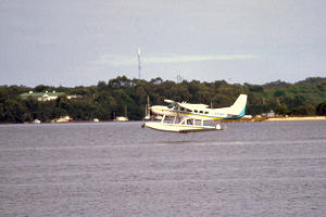
A seaplane takes off from Strahan |
|
 |
 |
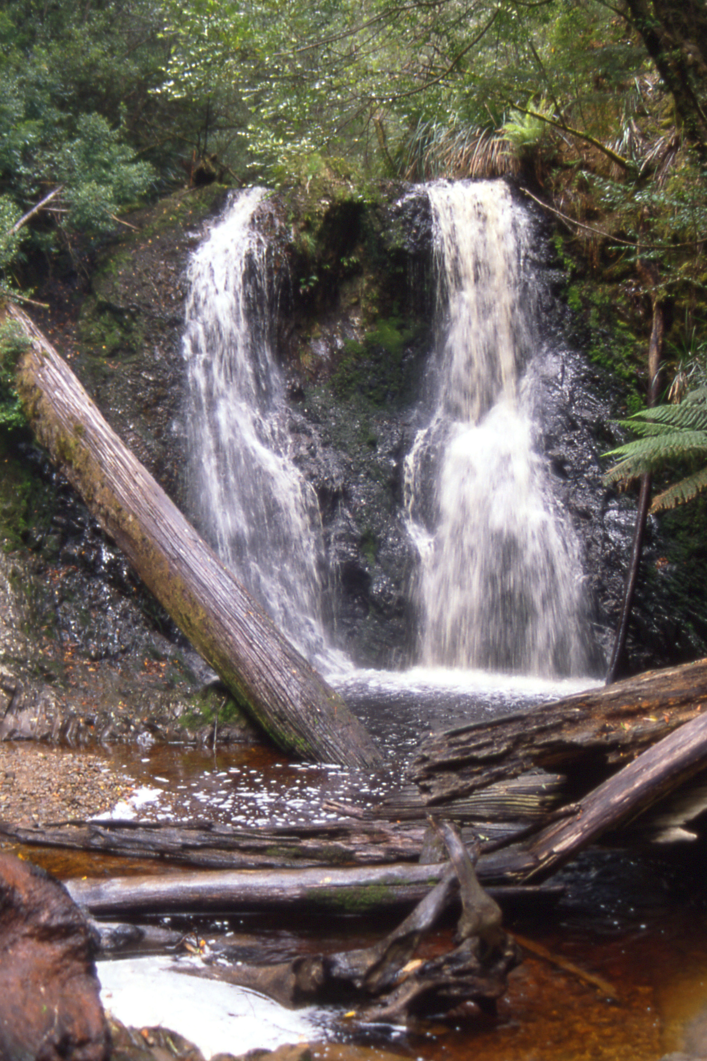
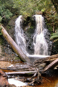
Hogarth Falls in the Peoples Park
|
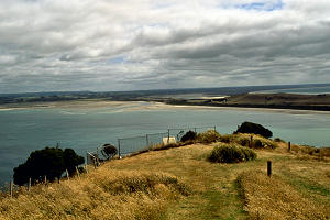
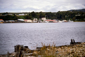
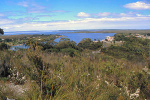
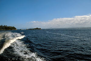
Strahan and the north end of Macquarie Harbour
from the lookout on Water Tower Hill |
Then it was time for an early lunch, into a cafe, quick glance at the menu, “tea and a cheese and ham sandwich please”. “Sorry, we only have silverside or salami.” “Well, give me that one there, I can see a bit of cheese sticking out.” At the first bite, I thought I detected ham and on looking inside, there was some ham and some cheese, not a trace of silverside or salami. ’Twas a pity the cheese had no taste.
Having dined, I returned to the cruise booking office to book for the morrow which proved to be no problem. Today’s second piece of useless information was “You were here this morning - you could have gone after all, quite a few people didn’t turn up”.
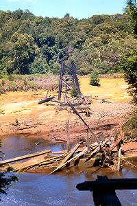
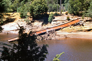
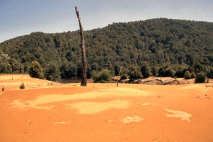
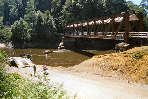
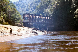
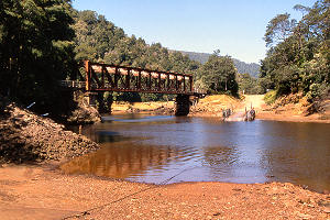
I took the car for a half-hour King River Drive to Teepookana, one time terminus of the Mt. Lyell railway which served the Mt. Lyell mine at Queenstown until the 1960s. The railway had been extended into Strahan and this bit of track bed is now the road. From Teepookana, a walk/cycle way extends about three kilometres to the remains of Quarter Mile (that was its length) Bridge across the King River. The interesting bit of line, with rack sections up and down the ridge between King and Queen Rivers, is beyond that point, on the Queenstown side, but I couldn’t see an easy way across the river and decided to go no further. The King River was “killed” by the untreated tailings discharged from the mine over many years until as recently as 1994. Plans to reopen the mine are conditional on no discharges into the river.
 |
 |
 |
The remains of Quarter Mile Bridge
which carried the Mt Lyell Railway
over the King River
|
Part of the remains thereof |
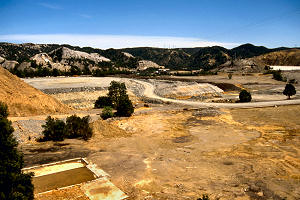
Desolation on the King River
wrought by untreated tailings discharge
from the Mt Lyell mine at Queenstown |
 |
 |
 |
| The Iron Bridge at Teepookana which once carried the extension of the Mt Lyell Railway over the King River and on to Strahan |
When I got back to Strahan, I continued on to Ocean Beach for a quick paddle in the Southern Ocean. After that, it was tea at the hostel before heading out for a pub crawl round the two pubs in Strahan, the Regatta Point Tavern and the Hanmer Hotel.
Monday 29 December — Strahan to Queenstown
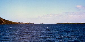
As this was my last day in Strahan, I loaded all my gear in the car and left it in the Municipal car park near the wharf before joining the Wanderer II, a catamaran built in Hobart in 1996, length 25 metres, beam 8.5m and draught 1.5m, with a capacity of 160 passengers and service speed about 25 knots. She was nearly full as we headed across the Macquarrie Harbour to Hell’s Gate, the harbour entrance where a local version of the Lang Dyke was constructed to deepen the channel. Then to Sarah Island for an hour, a penal settlement from 1826 to 1835 for those who broke the rules at Port Arthur. There is not much left standing but it’s amazing how much had been built there while the island was in use.
 |
 |
 |
Strahan waterfront from the Wanderer II
|
Hells Gate, entrance to Macquarie Harbour |
Wake of Wanderer II approaching Hells Gate |
 |
 |
 |
Looking into Macquarie Harbour at Hell's Gate
|
MV Wilderness Seeker approaches Hell's Gate |
The wake of Wanderer II departing Hells Gate |
 |
 |
| MV Wanderer II at the jetty on Sarah Island |
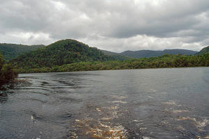
Somewhere on the Gordon River |
The day clouded over and remained cloudy as we cruised up the Gordon River at a leisurely 6 knots (to protect the banks) while a smorgasbord lunch was served. (I took more than my fair share of the smoked trout, very nice.) We went ashore at Heritage Landing where a short boardwalk was constructed in 1989 to allow viewing of the flora and fauna without the inconvenience of muddy feet while protecting the flora from damage (not to mention trying to deflect criticism from the government’s plans to dam the Gordon River by presenting this as a spin-off of that development).
Back at Strahan about half past three, I decided to regularise my position by buying a National Parks pass, but the office was closed. The notice said office hours were Monday to Friday, 9 - 12 and 1 - 5 but that it would sometimes be closed during these hours and open at weekends.
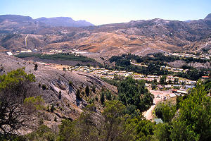
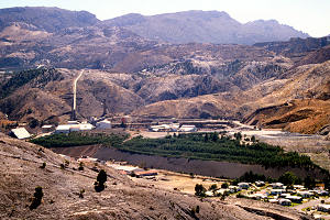
As I drove towards Queenstown, the lush forest gradually disappeared and was replaced by a barren landscape, most of the trees were felled for fuel for the smelter furnaces and the rest were killed by emissions therefrom. There is little sign of natural regeneration.
 |
 |
| Looking towards Queenstown from the Strahan Road |
At Queenstown, I had only $30 in my pocket and no sign of a cash machine. However a room at the Empire Hotel cost only $20 and they were happy to cash a travellers cheque so I could afford a few beers and a packet of crisps for my tea. A walk round the town revealed a nice wee place with quite a lot to fascinate those interested in industrial history, though I suspect it would have been much less pleasant when the industry was operating. It’s almost a pity I can spare only half a day here.
Tuesday 30 December — Queenstown to New Norfolk
I started the day with a cooked breakfast in the hotel, only $7.50 and plenty to eat, then, as I had to move the car before the parking restrictions took effect at 0900, I drove up to the lookout at Spion Kop for a few photos before returning to leave the car in the town car park. The local park has one of the Dubs Abt locos (No.3) from the Mount Lyell Railway on display under a cover, looking very nice.
 |
 |
 |
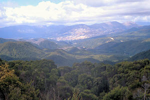
Parts of Queenstown from the Spion Kop Lookout
|
Queenstown with the Empire Hotel on the right |
 |
 |
 |
| Mt Owen from the Spion Kop Lookout |
Mt Lyell Railway Abt locomotive No.3 (Dubs) in the park at Queenstown |
The Galley Museum had not opened by 1005 so I walked out to the chair lift and ascended for more photos of the town and the Mount Lyell mine. I concluded my visit there with tea and a pie in their cafe before returning to town, cashing another travellers cheque in the bank and setting off over the hill for Lake St. Clair, with a few photo stops on the way.
 |
 |
 |
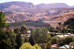
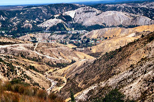
The Mt Lyell mine from the top of the chairlift
|
Part of the Mt Lyell mine |
Queenstown from the top of the chairlift |
 |
 |
 |
| Hills above the Mt Lyell Mine |
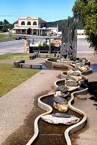
Water feature in the park
with car and hotel in the distance
|
Mt Lyell Mine from the road leaving Queenstown |
 |
 |
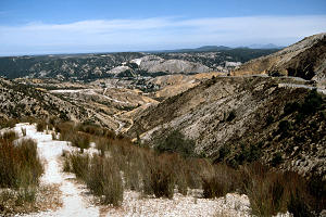 |
Denuded hillsides
by the road out of Queenstown
|
Part of Queenstown and the Mt Lyell Mine |
A view from the road leaving Queenstown |
 |
 |
 |
Denuded hillsides
by the road out of Queenstown |
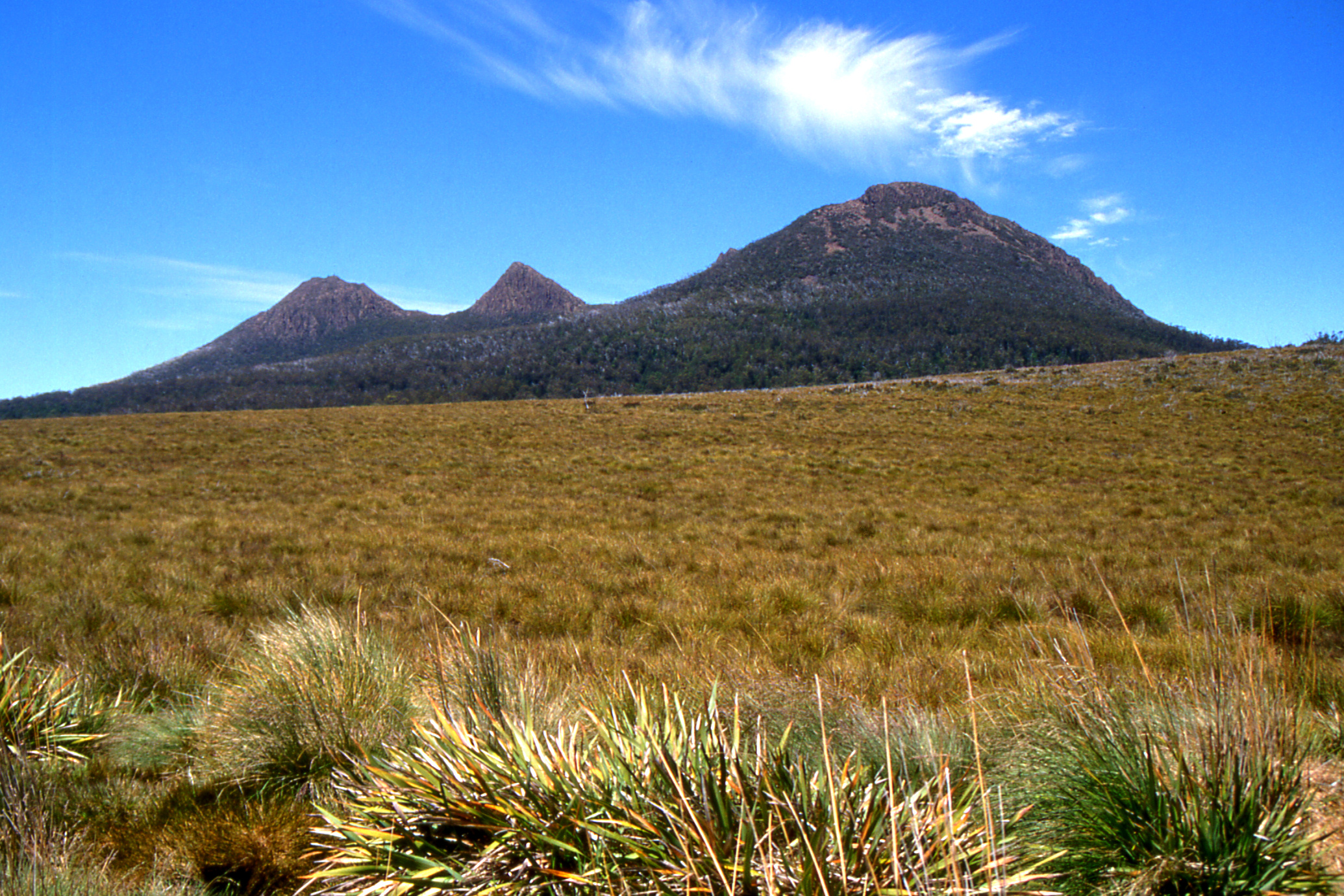
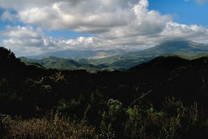
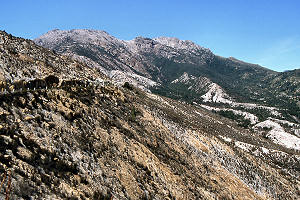
Mt King William I, Milligan's Peak and Mt Pitts
from King William's Saddle on the Lyell Highway |
Another hill from King William's Saddle |
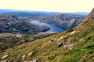
At the Lake, I finally purchased a park pass (well, I had to get into the car park), $30 for the car for one month. I went for a stroll on the Woodland Walk, then round Platypus Bay before finishing on the last 1.5 km of the Overland Track. About an hour in all, my longest walk yet in Tasmania. I took tea in the cafe before setting off again with no particular destination in mind. At Hamilton, I was unable to get any tobacco so turned south in the general direction of Hobart and stopped at New Norfolk where I booked into the Bush Inn for the night ($28 for bed and breakfast). A stroll round the town revealed the location of the tobacconist whereupon I partook of a few beers to celebrate before returning to the hotel and bed.
Wednesday 31 December — New Norfolk to Deloraine
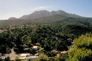
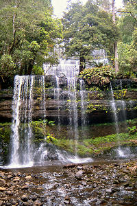
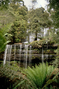
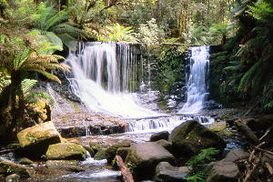
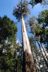
After a good breakfast, I called on the tobacconist who was able to supply my preferred brand, thus obviating the need for a trip into Hobart. I then headed for Mt. Field National Park for a walk round Russell Falls, Horseshoe Falls, Tall Trees (swamp gums) Track and Lady Barron Falls, about an hour and three quarters at a leisurely amble. Back at the car park, I spotted a familiar motorbike. I was looking for paper and pen to leave a note when South African Stuart appeared. He’d been staying at Mt. Field YH for the last couple of nights and was now off to Hobart for the New Year.
 |
 |
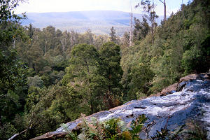 |
| Russell Falls |
Russell Falls |
Part of the Maydena Range
from the top of Russell Falls
|
 |
 |
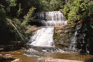 |
| Horseshoe Falls |
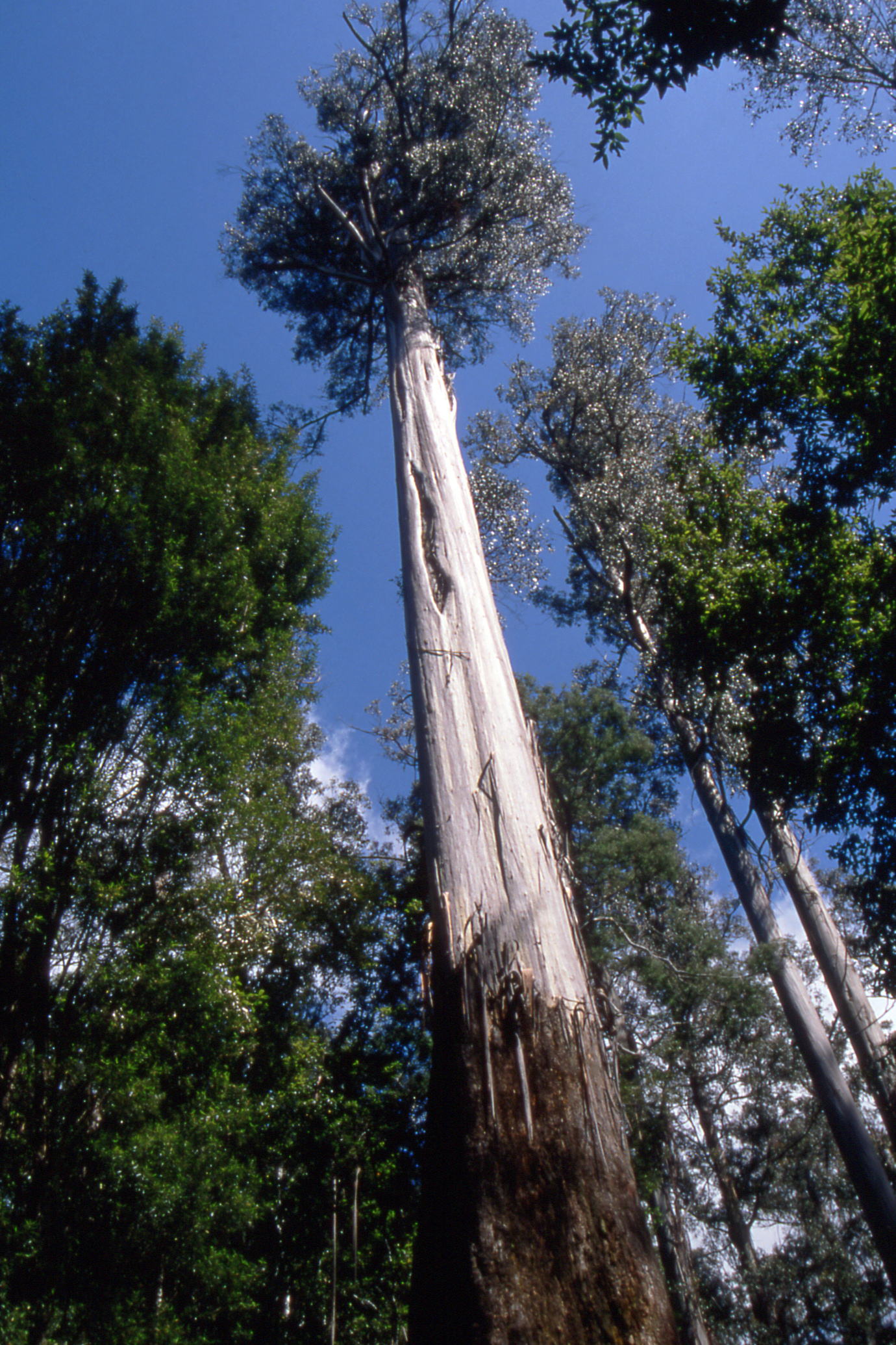
78 metre swamp gum |
Lady Baron Falls |
I headed north, stopping to photograph the Clyde River (a tributary of the Derwent) near Hamilton and Bothwell, about 30 km apart in this part of the world. Then up past the Great Lake, there are no towns in this area, just groups of holiday homes. At one point I thought I was approaching a bush fire but it turned out to be dust from cars ahead on the gravel road.
 |
 |
 |
River Clyde near Hamilton
|
River Clyde near Bothwell
downstream from the road bridge |
River Clyde near Bothwell
upstream from the road bridge |
In the late afternoon, I reached Deloraine, which has a youth hostel, and did some shopping before calling there and booking in for a couple of nights. The hostel is at the top of a hill, a considerable hill, but that did not deter me from walking down to the town for a couple of beers in the Bush Inn. Everything seemed very quiet - as if waiting for something to happen, without knowing what. Back at the hostel, some pleasant conversation on the terrace with the four or five other residents, a German girl is also driving a Beetle but paying only $38 per day! Also, it seems I should have been putting leaded petrol in the car, no wonder I have not been impressed with the performance. Everyone was in bed by half past ten.
Thursday 1 January 1998 — Cradle Mountain
I am still having difficulty getting an early start. Despite being up shortly after seven, it was almost half past eight before I was on the road, along through Mole Creek and over some twisty roads to pick up the main road down to Cradle Mountain National Park, where I arrived about 10 o’clock and proceeded to the car park at Waldeim.
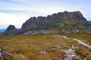
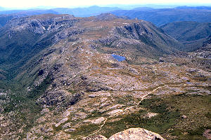
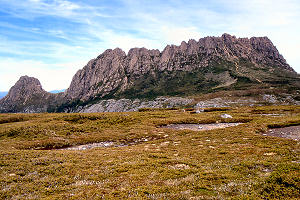
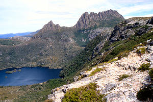
By the time I had my boots on and had signed the visitor (intentions) book, it was about ten thirty when I set off up Crater Peak, only an hour from the car park and not dramatic in itself but offering fine views over Crater Lake and an enticing view of Cradle Mountain. I hadn’t really intended going up Cradle Mountain but it looked so tempting that I reached the summit about quarter past one after an interesting spot of boulder climbing near the top. I spent about twenty minutes on the top, fine views all round with some interestingly shaped outcrops to the west.
 |
 |
 |
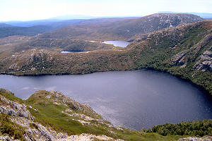
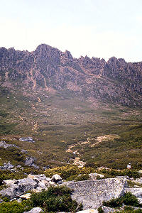
Crater Lake from Crater Peak (1270m)
with the north end of Lake Dove in the distance
|
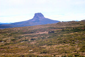
Cradle Mountain (1554m) from Crater Peak |
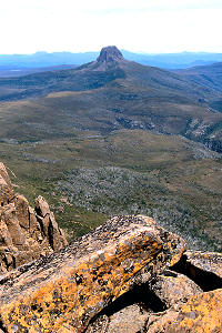
Barn Bluff from Crater Peak |
 |
 |
 |
Smithies Peak and Cradle Mountain
from beside Kitchen Hut |
Barn Bluff (c1559m) from the summit
of Cradle Mountain |
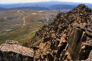
Looking west from the summit of Cradle Mountain
over Suttons Tarn and the Suttons Creek valley.
The well-defined path is the Overland Track
|
 |
 |
 |
Looking west from Cradle Mountain (1545m)
over the Cradle Plateau and Crater Peak (1270m) |
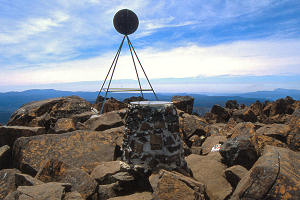
Summit marker on Cradle Mountain (1545m) |
A patch of snow near the summit |
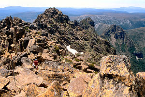
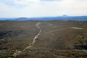
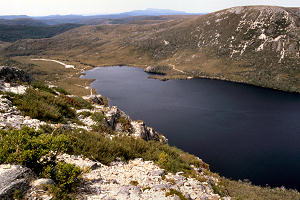
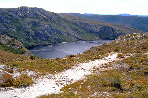
The return down the boulders proved less difficult than I had expected and I was soon back at Kitchen Hut where I opted for the longer route back to the car park using the Overland Track via Marian’s Lookout and Crater Lake (for a look up to Crater Peak). Can I now claim to have “done” the Overland Track, having walked both ends of it and I’m sure the bit in-between (all 80 km of it) is not much different?
 |
 |
 |
| Part of the descent |
Dove Lake from the side of Cradle Mountain |
Horse Track goes left over Crater Peak,
Overland Track goes right towards Dove Lake
|
 |
 |
 |
Weindorfers Tower (1458m),
Smithies Peak (1527m) and Cradle Mountain
|
Weindorfers Tower etc from Marions Lookout
above the Honeymoon Islands in Dove Lake |
The north end of Dove lake from Marions Lookout |
 |
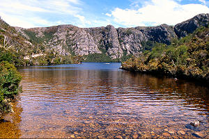 |
| Crater Peak (1270m) above Crater Lake (1035m) |
Crater Lake from near the outflow |
|
Back at the car park at half past four, I signed out in the visitors book, almost the last person to do so. The visitor centre at the park gate did not offer a tearoom so I stopped at the petrol station at Moina for tea and carrot cake (but no petrol). I returned to Deloraine via Sheffield and Kimberley for a bit of variety. This route was 10 km shorter than my outward journey, but took about the same time which seemed odd as the roads seem generally straighter.
The evening was spent in the hostel, time passing pleasantly with tea and conversation. Early to bed and we’ll see how early I wake in the morning.
Friday 2 January — Deloraine to Devonport
And I woke just before six. I failed to find a weather forecast on the radio and the next thing I knew it was five past seven. There was some low lying mist across the base of Quanby Bluff, worth a photograph. By the time I was ready to leave, it was quarter past nine.
 |
 |
Quanby Bluff rises above the morning mist
beyond Deloraine |
TGR E class No.2 (built by Beyer Peacock)
now languishing in a park in Deloraine |
I had a brief halt in town to photograph the E class loco in the park before heading east to Perth for petrol (leaded this time) then south on Highway 1 before taking the A4 through Avoca, Fingal and St. Mary’s to the east coast at Scamander. I had thought to stop for lunch here but there was rain in the air so I continued to St. Helen’s by which time I was no longer hungry. After a short break, I headed back inland through Weldborough Pass, Derby and Scottsdale to Bridport for another break (and more petrol).
From Bridport I headed for Devonport via the Batman Bridge across the Tamar, rather than going down to Launceston. I was in Devonport just before five, where I bought milk and tea bags before going to the hostel and booking in for the night. Had a bath and did the laundry.
[ next chapter ]
John Reynolds — April 2014